Category Five Equivalent Surigae Intensifies Over Pacific
Typhoon Surigae has rapidly intensified amidst impressive atmospheric and oceanic conditions overnight, and will remain a very powerful storm through the near-term as it churns northeast through the Pacific. While the storm will likely impact the Philippines with a glancing blow, the worst of the typhoon will remain over the open ocean.
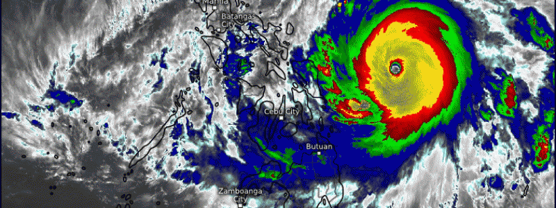
Satellite imagery shows a beautiful, highly organized tropical cyclone this afternoon. The typhoon sports a ring of very intense thunderstorms, with cloud tops colder than -80ºC, locally around -90ºC. This indicates continuous, extremely intense convection, helping Surigae consume the energy stored in the balmy Pacific water. These powerful thunderstorms surround a clear, circular, and small-ish eye. Satellite imagery also confirms that Surigae has established a broad, substantial outflow to both the NE and SW, as well as an expansive wraparound feeder band to the W. This all indicates a tropical cyclone capable of thriving in the atmosphere it’s located in.
Tropical cyclones need a few things to intensify, and to remain intense. Understanding the future of Surigae requires us to understand these different factors. The first is a structure that can most efficiently and effectively turn oceanic energy into atmospheric energy. Surigae clearly has that. Two things can really send the structure back down: wind shear, which can disorganize the core of a cyclone, or an eyewall replacement cycle, which can crush a budding storm’s eye. We’ll get into these later.
In addition to “no wind shear”, these cyclones also require warm sea surface temperatures, well in excess of 26.5ºC, midlevel moisture, and some degree of atmospheric support for outflow (ie, a broad midlevel anticyclone).
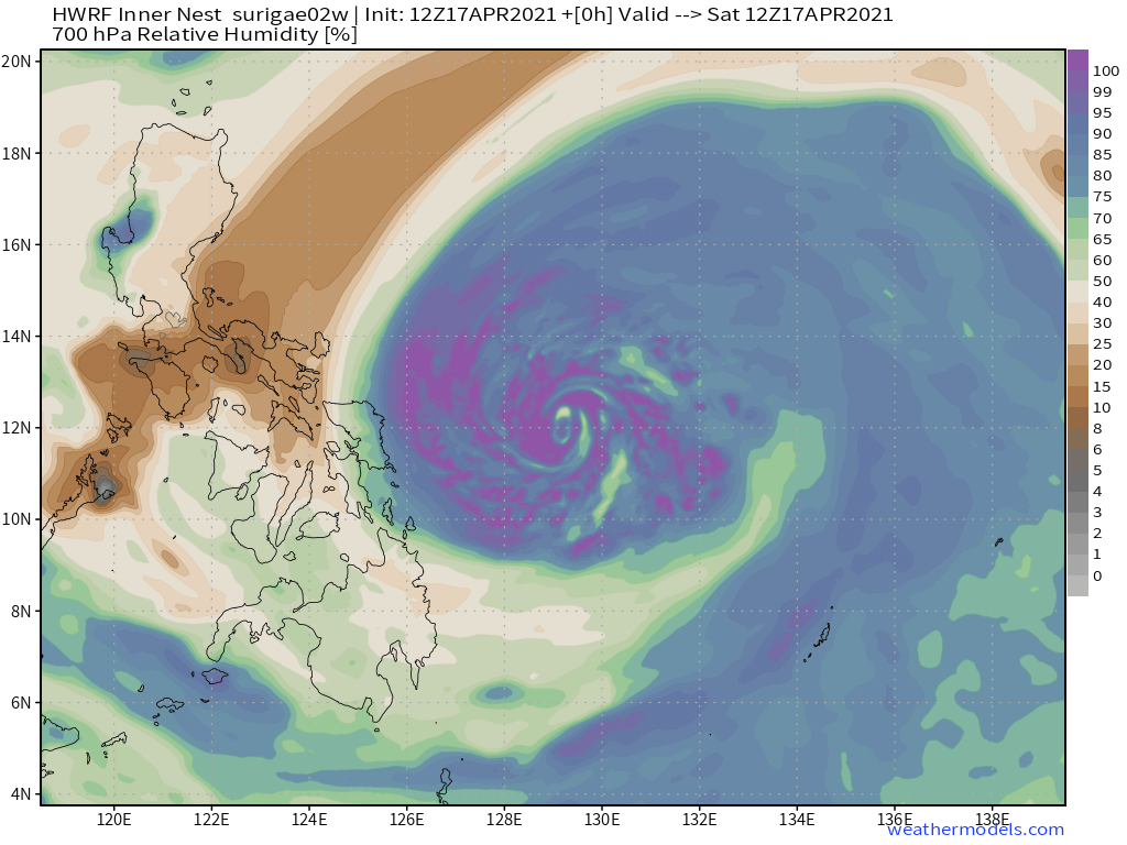
It can be tough to diagnose most of these things on IR satellite imagery, so it’s lucky that we have a lot of tools in our toolbelt to help us. First, let’s use the HWRF to look at midlevel moisture content.
Clearly, while inflow from the rough Philippines topography is introducing dry air into the broader circulation of Surigae, the very well organized inner core is effectively ‘walling off’ any intrusion that could threaten the central circulation. Dry air looks to occasionally get close, in discrete packets, to disruption, at least per the HWRF. However, the favorable organization should continue to protect the cyclone. This is important, though: it means that either any shear, sneaky or not, or an eyewall replacement cycle could both lead to a fairly rapid weakening via injection of dry air into the core. This is something to keep in mind.
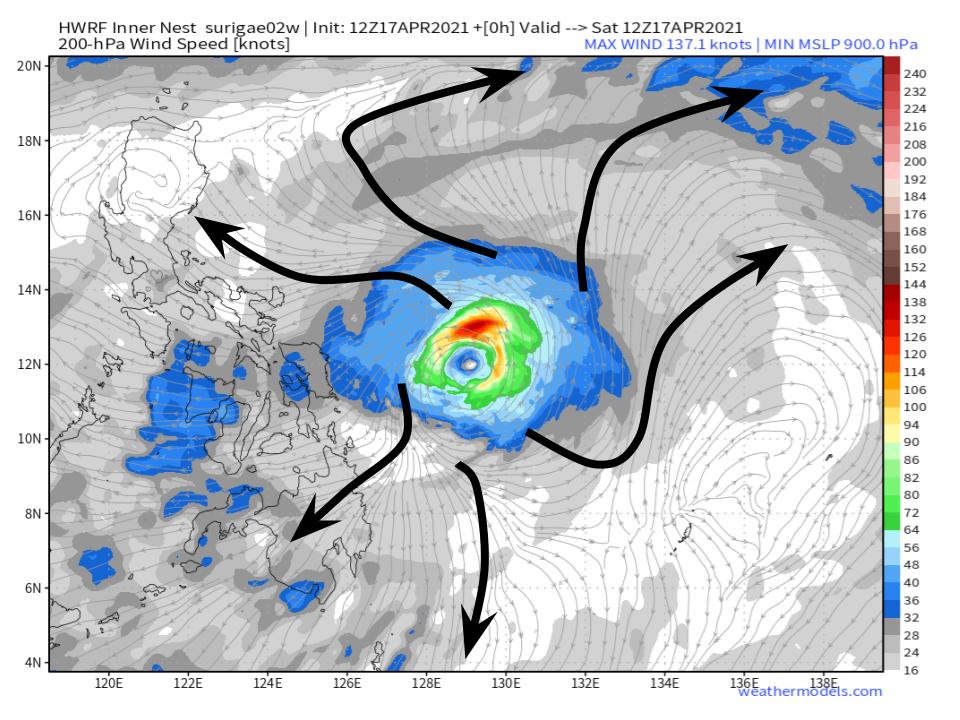
Sea surface temperatures remain well above 26.5ºC for hundreds of miles ahead of the cyclone, and Surigae is imbedded under a really, really favorable venting regime amidst an upper level anticyclone. Seriously, it’s hard to imagine a storm in an environment more favorable for mass removal.
With this all being said, it’s no wonder Surigae was able to bomb out to such an impressive cyclone. While it is difficult for storms to maintain such tail-end intensities for long, there’s nothing in the atmosphere or the oceans that suggest meaningful weakening is imminent.
So where is the monster going?
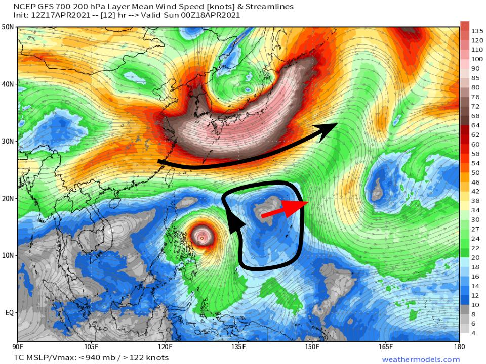
A look at weathermodels.com’s nifty steering level wind product can give us a pretty good idea, as it indicates foremost that the main factor in Surigae’s track will be a squished anticyclone to the storm’s east. Right now, its position relative to the cyclone will assure motion remains largely to the northwest, shifting closer to north with time as Surigae starts to round the ridge.
This will keep Surigae close to the Philippines, but will luckily assure the worst of the very intense typhoon remains offshore.
As the cyclone moves to the north and the ridge moves to the east, Surigae will increasingly feel a tug towards the east from both the ridge and the expansive midlevel jet positioned across the central-west Pacific.
This can be seen in model guidance:
The biggest impacts to the Philippines should be some gusty winds and heavy rains, especially along the eastern islands.


