Building Mid-CONUS Ridge Threatens Midwest, Northeast with Weekend Storms
Synoptically, nothing screams summer quite like an oppressive, immobile mid-CONUS ridge. Known casually as the ‘death ridge’, the bulging zone of high pressure commonly traps heat over much of the central US, promoting broiling conditions and sunny, searing skies. Death ridges almost always develop by the end of July, and they don’t like to move very much until the Autumn jet begins to descend.
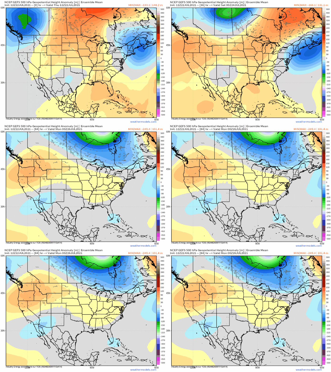
As Meghan wrote about in her blog yesterday, the fearsome death ridge is finally beginning to consolidate this week over the south-central US, ending a period of anomalously cool weather.
Aside from heat stress, death ridges pack another occasionally significant hazard in the severe thunderstorms that can erupt along their northern periphery.
When broad, anticyclonic flow around heat domes is sourced from the Gulf or south Atlantic, a moist airmass modified by solar heating can turn into a ticking time bomb of high-end instability. This is especially true when the same anticyclonic advection regime transports the warm and dry high-elevation airmass known as an EML atop hot, moist air below. The combination regularly supports the most extreme instability found in the continental US, which can be found surprisingly far north and east thanks to the suppressing influence of the death ridge, which prevents thunderstorms from sucking up all of the fuel.
This tendency for extreme instability to develop amidst summertime heat domes fosters an environment quite favorable for severe thunderstorms, if other ingredients like kinematic and dynamic support are present. However, calm winds and general subsidence under the death ridge are increasingly hostile to organized thunderstorms with proximity to the ridge’s center. The equilibrium between these factors can be found along the ridge’s periphery, in a zone of excessive instability and moderate kinematics commonly known as the ‘ring of fire’.
It is under this type of synoptic set-up that many of the most famous summertime severe thunderstorm outbreaks have been able to occur. Just about every high-end derecho to strike the Midwest or Northeast has seen the region on the outskirts of a major heat dome, for example. And as this type of setup develops into Saturday and Sunday, such a severe threat could potentially target parts of the northern third of the country.
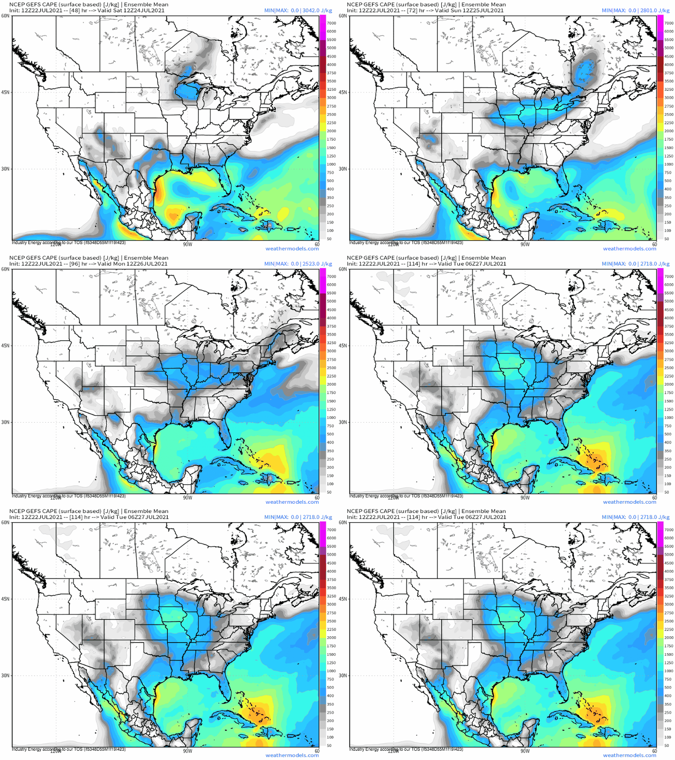
As discussed above, the overlap of profusely heated, high-humidity air with a dry, warm EML will likely send instability to locally extreme levels across these regions come the weekend. CAPE modeled by the GEFS, an ensemble mean, shows extremely high values likely underestimated by the averaging inherent in the guidance.
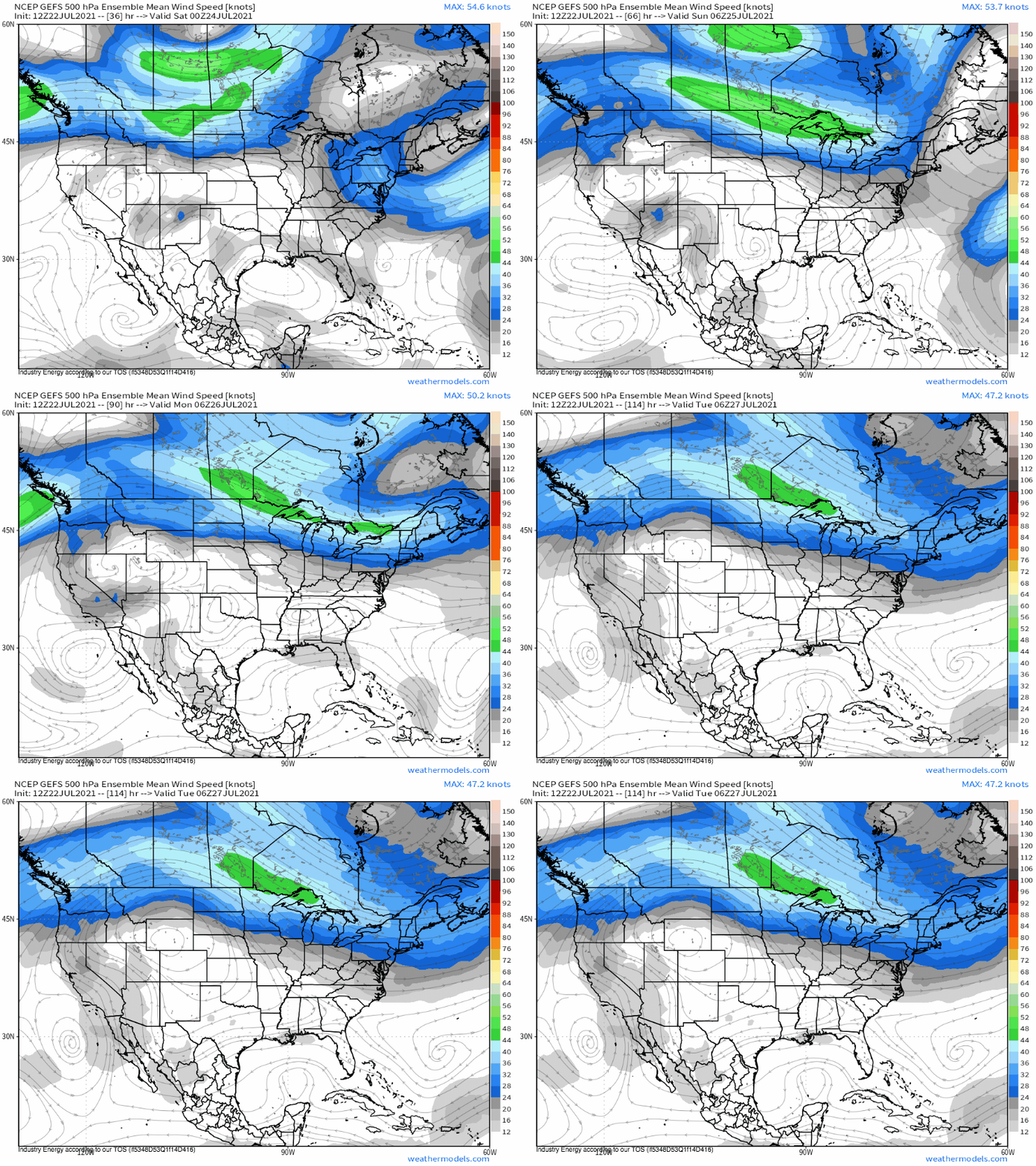
As the expanding ridge pushed high-end instability across the northern tier of the CONUS, a powerful midlevel impulse diving southeast will enhance flow along the ridge’s periphery. This ripping jet will encourage bulk shear and linear forcing that should prove more than sufficient for organized convection. And with low level flow increasing as a downstream result of the impressive dynamics, supercells will be possible, as will significant bowing segments.
Of course, like any severe threat, a degree of uncertainty still abounds. But the synoptic set-up is there for quite the multi-day severe thunderstorm episode.


Enjoyed your discussion. Retired NWS. Worked the 1995 Adirondacks Derecho from NSSFC in KC. Similar setup that you write about here.