Brisk Low Level Flow Brings Gusty Warmth, Low-End Fire Threat to Midwest
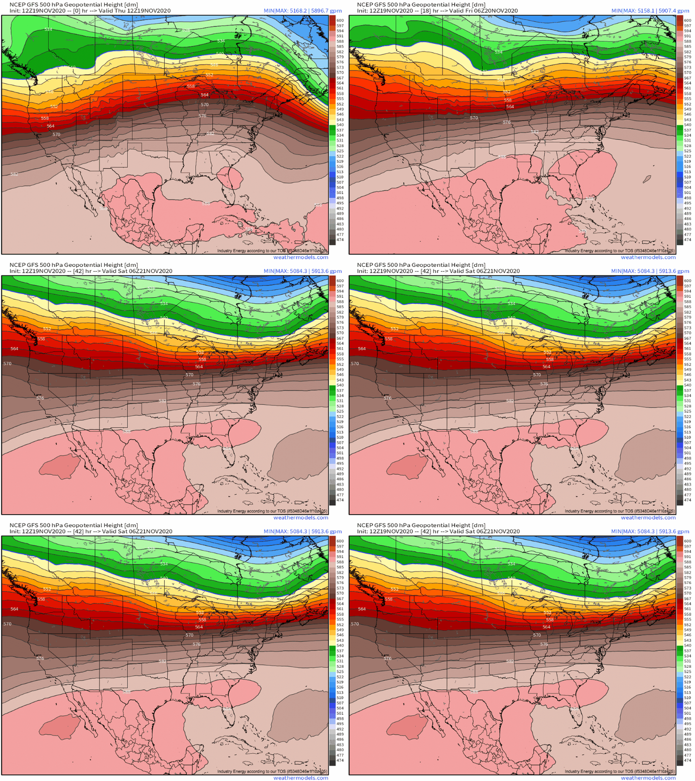
Today sees much of the United States settling into a zonal flow pattern, as a large, flat ridge dominates the midlevels through at least the weekend.
The type of significant divergence that allows low-level cyclones to dramatically strengthen is, notably, quite hard to find over much of the US. This is a result of the largely west to east flow, without the north/south advection of temperatures that tend to lead to strong low pressure systems. 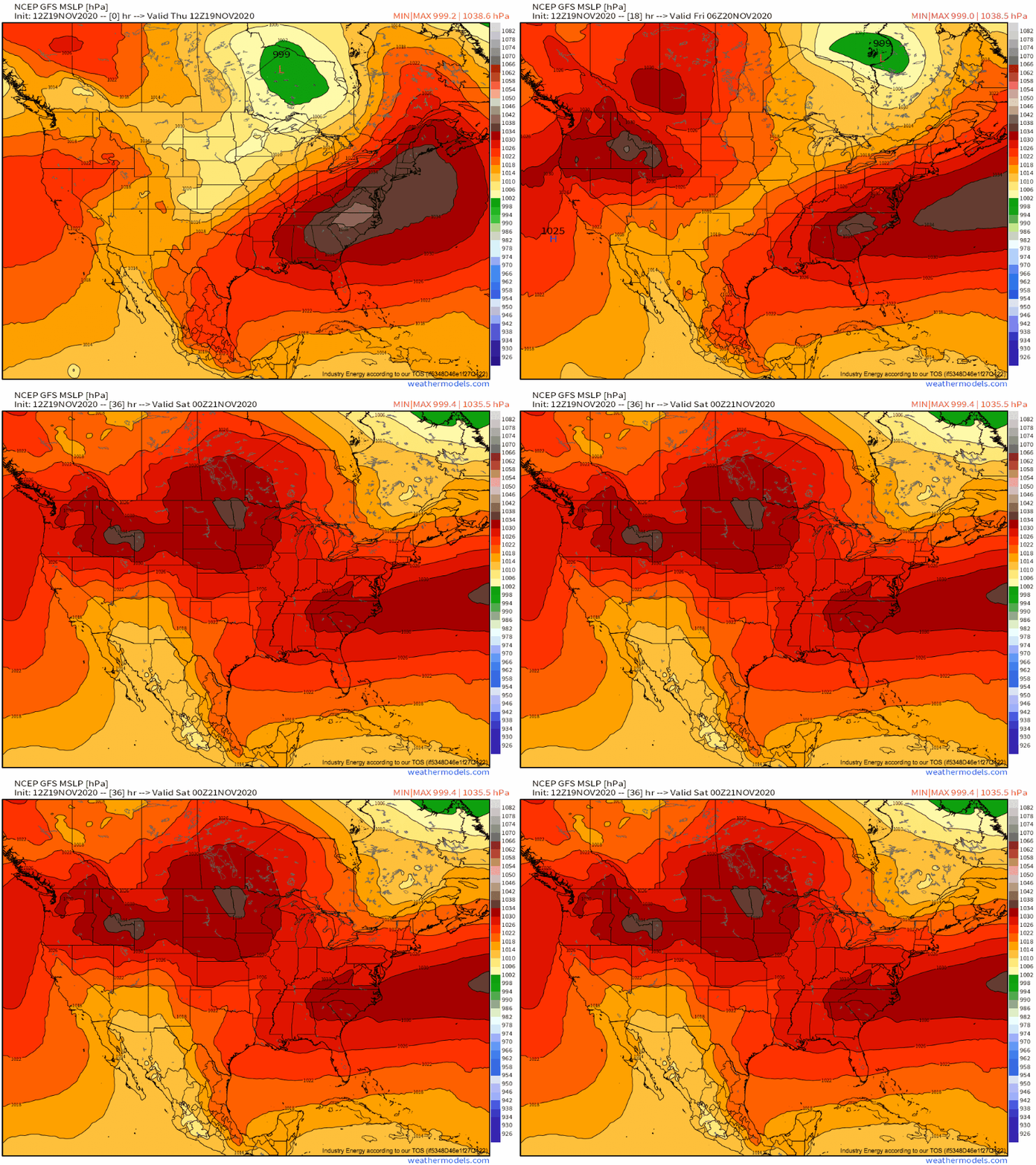
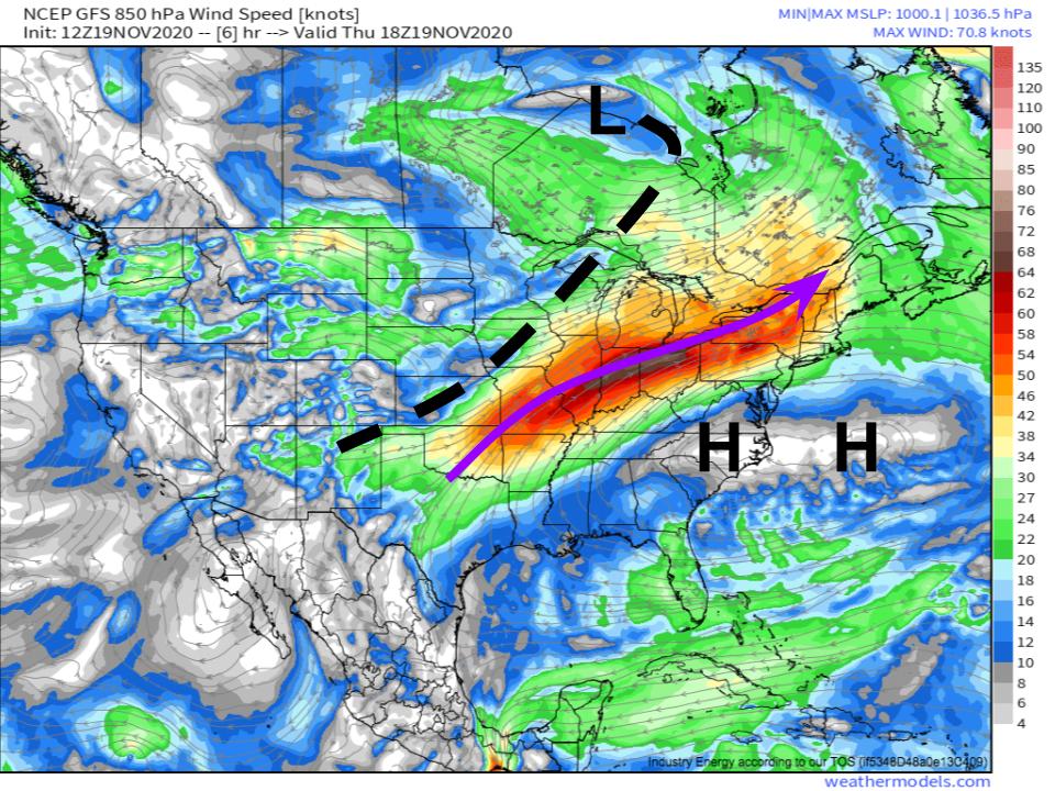
There is one zone of subtle favorability for pressure falls north of the Great Lakes, ahead of a couple shortwaves, small kinks in the midlevel flow that can spin up low-level divergence. As the moderate low-level cyclone here races towards the Hudson Bay today, a ‘trough’ of low pressure will slide slowly northeast in its wake. This will correspond with convergence west of the now-departed east coast trough, which will allow a large Atlantic high pressure system to strengthen into the eastern seaboard. The clash between these two systems will actually set up a pretty strong pressure gradient through the bottom couple thousand feet of the atmosphere.
Along this pressure gradient, northerly flow squeezed between the two systems will accelerate dramatically, allowing a roaring low level jet to develop, especially for the general lack of synoptic forcing.
71 knots over Ohio at a time in which minimum sea level pressure over the entire continent is unable to fall below 1000mb? Not bad!
This strong southerly flow, along with the large heights aloft, will allow an anomalously warm airmass to settle into the midwest, where temperatures will approach 20°F above average.
Typically, southerly flow in the midwest is able to tap into Gulf moisture, and may even allow convection to develop along any convergence. But that isn’t the case today, with a significant westerly component to flow arcing across the East Coast high keeping advection largely from the warm, arid Central Plains. In addition, the general convergence aloft is keeping air sinking, rather than rising, which leaves the surface relatively dry and warm.
So we have warm, dry air being transported under very speedy low level flow. This type of setup leads me to think there’s a chance fire chances will be somewhat maximized over parts of the midwest today, even for a typically unfavorable time of year.
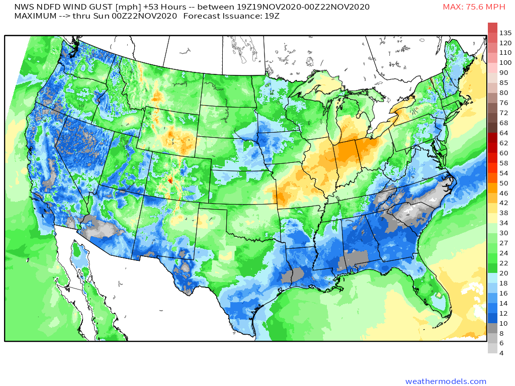
The two most important atmospheric parameters to consider for fire weather are relative humidity and wind gust potential. A combination of high wind gusts and low humidity can easily lead to uncontrolled fires exhibiting erratic, aggressive behavior. Let’s take a look!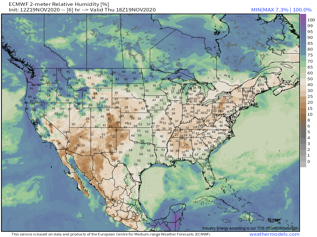 Link
Link
Evidently, the influences from the low-level jet and the eastward strengthening surface high will allow an overlap of gusty winds, aforementioned warm temperatures, and low relative humidity. While the parameters are certainly at a level conducive to fire spread, none are extreme, and so in all likelihood this will be a fairly marginal fire weather event, with perhaps a few briefly uncontrolled burns in the eastern Midwest.
