Breaking Down The Omega Block
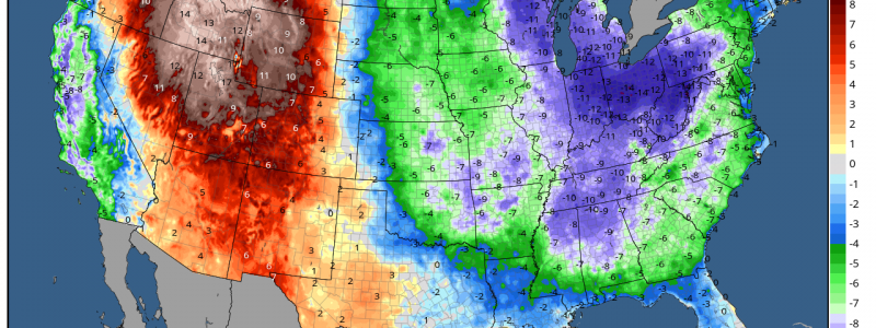
When I read the temperature off my personal weather station just a few minutes ago, I could barely believe it. Seventy-five degrees! After over a week with temperatures struggling to climb out of the 50s and 60s, the warmth is moving back in to the Eastern US.
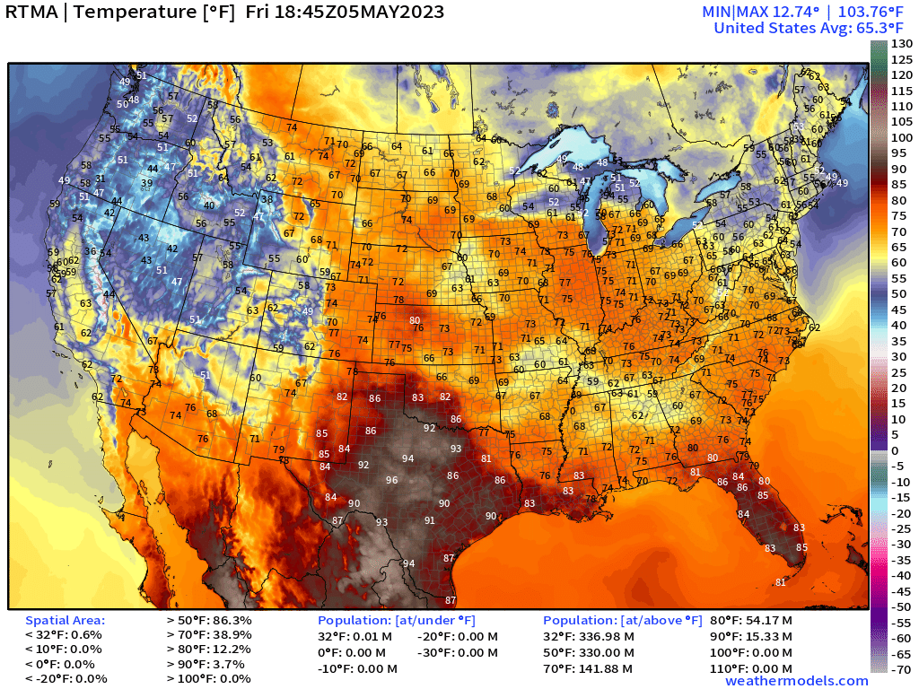
Yes, we do have some cooler spots such the Northeast, and some of the Mid/Deep South where thicker cloud cover and scattered showers are passing through. But overall, warmth is returning to the East after a really frigid start to the month.
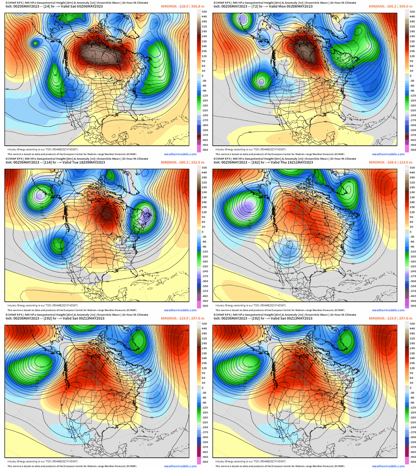
The Omega Block we’ve been experiencing will slowly begin to break down in the week ahead.
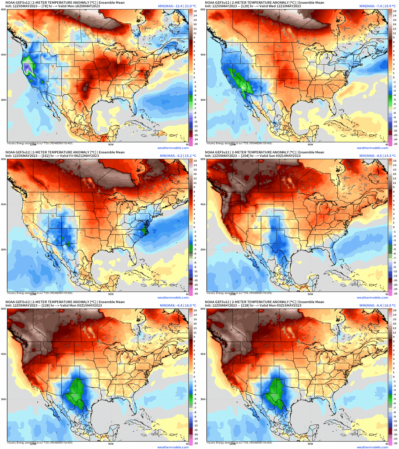
Unfortunately for those in the Western US, the eastern side will break down faster, allowing ridging to return and amplify east of the Rockies. Under the ridge, temperatures will warm, it will become more humid, and we’ll introduce the chance for those daily air mass thunderstorms we see so often in the summertime – especially across the south.
In the West, as troughing remains stuck in place for a bit longer, they’ll stay cooler and wetter than normal, potentially until next weekend.
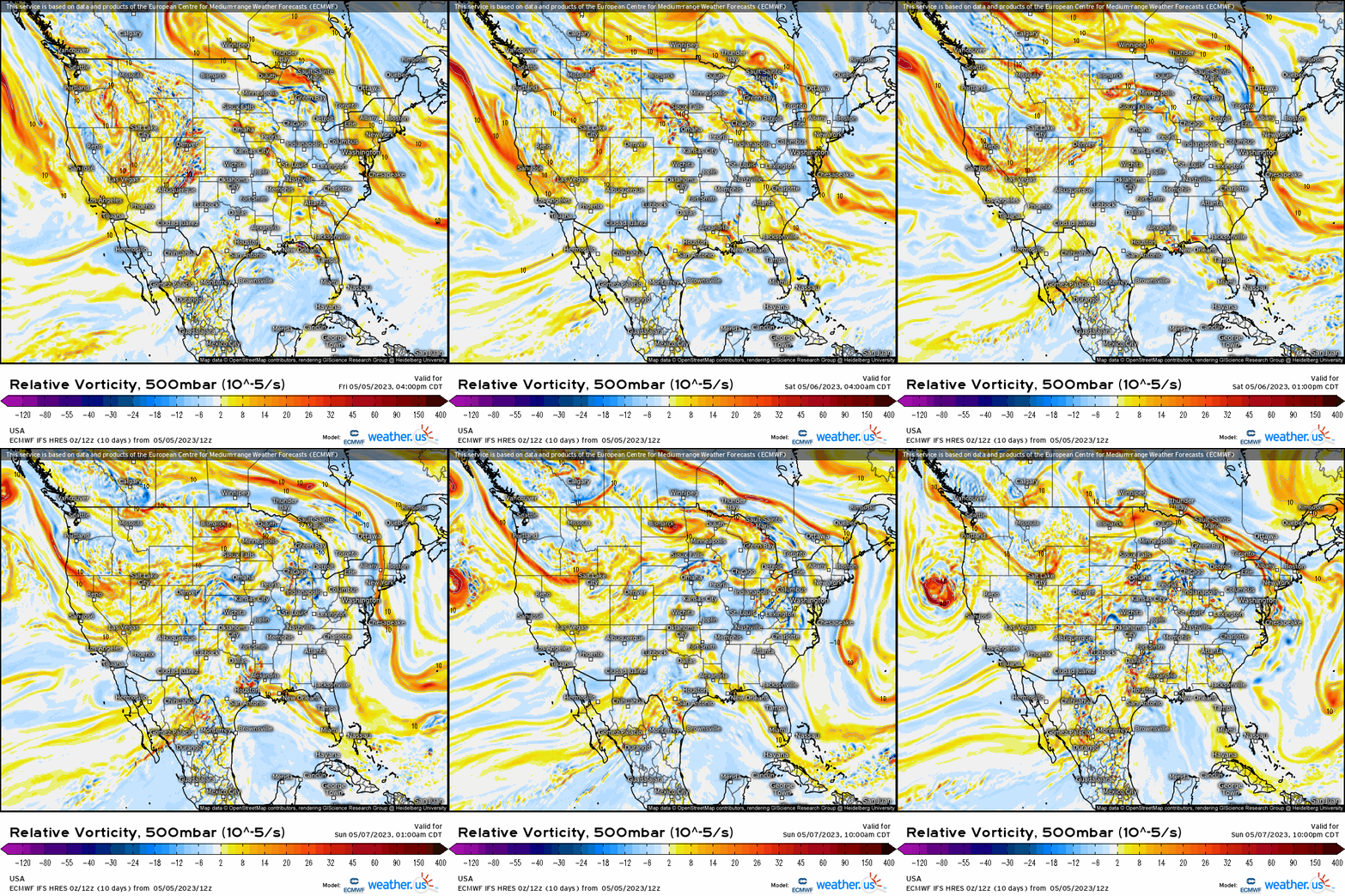
As the Omega Block slowly comes undone, shortwaves will round the broader trough parked over the Western US. Rounds of showers and storms will be possible from California through the Intermountain West and into the Plains States.
Where these shortwaves meet up with the building ridge over the Central/Eastern US, a few severe storms may be possible each day this weekend. The Southern Plains and the Central High Plains have a risk today. The Southern Plains and the Mid-Mississippi River Valley will see a risk tomorrow (Saturday). For Sunday, a broad risk area has been defined from the Southern Plains through the Upper Midwest.
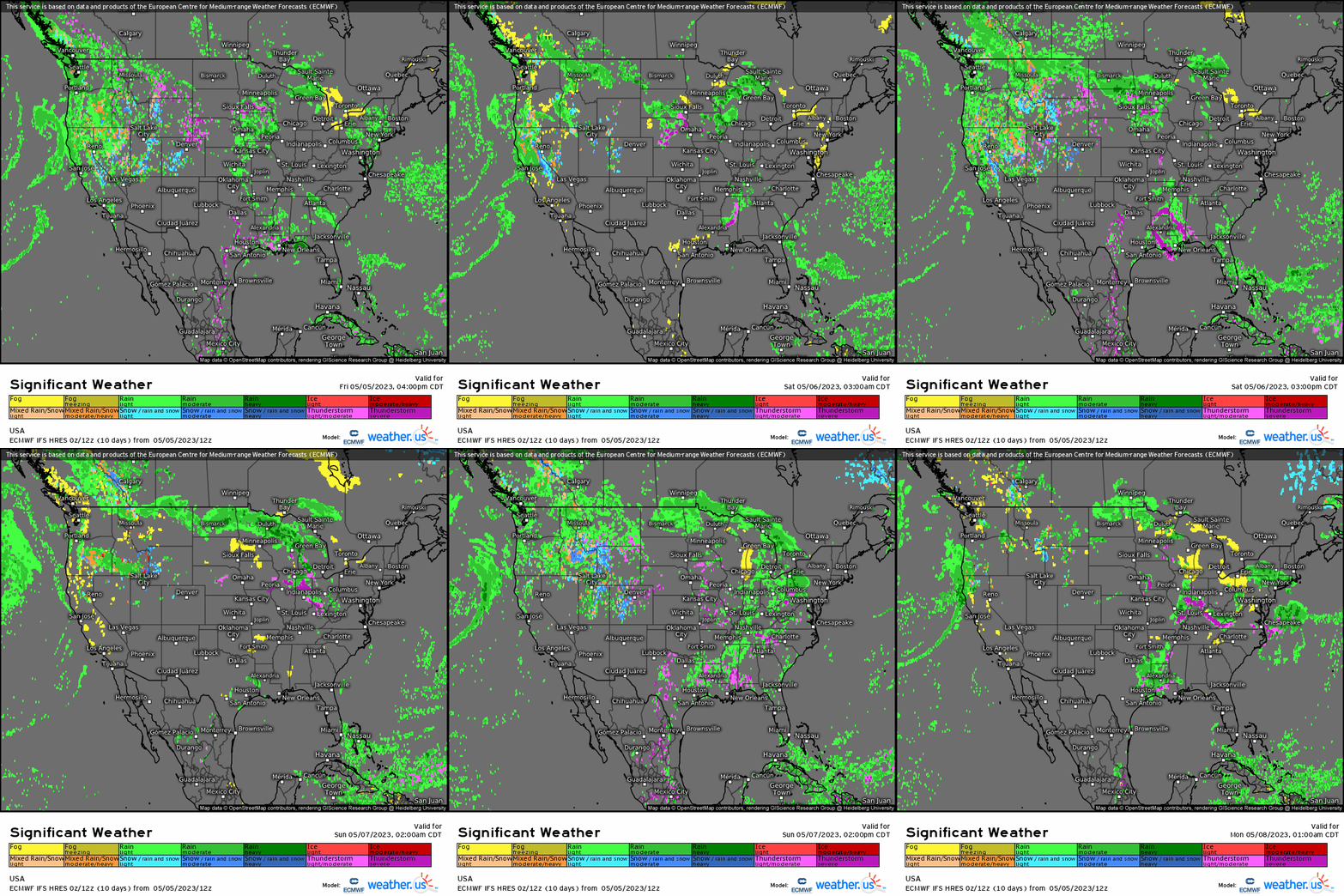
As far as risks go, large hail and damaging winds will be the primary threats each day. However, while not a large threat, a few tornadoes can’t be ruled out. Check on the forecast from your local NWS for timing and specific threats for your local area.
We’ll continue to break down that Omega Block in the week ahead. By the end of next week, conditions could be looking very different for the Northern/Northwestern US as the heat builds back in.
Stay tuned, we’ll look at that possibility early next week.


