Both Basins Now
As we edge ever closer to September and the climatological peak of hurricane season, tropical activity is ramping up – in both basins.
Today, we’re going to take a look at what’s lurking in the waters. We’ll start with the Atlantic.
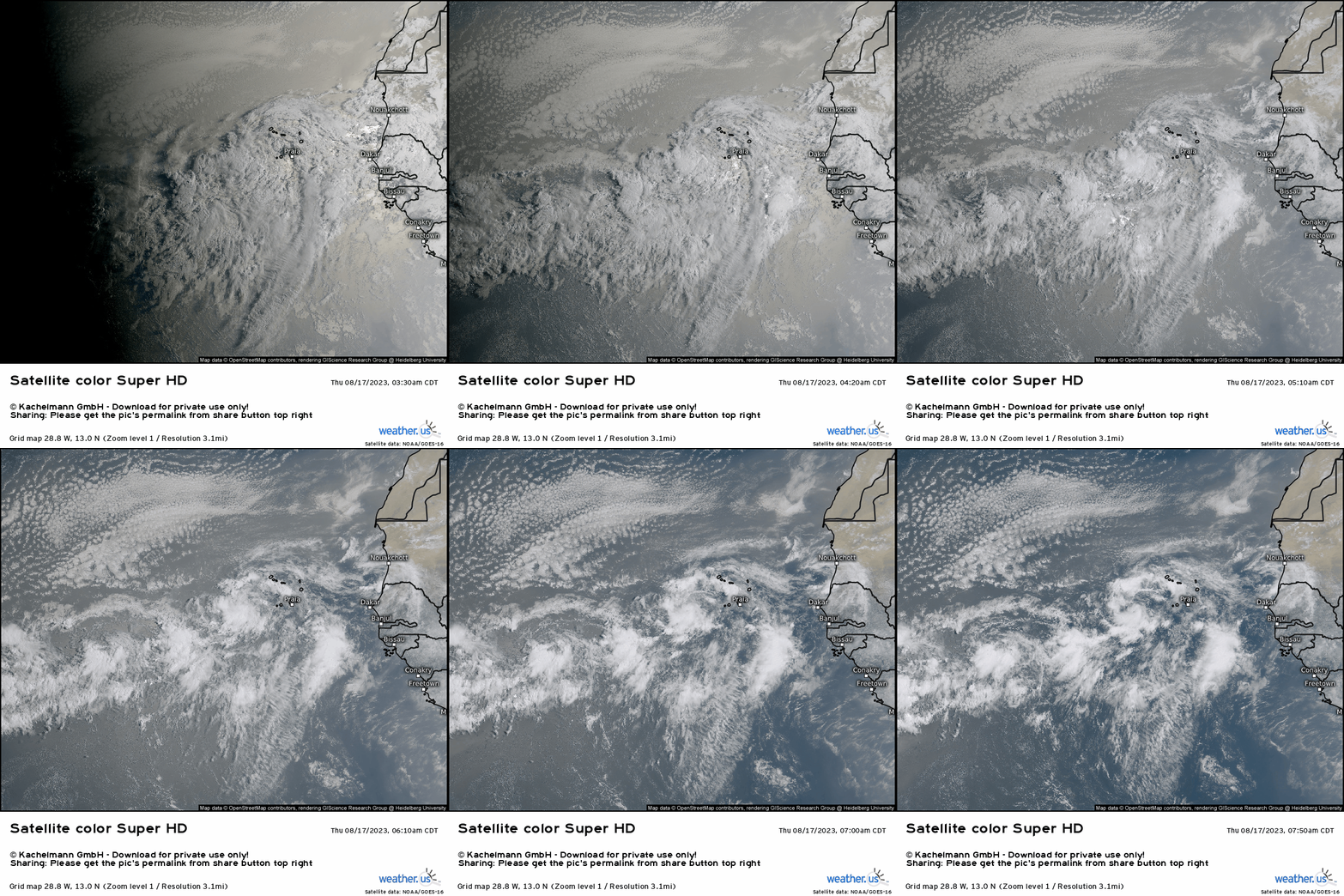
First, in the Atlantic MDR, we have two disturbances that bear watching for future development.
Invest 98L, the eastern swirl closer to the African continent, and Invest 99L, the lesser-organized swirl more toward the middle of the Atlantic MDR, both have a medium (60%) chance of development over the next 7 days.
Convection on both is rather lacking at the moment due to the presence of dry, dusty air, which can be seen on the loop above.
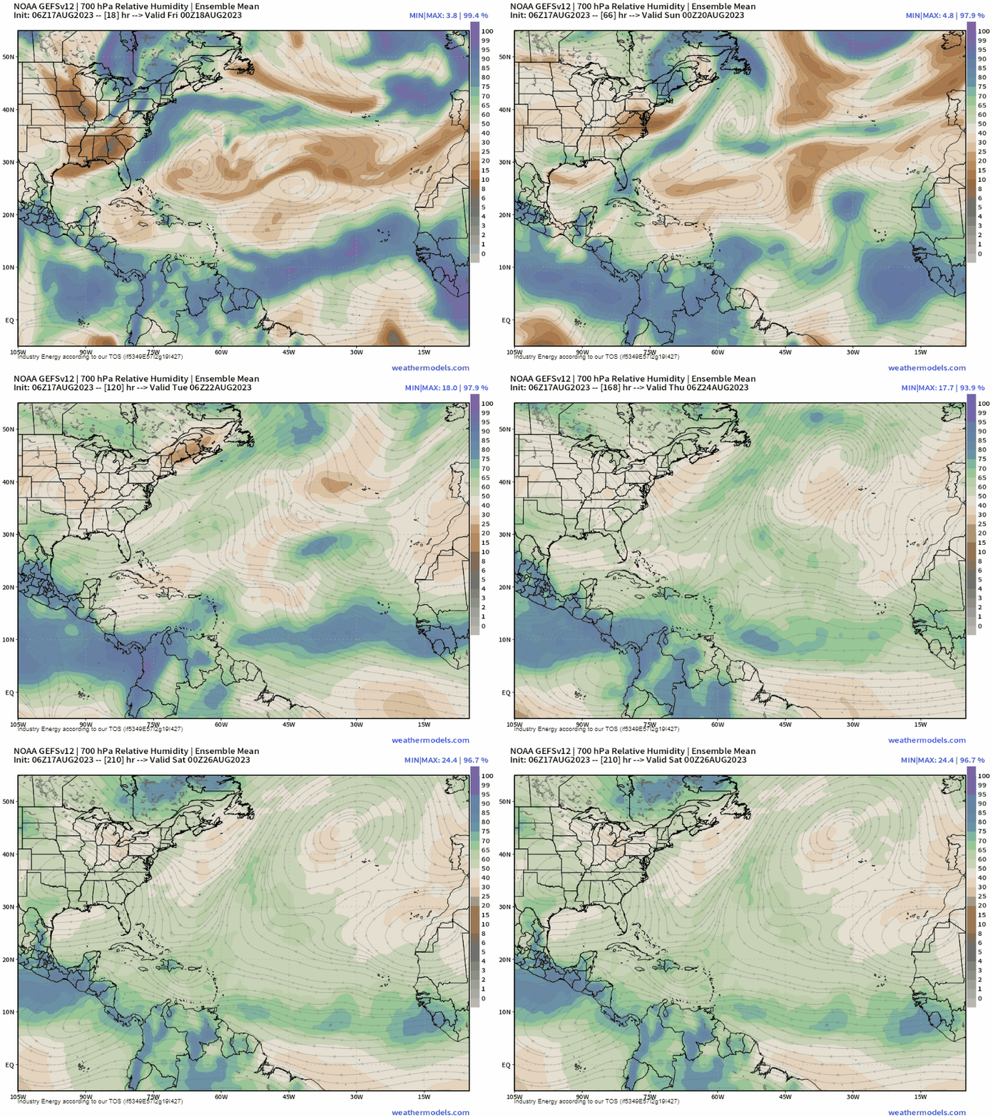
While the dry, dusty air will likely prevail in the short term, the basin shows signs of becoming less hostile – from a moisture perspective, at least – in the next 5 to 7 days. This could be a window of opportunity for development, assuming shear in place relaxes some as well.
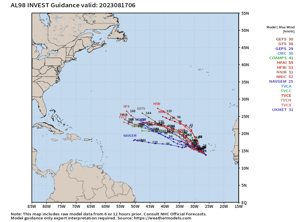
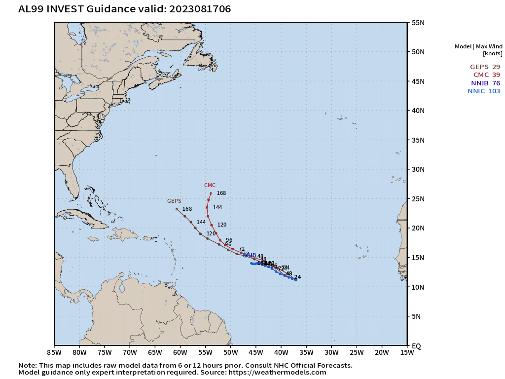
It makes sense then that Invest 98L, which is the slightly more robust, farther behind wave, has more model support for development and persistence. However, it only has a small window in which to develop before it enters a more hostile atmosphere.
Invest 99L is a bit less healthy-looking than 98L, but has a larger window for development as it wanders WNW into a marginal environment instead of lifting out NW into a hostile environment like 98L.
Either way, neither of these two invests currently pose a threat to the US. While it would be prudent to keep at least one eye on their progress, no imminent threat exists.
Let’s turn our attention to a “spot to watch” a bit closer to home.
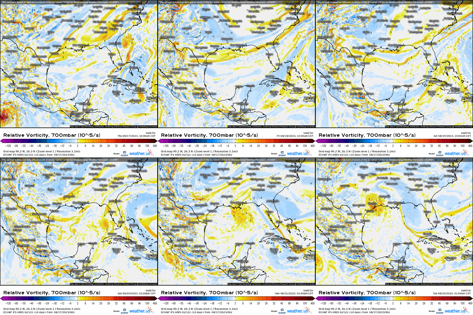
A tropical wave currently in the vicinity of the northern Caribbean will gradually make its way toward the Gulf of Mexico over the weekend. By early next week, it could be in and environment that is somewhat conducive to development.
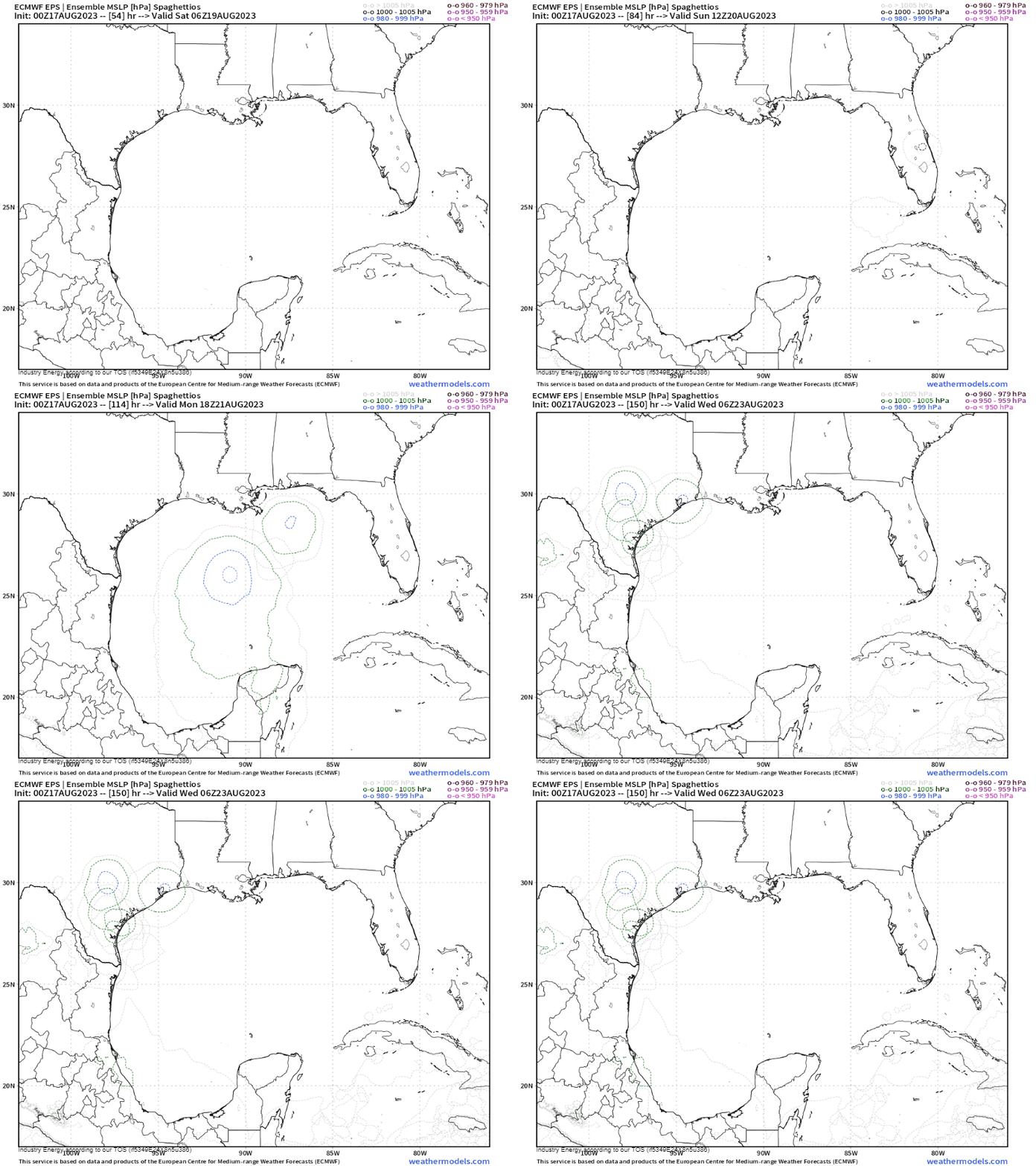
This may be a case of development heavily dependent on track. If the wave hugs the coast all the way across the Gulf, it won’t have enough “room” to develop much. However, if it can get itself into the open Gulf, it may have a chance.
Now, take this model run with a grain of salt and know that the GEFS does not develop this system at all. It’s important to remember, however, that lack of development does not equate to lack of impacts. This is still a tropical wave bearing tropical moisture. Heavy rain for some part of the Central/Western Gulf Coast is a given.
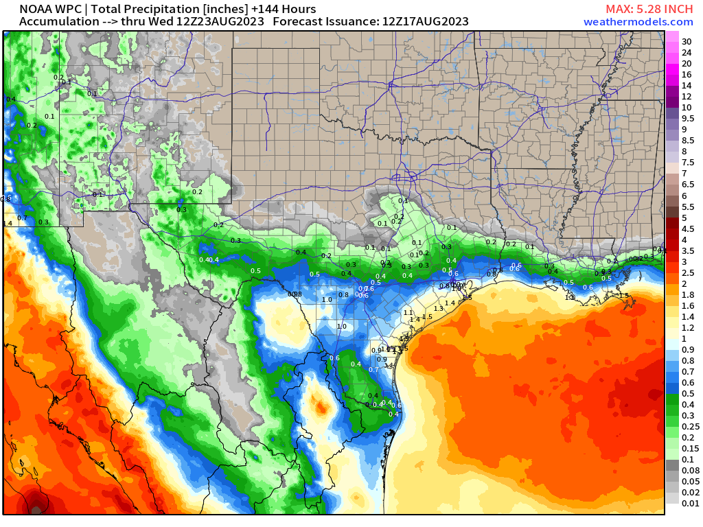
Where the heaviest precipitation falls will be dependent on the ultimate track. For now, this looks like, at the very least, some beneficial rain, cloud cover, and a short break from the heat for parts of southeastern Texas.
I’ll be monitoring the progress of this disturbance in the days ahead and will, of course, keep you updated.
This is not where the blog ends, however. We are turning our attention to the Eastern Pacific and to Hurricane Hilary.
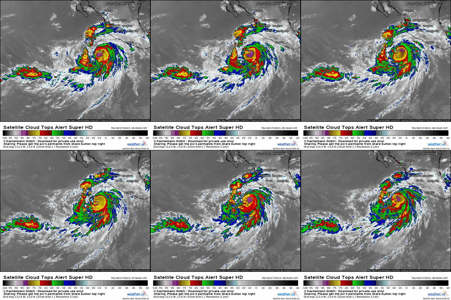
Hilary is currently a category one hurricane. While it may look way too far south to have any impact on the US mainland, that’s not the case.
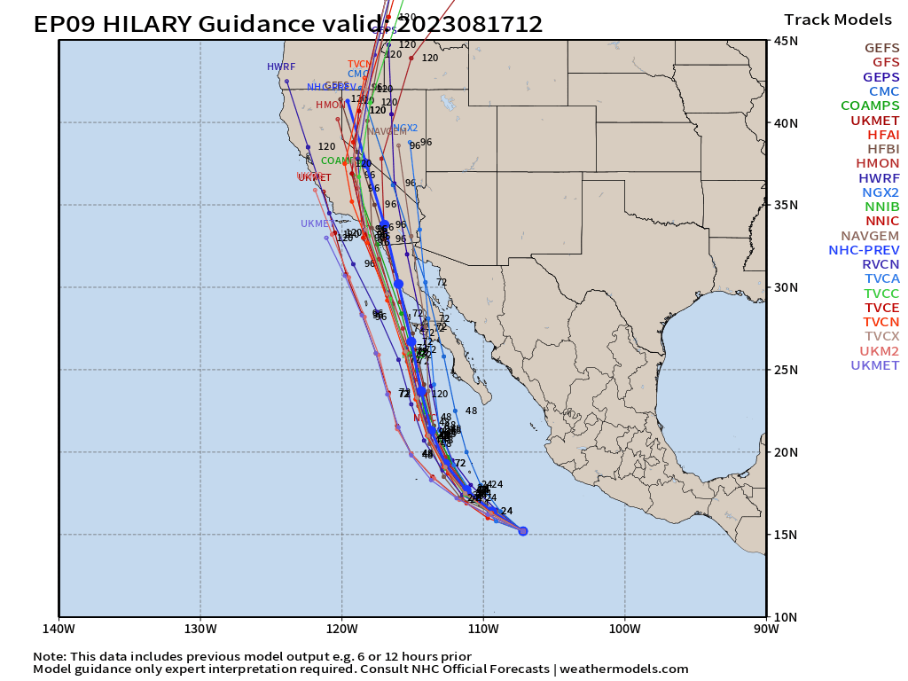
Hilary is forecast to take a hard right in the next 24 hours or so and begin moving nearly due north toward first Baja California and then eventually the southern California coastline.
Hilary is expected to intensify into a major hurricane on approach to Baja California, but then weaken significantly once it begins to interact with land. By the time it reaches Southern California, it is expected to be a tropical storm . Only three storms have come into California as tropical storms – Nora (1997), Kathleen (1976), and the 1939 Long Beach Storm.
Classification at the time of arrival will be more or less meaningless, however. For this storm, we will be focused on the water it brings with it as therein lies the biggest impacts.
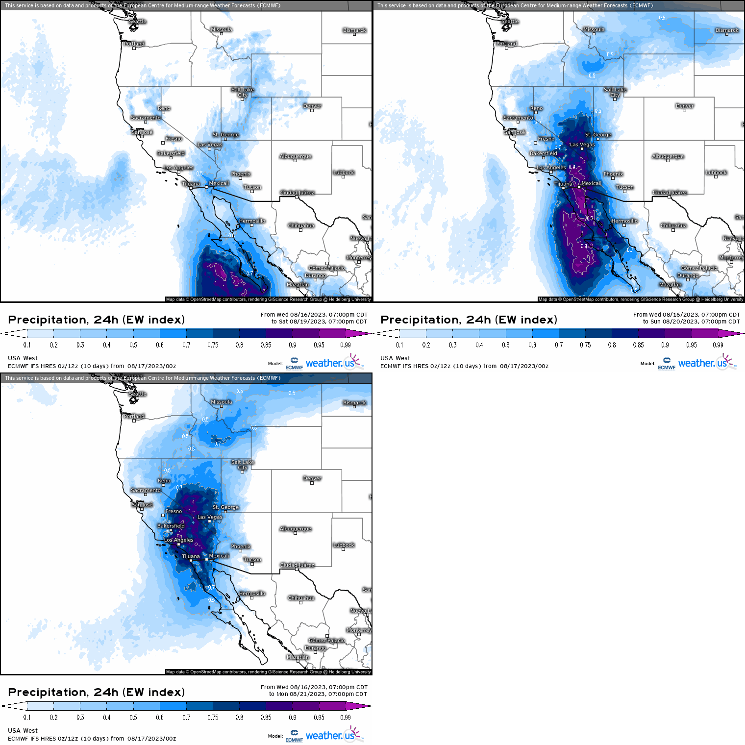
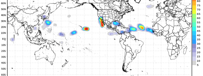
Deep tropical moisture will be forced into a region that typically receives in the vicinity of 15 inches or less of rainfall in an entire year. This region is not designed to take a hit from a tropical system. As seen in the graphic above, this is forecast to be a truly anomalous rainfall event with the Extreme Weather Index maxing out over parts of Southern California.
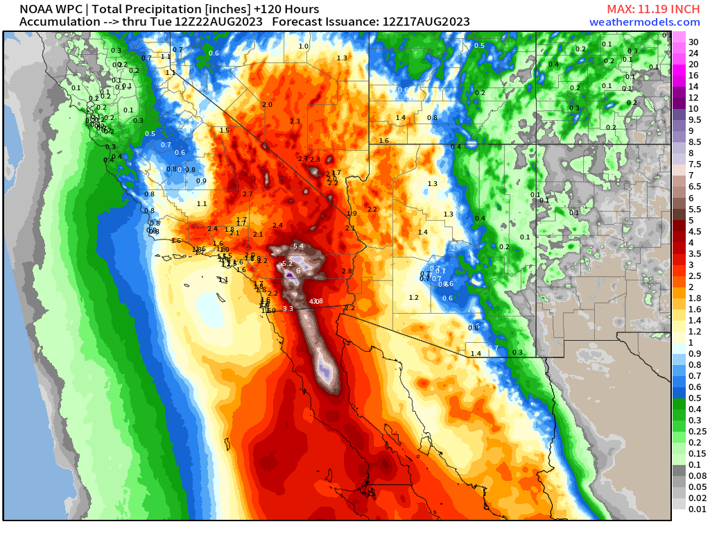
The potential exists for isolated locations to receive close to their yearly total over the span of about 2 days. This will no doubt lead to extremely dangerous flash flooding and landslides.
If you reside in this region, you need to get familiar with the vulnerable parts of your area. Know evacuation routes should they become necessary and keep a bag in the car and ready to go.
Turn to your local NWS office and broadcast meteorologist for your area-specific forecast. They know your region well and will relay the impacts to your area in greater, more specific detail.
Hurricane season is far from over. We’ll keep you apprised of any new developments in the weeks ahead.


