Big Impacts Expected from Pacific Bomb Cyclone
In yesterday’s blog, Armando outlined the next round of wet weather heading for the West Coast.
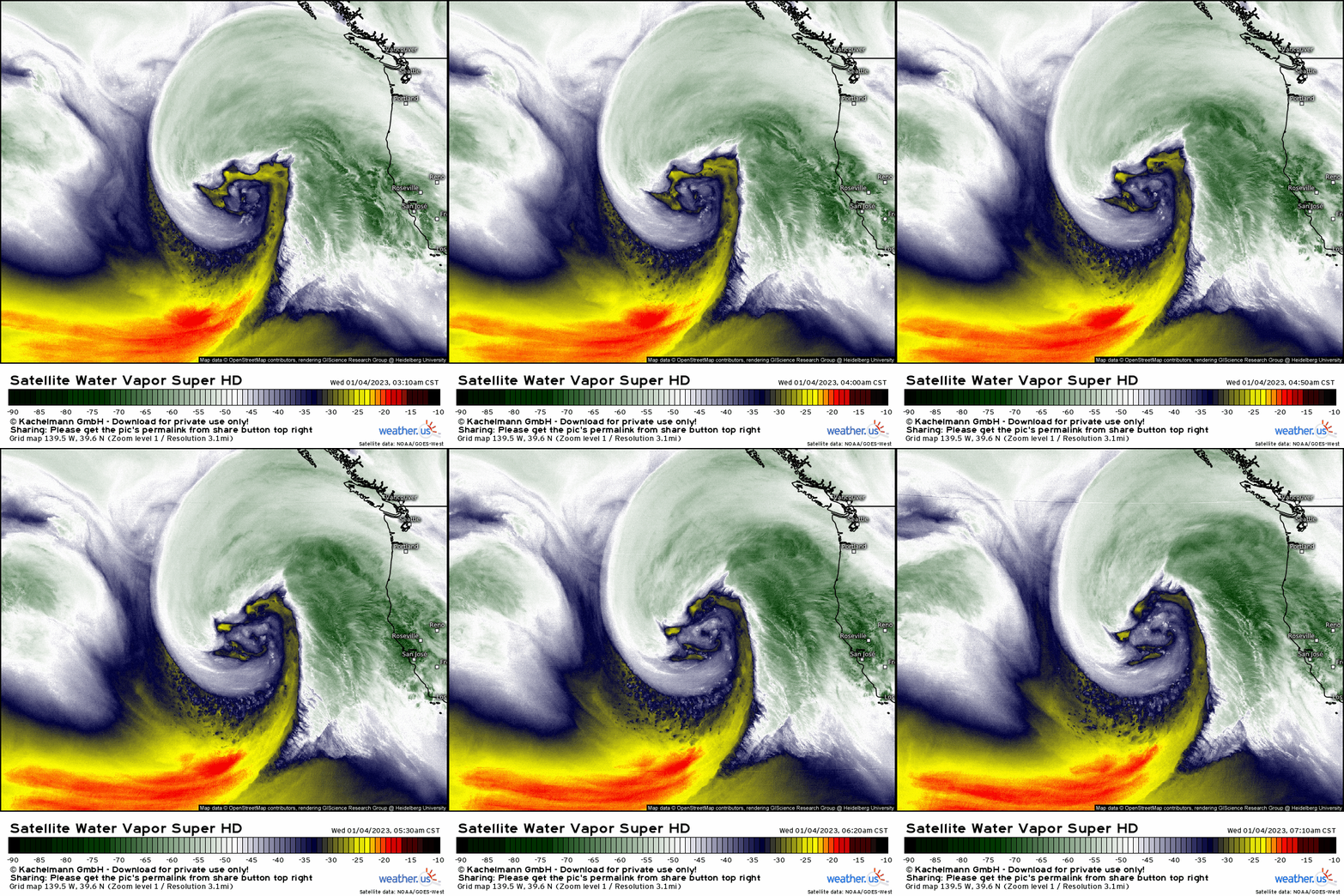
The “bomb cyclone” he mentioned is looking undeniably impressive this morning. It is a hurricane-force low with a minimum pressure of around 960 mb.
Though it won’t “make landfall” on the West Coast, the impacts will be widely felt anyway. We’re going to focus a bit more in depth on those expected impacts, some of which are already underway this morning.
Let’s first look at the water component.
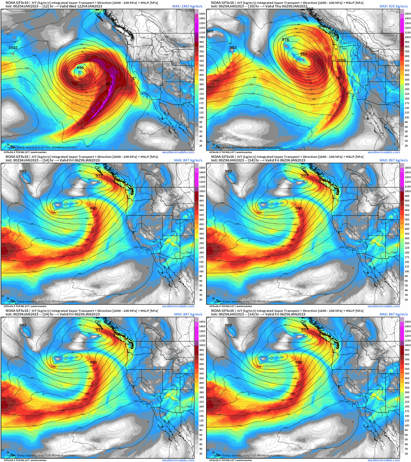
As mentioned, the low won’t technically landfall on the coast. It will, however, remain offshore and move parallel to the coast. This will allow an atmospheric river to sweep down the state of California, bringing heavy rain and mountain snow.

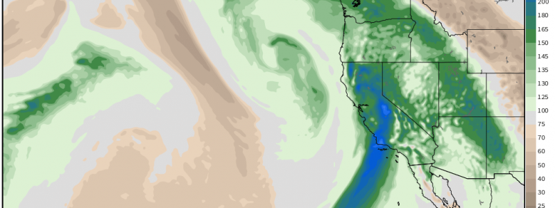
As atmospheric rivers go, this is a fairly potent one. The Precipitable Water (PWAT) it brings to California is rather anomalous – nearly off the charts in some cases. In simple terms: it’s a lot more water than is normal for California.
As Armando mentioned in his blog, California remains firmly entrenched in drought. So, it stands to reason then that an above average amount of water would benefit the region, right? While that may be true in the long run, it would be best if perhaps it didn’t come all at once.
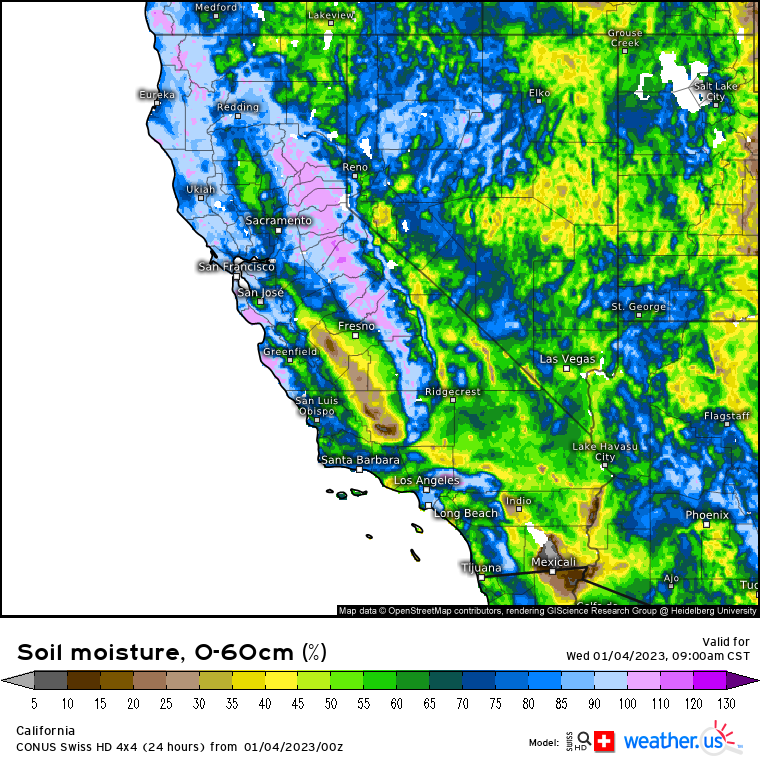
California has experienced a rather wet pattern recently. In the last 7 days alone, parts of the state have experienced in excess of 500% of their average rainfall. As a result, the ground is oversaturated, as displayed in the image above. There is quite literally no way it can absorb more water.
Any heavy rain that falls today and tomorrow, then, will be forced to run off. This introduces a very serious flood potential.
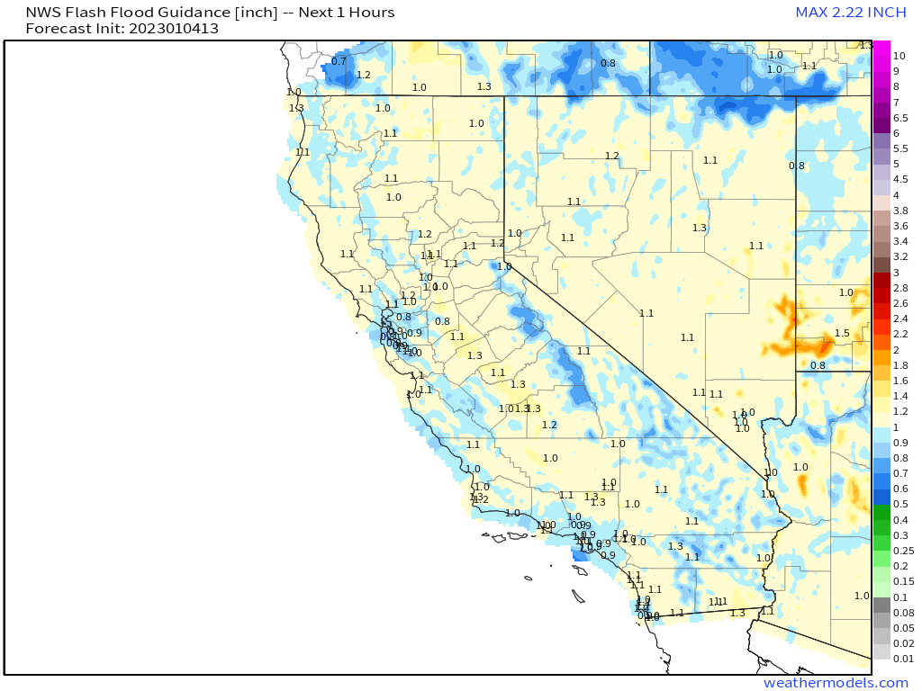
FFG values are very low across California. For some locations, it would take less than an inch of rainfall in an hour’s time for flash flooding to materialize. With several inches forecast to fall in the next 48 hours or less, it stands to reason that this threshold will be breached.
Terrain also needs to be taken into account here. Higher terrain will funnel run-off toward lower terrain, allowing them to reach the FFG threshold faster and resulting in perhaps more devastating flooding.
AFD’s from local NWS offices mention the likelihood of widespread flooding, significant urban flooding, and rapid rise of water in creeks, streams, and rivers. Additionally, due to terrain, land/mudslides are likely.
This is a high-impact system and we’ve only covered the water component.

We also need to discuss the potential strong winds.
Check out the modeled pressure gradient in the graphic above. The very tightly packed isobars indicate an intense pressure gradient between the deep low and a strong high over the Rockies. This pressure gradient will facilitate strong on-shore winds in addition to heavy rain.
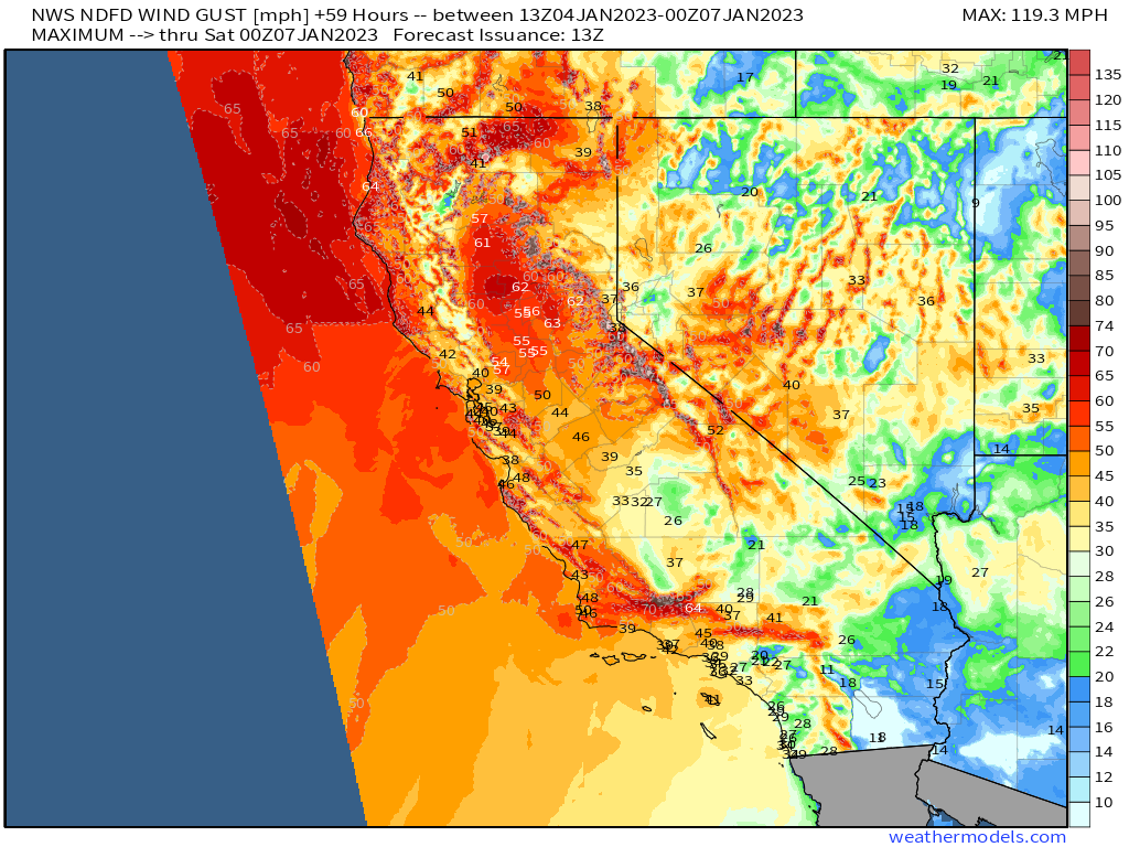
High winds pose a power outage threat on a good day. But then add in oversaturated ground and more heavy rain on top of that. Trees will topple much easier in saturated ground than dry ground. So, the combination of heavy rain and gusty winds present what could be a widespread power outage threat.
Additionally, winds gusting up to 80 mph (mainly in higher terrain) may cause damage to buildings and property.
This is a fierce storm. Protect your property the best you can, but also know when it’s time to go. If you’re in a flood-prone area, have a plan to evacuate before it’s too late. As mentioned in the discussion above, rapid rise of waters is anticipated. You may not have much time to act. Be prepared with a pre-packed car and escape route.
Unfortunately for what may become a waterlogged state, more rain is in the forecast for the weekend – but we’ll tackle that in a future blog.


