Big Changes Ahead
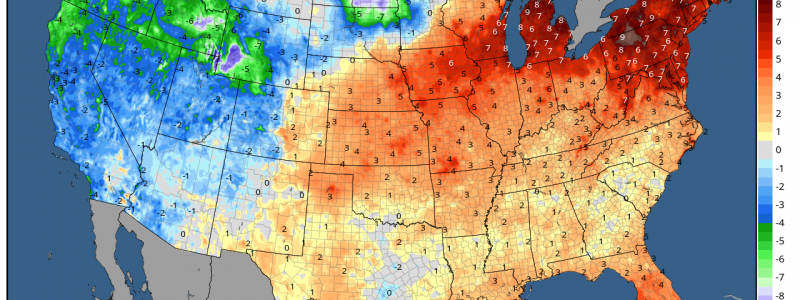
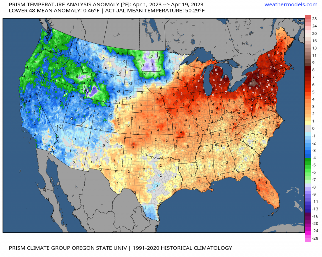
As we approach the final week of April and look back on the average monthly temperature anomalies thus far, we very clearly see a warm east (especially the Great Lakes/Northeast) and a cooler west.
Unfortunately for people who were enjoying the overall warmer pattern in the east (it’s me, I’m people), a complete flip is about to materialize.
Unlike the transient colder periods we’ve seen in between warm ups recently, this pattern flip looks to settle in for a while – possibly for up to two weeks.
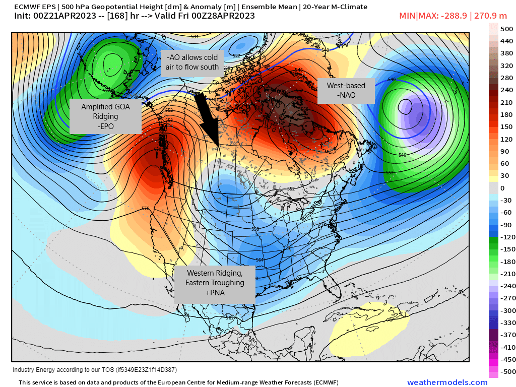
Our teleconnections will work together to produce a pattern that is coveted by snow and cold weather lovers during the winter months.
- The EPO becomes negative as a ridge amplifies over the Gulf of Alaska region, working with the -AO and -NAO to funnel cold air into the Lower 48.
- The NAO remains solidly negative, sustaining a west-based, high-latitude blocking ridge near Baffin Bay (between Greenland and Canada) and creating a “slow down” underneath it, allowing troughing to linger.
- The PNA will gradually become positive, producing ridging over the West Coast and prolonged troughing in the East.
- And finally, the AO remains negative, allowing cold air from the poles to flow southward between the blocks produced by the -EPO and -NAO.
In plain terms, the pieces to produce a significant pattern change will gradually line up over the next few days. The result will be a sustained period of cooler than average temperatures for US east of the Rockies.
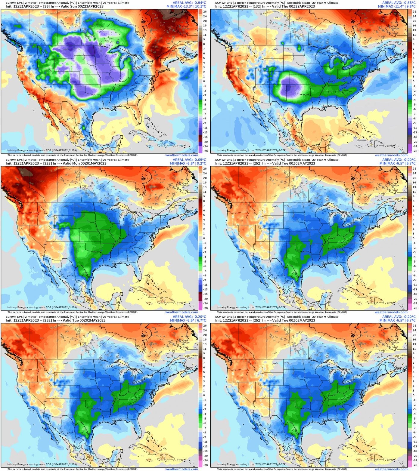
Were it still winter, this pattern would have the potential to produce significant cold and perhaps a winter storm or two for the East. However, since we’re edging toward the start of May, temperatures below average by 5 to 10 degrees will be chilly, but not frigid. Of course, the other side of the coin is that the West will at long last start to warm up. It’ll be feeling like Spring by the middle of next week as this pattern really settles in.
Want to see how cold or warm your area will be and for how long? Check out the 14 Day Trend Forecast for your city here.
What you may be wondering at this point is: Can this forecast change?
Absolutely. We saw how small changes in forecast for these teleconnections have large impacts back in December. Due to a persistently negative PNA, the Eastern US cold snap kept getting pushed further and further out. Finally, near Christmas, everything lined up to produce a record-breaking cold snap.
As mentioned, this won’t be record breaking cold. It’s nearly May, after all. However, a late-season frost or freeze could occur. The possibility should be monitored, especially if you’re employed in agriculture.
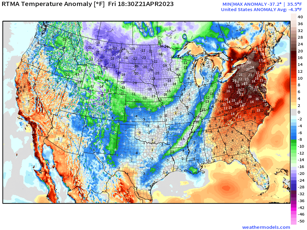
As evidenced by the map above, the flip I’ve spent this blog talking about is already starting to work its way in behind the latest cold front. If you’re out ahead of that front, get outside and enjoy the last day or so of really warm weather!


