Atmospheric River Event to Bring Significant Precipitation, High Winds to Northwest
A strong atmospheric river event will impact parts of the Pacific Northwest from later today into Sunday. Representing an incredible convergence of geographical and atmospheric factors, Pacific atmospheric rivers can bring significant rain and snow accumulations, as well as strong, damaging winds, to parts of Oregon, Washington, and California.
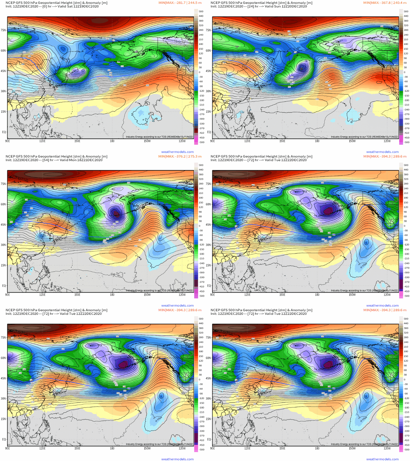
Our story starts with a significant closed low over parts of Alaska and Russia. As this closed low continues to largely sit over the northernmost reaches of the Pacific, unseasonal ridging over the mid-latitudinal sections of the ocean are creating an impressive heights gradient, strengthening the subtropical jet.
Weathermodels link (free GFS!)
This pattern has allowed persistent, roaring zonal flow to develop in much of the northeast Pacific ocean. As shortwave disturbances develop in this favorable regime, diffluence aloft allows low-level cyclones to form and strengthen while moving northeast towards the Canadian coast. As the mid/upper jet remains parallel to the track of these shortwaves (which it should be, to a degree, over the next ~3 days), the same locations see largely unwavering low level regimes. For those in the northwest US, this unwavering regime is southwesterly flow, capable of transporting an incredible deal of Pacific moisture smack into the coast.
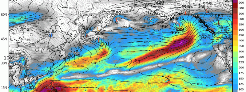
That was a bit of a mouthful. Perhaps this graphic will help it make sense: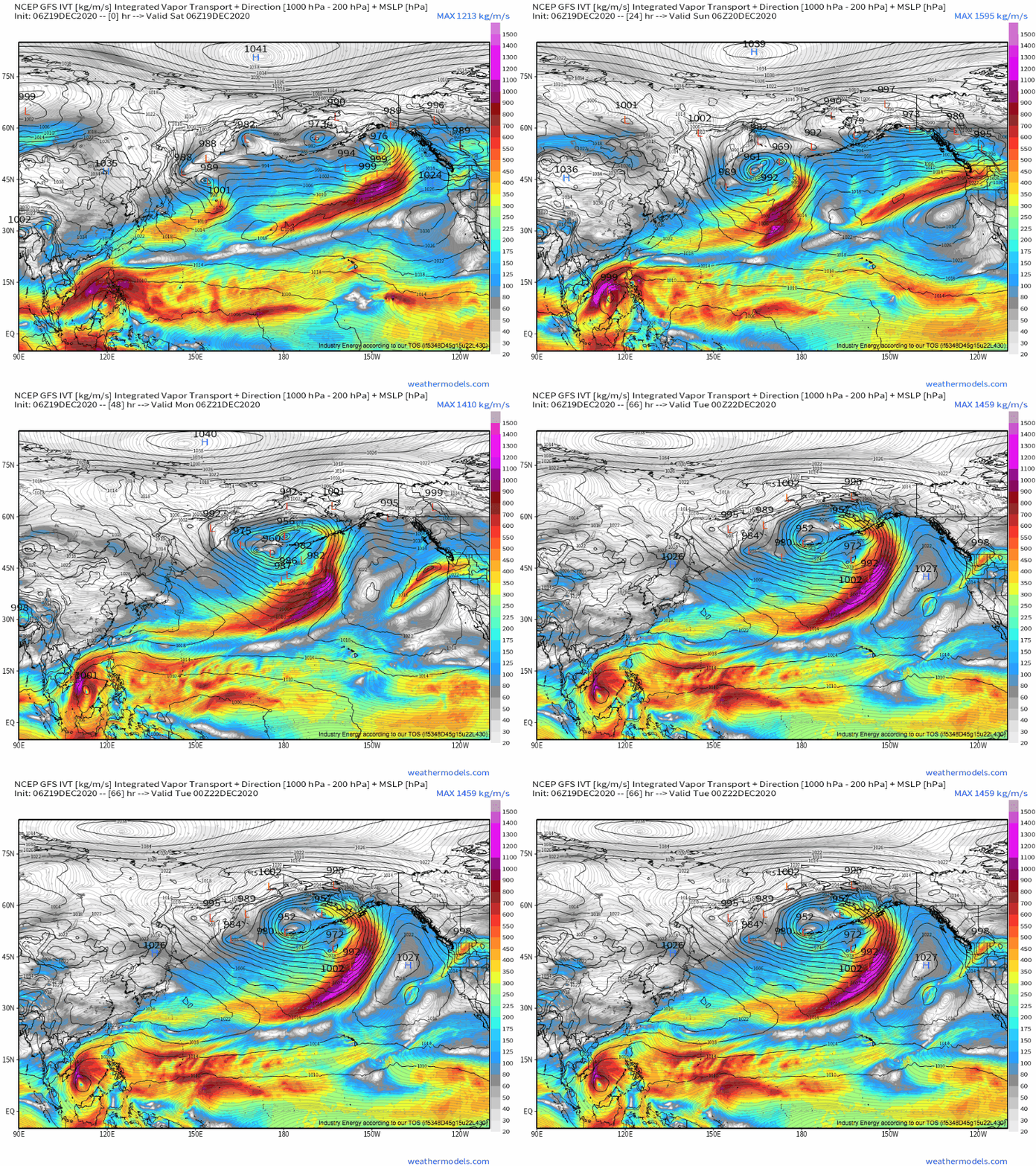
Weathermodels link (free GFS!)
This loop is of something called integrated vapor transport, a metric of how much moisture is being moved through the atmosphere. Notice how, in conjunction with persistent SW-ly flow beneath a series of westerly low-level cyclones, consistently high values of IVT are moved over parts of the Pacific Northwest.
This ‘firehouse’ of Pacific influx means much of Oregon and Washington will have oodles of one facet of heavy rain, moisture. The other necessary piece of the heavy rain equation is lift, which is actually provided by two things: frictional convergence from the air moving from water to land (this is moderately intense), and orographic lift from coastal mountain ranges (this is very intense). As mountains and coastlines don’t often get up and walk away, these sources of lift are very persistent. And, because of the aforementioned nature of this atmospheric river event’s Pacific influx, so is the moisture access. This combination sets the stage for heavy, long fused precipitation over the next two to three days.
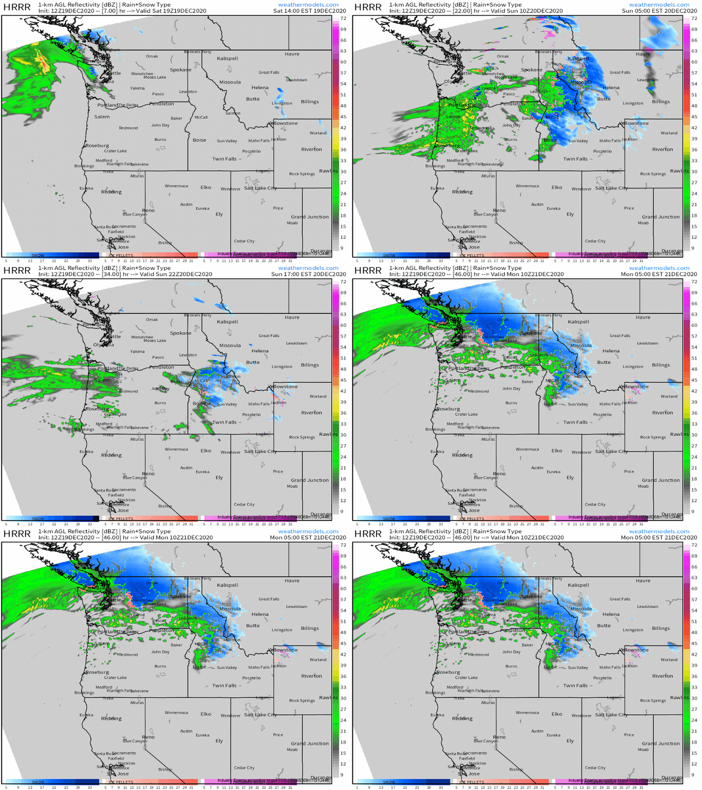
Don’t just take my word for it, though. Take a look at simulated radar from the HRRR:
You can watch the persistent moisture influx and non-moving topographical lifting interact! Now, the firehouse of moisture won’t be perfectly unwavering; rather it will shift north and south slightly as the midlevel flow flexes and buckles beneath subtle westerly moving perturbation. But the loop above is over 40 hours- that’s persistence!
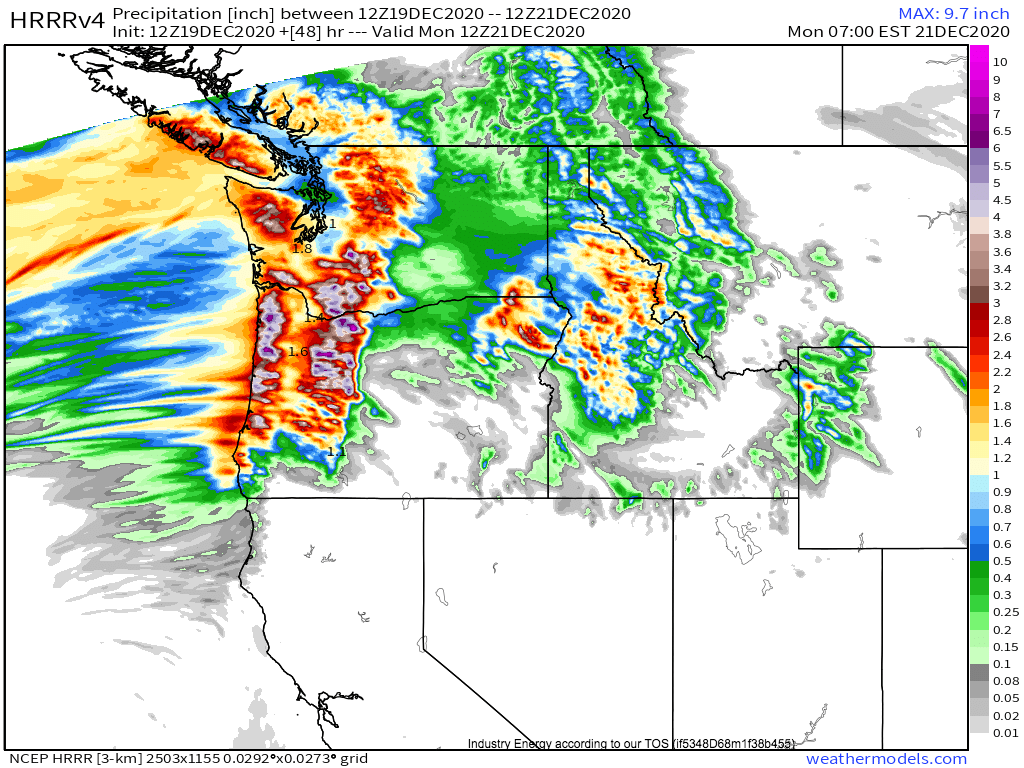
Typically, when it precipitates almost continuously for three days, a lot can accumulate. This will be true here. While this should be a ‘warm’ atmospheric river event, with snow levels rising throughout, very heavy snow will be likely above ~6000ft in the mountains. Here, where snowpack is already measured in the dozens of feet, some peaks will see >50″ of accumulation. Elsewhere, where rain falls, up to 10″ will be possible in favored upslope locations! Elsewhere along the coast, widespread 2-4″ accumulations will be likely, with less in valleys that typically stay dry with westerly flow. Some river flooding and mud flows can occur with this level of rain, and a flood watch is in effect.
A secondary threat will be gusty winds. As the low level jet moves ashore tonight, it will bring very gusty surface winds (limited by poor mixing at the hands of Pacific moisture, but bolstered by lack of friction over the ocean) to the northwest. As usual, the strongest winds will be along the immediate coast and the higher peaks, both of which will see wind that isn’t as reduced by friction of traveling over the surface. 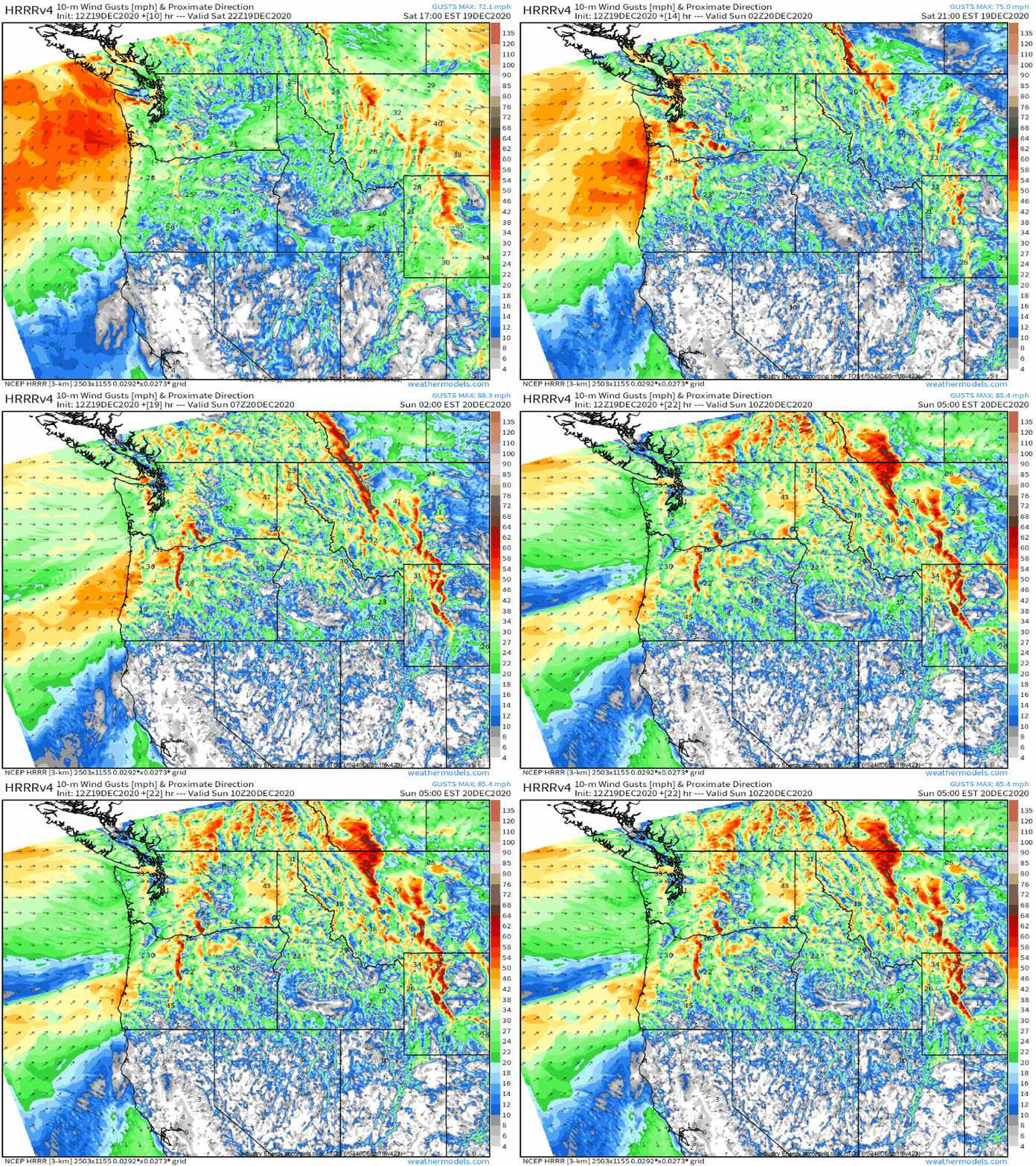
These winds could be locally damaging, although many areas impacted are ‘used to’ this kind of wind.
Anyway, there you have it- the atmospheric river, an incredible culmination of atmospheric and topographical factors that can relatively easily produce copious precipitation and damaging winds. How cool! And to those in the PacNW, good luck staying dry!
