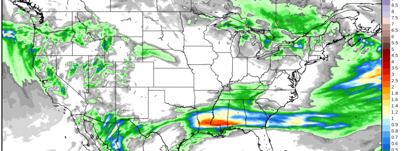
As Fire Threat Wanes, Pacific Low Incites Heavy Rain Downstream
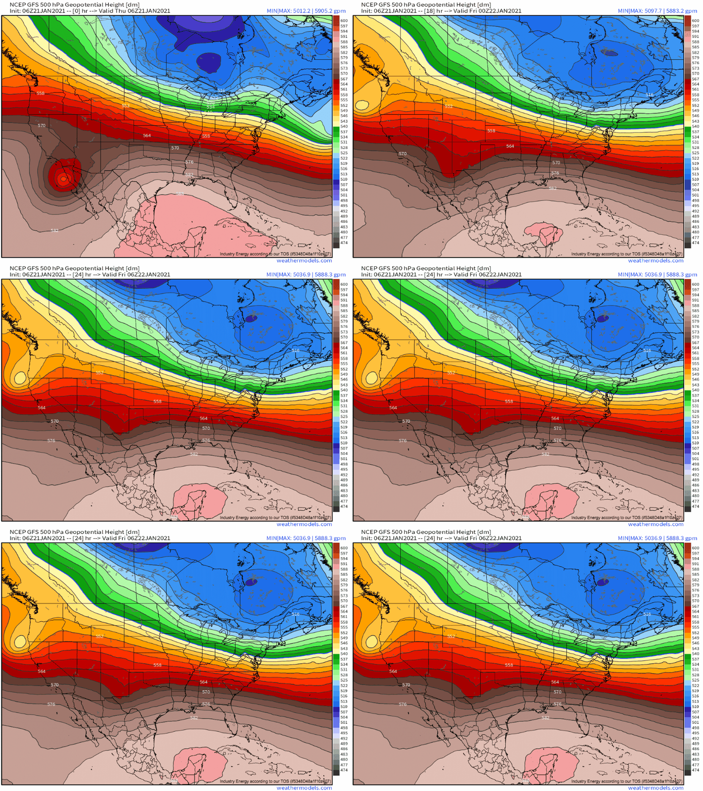
The midlevel low southeast of the California coast brought an unusual high wind/wet season fire event to California. But as the system is incorporated increasingly into broad troughing, the opposite is happening: Pacific moisture, funneled east by the unusual setup, is bringing several areas a heavy rain threat today.
This “unusual setup” of which I speak is actually the steady de-amplification of the unusually intense midlevel cyclone that moved off the California shores a couple days ago.
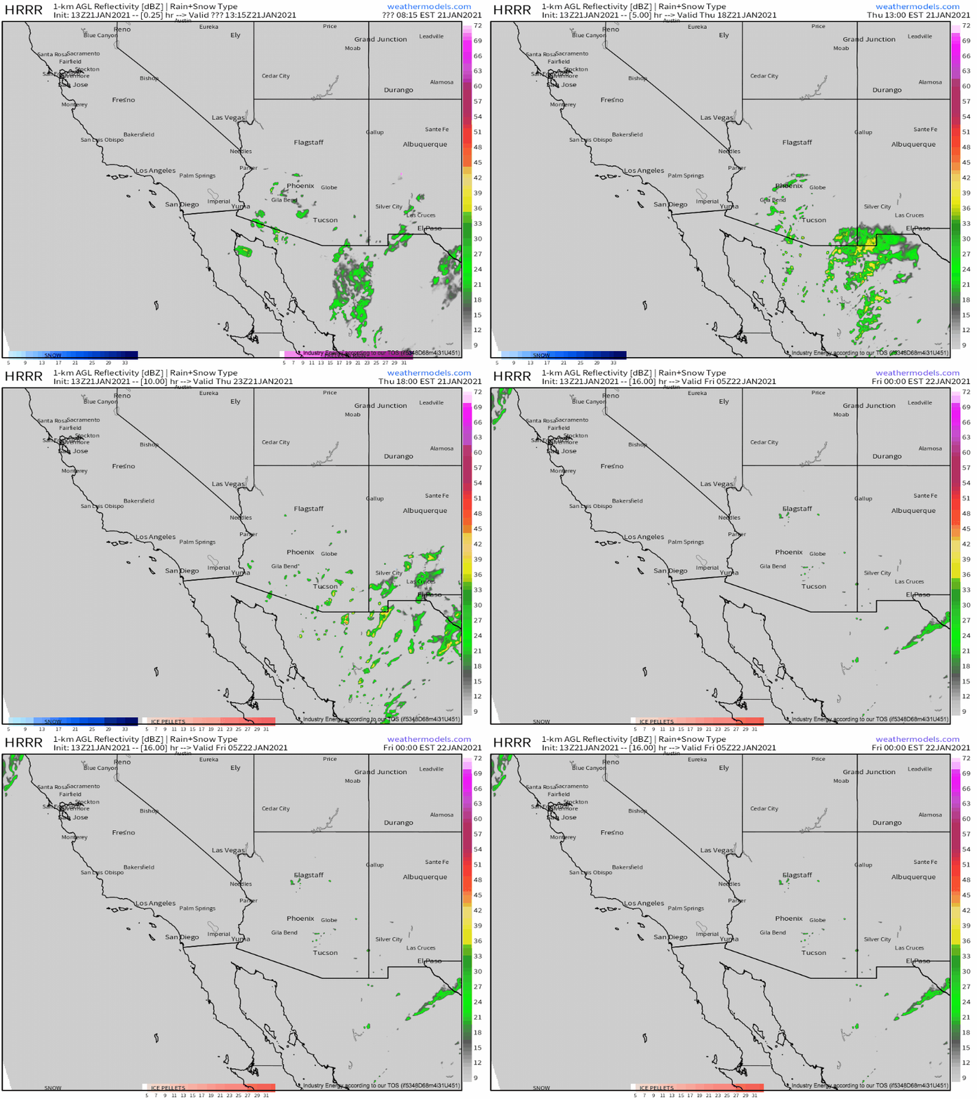
The first zone of heavy rain is pretty straight forward, given this sort of midlevel evolution. It’s to the immediate east of the midlevel low axis, a zone where intense divergence aloft is incited by a dramatically spreading height field overlaps cold midlevel temperatures, a pacific moisture stream, and complex terrain.
This will be across parts of southern New Mexico and Arizona, where a potpourri of convective and topographically forced showers will continue to drop moderate to locally heavy rain. These lifting incentives suggest ‘spotty’ cellular rainstorms are more likely than stratiform, so some areas will see quite a bit of rain while others see none. While accumulations anywhere shouldn’t be that significant, the nature of the storms means there could be an isolated incident of flooding, perhaps flashy, as a lot falls in a little time and on unreceptive terrain.
So, that’s zone one of heavy rain concern today.
Zone two is a little more interesting, and could feature much higher totals, although over a region much more receptive to heavy rain.
If you remember from November, a hurricane well placed relative to a midlevel trough can incite a very significant rainstorm hundreds of miles away from the cyclone itself, in a setup known as a predecessor rain event (PRE). Read a blog I wrote about a high-end PRE that dumped more than a foot of rain in the Carolinas in association with Eta, for example.
The fundamentals: a hurricane introduces a great deal of moisture into the atmosphere. When a midlevel jet increases in speed with distance from a hurricane, moisture than can be ‘siphoned’ north by a low-level jet associated with the speed divergence-related mass removal, a region that also inherently has synoptic-scale lift supportive of precipitation. When this plentiful moisture smacks into a frontal boundary associated with the midlevel trough, efficient, heavy rain can fall. And, if the trough is sufficiently deep for a PRE to develop, the front typically doesn’t move very fast, so PREs can last days, producing catastrophic flooding.
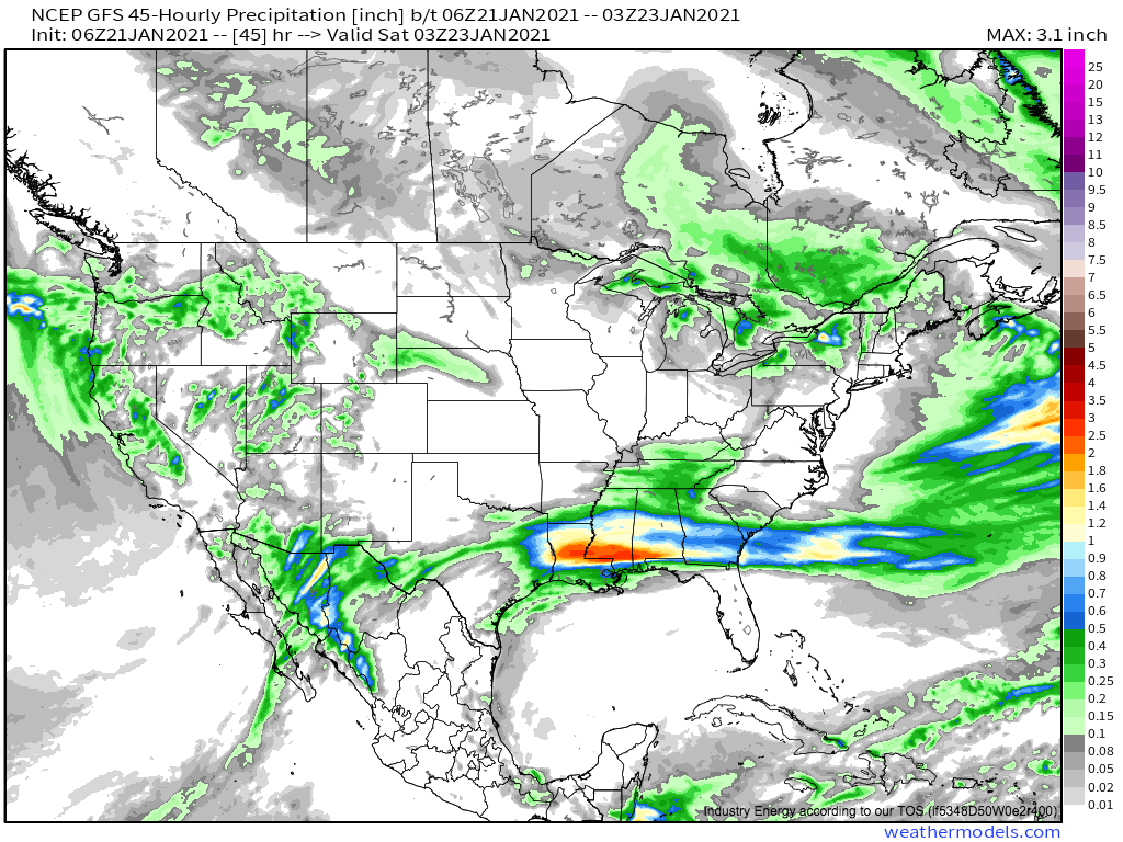
Something pretty similar will actually bring heavy rain to the south-central US today into tomorrow. Sure, it will be sideways, won’t actually involve a tropical system, and won’t drop any more than 3-5″ of rain, but the dynamics at play are not too different.
The moisture source will actually be the 500mb cyclone near the Baja peninsula and associated convection, which will introduce a fair deal of Pacific moisture aloft.
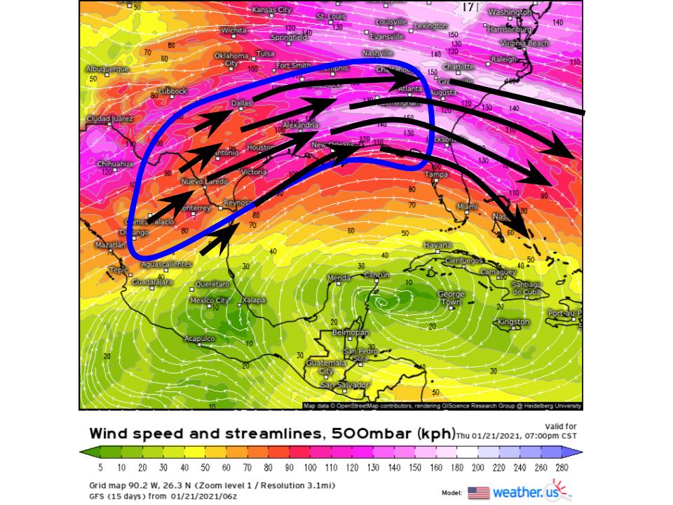
As the cyclone approaches the large scale troughing that’s currently bringing chilly temperatures and snow squalls to the northeast, the south-central US will find itself under interesting flow aloft.
A speed min shifting through the south-central US between the two speed maximums will incite mass evacuation in the lower levels through speed divergence along a streamline:
As this happens, westerly flow in the lower atmosphere will intensify, siphoning Pacific moisture injected into the atmosphere by the cyclone towards the east. 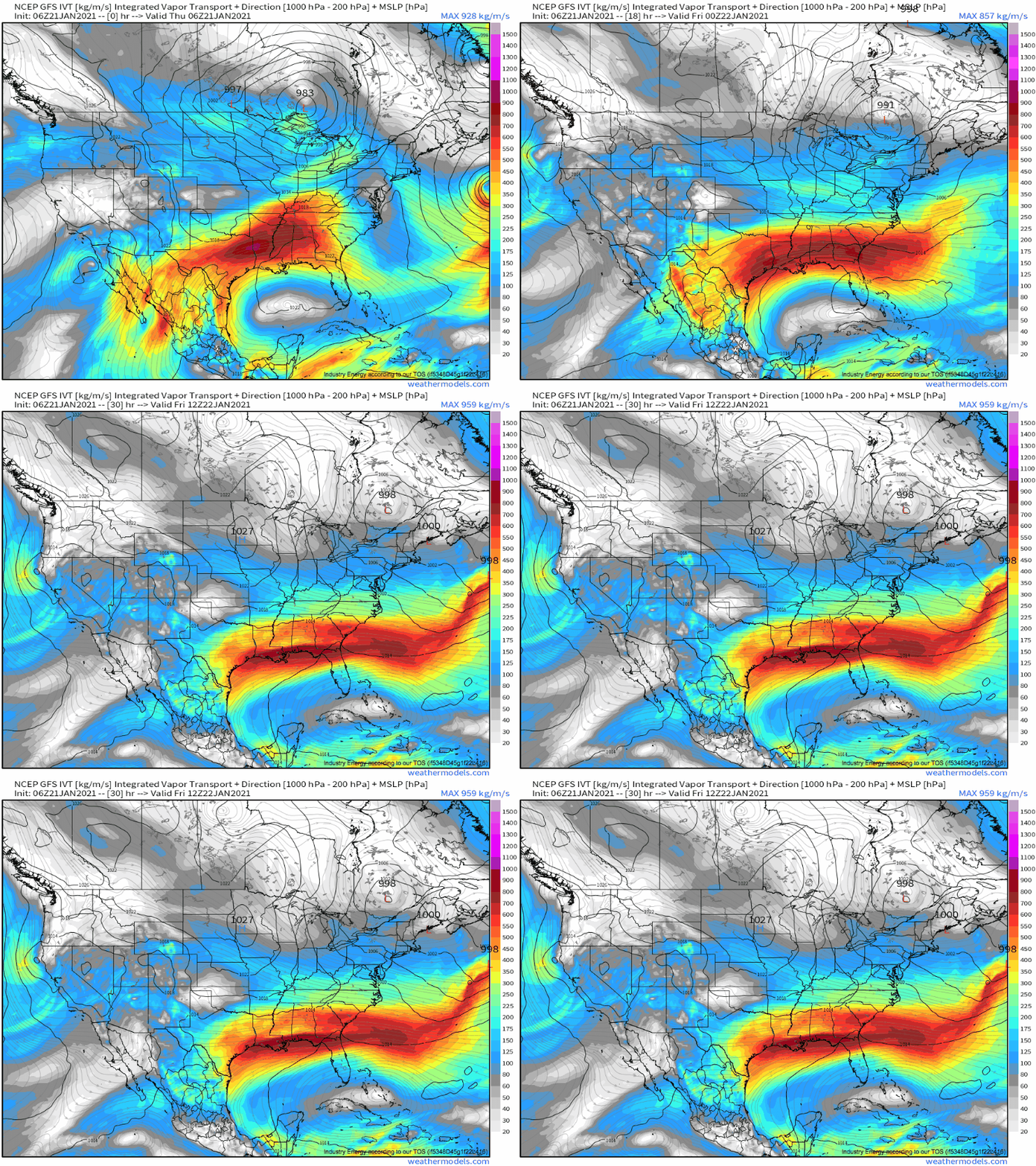
This can be seen in integrated vapor transport fields, a measure of how much moisture is being moved through the atmosphere. Clearly, there is a great deal of Pacific moisture being transported from the opening midlevel cyclone towards the south-central US over the next ~30 hours.
Where lifted by a semi-stationary surface front aligned with the Gulf coast thermal gradient, some reasonably persistent, moderate rain is likely. While limited by a lack of instability and by the fact that chilly January air can’t hold all that much moisture, this should still be a relatively heavy event.
