As Dangerous Heat Builds, Thunderstorms Erupt
Low pressure systems are the drama queens of the atmosphere. As air erupts upwards to fill mid-atmospheric vacuums, rotating cyclonically with the coriolis force, it can smash airmasses together with the type of dramatic convergence that drives threats ranging from damaging wind to flash flooding, storm surge to blizzards. But the humble anticyclone, a great mass of sinking air, shouldn’t be underestimated either, a lesson taught by the massively expensive and tragic cold air outbreak that struck the south this February. And today, an increasingly powerful and large anticyclone parked over the central US will drive an immense poleward advection of record-setting and, in places, dangerous heat.
Our story starts with a ridge of anomalously large heights that extends from the Pacific into the Atlantic, highest in amplitude over the north-central Plains. Perched beneath this ridge is a pocket of midlevel low pressure over Texas, which is helping to keep pressure gradients stout, enforcing fairly progressive midlevel flow for such a broad ridging regime.
The midlevel structure translates fairly well to the lower levels of the atmosphere, as does the regime of moderate flow to the east, curved cyclonically around a Texas low. As this flow whisks low-latitude air through the gauntlet of topographically-induced ups and downs known as mountain ranges, it warms, dries out, and warms some more. Where soil moisture is low, in some cases anomalously due to the extreme drought conditions that mar the West, solar energy that would otherwise be partitioned into evaporating low-atmospheric moisture is instead ‘used’ to heat the air, allowing warming to accelerate. The result is a series of ‘pockets’ in which temperature are set to match daily record highs today- in the southwest, the north-central plains, and the northeast.
This heat may be atmospherically interesting (each circled number is a record high that will be approached or even exceeded today), but it can also prove dangerous. This will be especially true in cities like Minneapolis, and the corridor from DC to Boston, where the urban heat island effect will increase heat stress on the vulnerable. Many in these cities are simply not used to such temperatures, meaning the body will be more stressed today than would be the case come July or August. Additionally, with night time lows having trouble getting below 70ºF in the aforementioned areas, stress to the body could well accumulate over several hot days and warm nights.
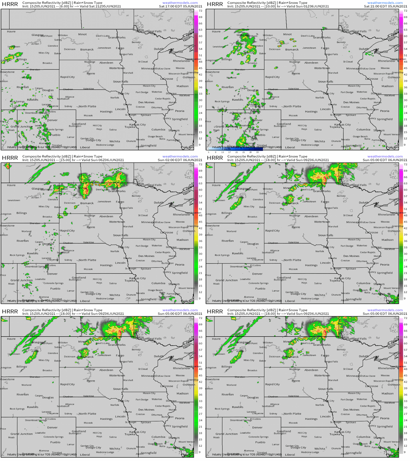
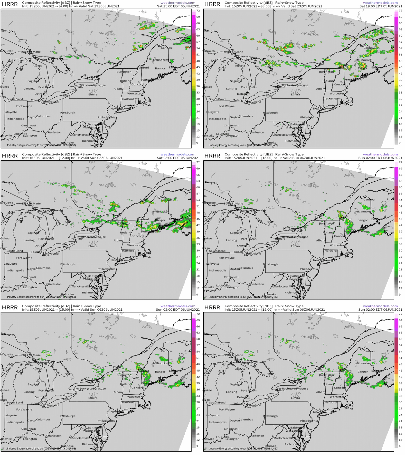
An additional hazard will develop along the northern periphery of this big high pressure dome, as a couple diving midlevel jet streaks thousands of miles apart overspread the instability inherent within a summery airmass with moderate shear and forcing for ascent.
In the northern plains, this will take shape as a stout EML and moderate moistening of a very hot airmass promotes stout instability overlapped by flow to 70 knots from Montana to North Dakota. A number of bowing segments and low-precipitation supercells capable of strong wind gusts and large hail will be possible here; I wouldn’t be surprised to see a significant wind gust amidst a stout inverted-V low level profile.
Over Maine and adjacent sections of interior New England, meanwhile, a secondary severe thunderstorm threat will evolve as enhanced midlevel flow dives southeast towards the Atlantic coast. With 40+ knots of deep shear overspreading a 20-30 knot LLJ pumping the area full of high-end moisture, a setup marginally favorable for hail and tornadoes and potentially very favorable for damaging wind will develop. Surely, storm mode will play a big factor, but if a primary round of storms remains muted in coverage, and if secondary storms this evening develop before sunset, swaths of wind damage could occur.


