Any Signs of Sustained Spring Warmth?
To answer the headline – No.
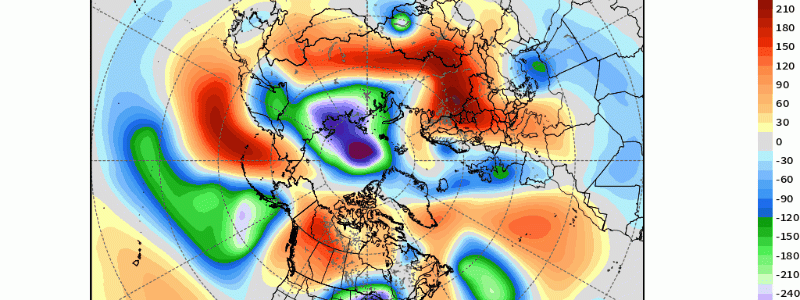
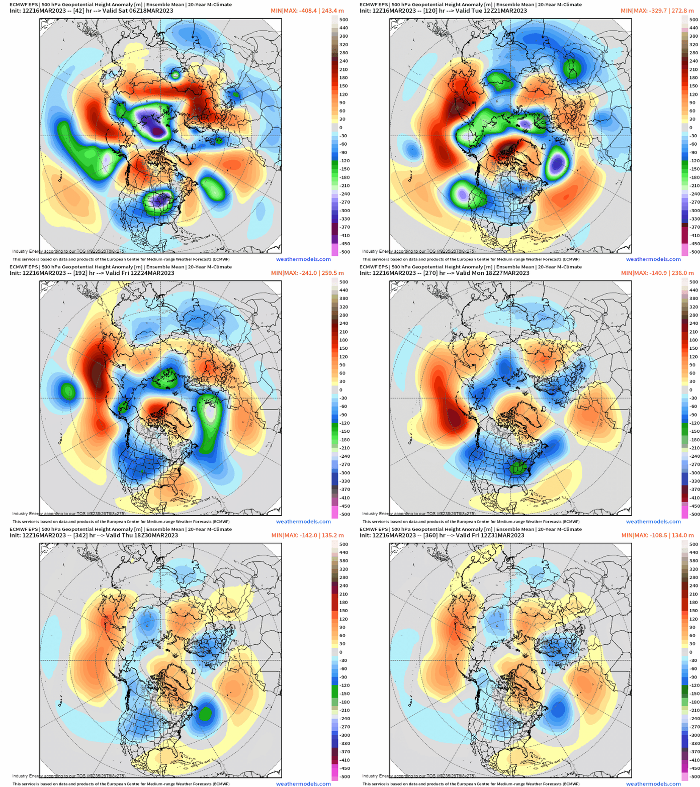
In fact, there are still no signs of any sustained warmth to flood the CONUS heading into April. This is a result of both the MJO and lingering effects of the major sudden stratospheric warming we had back last month. Let’s simply analyze the z500mb height pattern through the end of the month.
- Ridging persists across Greenland / Hudson Bay / Davis Strait
- Ridging extends across the northern Pacific
- Continued activity via Pacific jet for the West
- Polar air intrusions as a result of lingering high-latitude blocking

Now viewing 200mb where we can glean information regarding the jet stream, we see a split flow across the Pacific with an active sub-tropical jet “feeding” tropical moisture and waves toward the U.S. We also see how from west-east, there are undulations in the jet stream and continued activity. In essence, there’s no pattern in sight that becomes truly “locked” in.

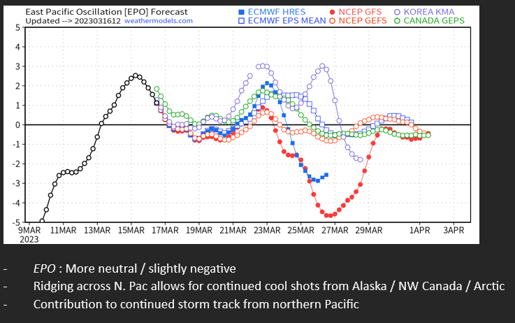
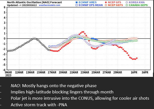
Now putting it through an index perspective, I’ve created bulleted points what the teleconnection verbatim applies. We see the EPO straddle the neutral side, which aligns with somewhat suppressed ridging across the northern Pacific, but this can facilitate troughs into the West while also supplying polar air masses southward. The NAO index to no surprise stays mainly negative as a result of the continued blocking. This keeps the polar jet suppressed into the U.S. with cool shots continuing, and an active storm track as well. Lastly, the PNA remains negative as a result of the Pacific Jet, so the West Coast will continue to remain remarkably active. This also implies with repeated trough’s “crashing” into the West Coast, these storms have to trek eastward across the CONUS.


To sum up everything: The pattern going forward across the CONUS will remain active and transient. Several shots of chilly modified continental polar air masses will rotate through as a result of a combination of the above, with more wintry weather likely impacting the West, Plains, and Midwest. This cold air, however, will be modified under the rapidly changing March sun angle and shift toward the official Spring season. We’ll have to wait until April for more spring-like weather and notable warmth to occur, but for now, we’re certainly in the midst of the “battle” between the departing Winter season and incoming Spring.


