Another Winter Weather Mystery
One winter storm down and… who knows how many more to go. That’s right, we have another weekend winter storm mystery to unravel. Let’s take a look.
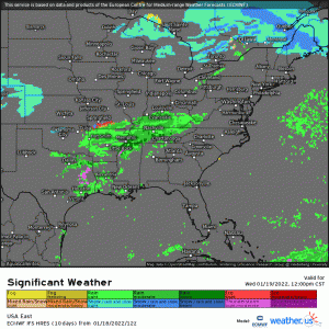
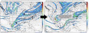
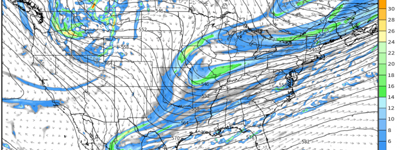
Wednesday into Thursday, a shortwave preceding this weekend’s potential event will set the stage.
Though severe storms are possible on the southern end (mainly for Texas, Louisiana, and Mississippi), this will be a rain to snow event for some in the Mid-Atlantic.
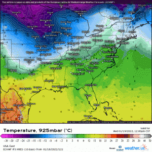
As this front passes, it will pull some very cold air in behind it.
Any moisture left over on the trailing edge of the front could easily become a quick inch or two of snow for some lucky region, especially with a little extra lift along the frontal zone as the cold air clashes with the “warm” air ahead of it. Nothing major at first, though.
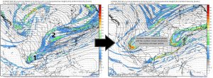
This frontal zone is then forecast to stall and a trough swings in from the northwest. Here’s where our path forward becomes unclear.
We know we’ll have the cold air in place for winter weather. Whether these two separate disturbances phase or not will drive the intensity of the weekend storm.
Scenario 1
In this scenario, the elongated southern stream disturbance and the northern stream disturbance phase, or combine, producing a more powerful system.
The ECMWF, ICON, UKMET, and KMA all, at this time, support some degree of phasing.
The resulting weather for the southeast would be an area of heavy snow inland, likely in Piedmont of North Carolina and into Eastern Virginia, and an area of sleet or freezing rain along the lowlands/coasts of the Carolinas.
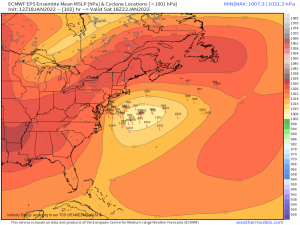
This scenario also favors a ridge in the northeast working to keep the low fairly far offshore once it emerges into the Atlantic. In this case, the precip shield would likely brush the outer edges of New England with snow on its way northeast, but not bring any heavy accumulations.
Scenario 2
Scenario 2 sets us up with both a northern and southern stream disturbance, much like scenario 1. However, unlike scenario 1, they fail to phase. The result is a system that quickly heads out to sea in the north and a weak, open wave in the south.
The northern system would bring a few snow showers to the Mid-Atlantic, but nothing substantial, as it exits quickly. The southern system, now without the added support of the northern system via phasing, would largely be an interior NC/SC/GA icing event with very little snow for those north.
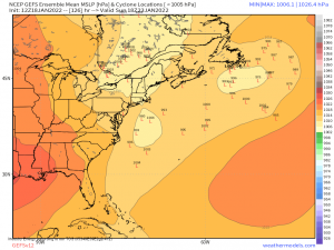
The timing would be a bit slower with this scenario. As of the current model runs, it would be Sunday morning before the second system emerges into the Atlantic. By this time, the ridge that had been blocking the low from moving NW toward the New England coast is gone. However, there is very little agreement in the placement or strength of the low via the GEFS.
Going with the little agreement we do have, an somewhat offshore low has the potential to bring a decent snowfall to the Northeast – especially far northern New England – but honestly, there’s just not enough agreement to make that call. Not to mention that this is one of at least two scenarios.
So there you have it. Two separate scenarios with widely different outcomes and lots of moving parts. Have I mentioned that I hate forecasting winter weather?
We’ll watch the trends over the next day or two and hopefully have a better idea of what to expect when we revisit this topic in Thursday’s blog.
