Another West Coast Cyclone Next Week?
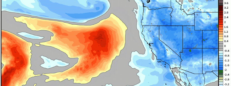
In the last 30 days, the entire state of California with the exception of far southern Ca (Riverside and Imperial county) are above average to well above in terms of precipitation and even those aforementioned are just about near average. We’ve seen a substantial amount of condensed water over this winter, and there’s no signs of this letting up as we roll into yet another active week next week!
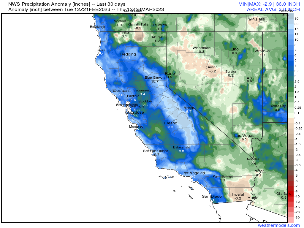
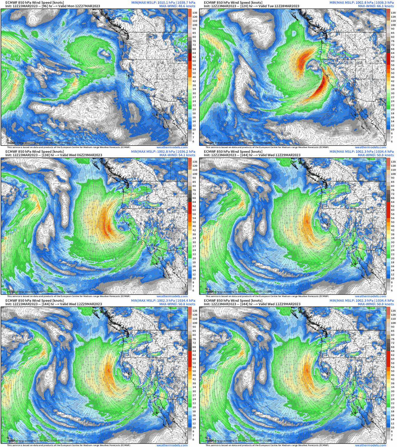
Below, a potent upper-level low will look to drop southward and “bowl” itself into northern/central California. Such a mid-level disturbance will allow for a surface cyclone to manifest, and crash somewhere north of Sacramento come Tuesday midday.
However, impacts will be felt later Monday because of a potent low level jet out ahead of the disturbance with strong moisture advection and forcing for ascent that transpires ahead of the impending mid/upper level low. A 40+ knot low level jet will propagate ahead of the disturbance, causing both warm air and moisture advection off the Pacific ocean allowing for rain to make landfall across northern California before the main axis shifts southward toward the Bay Area. By later Tuesday into Wednesday, the slug of rain will push further south toward Los Angeles. Along with low elevation heavy rain, heavy snow will also occur for Sierra Nevada Mountains, which by the way is already in the running for the most snowiest winter ever (currently sitting 2nd place with more than 56 feet that has fallen this winter!).
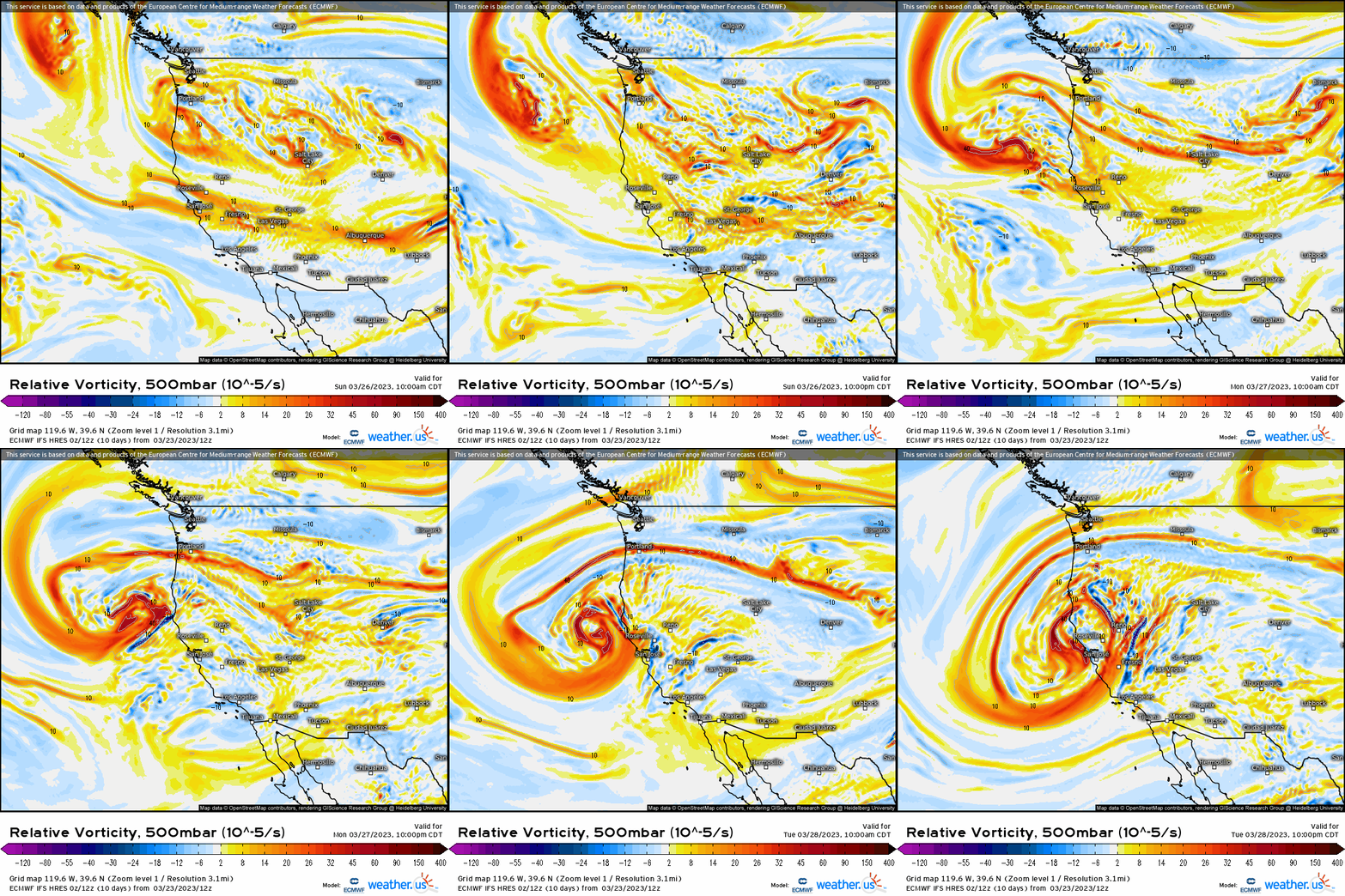
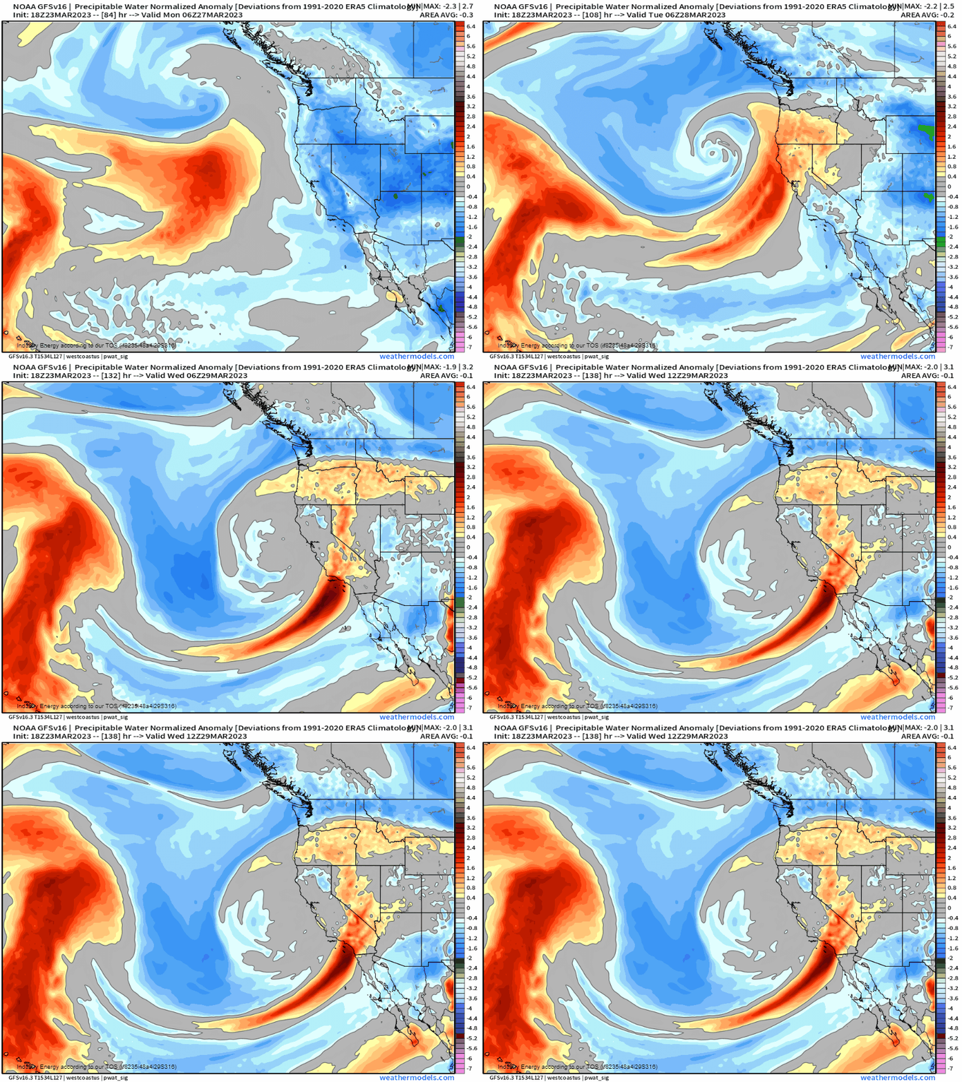
In terms of moisture in the form of water vapor readily available to be condensed, we’re looking at signals of at least 0.5 – 1 standard deviation above climatology within the warm sector of the cyclone, and unsurprisingly coincides with a potent low level jet.
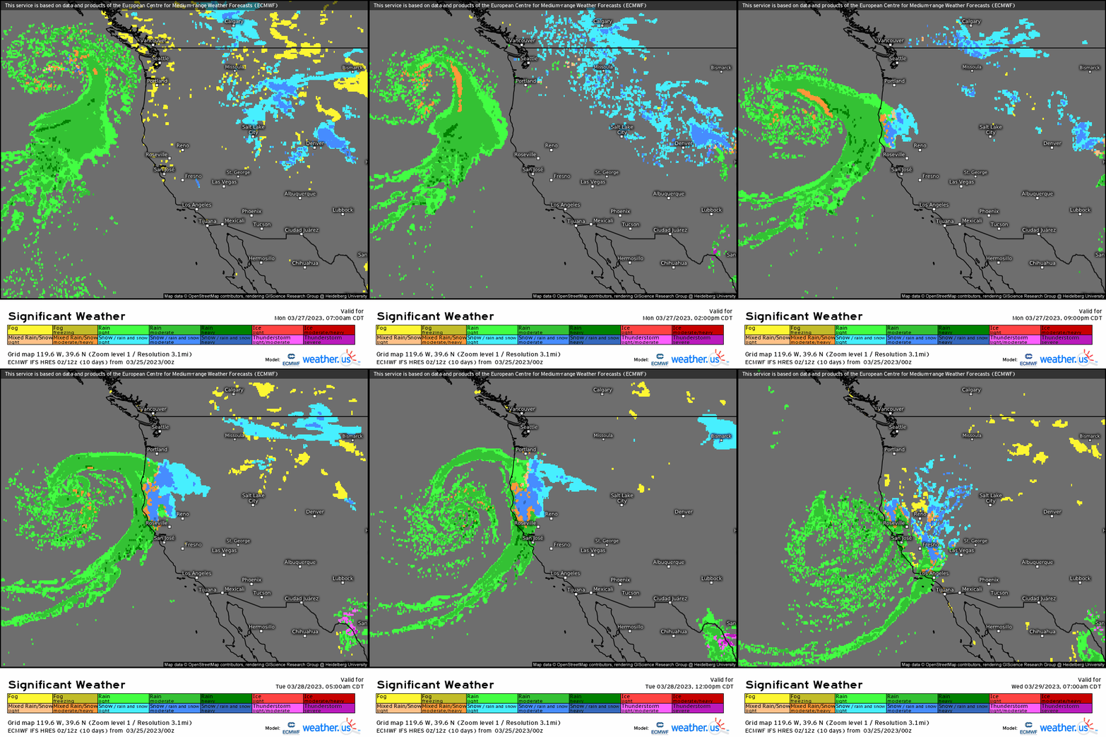
Here we can see how the surface is represented with a mature cyclone making way toward northern/central California and heavy rain overspreading from north to south along with heavy snow impacting the higher terrain.
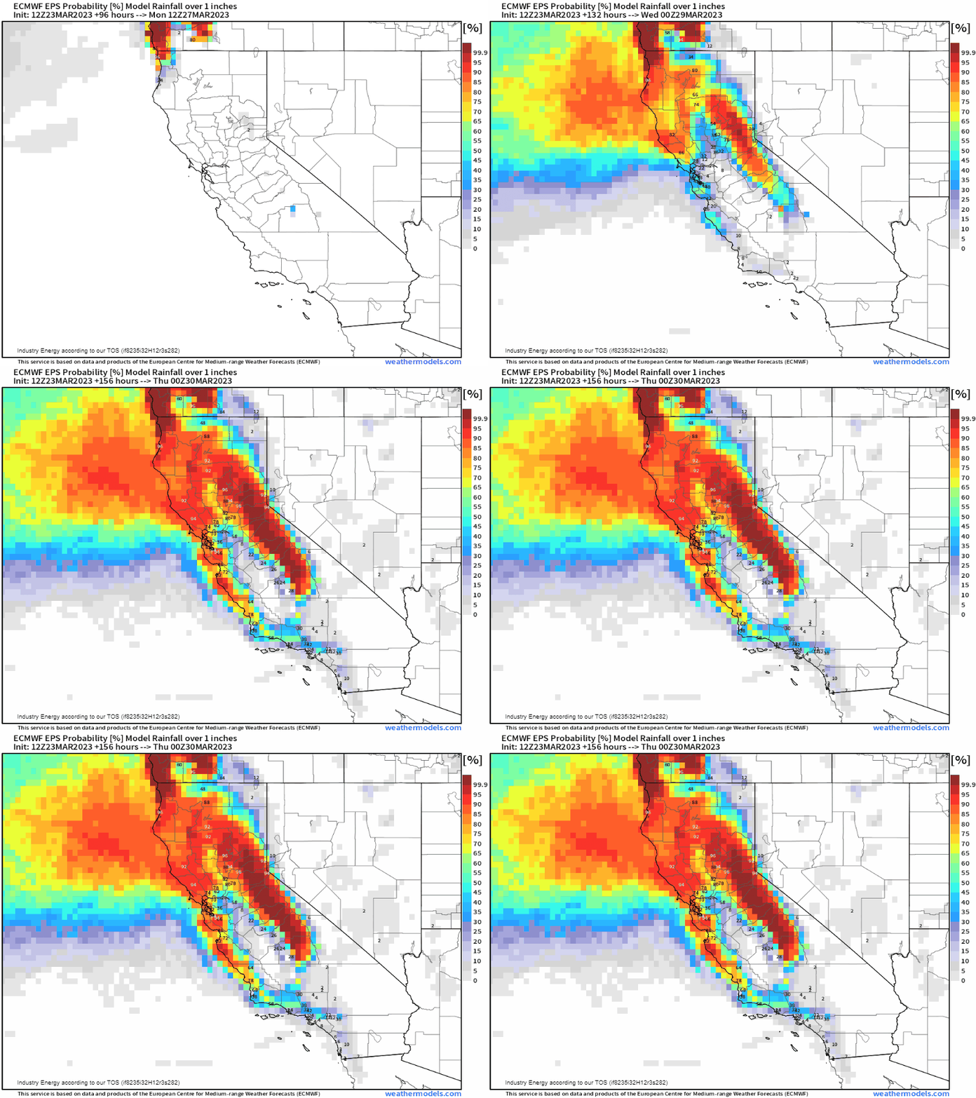
While there still may be some discrepancy in where the heaviest rain totals occur, there’s a growing consensus for a widespread swath of at least over an inch. The only positive aspect of this system is that this falls over the course of a day, so flash flooding won’t necessarily be an issue; however, it’s areas already prone to flooding from previous events that could allow for excess runoff to nearby lower elevations or surrounding locations.
