Another Week, Another Active Stretch!
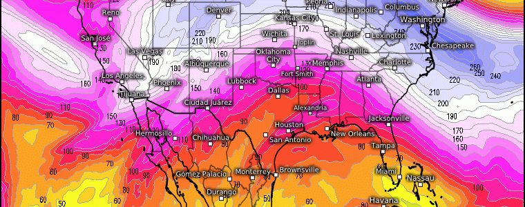
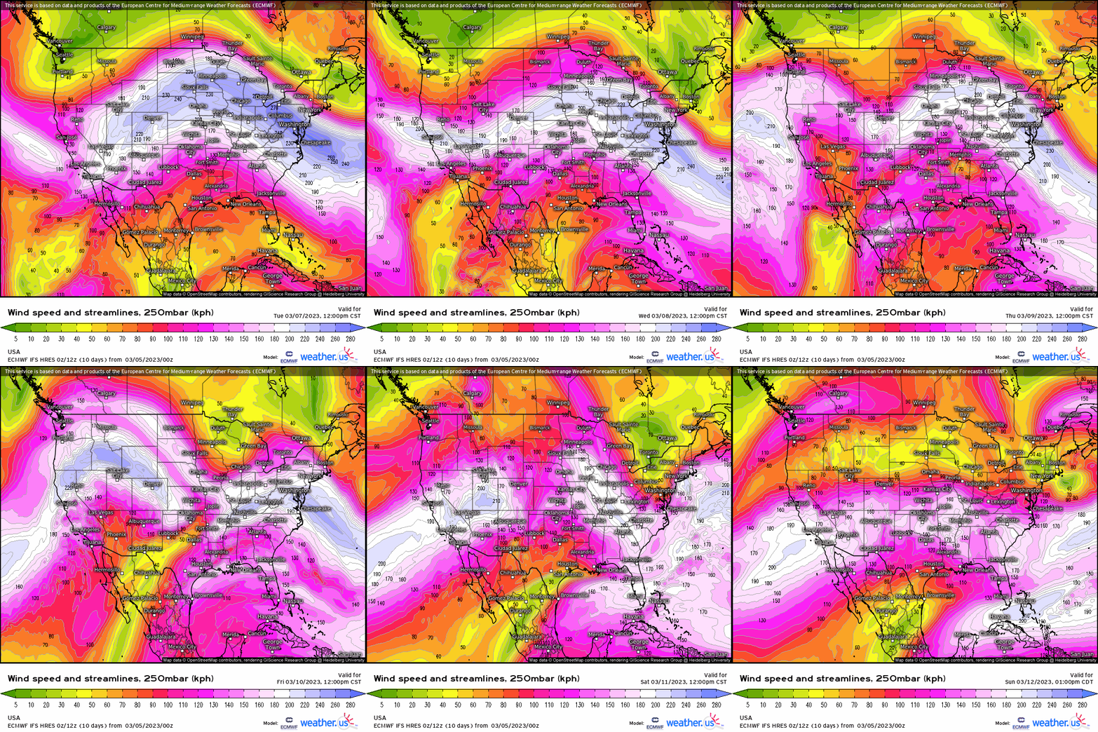
One way you can garner a sense of what may be happening at the surface as you analyze the 250mb or 300mb level is look at the overall orientation of the jet stream, with the jet streaks embedded. What do I mean by this? For example, look below. We have a quasi-zonal flow this week, but I can pretty much say with very strong confidence that north of the jet stream we have cold air while on the contrary it’s warm south of the jet stream; therefore, we likely are going to be dealing with unsettled weather where we see the “clash” of different air masses.
We know that we’re in the mid-latitudes, which means we’re in a baroclinic environment. A baroclinic environment implies contrasting air masses, fronts, and that means differences in densities. The latter then means we have differences in temperature! So putting it together, one way we can depict what the atmosphere may be doing at the surface is by what’s likely happening aloft due to the horizontal pressure gradient that is driven by such temperature a temperature gradient (which allow jet streaks to propagate in the first place!).
Temperature gradients we know usually are the impetus for unsettled weather if we have sufficient forcing for ascent of course.
Using a 850mb temperature anomaly, we can visualize this broad temperature contrast where again, north of the jet stream (streaks) we have colder air while it’s relatively warmer south (and more moisture); this helps establish a broad zonal frontal boundary where now we may likely find waves of low pressure form along.
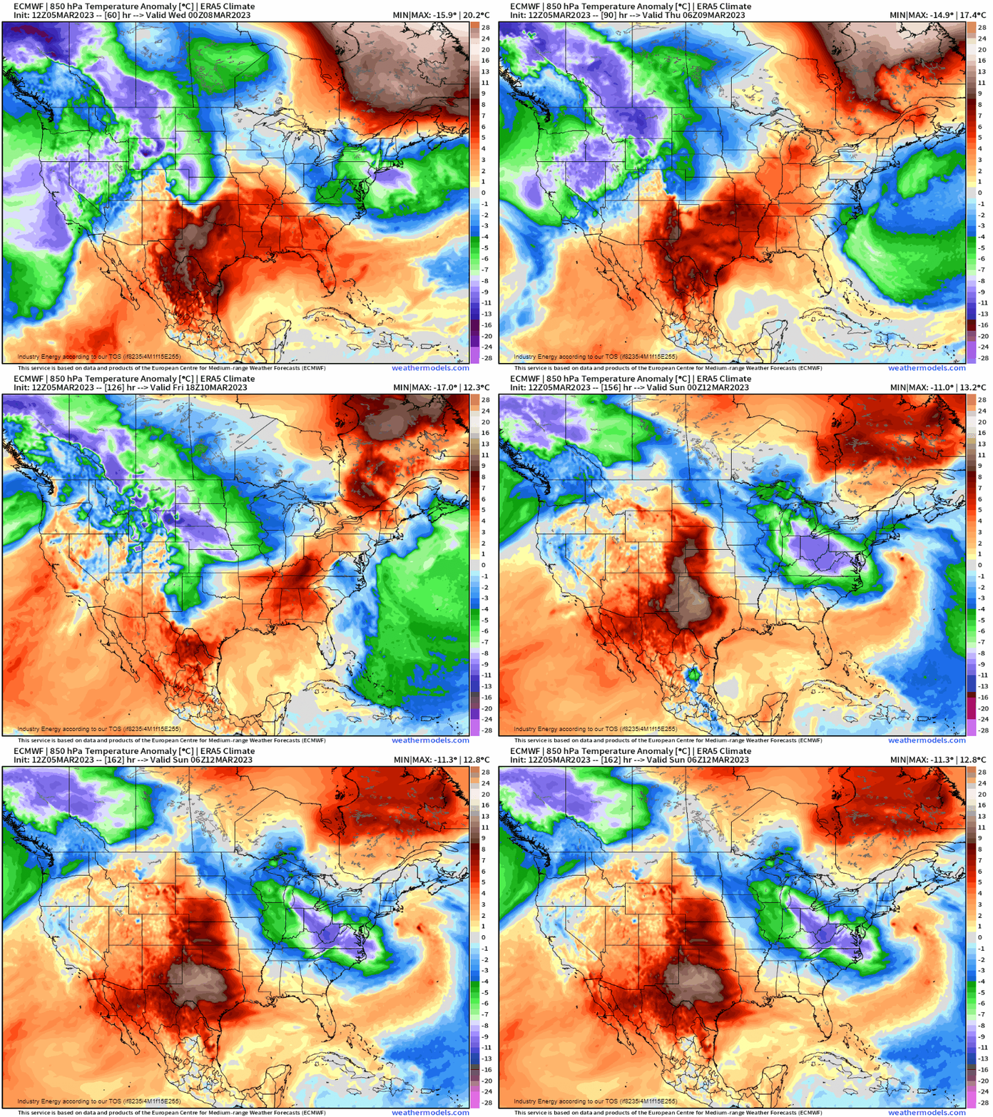
Without much surprise, we see that we have several shortwaves that move west-east this week as a result of our quasi-zonal flow. So we have our temperature gradient at the surface (surface convergence) and several shortwave troughs zip across the CONUS (providing lift) with an interesting notable trough this weekend that can make for an interesting potent storm in the Great Lakes and Northeast this weekend, that likely will be further covered later this week if necessary.
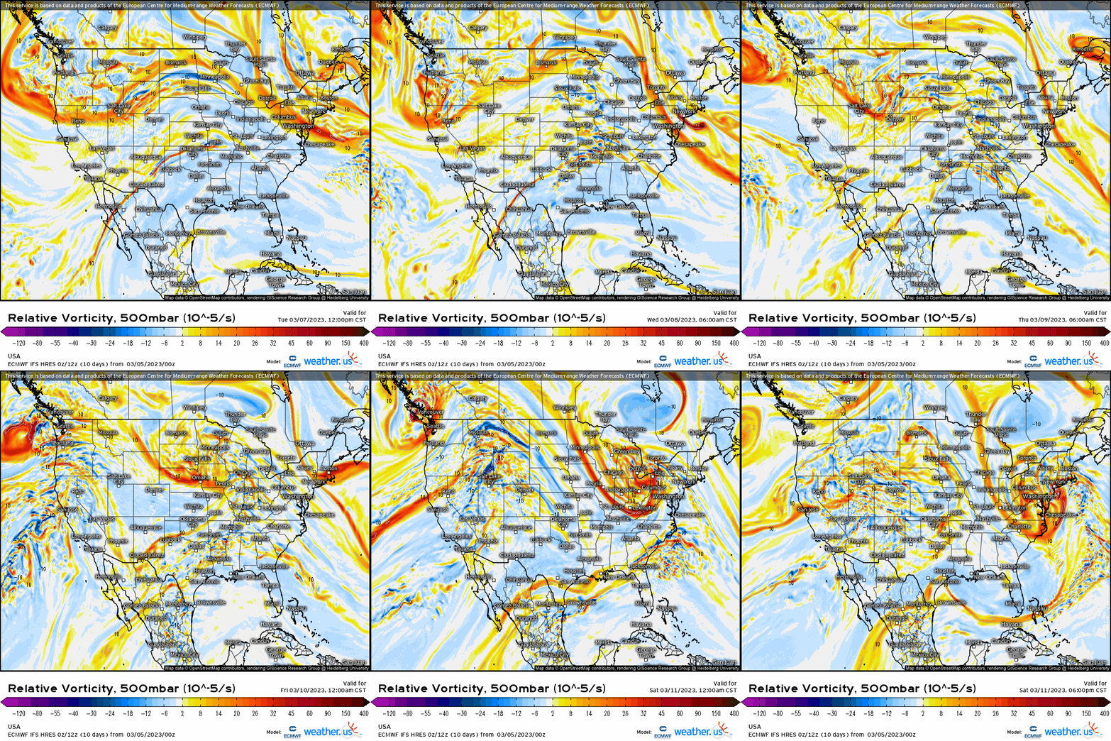
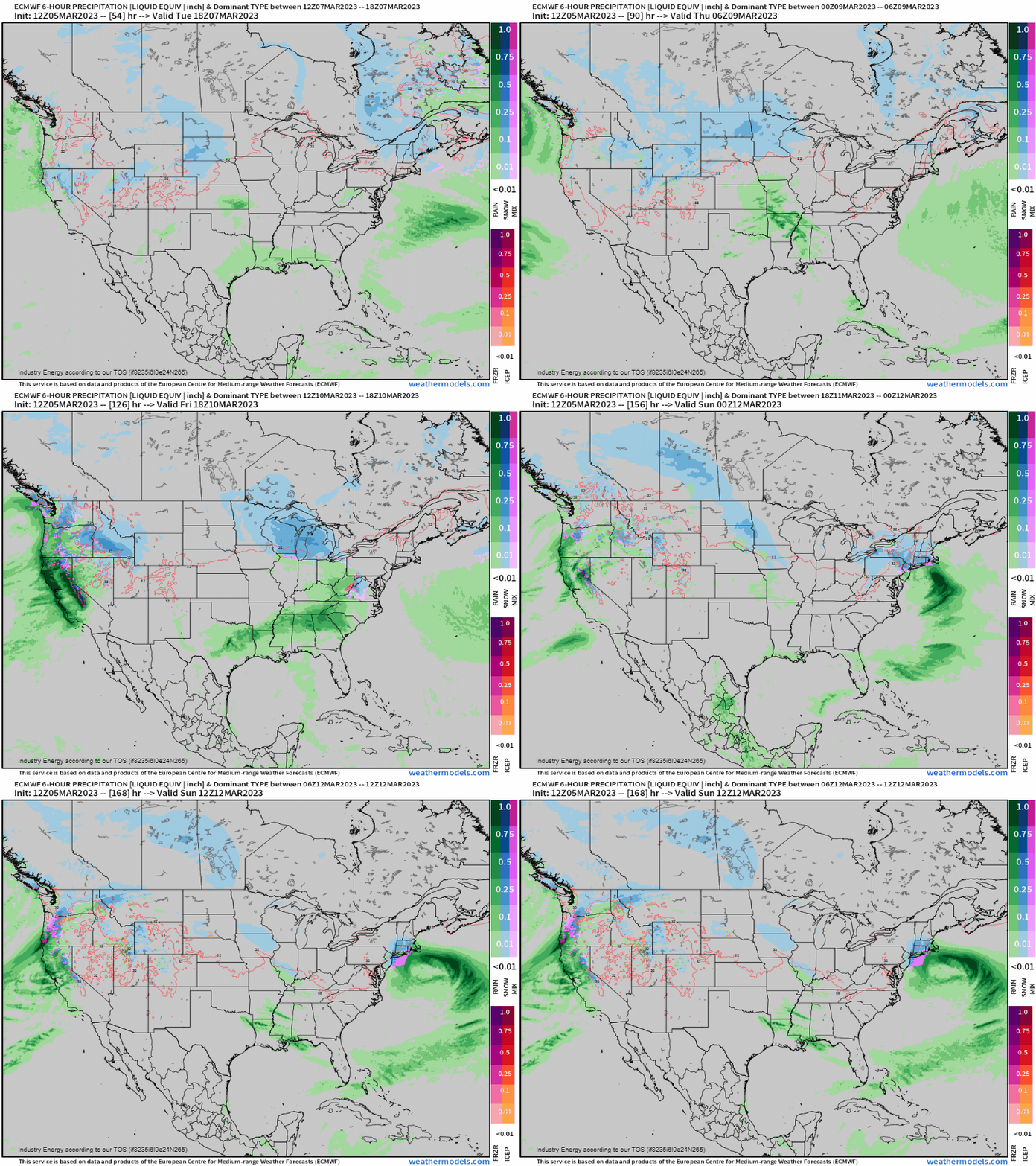
Now we can look at the surface, and as you’d expect, we have several areas of low pressure to watch with accumulating snow along and north of the low pressures, with rain south. With a zonal pattern as such, when you have forcing for ascent (lift) and bountiful moisture from the gulf, this is a recipe for flash flooding and excessive rainfall. This has implications for the southern Plains and the MS River valley this week, where in excess of 2” is likely across the ArkLaTex/ArkLaMiss regions.
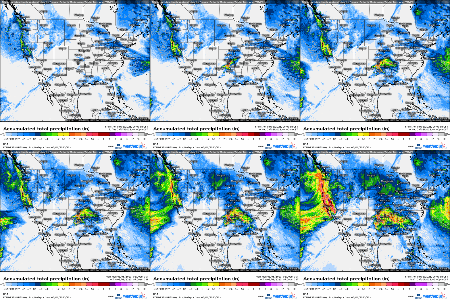
This continues to keep the Great Basin, Intermountain West, Northern Plains, and Great Lakes active with yet more snowfall, while areas further south sees an active stretch in rainfall, though a “break” in severe weather outbreaks this week given the progressive stretch of weather. We then see that this week may cap off an already active stretch of weather with what could be some type of transfer to coastal event that could reform offshore, bringing a variety of weather to the Northeast. This also could potentially be the most notable snow event for many areas closer to the coastal plain. We’ll surely be monitoring, but regardless winter will not be going down quietly as we trek closer and closer to the Spring equinox.
