Another Threat Of Winter Weather For The Northeast This Weekend
While the calendar has turned the page from Winter to Spring, Mother Nature knows no calendar dates. Looking ahead to the weekend, yet another disturbance could cause more havoc across parts of the eastern US — in particular, the Ohio Valley, Mid-Atlantic and Northeast regions of the US with frozen precipitation implications.
At this juncture, I suspect that area of greatest concern for snowfall could stretch from the upper Ohio Valley to the Mason Dixon Line up through central and southeast Pennsylvania, southern New England and coastal Maine. Keep in mind, even the slightest shift in track, in any cardinal or nominal direction, can alter snowfall amounts as well as what areas may turn to rain, a rain/snow mix or freezing rain/sleet. Even a 20-mile shift in the track can cause a forecast to go awry very quickly.
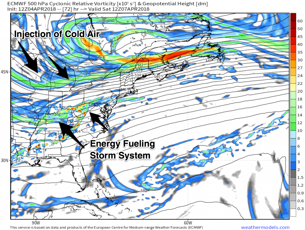
Taking a look at the mid-level snapshot of the atmosphere this weekend, we get a better idea of the pieces and parts that will drive this system. By Saturday morning, the ECMWF model has energy feeding into the Ohio Valley with an injection of cold, Canadian air funneling into the Northeast.
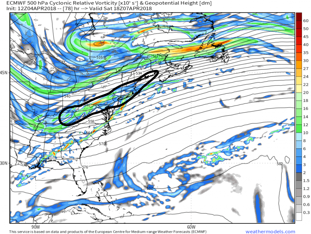
By midday Saturday, the ECMWF we have a more consolidated piece energy across the southern branch of the jet stream. This is energy is, essentially, your storm at the middle level of the atmosphere. Note the upper-level high-pressure feature just south of the Hudson Bay. This high is the injection of cold air, feeding into the energy, creating the storm system at the surface. The enclosed area shown in black below identifies a preliminary area of greatest concern for snowfall, though, we cannot discount freezing rain/ice working for periods of time across this area, especially for areas along the southern periphery of the outlined area.
While this winter storm threat will certainly not be something to laugh at, I suspect that given the positive-tilt of the trough as the energy rounds the base of the trough across the coastal Mid-Atlantic and New England regions, this might be a saving grace from a full-blown, blizzard for these areas. Could this change? Absolutely, and, it is something we need to keep a very close eye on.
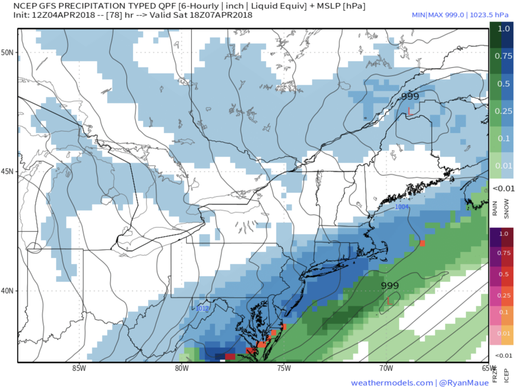
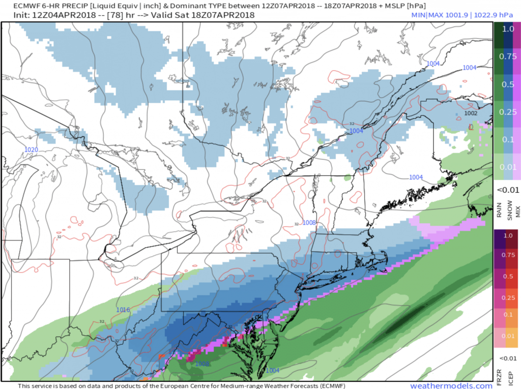
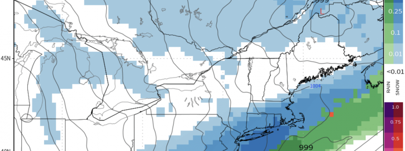
Both the GFS and ECMWF are modeling an impressive winter storm, though, the American solution is a bit more aggressive with heavier snows from the upper Mid-Atlantic to southern New England, while timing is nearly mirrored for both solutions.
GFS guidance valid around late morning/midday Saturday…
ECMWF guidance valid around late morning/midday Saturday…
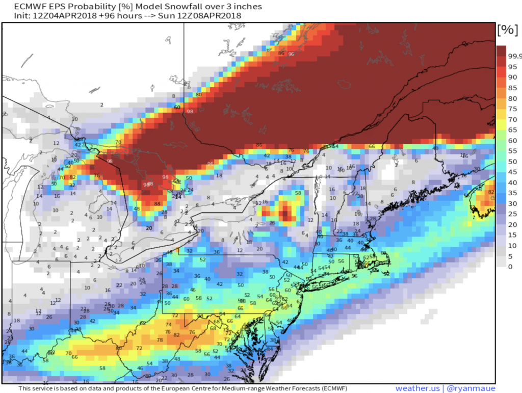
EPS Probability values are signaling heightened chances of 3″ or more of snowfall from the upper Ohio Valley to southern New England through early Sunday morning. Early on, I would not be surprised to see a very broad area (refer to enclosed snowfall threat area) of 3-6″ of snowfall, with locally heavier amounts, where frontogenic banding develops.
Still, details are not concrete at this point as we will get a much clearer picture of the evolution of this threat over the next 24-48 hours as new model data comes in. Will have a follow-up update as new data is made available or if current thinking changes.
