Another Round Of Wintry Precipitation Amidst Continued Record Cold
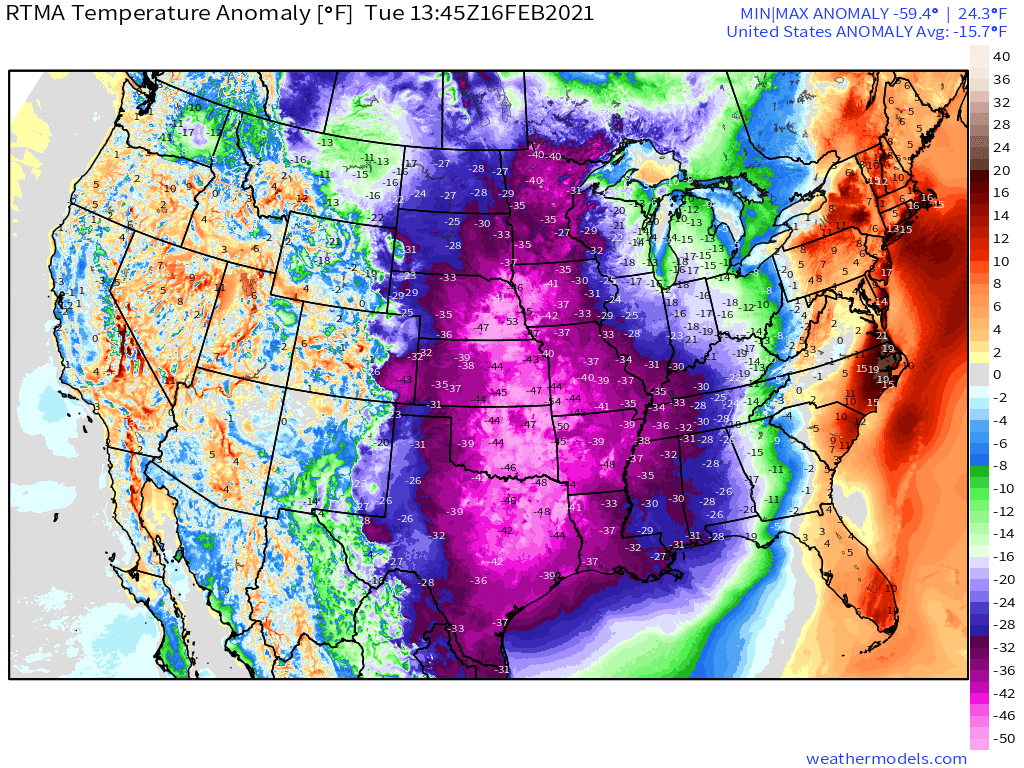
February 16th, 2021 is surely a date that will go down in meteorological history. A well-predicted but nonetheless incredibly intense fist of frigid air, advected directly from the Arctic, has sent temperatures careening towards all time record lows with sunrise. It was the climax to what is now a three day stretch of temperatures at least 40°F colder than average for much of the central US, a climatologically extreme event that is stressing power grids to the point of widespread failure and inciting snow and ice to accumulate as far south as the Gulf coast.
Yet another storm will develop along the periphery of the frigid air, bringing a second round of major snow and ice accumulations to a swath from the south-central US and western Gulf Coast to the northeast.
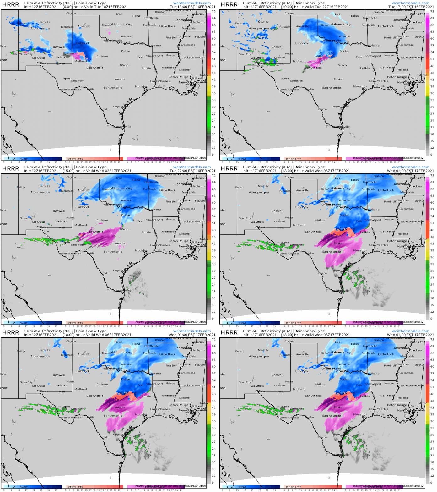
Initially, a secondary longwave sliding southeast along the intense mid-country jet will continue to incite some degree of low-level storm development, overspreading the four corners region with sufficient ascent to allow a fairly large shield of moderate precipitation amidst diffuse surface cyclogenesis. A combination of rapidly modifying Pacific moisture and a lack of considerable surface baroclinicity will keep a lid on storm intensity and precipitation organization, but a quick-hitting plume of moderate snow will likely impact parts of Oklahoma and central Texas in association this afternoon.
It’s an unusual shape for a precipitation field to take, with a very pronounced comma head that should feature a ‘thump’ of heavy snow on the northwest periphery, with some more convective but still purely snow showers thereafter. Where this northwest periphery is able to orient favorably, probably somewhere northwest or near OKC, 6+” of snow could fall. Efficient ratios due to a large DGZ favorably coincident with lift and moisture should ensure powdery snow for many down to north-central Texas. Further south, freezing ran will be falling; it should be heavy and brief, keeping accretion limited, but roads in places like Waco, San Antonio, and Houston could well become slick. Please don’t drive tonight unless you must!
A second set of issues commence as divergence associated with troughing aloft reaches impressive temperature gradients at the surface, where frigid temperatures clash with warm Gulf air. If this sounds familiar, it’s because the exact same thing happened over the past two days. The result will be an increasingly consolidated surface cyclone forming alongside plentiful southerly low level flow, which will pump moisture north above the cold sector at the surface in a zone of renewed surface/low level lift.
With much of the surface south to the Gulf still very, very much colder than average, another period of impactful winter weather will likely occur.
For some, precipitation will fall north of even the 850-700mb warm front, and here, snow will fall the entire time. In this zone, a large area of 5-7″ totals are likely from central OK through AR. For others, forcing will be sufficient to pull warmer air north at the surface, and plain rain will fall. Between these two zones will be areas below freezing at the surface but above freezing aloft- a hotbed for freezing rain.
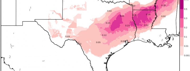
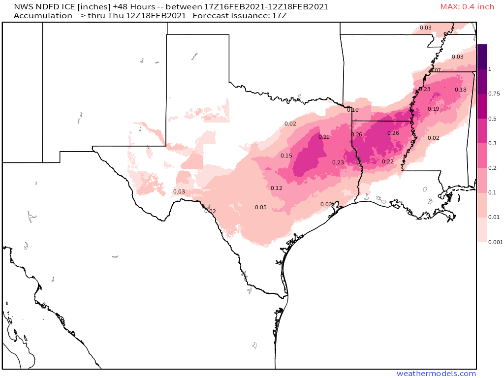
Like yesterday’s system, the ice and snow accumulation zones will initially be fairly cut and dry, as the immature, tilted cyclone drops heavy precipitation along a pretty consistent swath from Texas and Louisiana northeast. Through midnight tomorrow night, this swath of freezing rain will lead to ice accretions from 0.25-0.5″ , with locally higher amounts certainly possible.
This is likely to be a significant roadblock in recovery from the period of frigid temperatures that have paralyzed parts of the south central US, and will present problems itself to localities that see enough ice accretion for widespread power infrastructure failures.


