Another Round of Severe Weather Likely Next Week
I have one request in regard to the weather through the end of the year: can whoever keeps wishing for severe weather just cool it for a bit? I mean, I love a good thunderstorm or three, but I’d really like some snow around the Christmas time frame.
While the longer range seems as if us holiday snow-lovers might have half a shot at our wish, we’re first watching yet another chance for a Mid/Deep South severe weather event early next week.
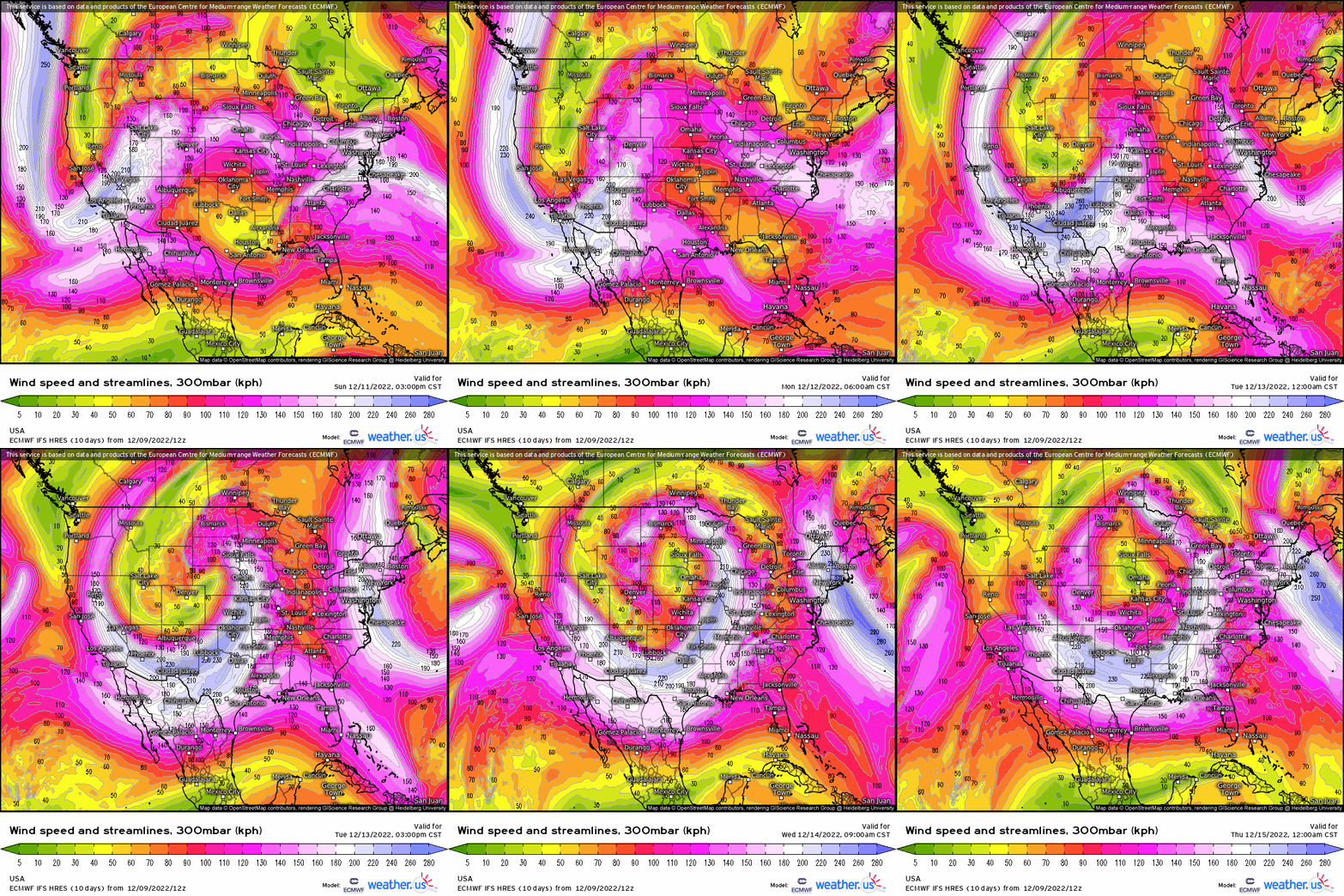
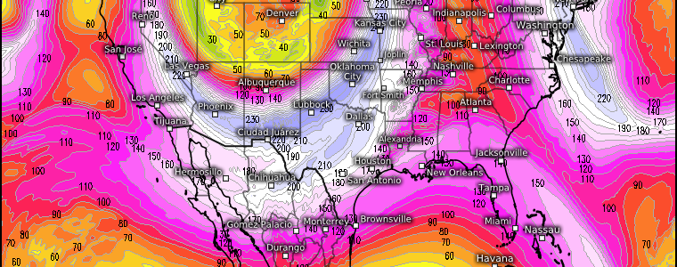
Later in the day on Sunday, a rather amplified trough will begin to come ashore over the West Coast. As it moves across the Rockies, a large, closed, upper-level low will form. Cyclogenesis will occur with a deepening low forming at the surface as well.
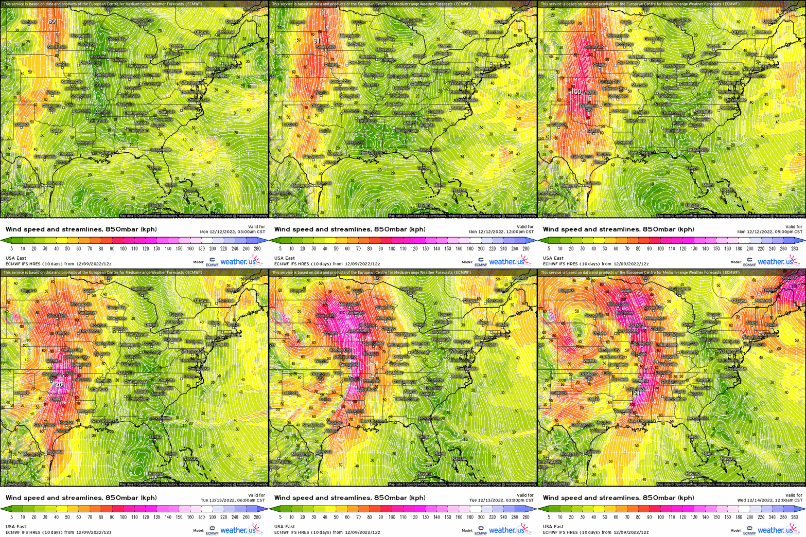
In response to the deepening surface low, a low level jet will crank and prime our target area with warmth and moisture.
In the early stages of this forecast, it appeared as if some fairly widespread severe potential would exist for overnight Monday.
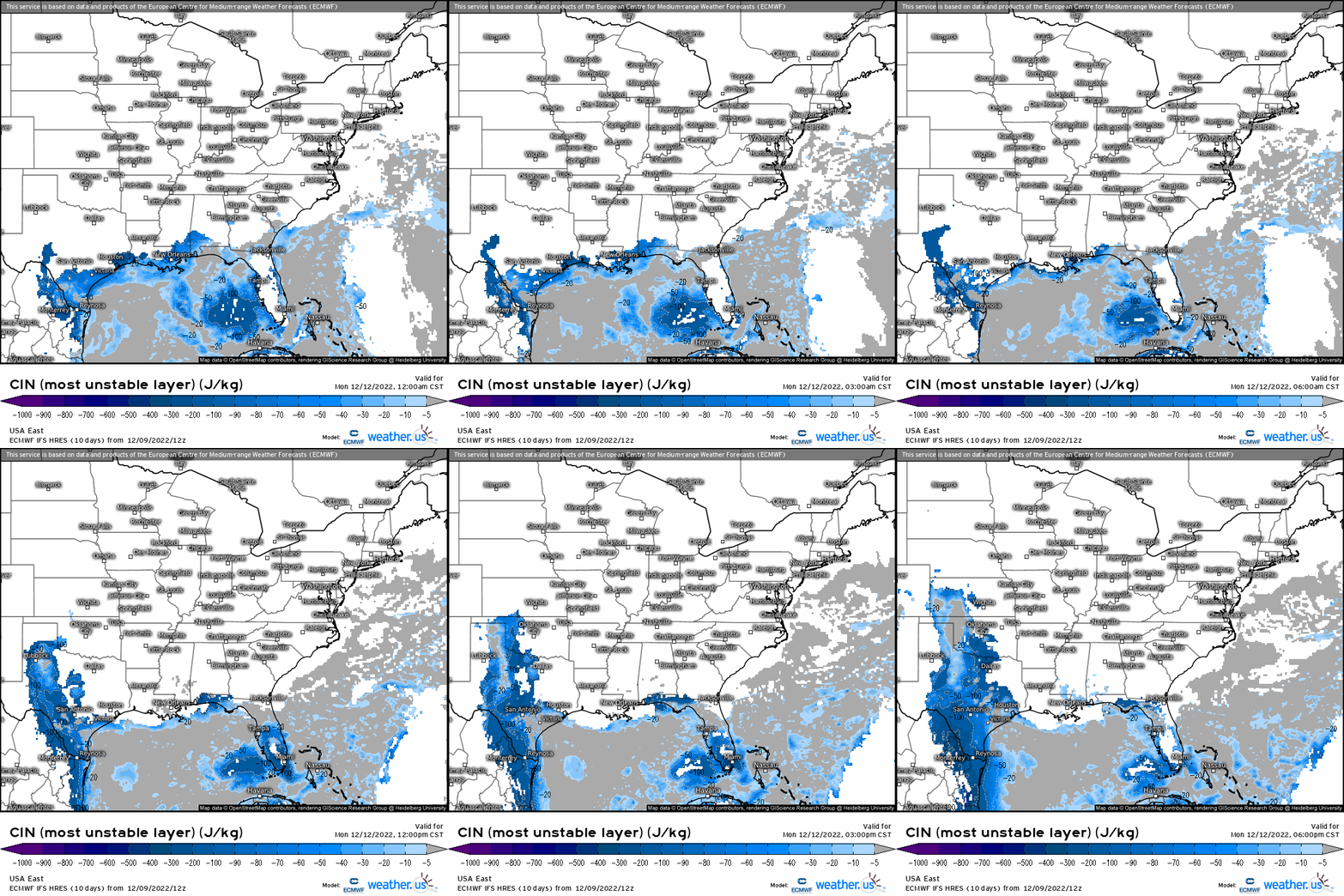
However, a persistently stable layer at the surface indicates that the atmosphere ahead of the dry line in western Texas will remain capped. Any convection that occurs then would remain elevated. This makes scattered large hail the only real threat from these overnight storms.
So now all eyes are on Tuesday and, to some degree, Wednesday.
Global models are in good agreement currently as to the evolution of this event. However, it’s a bit too early for specifics as only global models are in range right now. But, that doesn’t mean we cant take a look at a sounding and see what the environment may be.
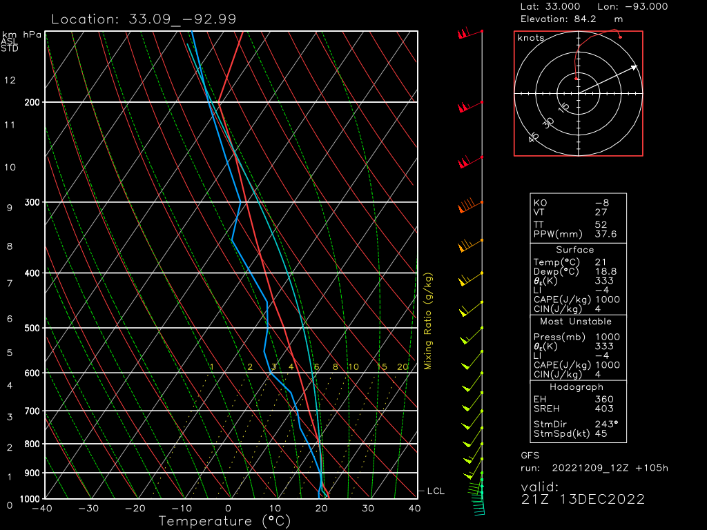
In a sounding via the GFS taken along the Louisiana/Arkansas border valid at 21Z on 12/13 we have:
- Good shear. Though the mid-levels are a bit unidirectional, low-level shear is excellent. Winds back from the SSE at around 20 kts at the surface and quickly change to SW at 55 kts by the 800 mb level. Low-level shear is important in tornadogenesis. Deep layer shear is also adequate to organize supercells.
- A small inversion exists at the surface, but it doesn’t seem to be anything that a little extra lift or energy can’t overcome. It will serve to focus convection some, perhaps resulting in more discrete or multicellular storms initially.
- A low LCL means all that warm, moist air won’t have to travel far before being sent aloft.
- A moderate amount of CAPE is modeled. Storms should have enough fuel to produce robust updrafts.
- Lapse rates modeled are just okay. We’ll have to see how this evolves, but it could become a limiting factor.
- Storms are modeled to perpetuate nearly perpendicularly to the initiating boundary. This general favors the formation and persistence of discrete cells.
So, as we can see, Tuesday has a lot of potential.
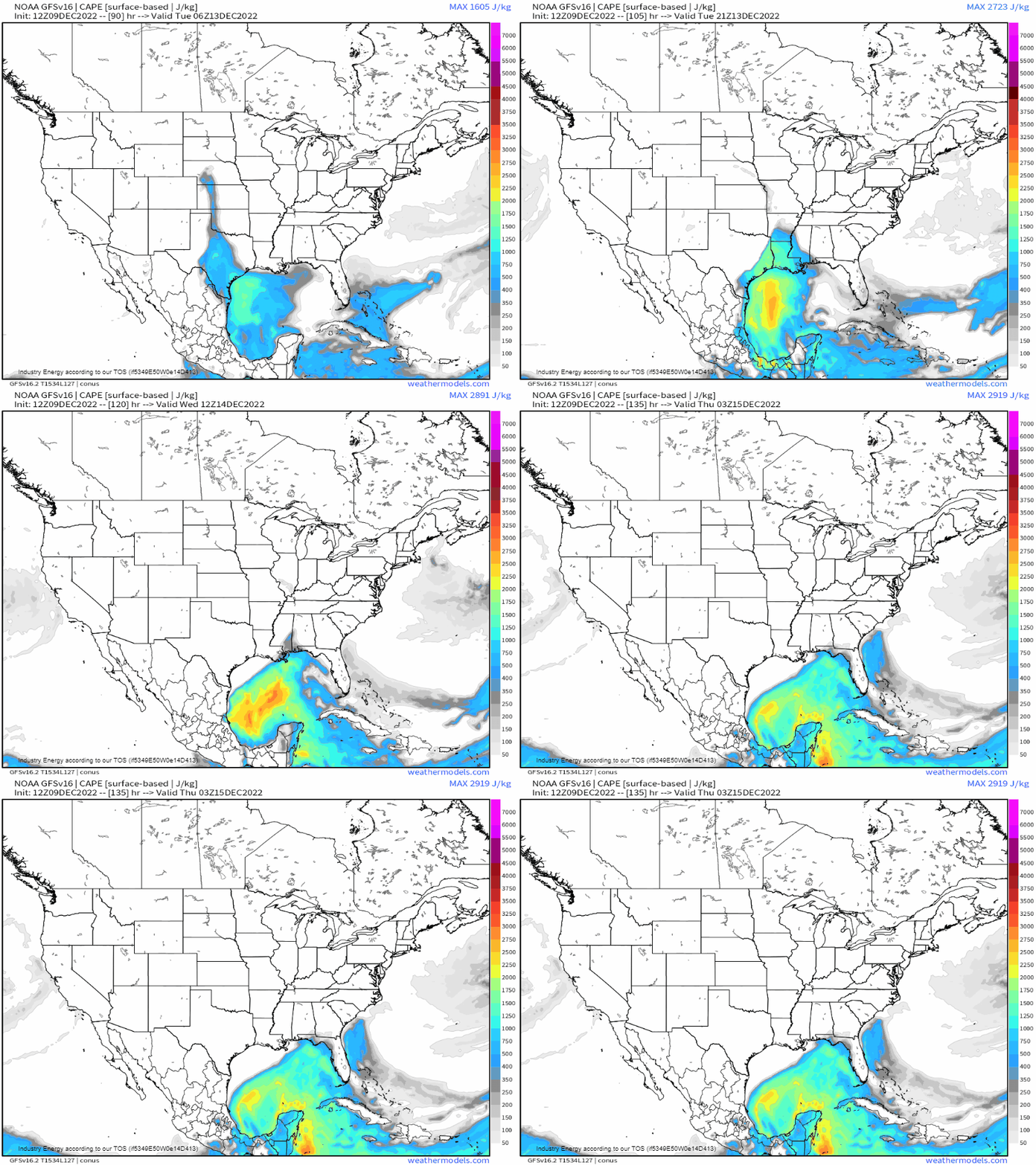
Though I mentioned above that we’re also watching Wednesday for severe potential, the current thinking is that any potential will remain suppressed closer to the Gulf Coast.
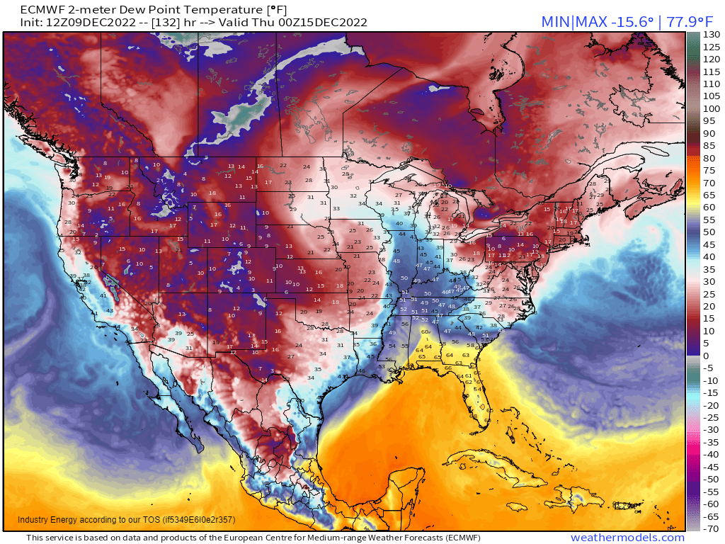
High pressure lingering over the Northeastern US will severely limit moisture return into the Southeast. Therefore, Wednesday’s threat will likely be a bit more localized than Tuesday’s larger threat.
What You Need to Know
- Potential for severe weather exists for the Mid/Deep South on Tuesday and, to a lesser degree, Wednesday of next week.
- Details are still being hammered out, but a more widespread event is possible on Tuesday with all hazards currently on the table. Wednesday’s threat seems a bit more localized and less potent.
- The forecast has changed in the past few days and will continue to change until more mesoscale models come into range. If you’re in the area of concern, keep checking the most recent forecast.
I’ll revisit this topic in Monday’s blog and we’ll check in on how the forecast has progressed.


