Anomalous Warmth Brings Enhanced Fire Threat To North-Central US
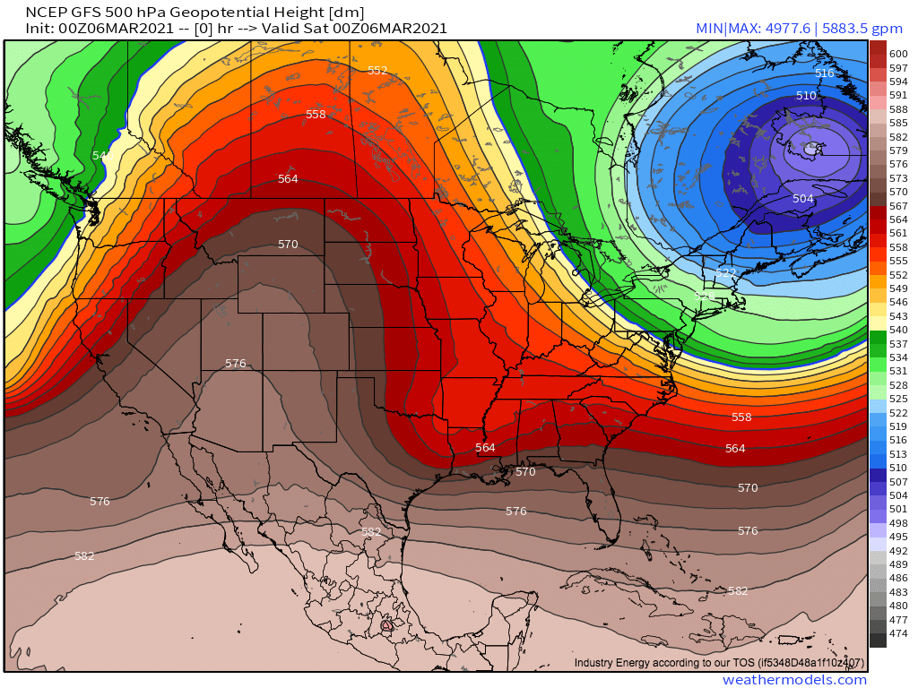
The jet stream has managed to contort itself into quite a high-amplitude mess for this morning, with substantial ridging pushing into the central US, and a large closed low slowly winding down over southeast Canada. The blocking pattern is so impressive that, as of the 00z GFS’s initialization, 500mb heights along the same latitude line (50ºN) range from 565dm just north of Montana to 495dm near the St. Lawrence. Wow!
This amplification is bringing a pretty substantive temperature anomaly gradients across the United States, as Meghan discussed in her blog yesterday.
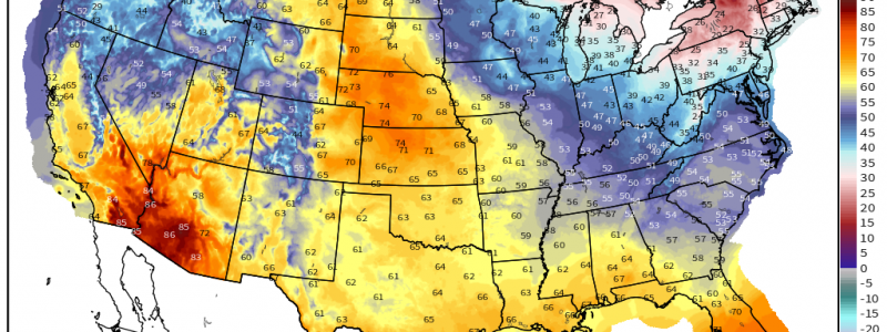
Across the north-central United States, southwesterly flow aloft sourced from the Pacific is working with substantial southerly advection of warm, topographically downsloped air to create warmth rare for this time of year.
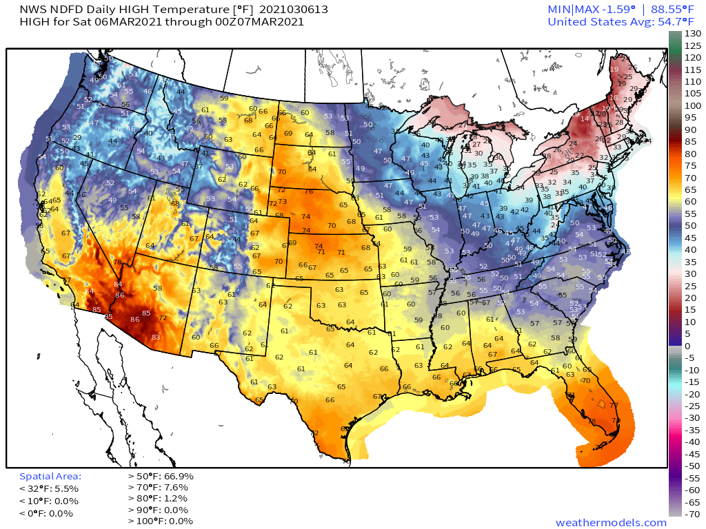
In fact, the NWS NDFD pegs daily highs for today in the upper 60sF all the way to the Canadian border at the most favorable confluence of the aforementioned factors, with temperature anomalies locally exceeding 30°F.
Because downsloping dramatically reduces relative humidity by maintaining specific humidity while dialing up temperatures, this airmass will be exceptionally dry, especially with westward extent towards the Rockies where less modification has time to take place.
The story then returns to the crazy jet amplification, which will promote a zone of quality divergence aloft as a closed low bowls into the northwestern extent of the expansive ridge from Oregon through Idaho towards Canada.
The result will be some degree of cyclogenesis over south-central Canada over the next 24 hours, which will promote an intensifying low level jet.
As gusty winds associated with this jet overspread the warm, dry surface air, an enhanced threat for the spread of fires will develop. This will exist in a somewhat narrow swath that extends from southeast Colorado north to the Montana/North Dakota border, where burning is discouraged.


