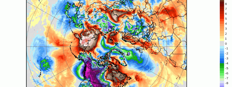
Anomalous Arctic Air Christmas Week
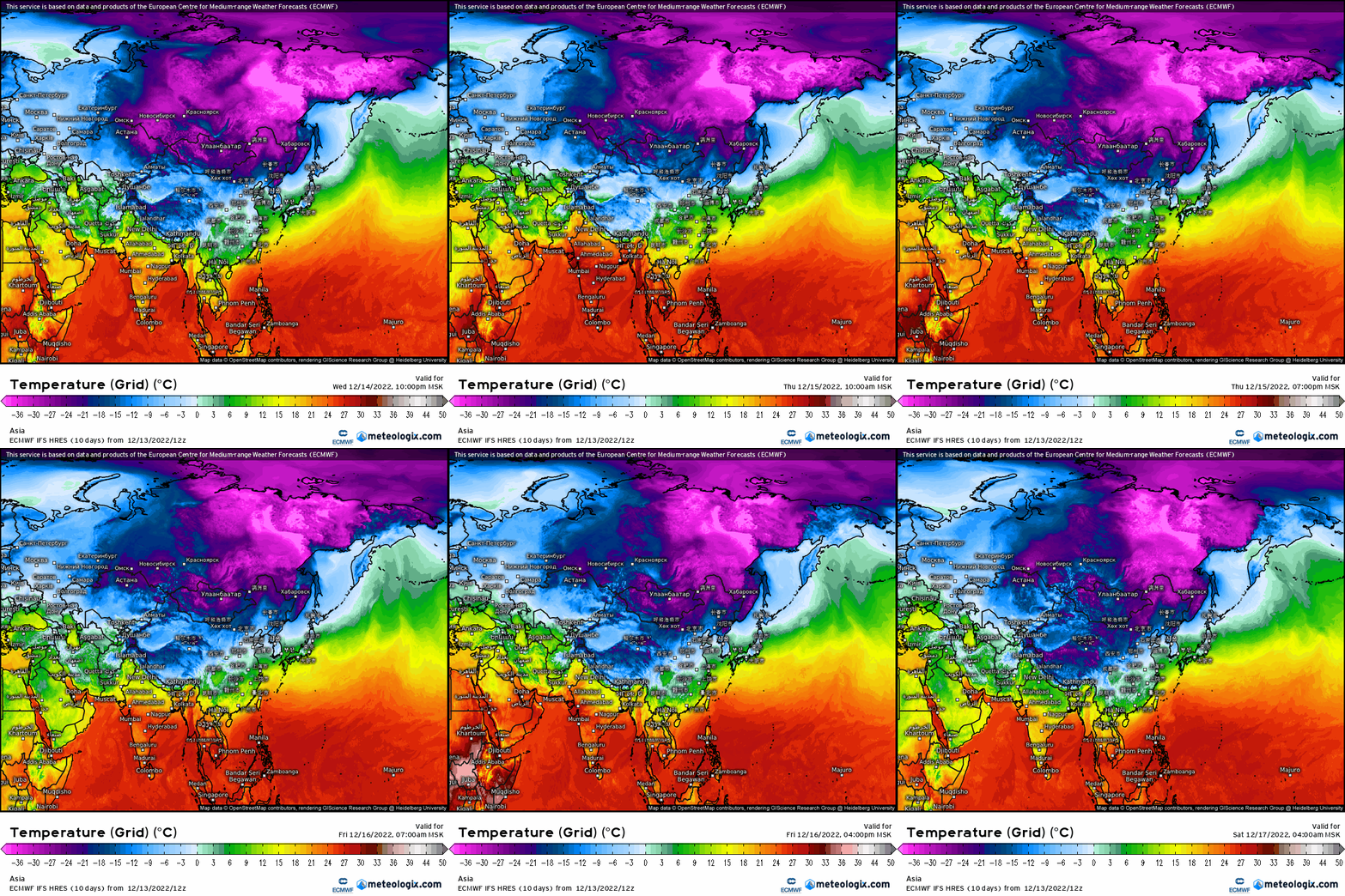
This past week, a very frigid arctic air mass set up across Siberia with widespread temperatures below -30*F! Why is this relevant you may ask?
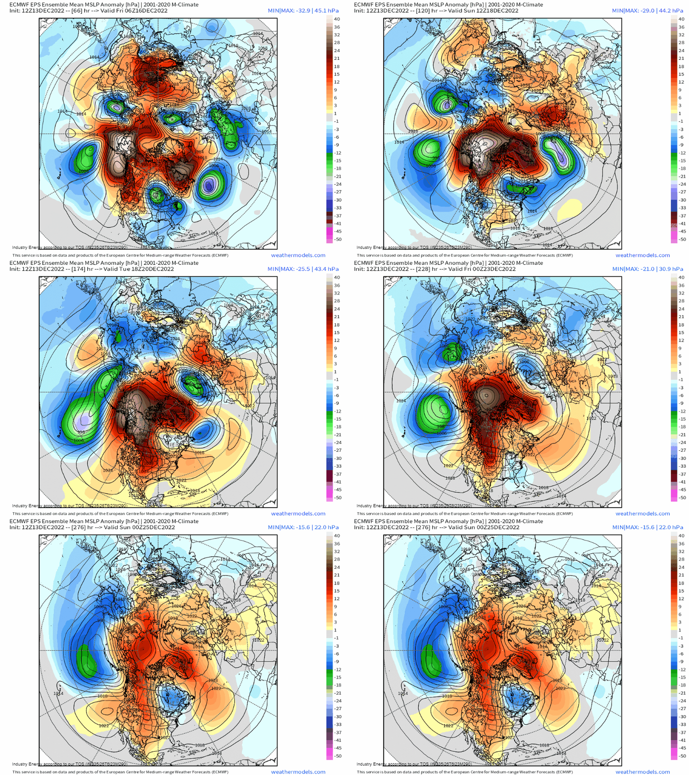
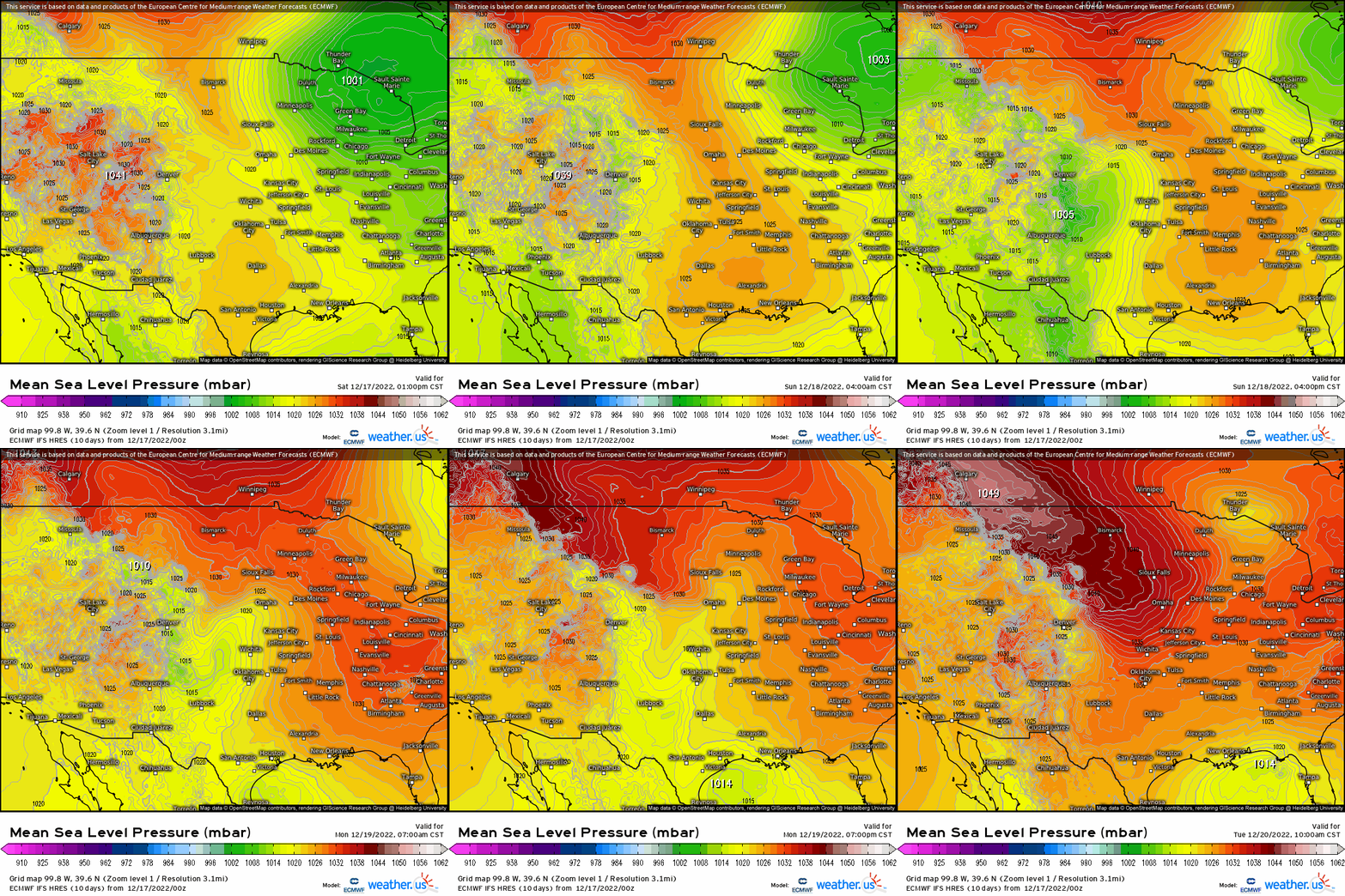
Well, over the course of the next few days, the same arctic air mass that has brought very cold air to Siberia, will dump into the U.S. by early next week! Lets examine the sea level pressure and capture the progression from this past week and into next week. Watch how first, a strong high pressure bleeds initially into Siberia. As it does so, this translates to the same high pressure to advect across the Arctic, and shift into the U.S. by first crossing the Pacific NW, and then into the Midwest before slowly advancing eastward. We can track the MSLP as it works across the Arctic from a global perspective, and then watch how a 1048mb high works its way into the northern Plains by early next week.
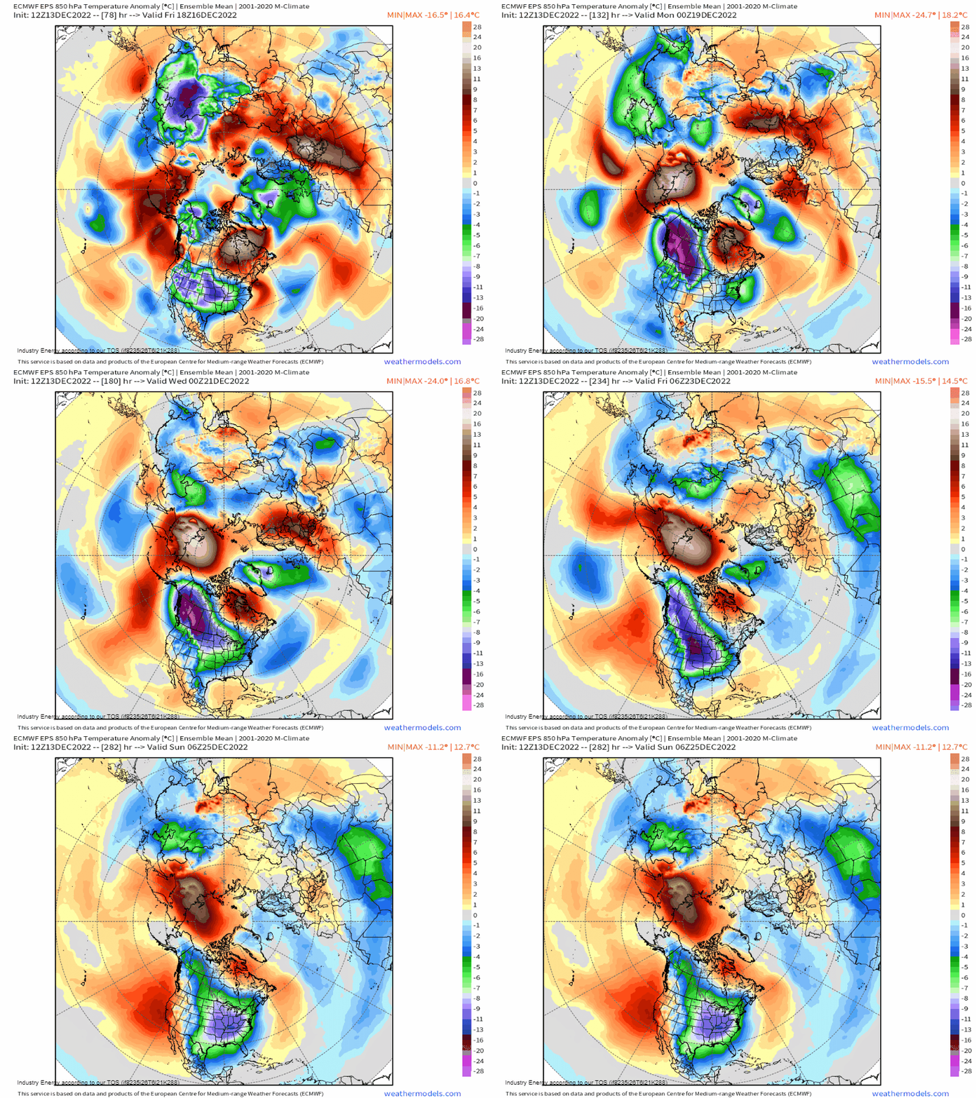
Below are the modeled 850mb temperature anomalies. Remarkable agreement in ensembles (which is an aggregate of individuals model runs) shows 850mb reaching greater than 15 – 30 degrees below average across 2/3rds of the CONUS, for at least 5-7 days!
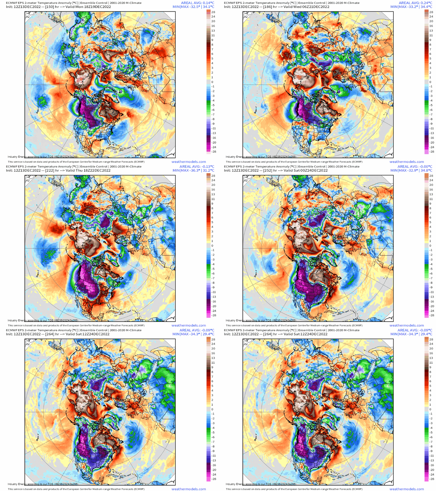
What’s even more impressive are the surface temperatures! For an ensemble to show widespread -25*F and greater departures is simply unfathomable! This type of cold is going to cause serious heating demand and stress on electrical grids and infrastructure, especially across the deep south! This air mass will moderate to an extent as it translates eastward by Christmas, and on top of this, a dynamic system could unfold leading right up to Christmas (analyzed by Meghan in her most recent blog). This system we’ll be monitoring as it could have implications for the Midwest and Northeast, the main story will be the frigid temperatures that’ll cause may records to fall from the cold that’ll grip the nation next week starting Monday!


models here in the PNW have been struggling with how far south it gets here before it starts heading east.
Sorry, just seeing this comment now. But yes, there was a lot of disagreement and struggling with the placement of the axis of the western ridge. An offshore axis would allow air to funnel further west while an onshore/further east axis would immediately shunt the air east.