An Unusual Combo: Canadian Wildfire Smoke & Fire Risk
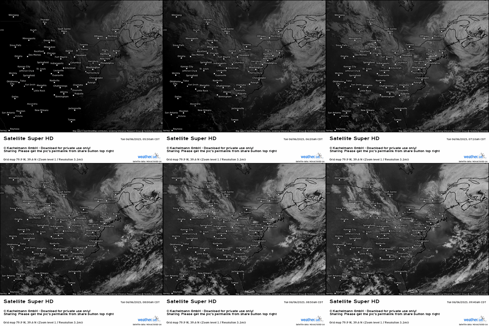
We start out by analyzing the visible satellite imagery (“Smoke-Check Super HD” – helps to see blowing smoke and/or dust using this product) today across the Midwest and East. We see a cyclonic upper level south of Nova Scotia, and while not as obvious, there’s a ridge (clockwise flow) out over in the northern Plains. The flow in between each feature helps to push the wildfire smoke across eastern Canada down into the Northeast that is denoted by the opaque white color you see that aren’t clouds.
So how does this all tie into the elevated fire risk, and even working together with potential “dry thunderstorms”?
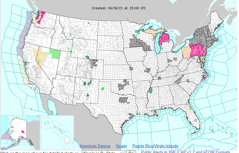
Before getting into the explanations, look at the current alerts from the National Weather Service. We have the grey outlining a large portion of the Northeast, and the pinks mainly across the Mid-Atlantic. To reference what each color means, the grey stands for “air quality alert” and the pink is for “red flag warning” or elevated fire risk.
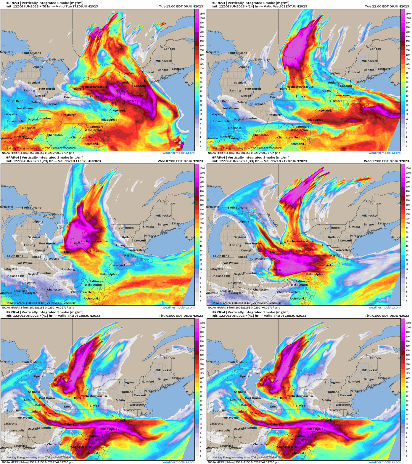
Analyzing the HRRR through tomorrow night, we see that several plumes of high density smoke will shift into the Northeast and Mid-Atlantic through the day and once again tomorrow. In fact, this is why it’ll be quite hazy, since this smoke will get fairly close to the boundary layer, if not in it (lowest portion of the atmosphere where we all experience weather). Thus, it’s why we have the air quality alert.
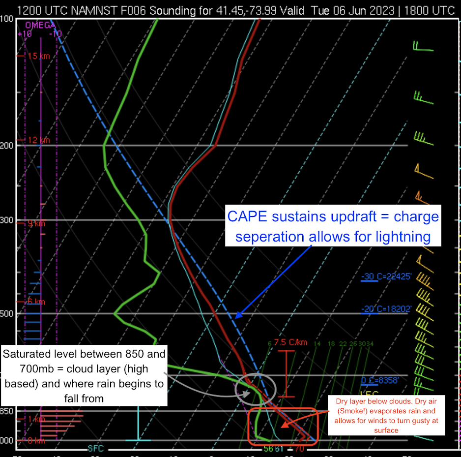
Now, lets circle back to the “dry thunderstorm” concept, and how this ties into the fire risk with the smoke today. It’s easiest if we study the vertical profile of today’s atmosphere in the Northeast. From the College of Dupage, a skew-t is shown that was picked from the Hudson Valley that represents mainly the entire Northeast. I’ve outlined as best as possible to illustrate this. First, a dry thunderstorm is basically a storm without rain. It has a high cloud base, where rain falls from a higher distance measured from the surface. The further a raindrop falls with dry air below, the much more likely it’ll evaporate. We know evaporation is a cooling process, so now the air that was evaporated is denser than the ambient environment. Due to gravity acting upon it, this denser air falls toward the surface hence strong gusts potential. Another key component is lightning. We need CAPE for an updraft to reach vertically to allow for charge separation, which is the catalyst for lightning. Typically, we want to see CAPE in the -10 to -20 layer for hydrometeors (i.e. rain, graupel, hail, etc.) to transfer such charges. When we combine that, we get lightning.
Below, we have CAPE sufficient for a growing updraft, a high cloud layer, and a large area of dry air below the main cloud layer. This right here would be your “dry” thunderstorm setup. That dry air you see is actually the smoke originating from eastern Canada! Lastly, lets check our elevated fire risk to see how this all meshes together.
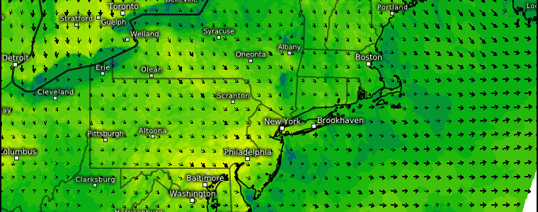
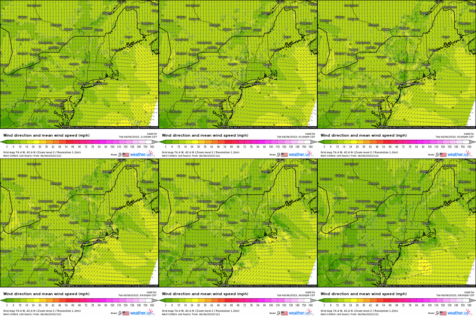
Today, we have a mean wind flow out of the Northwest. Typically, we want to see wind speeds over 15 – 20 mph, though gusts over 20 mph. With a cold front dropping southward today, this not only enhances winds out ahead, but acts as the forcing for ascent in which we can see pop up storms across the Northeast.
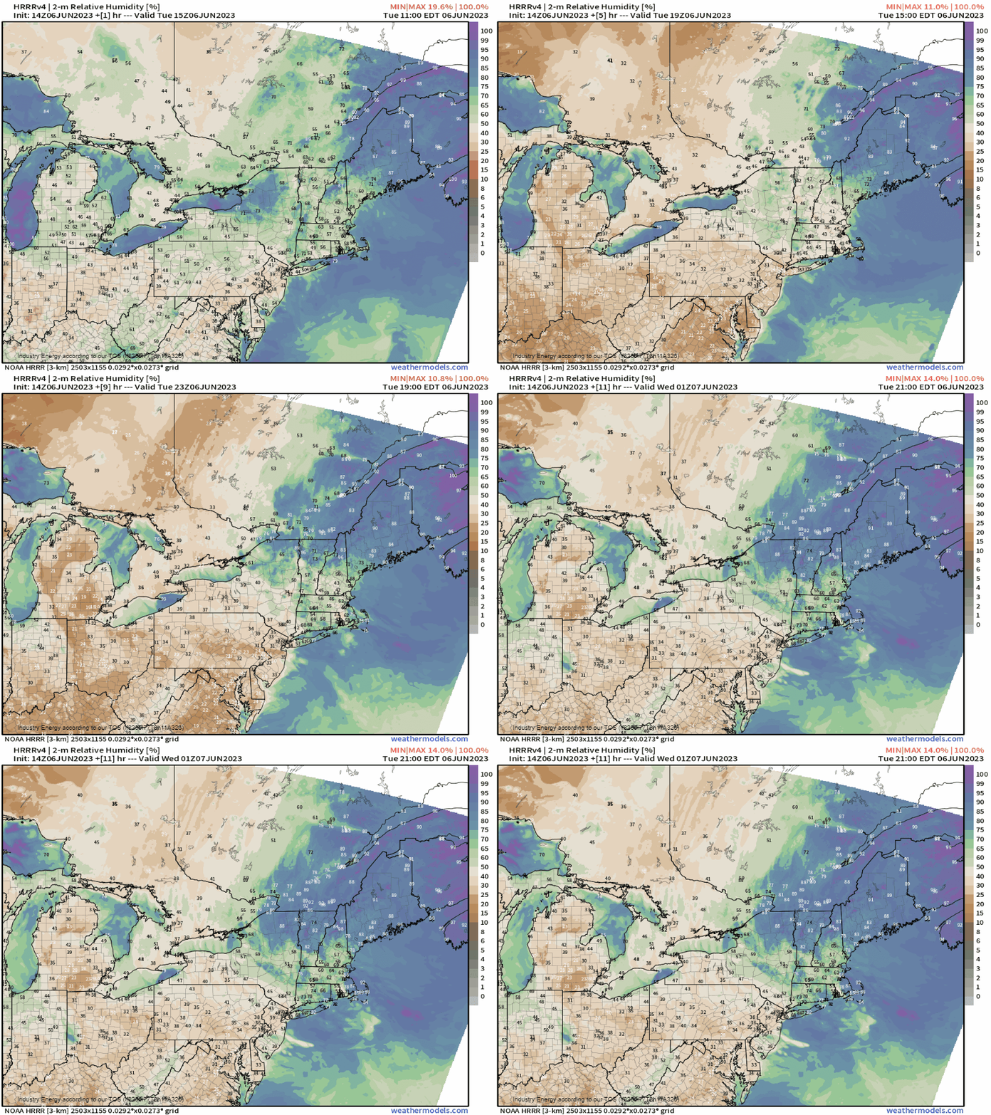
Next, we have relative humidity values less than 40%. It also hurts that this area hasn’t received much rain recently, if any. Combining the winds to help spread the local wild or brushfires and dry out vegetation, and low humidity values with antecedent dry conditions, we have the ideal recipe for fire weather. Adding in the sufficient parameters today for pop up cells and storms, and our dry thunderstorm risk with the smoke coming into play – we now see why we have a very unusual setup today! If one of these cells produces lightning, it will not take much effort at all to initiate a wildfire or brushfire, and for it to spread quite dramatically given the dry vegetation and winds in place.
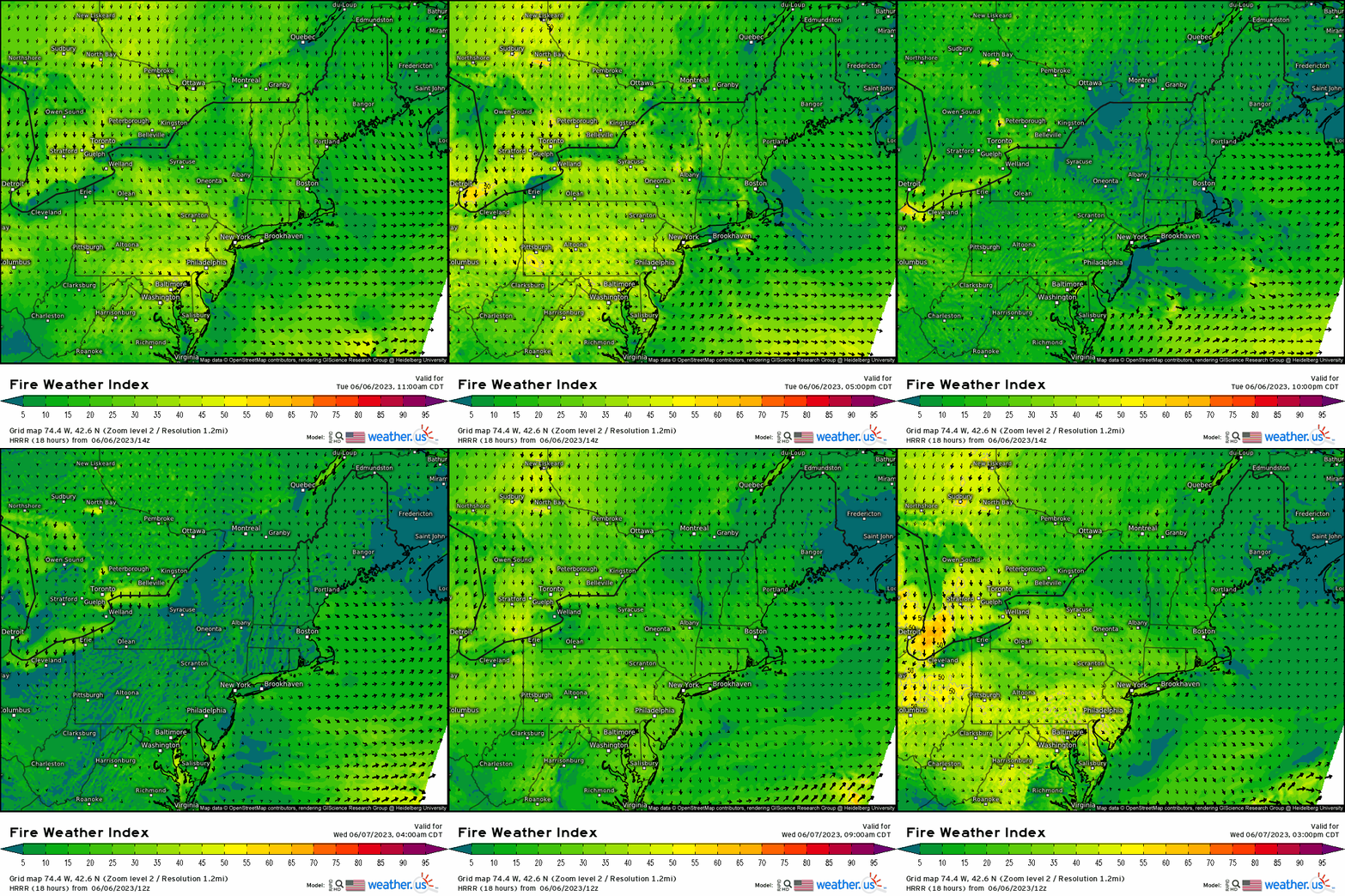
With all these ingredients in place, we can see from the fire weather index parameter via the HRRR how widespread it’ll be relative to this region with values over 45-50 mostly confined to the northern Mid-Atlantic.
The dry thunderstorm risk is mainly for today, though the haze and smoke will continue into the rest of the week thanks to a stagnant omega-block pattern before it breaks down this weekend.
Once again, today’s setup is quite fascinating meteorologically. Smoke from the wildfires mixes with the atmosphere to enhance a storm’s gusty wind potential by evaporating rainfall into the dry air (from the smoke as aforementioned). You combine that with prime fire weather conditions (low relative humidity, windy conditions, lack of rainfall, and sunshine as well to allow for CAPE and concentrate solar radiation), and we get the ideal recipe for fire weather in conjunction with poor air quality. If you’re sensitive to harmful particulates, please limit any possible outdoor activity (especially if strenuous) and try to stay confined mainly indoors if necessary to limit the effects.


