An Outlook Heading into Late Month Toward December
As someone who is into long-range forecasting, and utilizing certain phenomenon and large-scale global patterns to help give a “sense”, I personally believe forecasts passed about 10-14 days can be definitely spotted in terms of general patterns. There are obviously caveats of course!
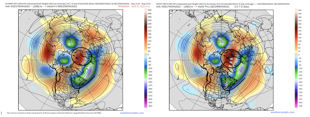
Heading into the last half of November, especially the week of Thanksgiving, we’re going to likely see a transition phase heading into December. Lets start in 5-day intervals of the 500mb heights, that takes us into the middle of next week. Below, we have a pretty amplified height pattern with ridging in the west (+PNA/-EPO), troughing in SE Canada and in the East, along with positive heights extending from Scandinavia into Greenland. The latter is reflective of a neutral NAO phase. Above average temperatures prevail across the West Coast with the opposite on the East Coast and Midwest.
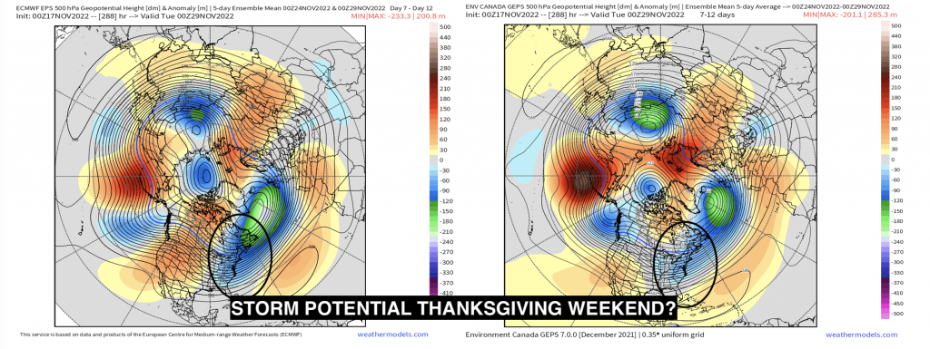
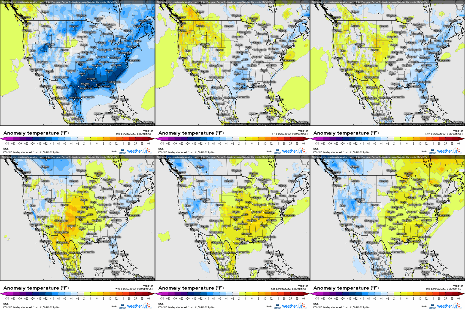
Thanksgiving week will feature largely lots of generally high pressure systems crossing the CONUS, with again the core of the below average temperatures confined to the Northeast, while near to above average temperatures across the Central and out West. Below, we’re going to see a reshuffling during this timeframe leading into the last week of November. The western ridge will begin to shift a bit, but with an active sub-tropical jet, we may have to watch a shortwave that could potentially render some trouble along the Eastern Seaboard and into the Ohio Valley around the beginning of the Holiday into the following weekend. There could certainly be some wintry implications for areas near the Great Lakes and interior Northeast, especially now that the storm looks to be more disorganized, which would be most likely on the backside where we may see more lake-effect. It’s just a signal that we’re monitoring, but in terms of traveling leading up to the holiday, overall there should generally be rather widespread “tame” weather conditions with no major headlines.
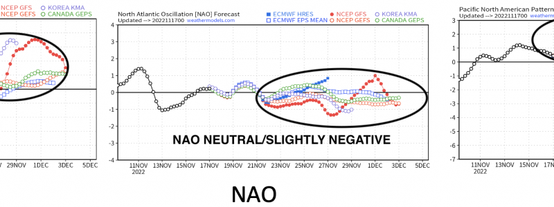
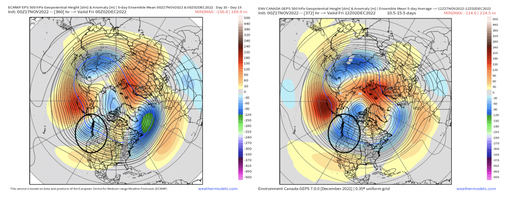
Heading now into early December and a brief glance at it, we see our reshuffling has transpired. What was originally a -EPO has trended positive (below average heights), and our western ridge (+PNA) will shift eastward leading to a relaxation and zonal flow with troughing into the west (-PNA, and a return to an active west coast storm track). We’ll see, however, a near neutral/slightly -NAO, which keeps those below average heights still off Nova Scotia and the Northeast coast. The latter keeps still average to slightly below average temperatures across the Northeast.
Utilizing teleconnections, which is a lovely way to “paint a picture” of how the pattern may reflect these indices, shows exactly what’ll transpire and aligns nicely with the forecasted height pattern! Our EPO shifts into positive territory, our NAO index hovers neutral, and we see the PNA dip negative as a result of below average heights out West.

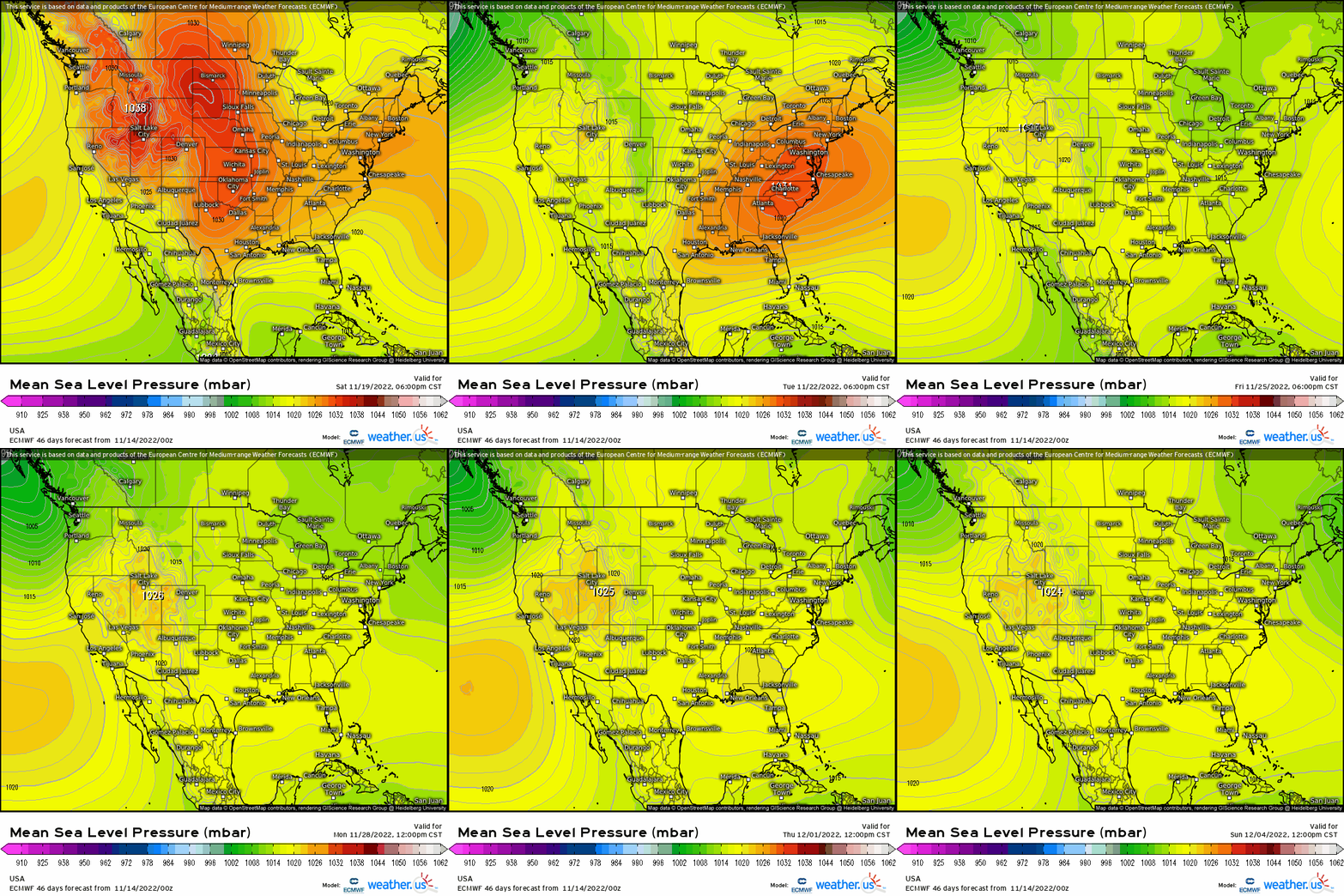
Using all the above to see how this translates at the surface reveals numerous high pressure systems across the nation into early December, along with some hints of a low pressure along the Eastern Seaboard later next week. Below also reveals where the core of above and below average temperatures will take place, and notice that moderating trend by the last week of November and into early December.
Now looking a bit ahead on the horizon after this broad period, we likely will see a return to a more active and wintry pattern east of the Rockies as yet again another reshuffling transpires leading to wintry potential for places like the Great Lakes, Mid-Atlantic, and the Northeast. We’ll certainly cross that bridge once we get there though!


