An Outlook Heading Into December!
Can you believe that we’re now officially in the month of December? I just remember starting Hurricane Season back in the early Summer, yet here we are dealing with winter, or just about to for some areas that haven’t seen snow thus far!
As I like to do, i’ll break down different periods starting early next week, and extend that into near mid-month using the height pattern. To begin, here we start off early next week: We see ridging extend across the Southeast and into the Ohio River Valley/Northeast regions, while troughiness expands across the West (-PNA).
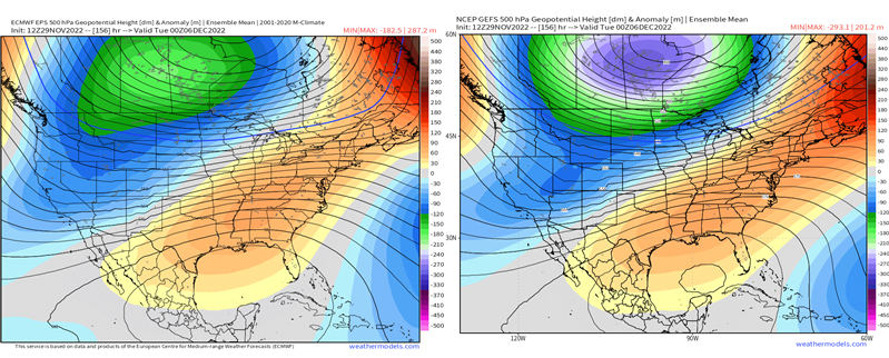
However, we’ll see quite a significant shift in the overall height pattern as large-scale shifts happen on the global scale. I’ve already talked about the significant -NAO that’ll develop in my most recent blog, but we can see the orange (positive heights) build across SE Canada, which is the outer periphery of the huge block. What this does, is alter the entire waveguide across the U.S., which is a fascinating evolution to watch! Check out the large trough that “bowls” its way into the Great Lakes, and soon into the Northeast by the end of next week. The ridging that was initially over the Southeast and expanding across the Eastern Seaboard, ends up retrograding westward, as the large longwave trough dips into the Central U.S. and migrates east.
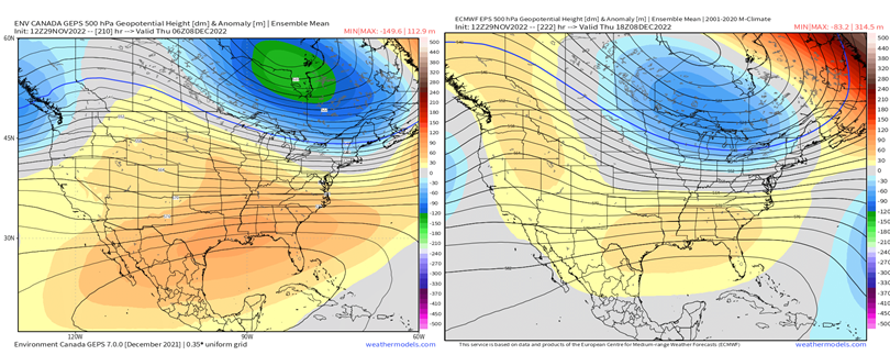
As we progress into mid-month, while predictability – especially with a retrograding blocking high, goes down in terms of skill, we can still garner a sense of how the pattern pans out given pattern recognition. Anytime we have high-latitude blocking and as strong of a -NAO we’re going to see (hovering near record territory for this time of year!), there’s higher-than-average confidence that troughing dominates across the Northeast and East Coast. We can see that below, despite some differences in ensembles figuring out the West Coast as again, this blocking high and its westward progression significantly impacts model guidance causing chaos!
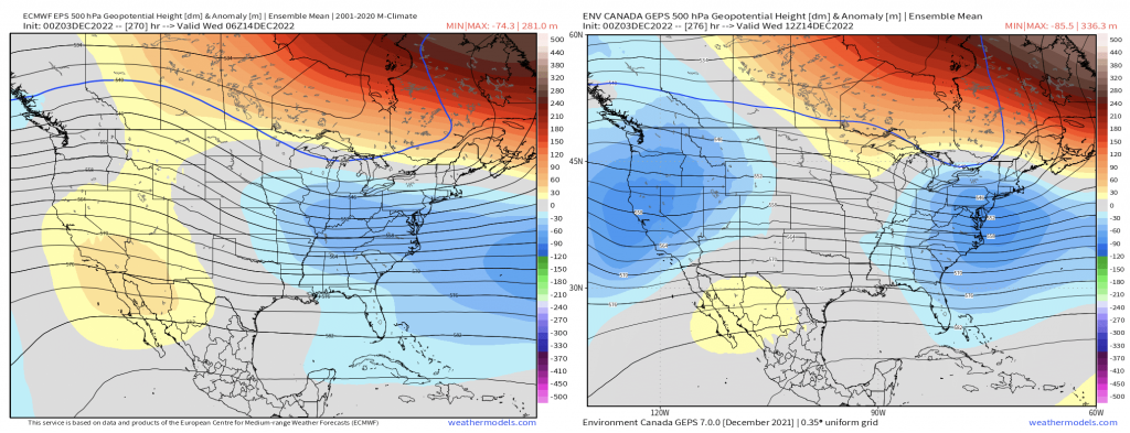
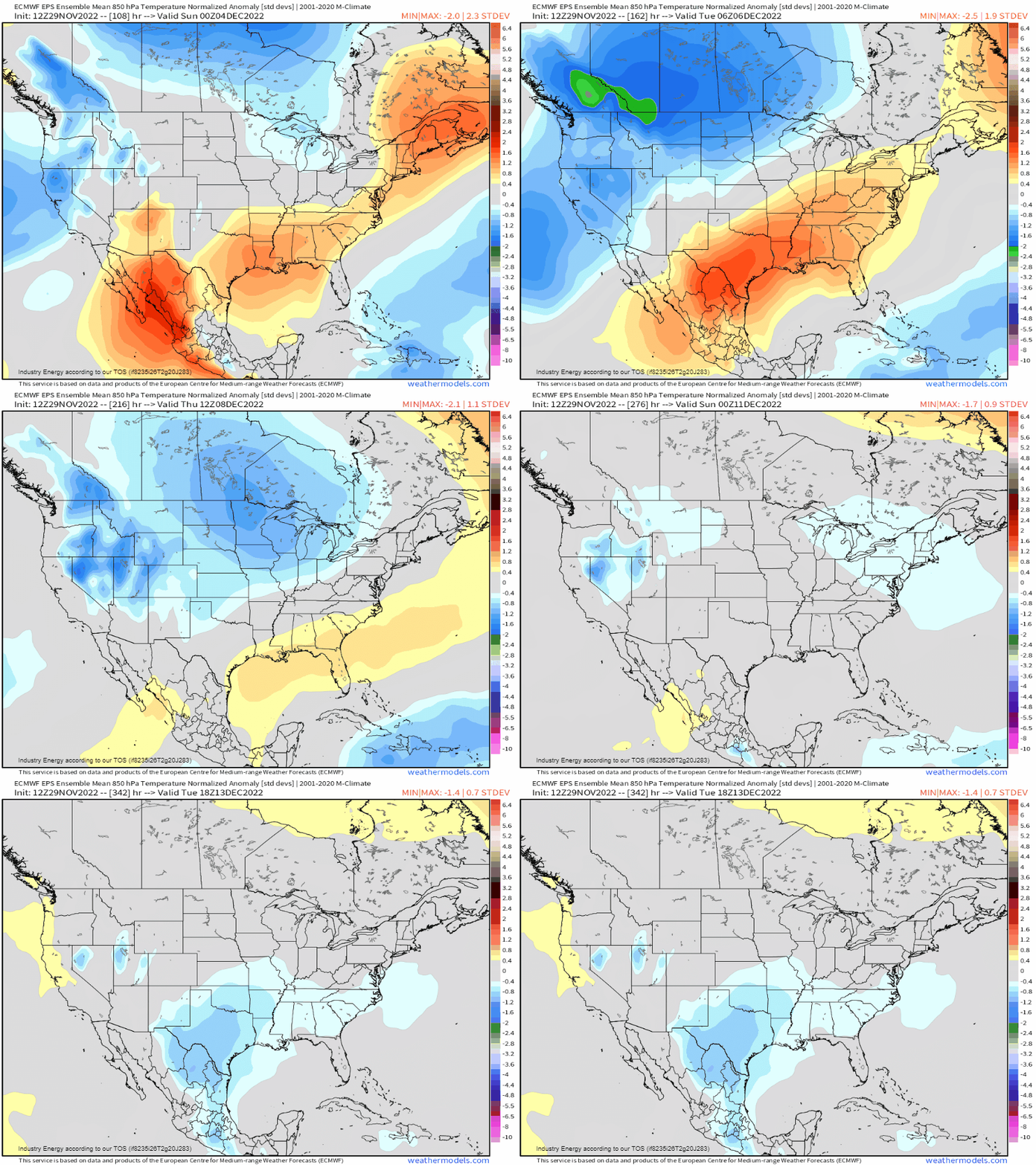
We can analyze the depth and magnitude of the cold air anomalies, demarcating the ridges and troughs. Here for example, is the 850mb temperature anomaly progression. Watch how the relatively higher heights and associated “warmer” temperatures, are replaced by cooler than average temperatures. Then we see the milder temperatures shift westward accordingly.
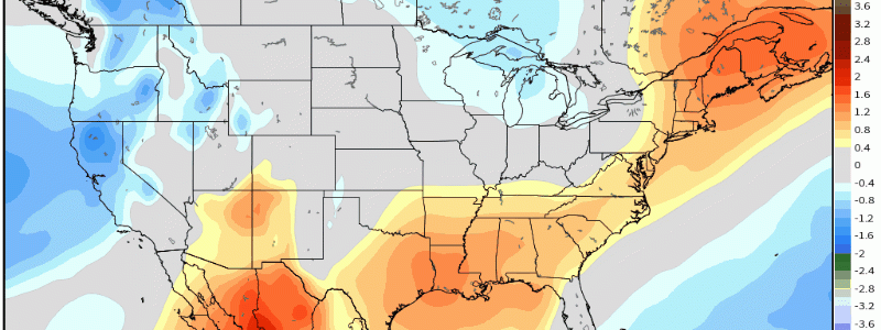
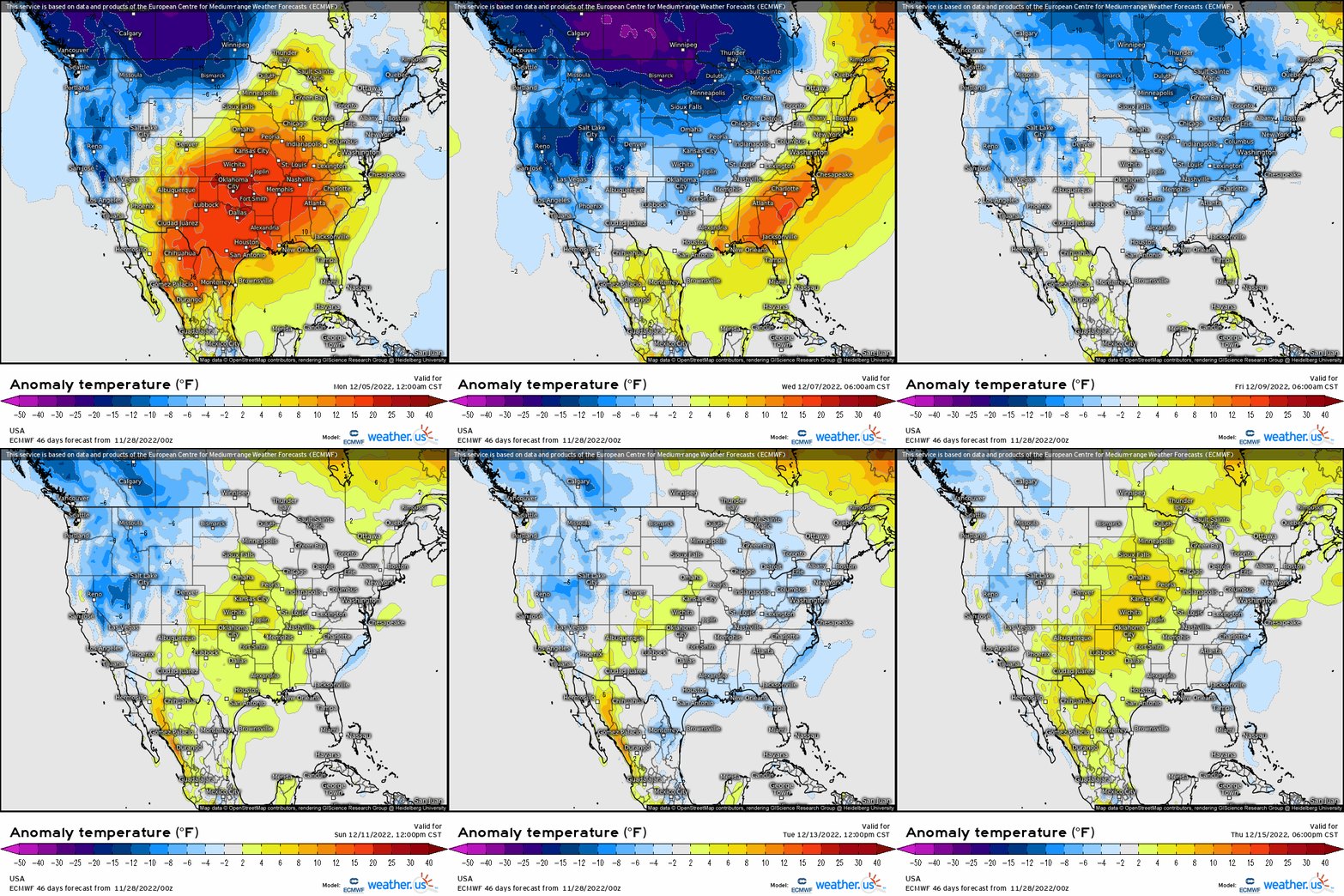
This nicely aligns with the surface temperature anomalies, which show the blue lingering across the Northeast, and generally east of the MS River. This is purely the result of the high-latitude blocking that develops in the short-term, and lasts into mid-month. Now we may see more in the “ballpark” of average by end of first full week of December and into the 2nd; however, the cold will slowly impart itself into the East by the 2nd into the 3rd week as this entire evolution is a “step-down” process.
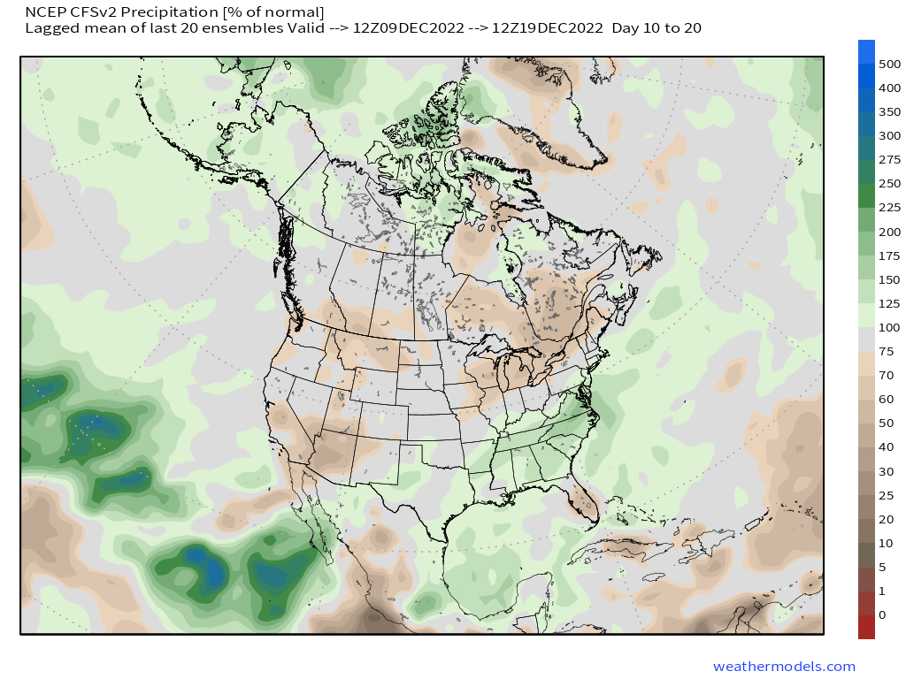
What about potential snow and winter opportunities? Well, the storm track with the -NAO developing, one has to be weary of snowstorms and wintry prospects along the Eastern Seaboard, as the polar jet stream is shunted southward. We see this hinted rather notably in the CFSv2 (climate model) weeklies, as it shows a defined area of above average precipitation along the East Coast and the South. This also implies an active sub-tropical jet, which can certainly make things interesting as shortwave troughs flow through, and could lead to phasing potential with the polar branch. A whole lot of potential fun could be in store for the Northeast and Great Lakes region in the next few weeks!
Stay tuned for winter events and storms likely to start showing up as we approach mid-month and beyond!


