An Outlook For September: Medium-Long Range
Looking ahead toward mid-month and slightly beyond, we’re going to see some changes from a height-pattern perspective from which we’ve seen since the end of July.
With very solid agreement among ensemble means, we’re going to see an evolution as follows heading into mid-month:
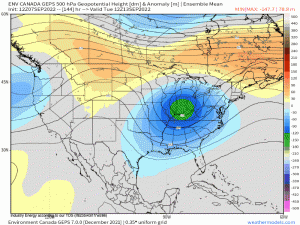
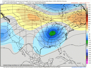
Verbatim the GEPS (Canadian ensembles), along with the EPS to help display support that extends further out (GEFS as well is in agreement), we’re going to finally see the tenacious western anticyclone and above average heights be replaced by troughiness and below average heights beginning next week. Along with the West Coast, along and east of the Ohio Valley will feature average to below average heights corresponding to seasonable temperatures, to even slightly below especially for the West.
The core of above average heights and mid/upper-level ridging will shift into the Central U.S. rendering above average temperatures. By the last 10-12 days or so of the month, we’re going to see relatively expansive ridging across the Central U.S. and nosing toward the Eastern Seaboard. Above average temperatures will be seen across the Rockies, Midwest, Deep South, Ohio Valley, and the bulk of the greatest above average temperatures is poised to establish across the Great Plains & U.S. Corn Belt.
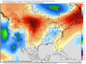
For visual purposes, the 850mb temperature anomaly helps to corroborate the mid-level height pattern in where the core of above and below average temperatures will establish. Notice how leading into mid-month, below average to seasonal temperatures are seen across both sides of the coasts with the core of above average temperatures over the Northern Plains, which gradually shifts into the U.S. Corn Belt and Midwest, then bleeds eastward heading into the latter half of the month. Below average to average temperatures look to be fairly consistent across the West and along the Rockies.
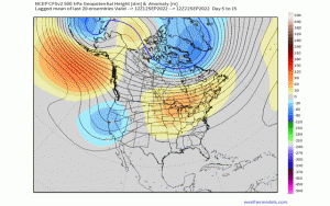
The CFSv2 – a seasonal climate model, shows in 5-day intervals, the height pattern through the month. This aligns nicely with ensemble means with troughs on both coasts to start with above average heights across the Central U.S., before shifting the ridging eastward as the West Coast gets a much deserved break from the persistent ridging.
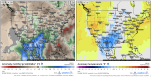
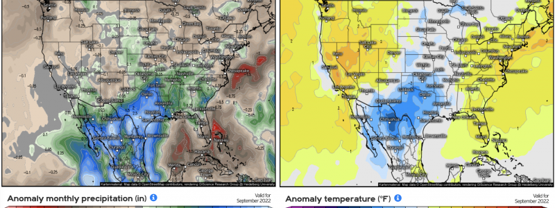
Lastly, using the ECM SEAS5 climate model, here is what the general agreement is in terms of precipitation and temperatures aggregated over the month. The core of above average to average precipitation and temperature departures will be centered across the Deep South and Southern Plains. Average to below average precipitation and temperatures will be seen across both sides of the U.S. coasts and the Midwest. This indicates generally higher-than-normal pressure will prevail across the latter, while the former will see continuous moisture advection from the Gulf given the synoptic pattern as advertised.
When all said and done, September should feature a rather tranquil and typical atmospheric height pattern with relatively large-scale ridging and periods of quasi-zonal flow as the very last month and tail-end of summer resides, indicating a seasonal transition from the warmest time of year toward the cooler seasons. On that note, one thing to be wary of is with above average heights allocating toward the Eastern Seaboard, one must caution any tropical threat that could form underneath the ridging as we continue to trek further into peak hurricane season.
