An Interior Northeast Snow Event Today into Tomorrow
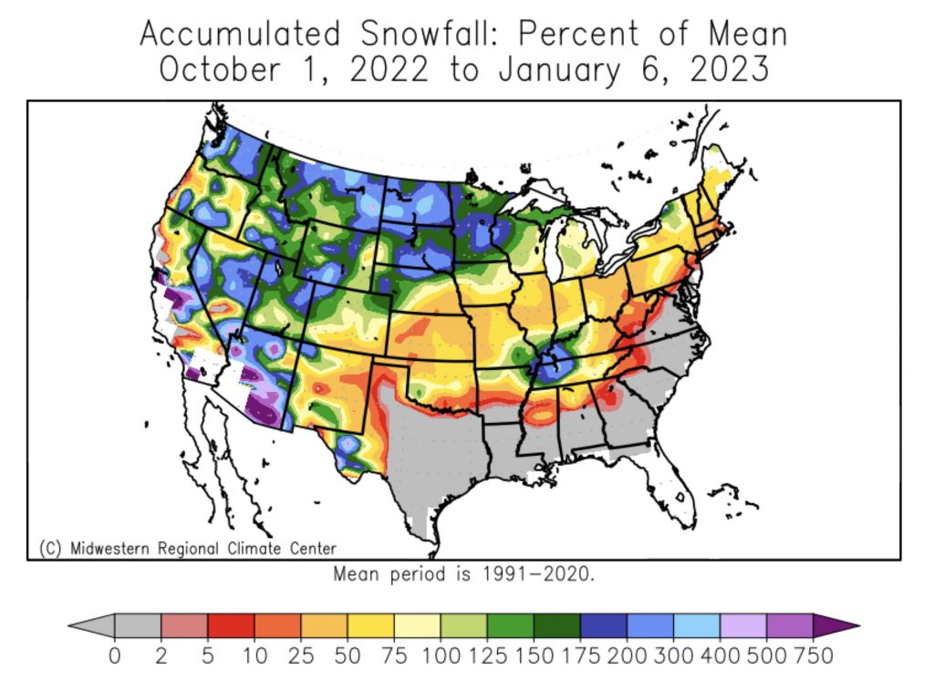
According to the collected snowfall data since October 1st (via Midwest Regional Climate Center), we’ve seen up until early-mid January, well below average snowfall with even worse statistics along the I-95 corridor as we focus here in the Northeast.
There’s certainly good news, and that bodes well today into tomorrow for the Northeast and ski resorts who are hurting from a snowless winter thus far. That, and even better news shortly on the way in my next blog that will discuss an interesting pattern change as we near the month’s end!
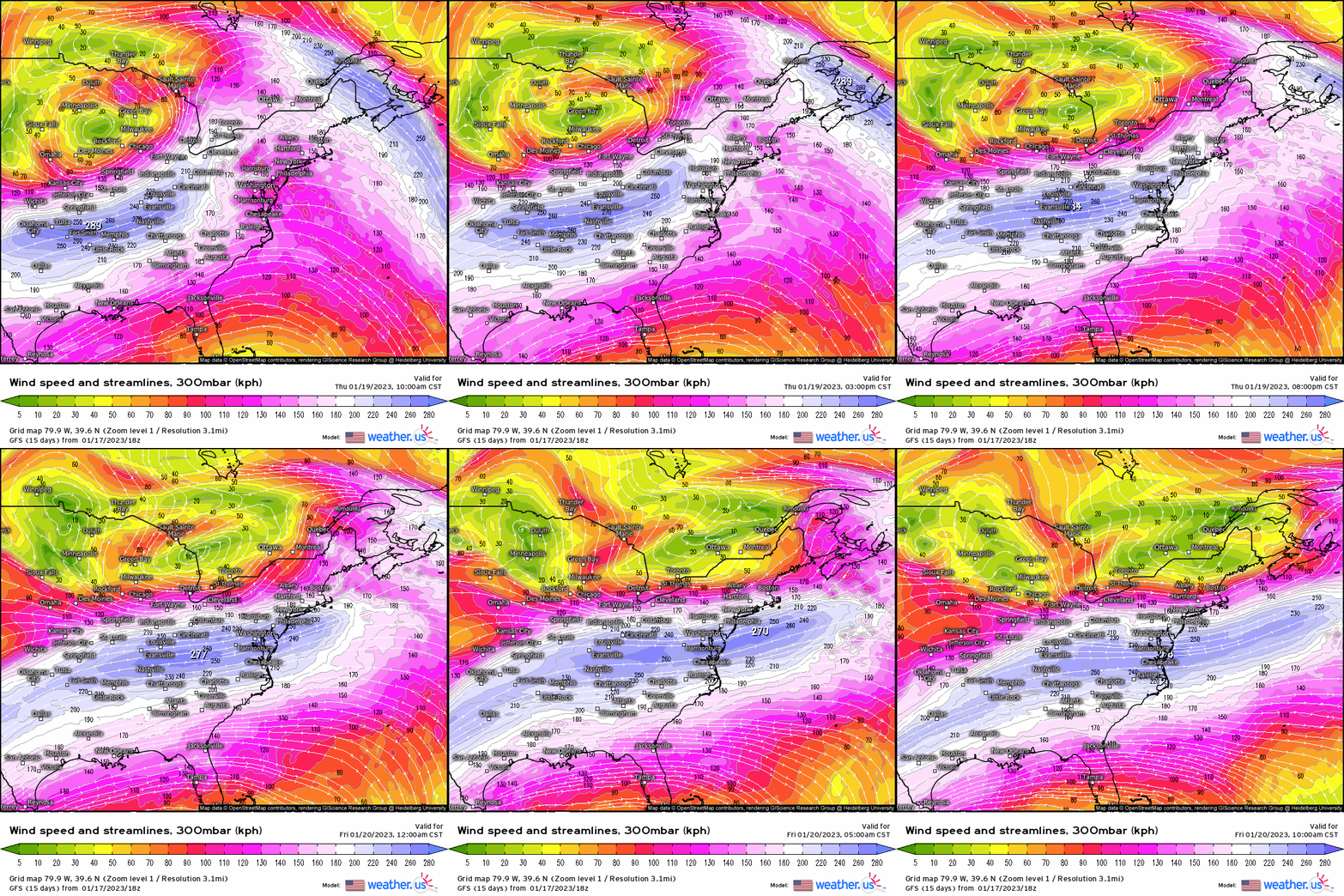
Starting with once again the jet streak level of 300mb, we see an interesting development right off the bat – an almost ideally placed dual-jet structure develops as a jet streak develops across Nova Scotia with the divergent right-rear entrance juxtaposed over New England while an approaching jet streak from the south propagates. This has the divergent left-exit region now shifting into the Northeast. From previous discussions, we know that it’s these divergent regions of the jet streaks that augment what transpires at the surface.
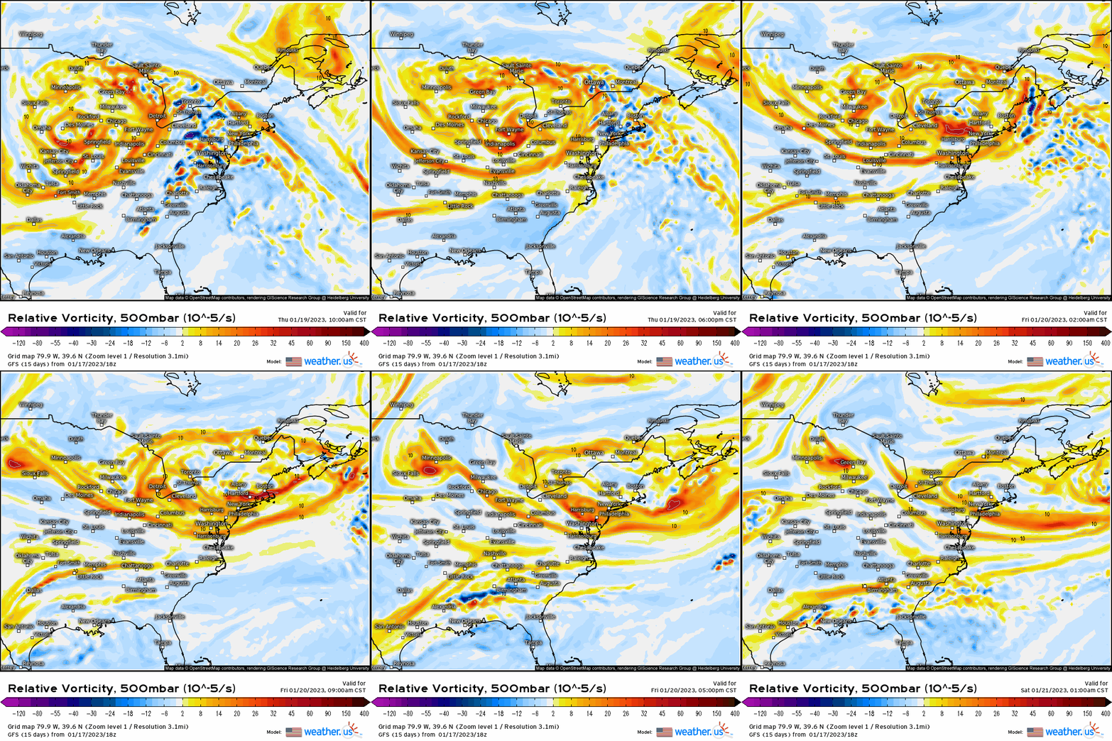
Next, we work our way down into the atmosphere at 500mb. We see here our large and expansive mid-level trough that gave the Midwest/Great Lakes/Northern Plains regions snow, now allocate into the Northeast with positive vorticity advection and shortwave vorticity maxima rotating through providing forcing for ascent.
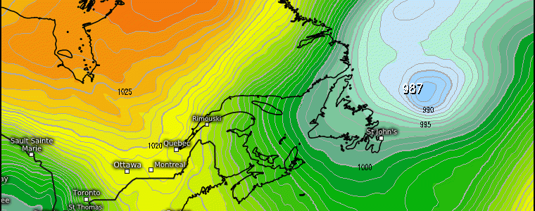
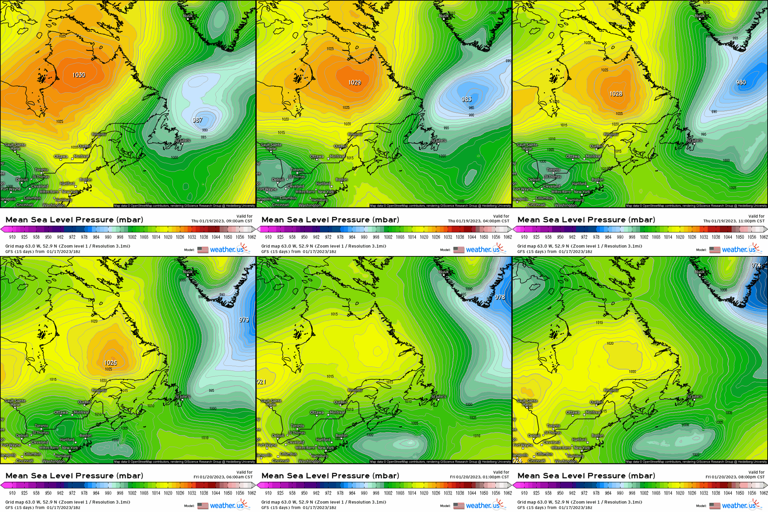
At the surface (1000mb), we see a fundamental atmospheric process manifest, and the GFS MSLP displays this nicely. Below, we see a near 1030mb high, slowly shift southeastward into southern Quebec. While in conjunction, the primary surface low that cuts into Michigan and into northern NY now must transfer the energy to the coast. The reason being the high pressure acts as a “block”, which forces the secondary low pressure to form over the Atlantic and we see this happen harmoniously.
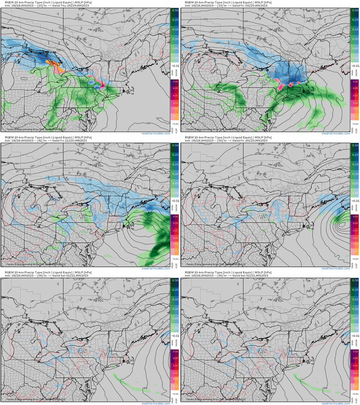
Using a mesoscale model with higher resolution (in this case the RGEM, which does quite well with winter systems), we see the scenario play out accordingly:
- As the primary low shifts into the NY/CA border, the secondary low takes over. Out ahead, warm air advection out ahead provides a brief rain to snow transition as the low strengthens offshore (remember the divergence happening aloft with the jet streak!).
- Low pops offshore, and winds suddenly turn northeast and advect colder air downward. We then see rain changing to heavy snow across southern NY into NH, as snow stays the primary precip type further inland and north. At times, the snow will fall at heavy intensity, which can overcome marginal surface temperatures
- As the low quickly shifts eastward, on the backside is where we may see a mix of some freezing rain along with snow showers and periods of light snow for these same areas that’ll see at least a nuisance of a wintry event.
- Timing would be later this afternoon through early Friday morning (with the heaviest of the snow), then tapers off to snow showers and light snow in general by tomorrow evening.
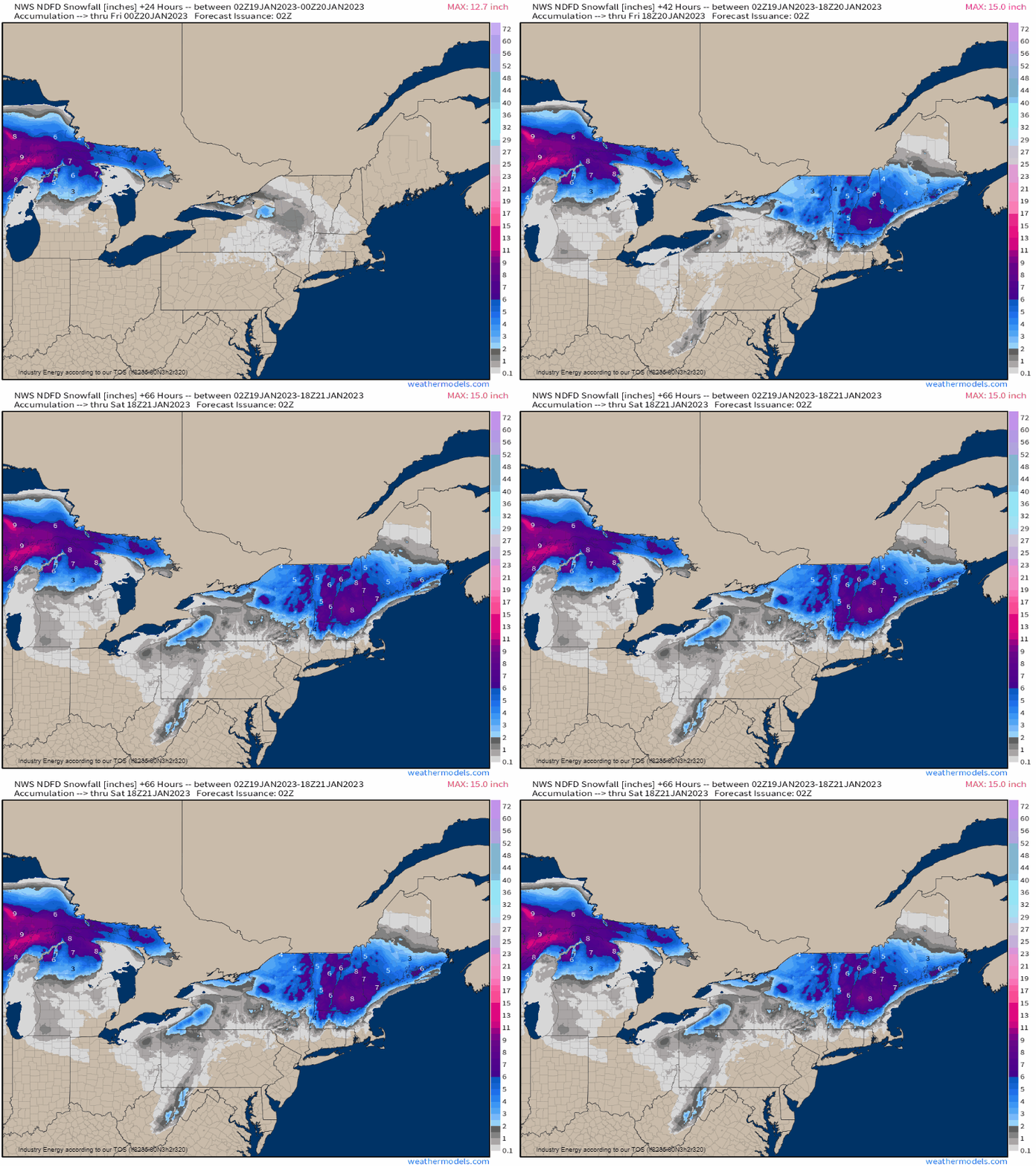
As for totals, we see the NWS consensus is for a general 3-6”/4-8”, with locally higher amounts including a “jackpot” zone across central-northern NH and into western ME. This is because of colder temperatures and favorable position relative to the storm track that puts these areas at risk for higher snow totals. This could be one of multiple opportunities that may be in store the end of the month into February looks rather active!


