An Icy End to the Week
As many in the weather world know, the trend isn’t always your friend if you’re wanting to see a significant storm. The Friday/Saturday system has gone from looking relatively promising earlier in the week to a much more suppressed overrunning event with not enough energy and too much dry air.
It seems that scenario 2 from Tuesday’s blog will be more or less what plays out. This doesn’t mean it will be without impacts, just that the impacts will be confined to smaller area.
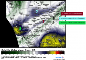
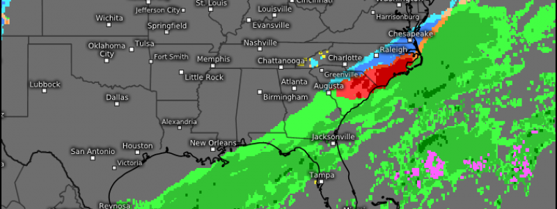
A look at current water vapor imagery shows the set up pretty well.
First, we have the current disturbance moving through this morning. This disturbance will go on to stall across the southern states.
Second, we have the incoming northern stream disturbance. This one is a bit more energetic, but without any real access to moisture on its own.
Third, we have a southern stream disturbance hanging out over the desert southwest. This one is forecast to move east and bring dry air with it.
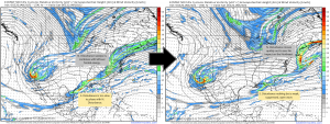
In order to get a strong storm capable of wide-reaching effects, we need disturbance two and three to phase. Although that looked promising earlier in the week, the forecast has evolved to where it no longer looks likely.
Disturbance three simply moves too slowly to phase with Disturbance 2. Instead, Disturbance 2 picks up the old frontal energy from stalled-out Disturbance 1, harasses the Southeast coast with a bit of wintry weather, and then moves quickly offshore.
So what do we have?
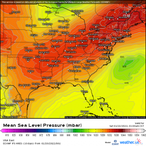
A strong area of high pressure located over the Northeast will funnel cold air into the Mid-Atlantic in a cold air damming (CAD) situation, much like last weekend. Temperatures at the surface will be at or below freezing, even as far east as the Carolina coasts.
Unlike last weekend, our low stays offshore. This translates to lesser impacts further inland due to lack of moisture. Also, the overrunning we saw last weekend will still occur, but the warm air aloft won’t penetrate nearly as far inland since the center of the low is far offshore.
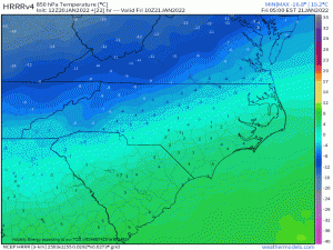
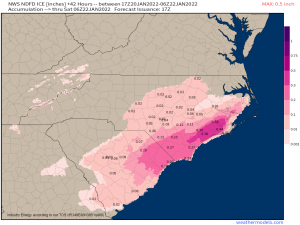
Warm air aloft mainly stays confined to the lowlands of both North and South Carolina. Those in this region stand to see the biggest impacts from either sleet or freezing rain.
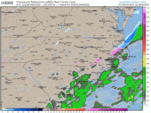
Should it play out as we’ve discussed above, it could look a bit like this:
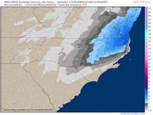
Precip remains confined to the eastern parts of VA, NC, and SC with those on the far edges receiving a little bit of snow. Those nearer to the coast receive sleet/freezing rain before the cold air filters in as the low departs and whatever moisture is left changes to snow.
The potential for the heaviest snowfall lies in north central NC through SE VA. They should receive enough moisture for a few hours of snowfall and will more than likely remain below freezing both at the surface and aloft for the duration of the event.
Ice accumulations near the coast could be fairly significant. This is something to be prepared for if you reside in this region.
Something to keep in mind: frigid air will settle in behind this system. Anything liquid will freeze and could continue to cause travel issues into Sunday morning.
There will be no wintry weather for the Northeast from this system. The high funneling cold air south to facilitate this event will also keep the low well offshore as it pulls away.
This system is not without impacts, obviously, but it is much more underwhelming than some hoped it would be at the beginning of the week. There’s always next time.
