An Extended Period of Heat Settles In
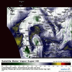
Well it’s a new week and there’s plenty of weather to discuss. Let’s start with some water vapor imagery.
I really love water vapor imagery. There’s so much we can tell about what’s currently going on by viewing it.
For example: the ridge-trough pattern is clearly visible. We can spot a shortwave moving around the fringes of the trough. We can see the monsoonal moisture in the Southwest along with the tropical disturbance now well inland in Texas.
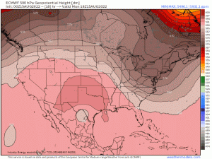
This ridge-trough pattern will be a driver for two “big” weather stories this week.
The ridge retrogrades west and amplifies in response a deeper-digging trough over the east. This trough is expected to allow for some rather wet weather for the Northeast this week – a topic Armando will visit in his blog tomorrow.
Today, we’re going to focus on the ridge, which will facilitate yet another prolonged period of heat for some of the Western US.
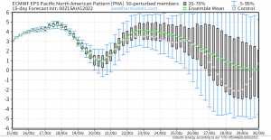
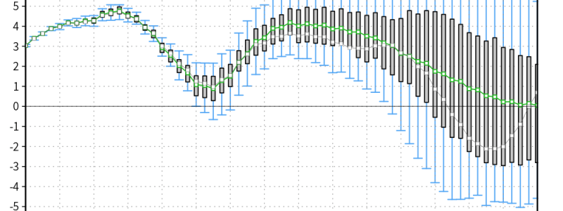
When we looked at the PNA last week, it had just begun to go into the positive phase, indicating the onset of ridging in the west, troughing in the east.
Now we’re looking ahead via the EPS. Both ensembles and deterministic models generally agree that, with the exception of a slight decline to a nearly neutral state toward the end of the week, the PNA will remain positive for quite awhile.
What does that mean in plain language? Simply – ridging, and therefore higher-than-average temperatures, will linger in the Western US for awhile yet.
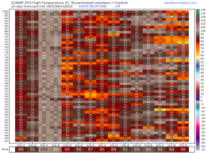
This TMax Matrix from the EPS for Medford, OR illustrates what the PNA showed nicely. We see a potent shot of heat by midweek, followed by a return to near average, followed by yet another stretch of heat.
So, what does that look like for the whole region?
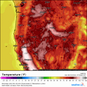
Well, in a word – hot. It is worth noting, however, that while the heat intensifies and then backs off for most locations, it stays hot for locations in the lee of the Cascades as well as the Central California valley.
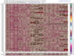
To illustrate this point, here’s the TMax Matrix for Fresno, CA:
Heat does seem to wane just a bit around week’s end, if you can call 99/100 degrees a break. This period coincides with the predicted near-neutral phase in the PNA we saw above.
I could continue showing temperature maps and anomaly maps but frankly, I’m running out of ways to say “it’s going to be hot for awhile.” So, as temperatures begin their upward climb today, remember to practice heat safety.
Some tips:
- Eliminate strenuous outdoor activities, especially during peak heating.
- Wear light-colored, lightweight clothing.
- Stay out of the sun.
- Eat light meals.
- Drink more water than you think you need to stay hydrated.
- Spend as much time in air conditioned places as possible.
- Keep your shades closed to reduce heat in your home.
- Take cold baths or showers.
More tips and resources can be found here: https://www.weather.gov/safety/heat-during
We’ll keep you updated here and on Twitter as the week progresses!
