An End of The Month Pattern Outlook
Since Meghan will be giving a Christmas weekend forecast, I decided to do my usual my post mid-month medium-long range outlook as we close out the last month of the year!
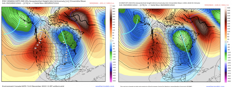
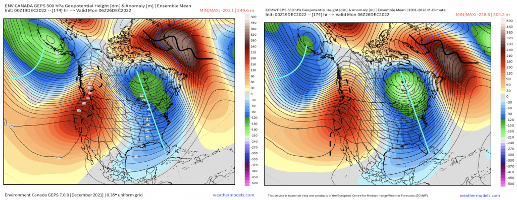
We first start with the period right after Christmas, and prior to New Years. Our large impactful system, which will track through the Midwest and into the Great Lakes (more on that in Meghan’s informative blog), will become a strong cut-off, upper level low that spins underneath the Greenland ridge as everything downstream is essentially in a “traffic jam”. A long wave trough is established in the East, with reinforced ridging across the Northern Atlantic and into Greenland (maintaining our -NAO). Out west, a temporary ridge (+PNA) builds as a result of upstream activity across the Northeast Pacific. So this pattern verbatim continues to at least maintain widespread below average temperatures heading into the end of the month.
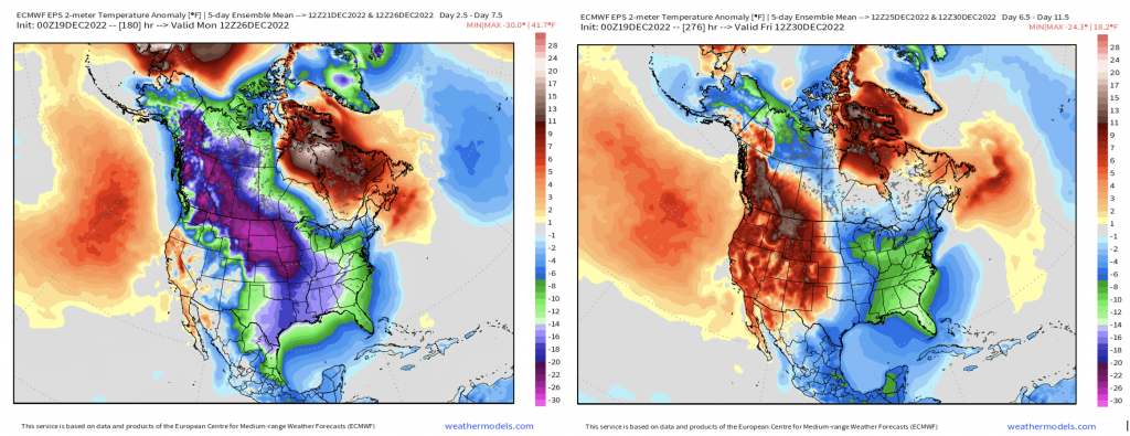
What this looks like from an ensemble mean (EPS) in 5-day increments is as shown below. The arctic air mass that floods in this week, especially behind the departing strong Midwest/Great Lakes storm, lingers and moderates to an extent. Then by the end of the month leading into New Years, we can see the relatively above average temperature departures out west reflected by the ridging.
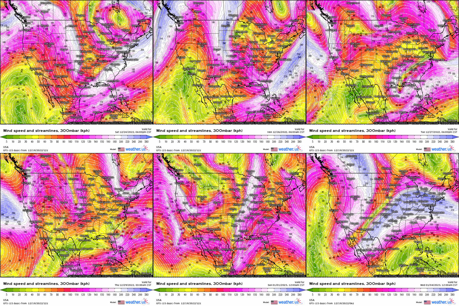
With below average temperatures hanging around, we’ll still have to monitor for any “sneaky” wave to ride the baroclinic zone enforced the large cyclone with cold air advection on the backside, especially along the eastern seaboard post-Christmas. We still will be dealing with an active storm track, especially the southern jet stream as we see several intense jet streaks impart onto the U.S., and also hints of an active west coast regime!
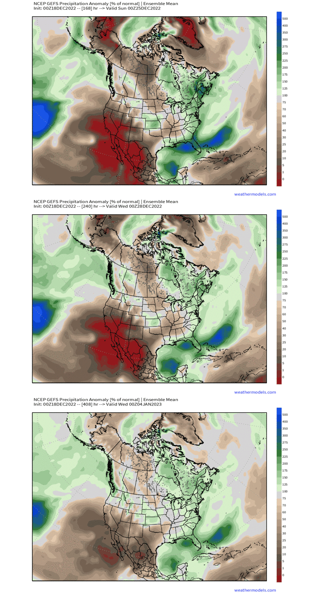
This is reflected nicely in the GEFS % of precipitation anomaly, where it highlights areas where we may see above or below relative to average. Note the above average departure in the Midwest, Gulf, and up the Eastern Seaboard (even out across the West Coast as the below average from normal is reduced quite significantly).
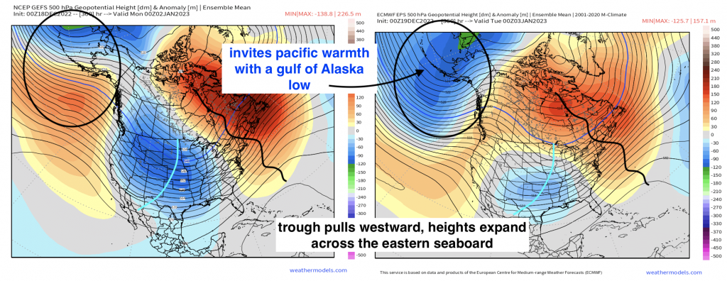
However, we’ll see a flip by the month’s end, and this has support from the tropical forcing out in the Pacific (MJO). Below, we see several things manifest:
- Mean eastern trough pulls back westward.
- -EPO is flipped positive, with below average heights taking control over Alaska, which allows for the Pacific storm track to “flood” into the pacific NW with milder air.
- Expansive ridging along the eastern seaboard, supporting a more mild type pattern.
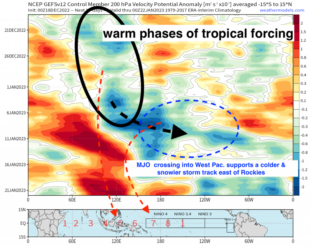
As we monitor changes in the Pacific along the equator, the hovmoller verbatim showing areas of divergence/convergence (convection & suppression), supports the relatively mild signal as we close out December for a good portion of the U.S. as divergence is seen across the Indian Ocean & Maritime Continent. This has large-scale impacts that correlates to ridging in the East and troughing into the west.
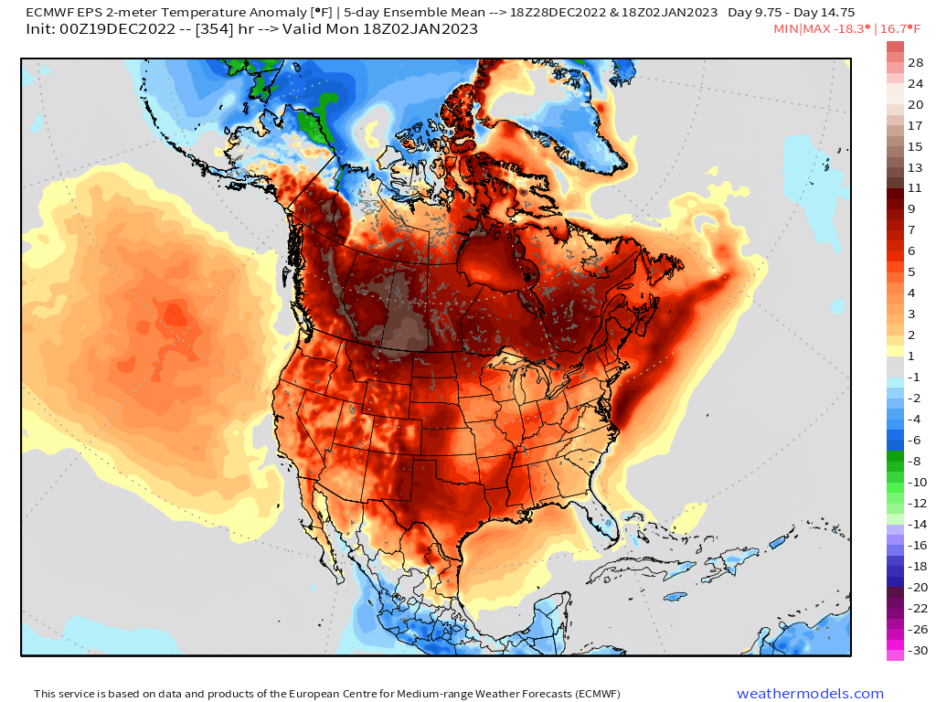
We see as we open up the New Year, we have widespread above average temperatures relative to average.
However, with the MJO crossing back into the Western Pacific by early-mid month January, which I know is far out but it still can be speculated since both research and analogs support this, a wintry pattern would be in the works for the Midwest on eastward. We’ll cross that bridge when we get there though, but for now, expect wintry weather at least through the next week or so before we begin to see a pattern change by the end of the month.


