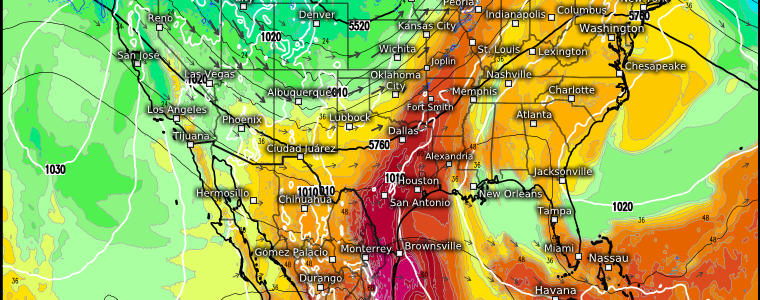
An Active Week Ahead
After another weekend of active weather, any severe weather has moved on and a much drier airmass is currently in place over the eastern half of the US.
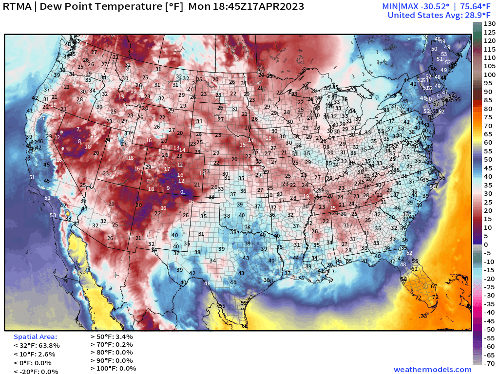
With the exception of the Northeast and Great Lakes where showers and snow showers persist, calm, clear conditions reign as high pressure builds slowly back in.
But don’t let the momentary calm fool you. Another active period isn’t far off. More widespread activity will begin to slowly ramp up as early as tomorrow in the High Plains, then shift eastward and persist through at least Friday.
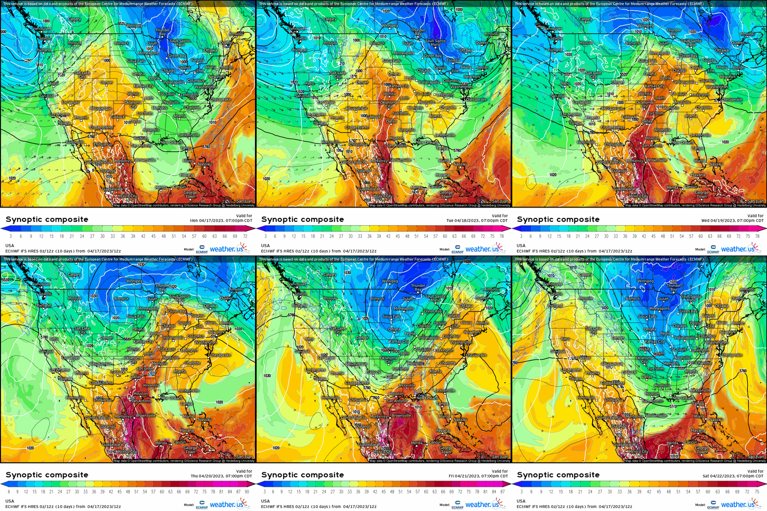
A trough currently moving ashore in the Pacific Northwest will make its way east through the day tomorrow, eventually ripening into a powerful cyclone.
As we can see by using the synoptic composite map, flow around a ridge to the east will allow moisture to be pulled northward ahead of the incoming trough. Moisture may be marginal at first (Tuesday), keeping the severe threat a bit more isolated over the High Plains. However, it’ll increase with eastward extent as the surface low forms and deepens.
By Wednesday, Thursday, and Friday, the threat is expected to become a little more potent/widespread – first over the Central Plains (Wednesday), then the Mid-South/Southern Plains (Thursday), and finally over the Lower Mississippi River Valley (Friday).
What hazards are we expecting?
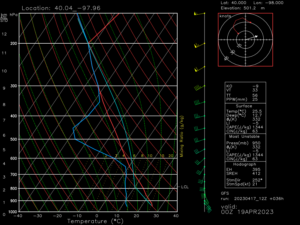
On Tuesday, with a decent amount of elevated CAPE and steep lapse rates, large hail is likely to be the primary threat.
A good amount of mid-level dry air exists as well, though winds in this layer aren’t terribly impressive. Some damaging wind gusts could materialize with stronger storms.
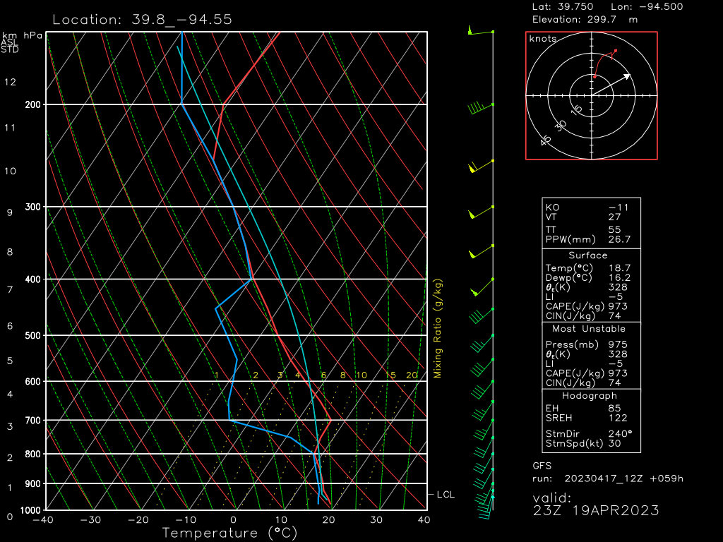
Wednesday looks similar with the same elevated CAPE, steep lapse rates, and mid-level dry air. Winds in this layer have increased some from the previous day though, so damaging winds may be a bit more prevalent than on Tuesday.
As for Thursday and Friday – at the moment, it seems like mainly a hail/wind event again. However, we are still a few days out from those potential events and fine-tuning the forecast as hi-res models come into range. We’ll check in on these days again a little later in the week.
Take Action:
- A slow-moving trough will facilitate the potential for multiple days of severe weather this week, with different regions being “in the crosshairs” each day.
- Monitor the forecast as the forecast for the second half of the week still has time to evolve some.
- Make sure you’re ready to receive warnings (at least 2 reliable sources) and that you have a plan to shelter ready to use if it should be needed.
- Spread awareness. If you have family or friends in any of the target areas this week, make sure they’re aware of the potential for severe weather so they can be prepared.
We’ll keep you updated on this forecast as it evolves through the week!


