An Active, Unsettled Pattern For Florida Next Week
We’re going to be entering a general, relatively “quiet” pattern as we head into the last week of May prior to the holiday weekend. Thanks a broad ridge that’ll expand across the majority of the U.S. east of the Rockies, this will help to keep any large-scale or notable severe weather outbreaks; however, that doesn’t mean a few severe weather events can’t happen, it’d just be more local / regional based and likely allocated toward the high Plains.
However, across Florida, it’s shaping up to be a wet week ahead and especially leading into Memorial Day as we see a trough become established across the peninsula.
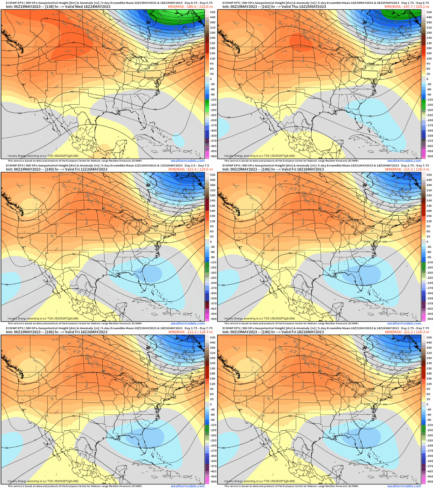
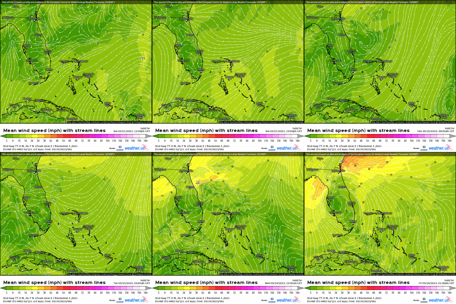
A cold front will push into Florida tomorrow, and essentially stall out for several days next week. This feature will become the catalyst for daily driven showers, storms, and a few areas of low pressure developing along with possibly something forming end of next week that’s a bit more robust. Using 10m winds, you can see a persistent onshore flow, which increases moisture in the atmosphere priming it for heavy rain and gusty winds, along with instability building during the day with enough solar radiation.
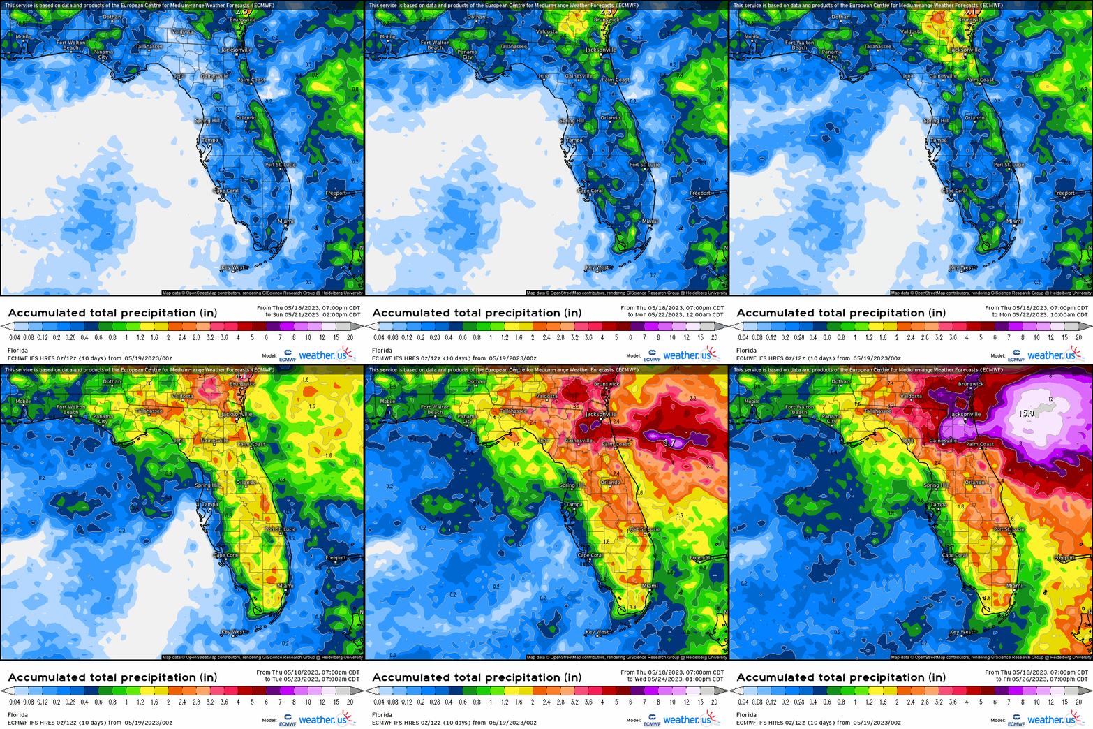
Each day, we see daily driven showers and thunderstorms with more notable waves of moisture trekking along that stalled boundary enhancing rainfall. The focus does appear to be more on eastern sections along the peninsula, especially with the onshore component. Then by the end of the week, we’ll have to watch for a more potent low pressure center that could bring more widespread rainfall. Pertaining to this, we’ll likely be dealing with localized flash flooding concerns each day.
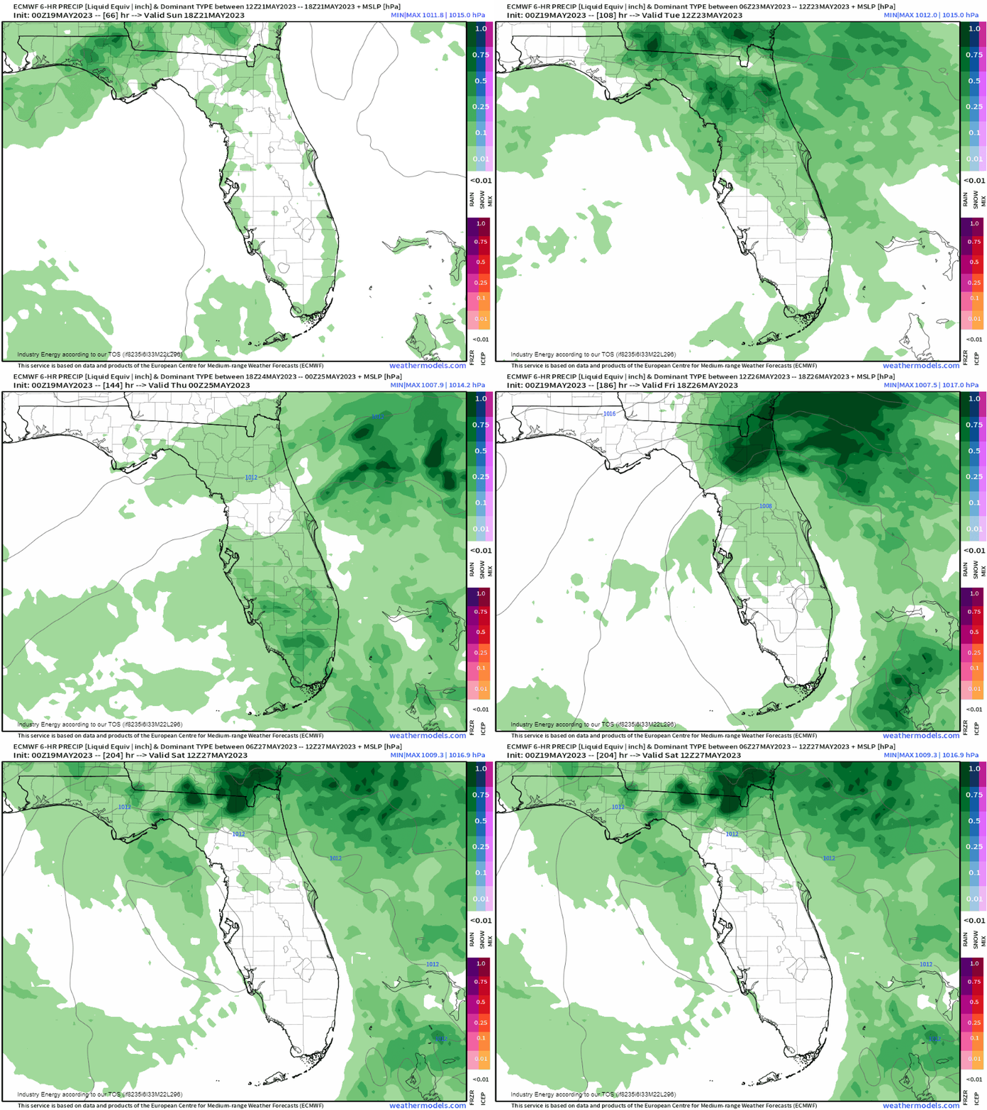
To get an idea of what we’re looking at, the heaviest axis appears to be confined mainly across inland areas and toward I-95 regions up and down the eastern Florida coastline. While verbatim the ECM hires model shows a “bullseye” near Jacksonville, indicating the increasing potential for a more potent developing low somewhere off the Southeast coast late next week as we’ll be closely monitoring that could probabilistically acquire tropical characteristics; however, that’s only one possibility that theoretically could transpire.
Regardless, a wet week is ahead for the sunshine state. All things considered, this rainfall actually will be beneficial for a majority of the state given the present drought they’re in.
