An Active Stretch Of Weather Upcoming
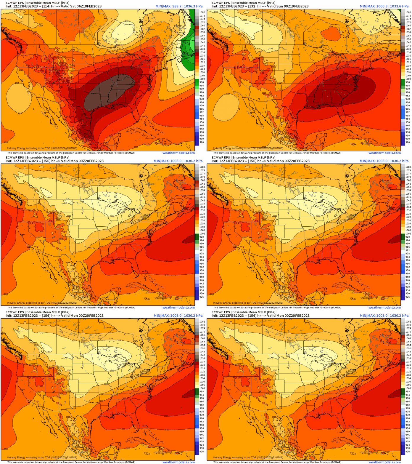
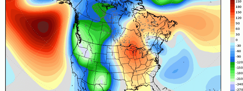
We have one active week ahead of us this week thanks to the general synoptic z500mb height pattern. With a mean ridge in the East (positive geopotential heights) and a mean trough in the West (below average geopotential heights), this forces low pressure and general cyclogenesis to manifest out in the Pacific NW and amplify as below average heights amplify once into the desert SW. This type of height pattern will yield several events this week and into this weekend.
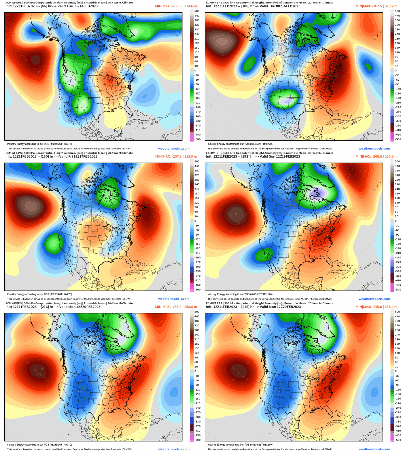
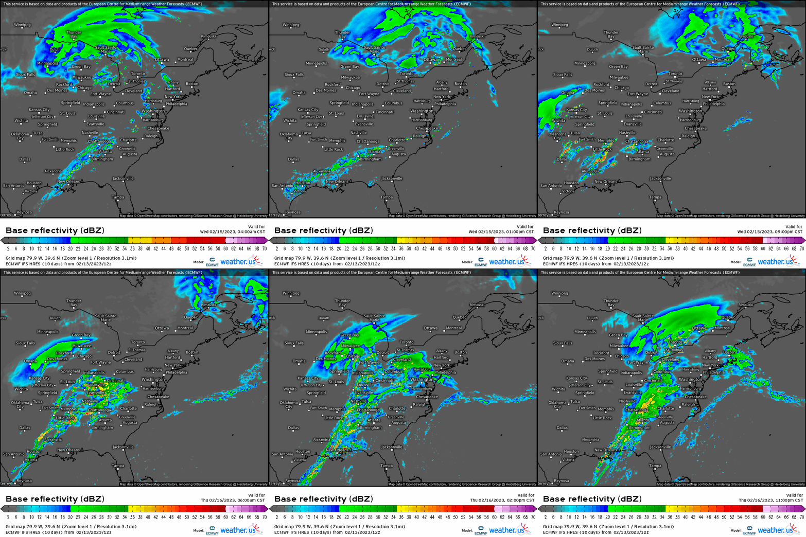
1.) A two-day severe weather setup Wednesday and Thursday with implications for ArkLaTex initially, then into the MS, TN, OH valleys. Hazards include damaging wind gusts, hail, and likely a few tornadoes heading into Wednesday night and Thursday.
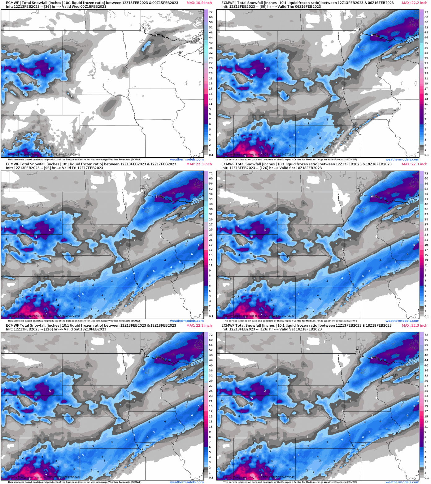
2.) Winter weather implications across the northern Plains from the first of two cut-off troughs with widespread rain across the southern Plains and parts of the Midwest. Then another more potent cut off low that’ll follow behind the former resulting in another surface cyclone that’ll be responsible for severe weather across the Southeast, and more snow on the backside of this cyclone for areas that see snow with the first one. In this case, however, the baroclinic zone gets shifted further southeast. This implies snow makes it further into regions of IA, WI, and into IL.
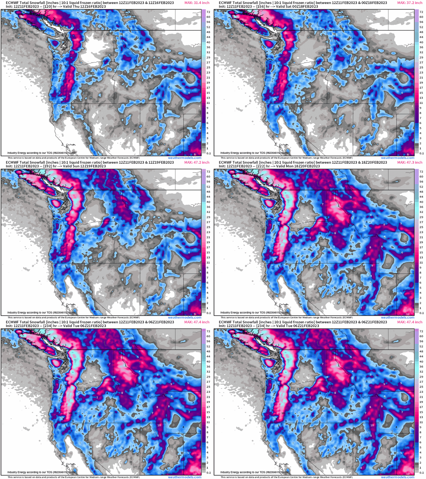
3.) Heavy snowfall for the Pacific NW and for the Intermountain West and Cascades with continued upstream continuous activity in the form of troughs providing mountain snowfall.
Severe Weather
Regarding the severe weather setup:
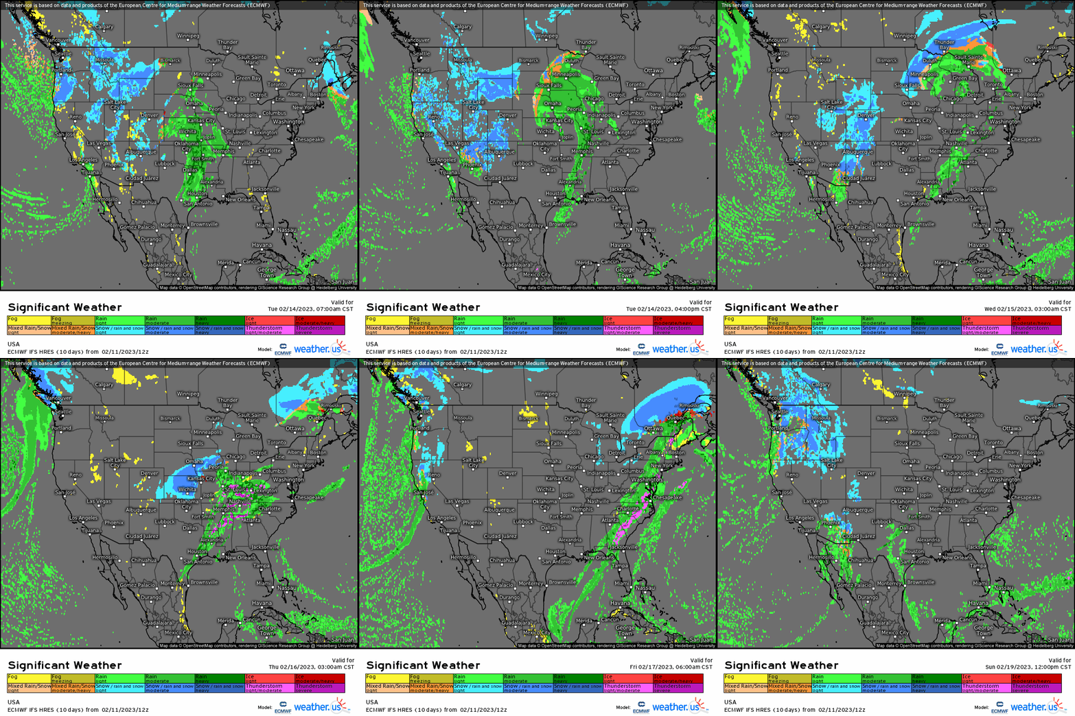
Thunderstorms look to develop during the later afternoon Wednesday, though limited to a degree in part due to modest thermodynamics across eastern TX/OK. With the trough axis more positively-tilted and the better dynamics further displaced toward the north/west, clusters of storms will be moving quickly with several likely to reach severe levels by late Wednesday into Thursday. This then shifts into MS, AL, and TN/OH river valleys as the surface cyclone treks into the Midwest with convection along the cold front.
Wintry Weather
In terms of snow, we see two apparent swaths with the initial manifesting across eastern SD & ND, and into MN. The second swath, which is more robust given a stronger surface cyclone, tracks further southeast resulting in snowfall across the Front Range into the Plains and parts of the Midwest / Great Lakes.
We then see toward the end of the weekend into early next week a healthy dose of new snowfall across the Intermountain West, Great Basin, and Cascades.
Once we get through this work-week, at least relatively quiet weather will return to a large majority of those east of the Rockies as active weather continues our across the West. We return to the action once again as we head into next week!
