An Active Spring Season Heading into April
Right off the bat, we’re going to start with the tropical widespread signal across the northern hemisphere by looking at the MJO using a hovmoller. Apparently shown, we have a divergent signal that aligns with the Maritime Continent, coming from the Indian Ocean. Below, i’ve attached MJO composites that also align with the background state of ENSO, which we’re still entrenched within a La Nina state. Utilizing this macroscale approach, and aligning it with composites along with guidance, we can garner an overall sense of where this pattern is going as we start April!
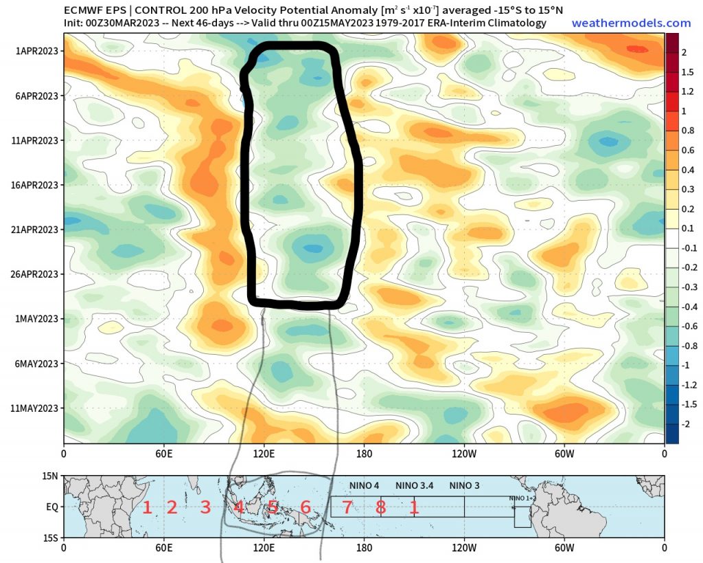
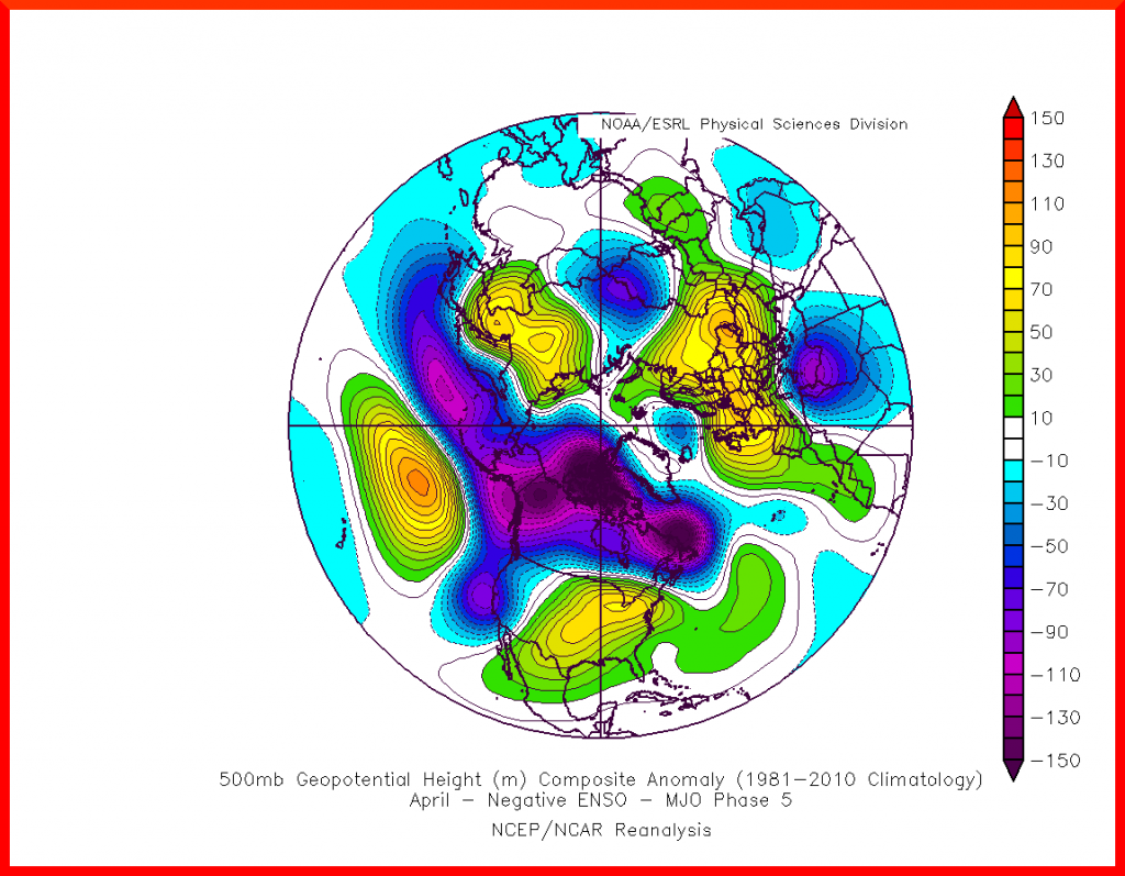
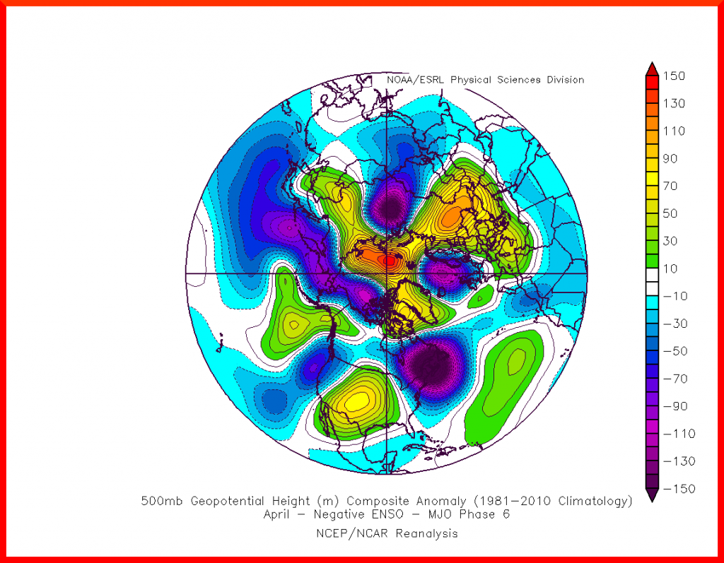
Unsurprisingly, with any convective signal cross from the Indian Ocean into the Western Pacific, this translates to a warmer east, cooler west. This shows rather nicely in the composites for phases 5 and 6! Lets dive into some of what ensembles are showing as we head into mid April.
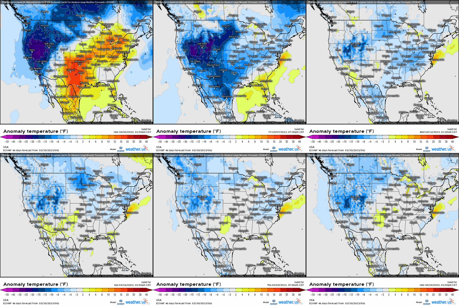
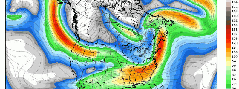
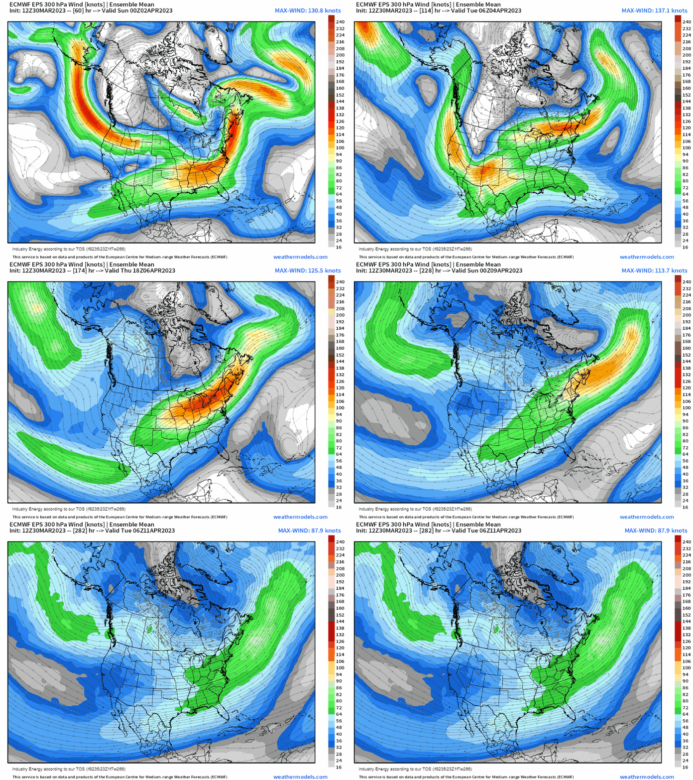
As we head into the first week of April, we see a continuation of troughs digging into the west, with ridging attempting to billow east of the Appalachians. Notice, the active Pacific continues with the absence of high-latitude blocking. This is reflected in the upper-level jet stream with a noticeable active pattern digging west of the Rockies with an apparent active sub-tropical branch developing. A pattern verbatim is conducive for severe weather outbreaks, especially in the absence of blocking since it can directly impact moisture return from the gulf by sending cold fronts down into the lower 48.
This also will allow for more warmups, albeit still progressive in nature, east of the Rockies with more feelings of Spring in the air and unimpeded bloom in vegetation, especially across the South and Southeast.
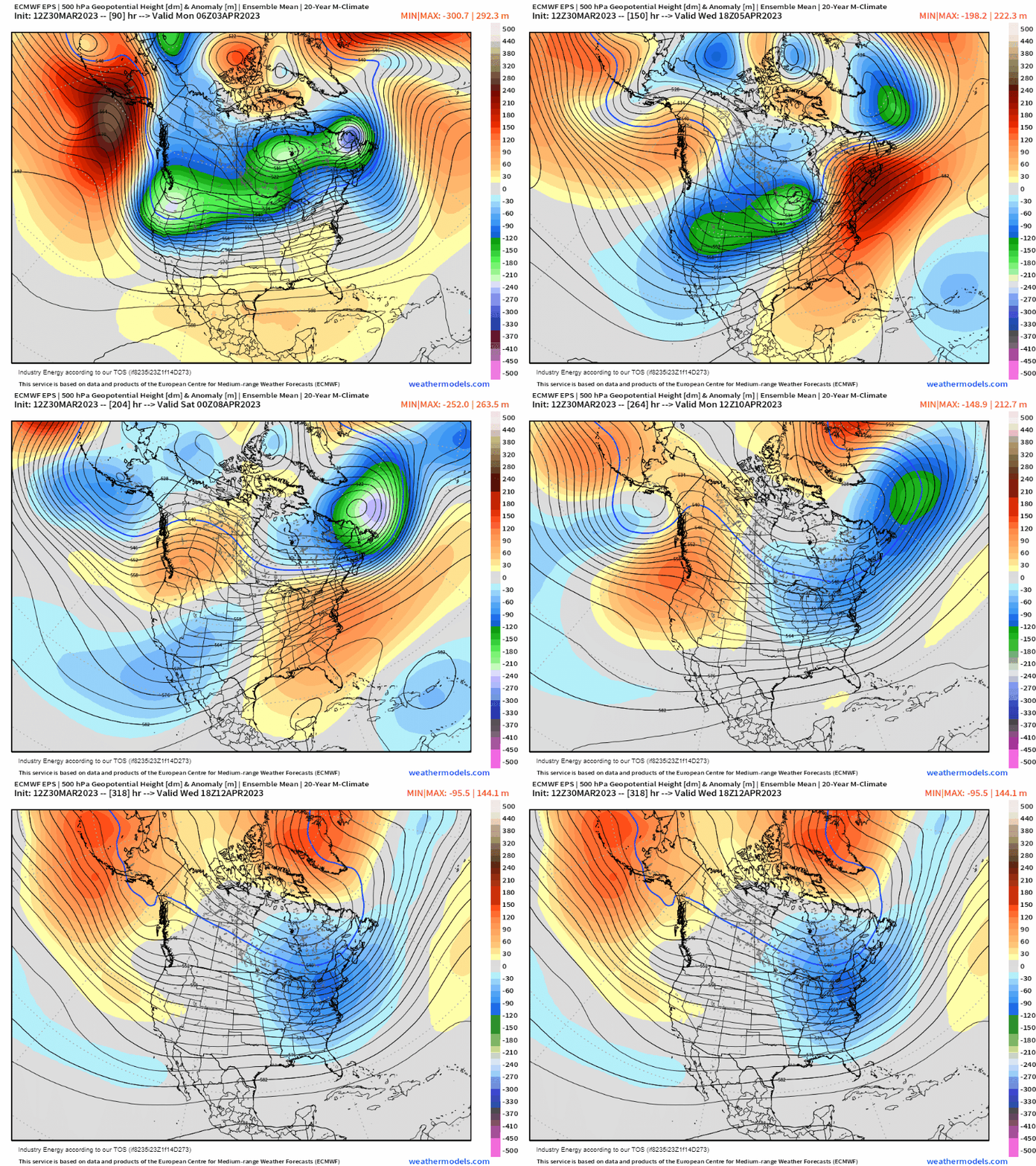
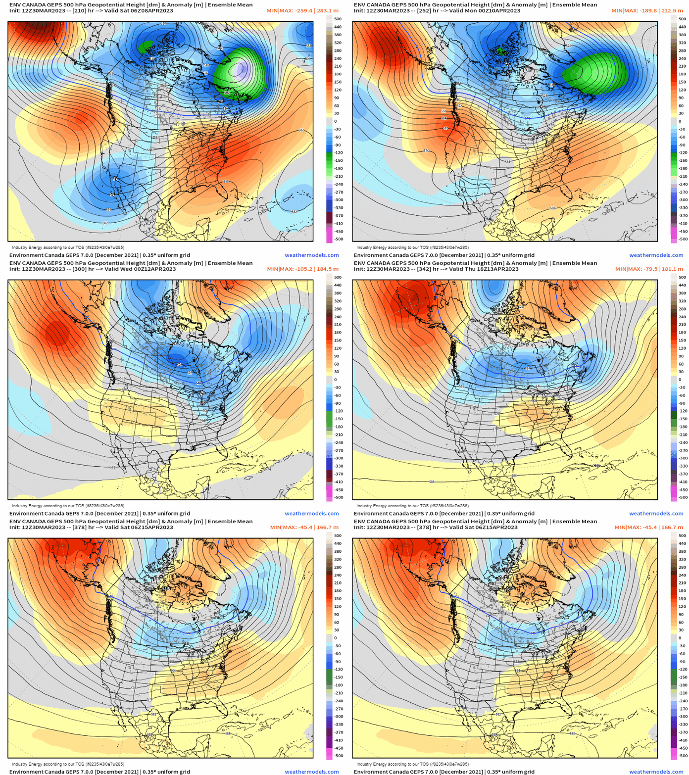
However, we do see a return to blocking across Greenland, which has merit given the lingering effects from the stratospheric warming event back in early February (yes, this can last up to 60 days post-warming with a continuation of “dripping” into the troposphere). What also makes it more legitimate is how it retrogrades westward. This would then force the polar jet southward, inducing more cooler risks into the lower 48 and bringing more widespread average to below average temperatures, especially east of the Rockies.
We see this reflected in the 2 meter temperature anomalies with for the first 7-14 days, we see a cooler west, warmer east depiction. This then shifts to more cooler and widespread air masses, which would also limit severe weather episodes temporarily. So going back to when I discussed in mid-March how the pattern isn’t necessarily one to “hit-and-hold”, here for April it does appear more or less the same, with a transient nature to the pattern though more stretches in terms of cooler and warmer air masses for regions across the lower 48.
