An Active Snowy Week Continues!
We’re currently seeing a system impacting Texas this morning as a relatively weak low is in the process of organizing, which will be quite dynamic as severe weather will exist across far southeast TX while snow continues to the north/west of the low pressure system!
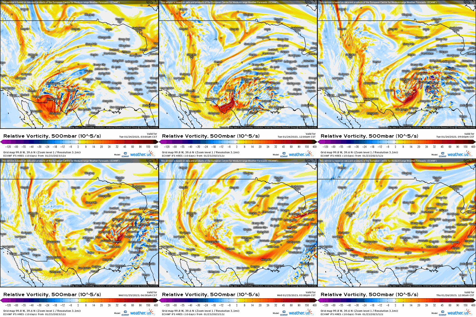
First, lets diagnose what is happening in the mid-levels because as well know, what happens higher in the troposphere influences what transpires at the surface with a feedback resulting. The catalyst right off the bat shows a large “bowling ball-esque” trough eject across the Deep South and it opens up as it traverses into the Great Lakes/Ohio Valley region. With a mid/upper level low that digs as far south as we’re seeing, this allows those locations to the north/west to see snow in the winter season as that’s the area seeing cold air advection along with dynamics for wintry precipitation to manifest. This same trough will be responsible to provide a decently sized snowstorm for the Midwest/Great Lakes region tomorrow.
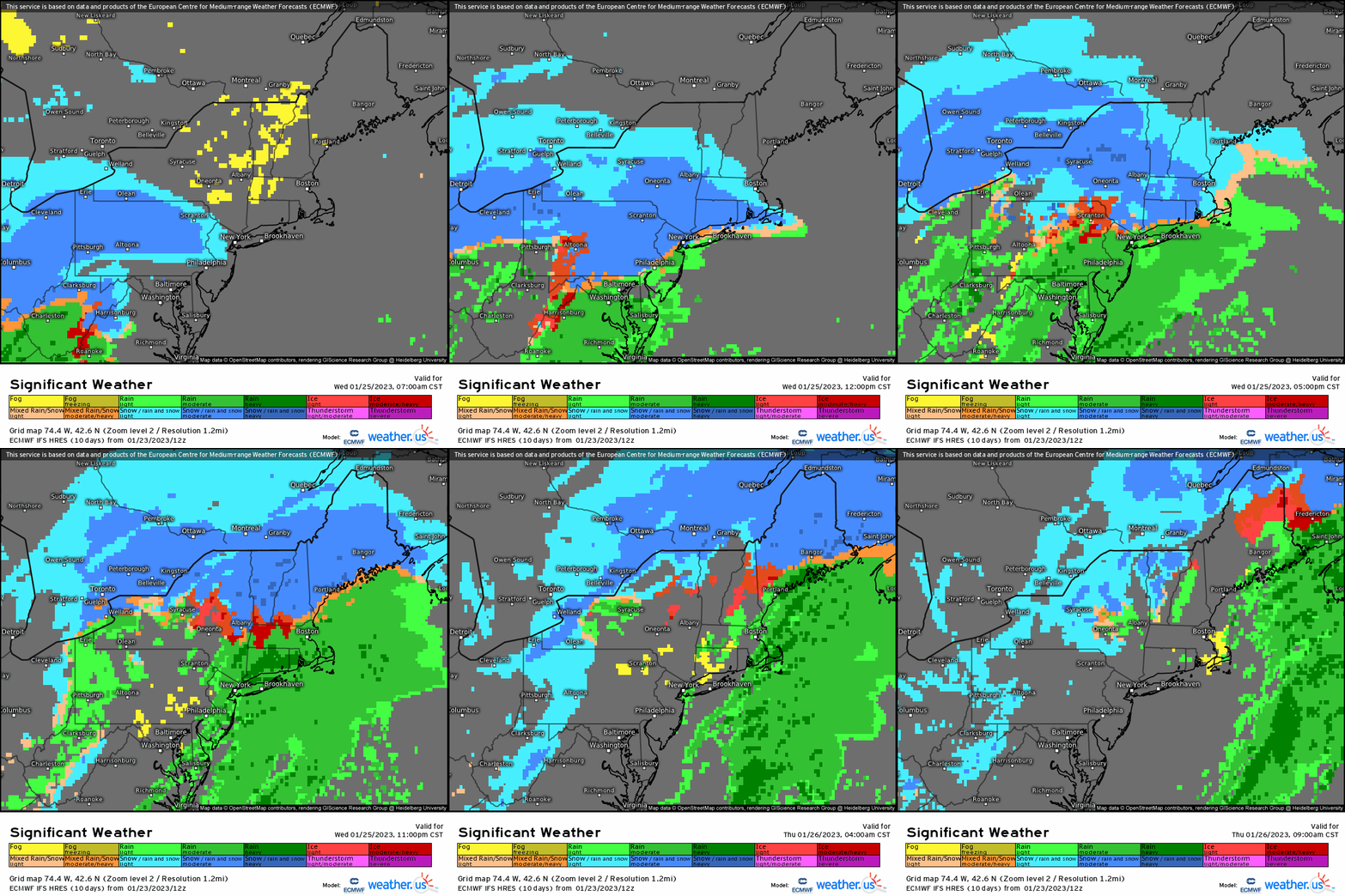
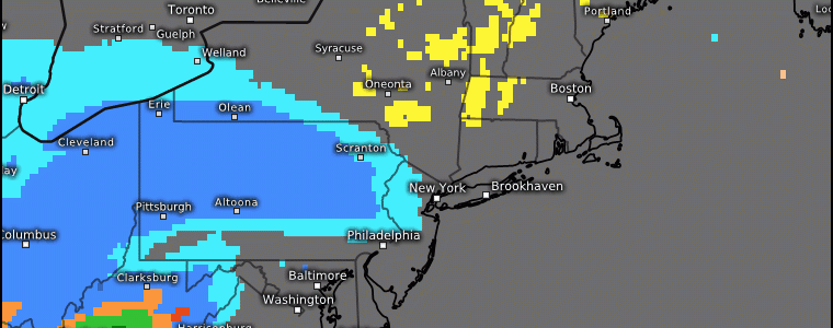
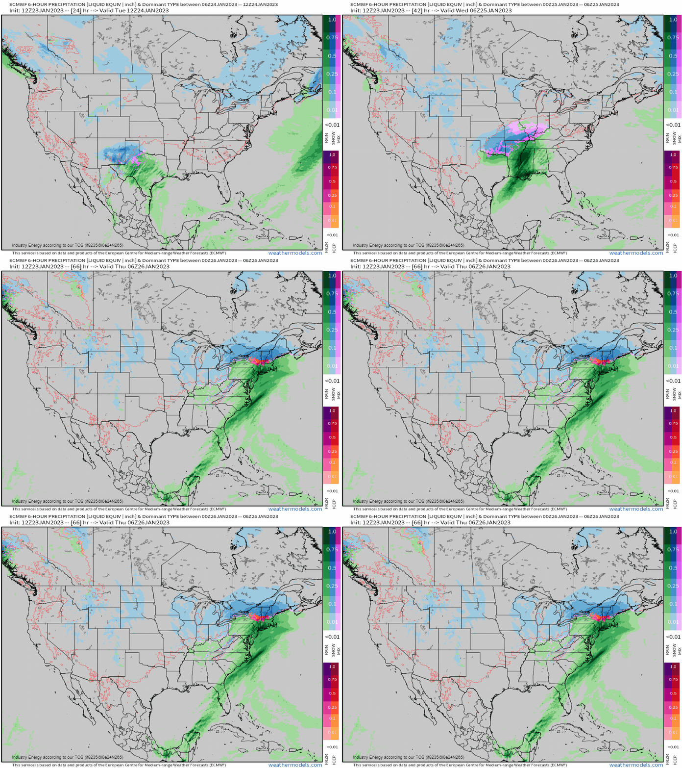
As we watch at the surface, the low will continue to shift northeastward through the MS River valley and into IN, OH, and into western PA. As a result, we see snow continuing along the TX panhandle before snow overspreads into AR, MO, and into IL, IN, OH, and into MI. This same system will even be responsible for providing a front-end “thump” of snow to places in the Mid-Atlantic and Northeast where below average snowfall continues out across the latter areas.
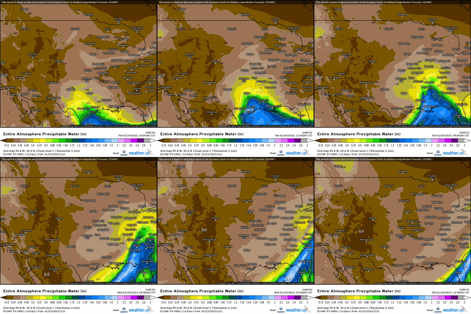
Using PWAT’s to visually “see” the water content in the atmosphere, we can see that this system will be certainly moisture-laden, as it lifts warmer and moist air poleward along and south of the warm front. This of course is one ingredient in today’s severe weather threat, but also provides plenty ascent (i.e. “lift”) for snow to occur further north.
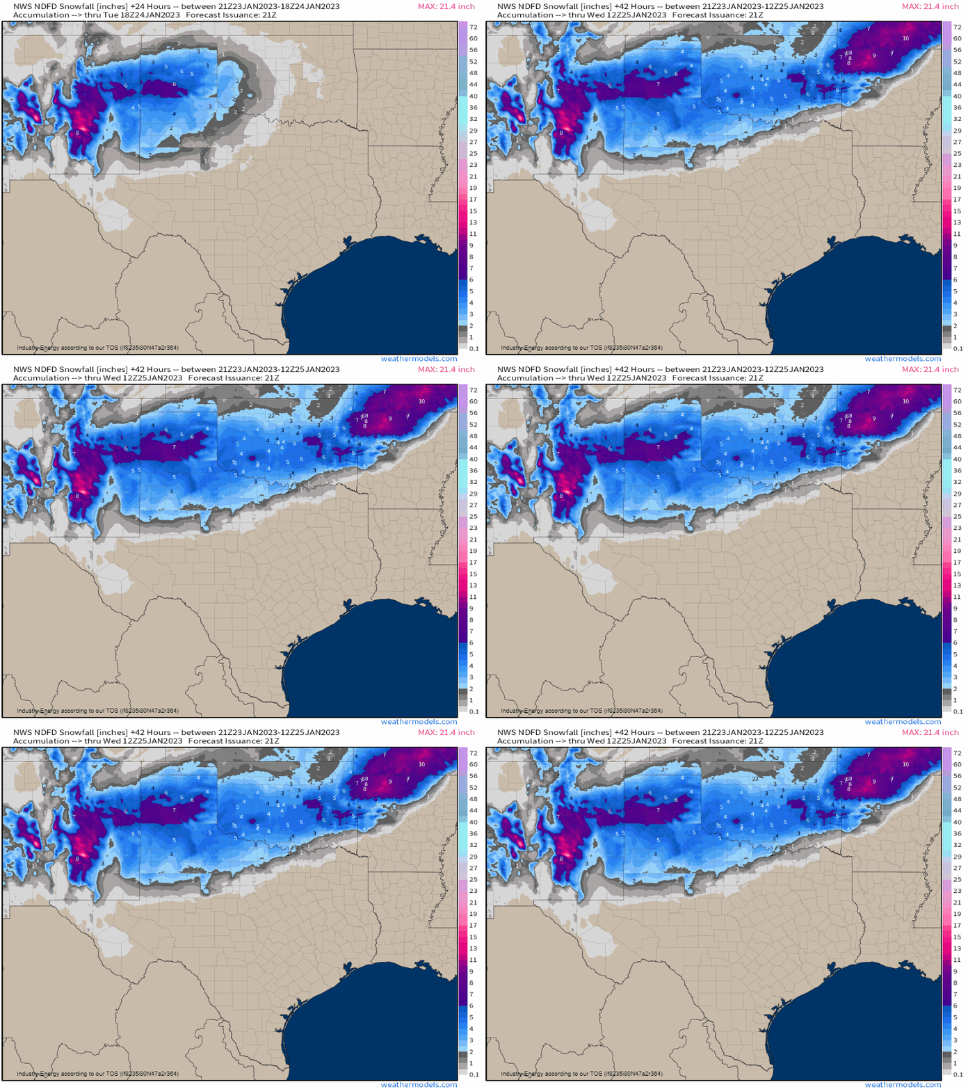
So the rest of today, we’ll see several more inches build across northern TX and into OK, before a swath of 3”+ continues on a N/NE trajectory.
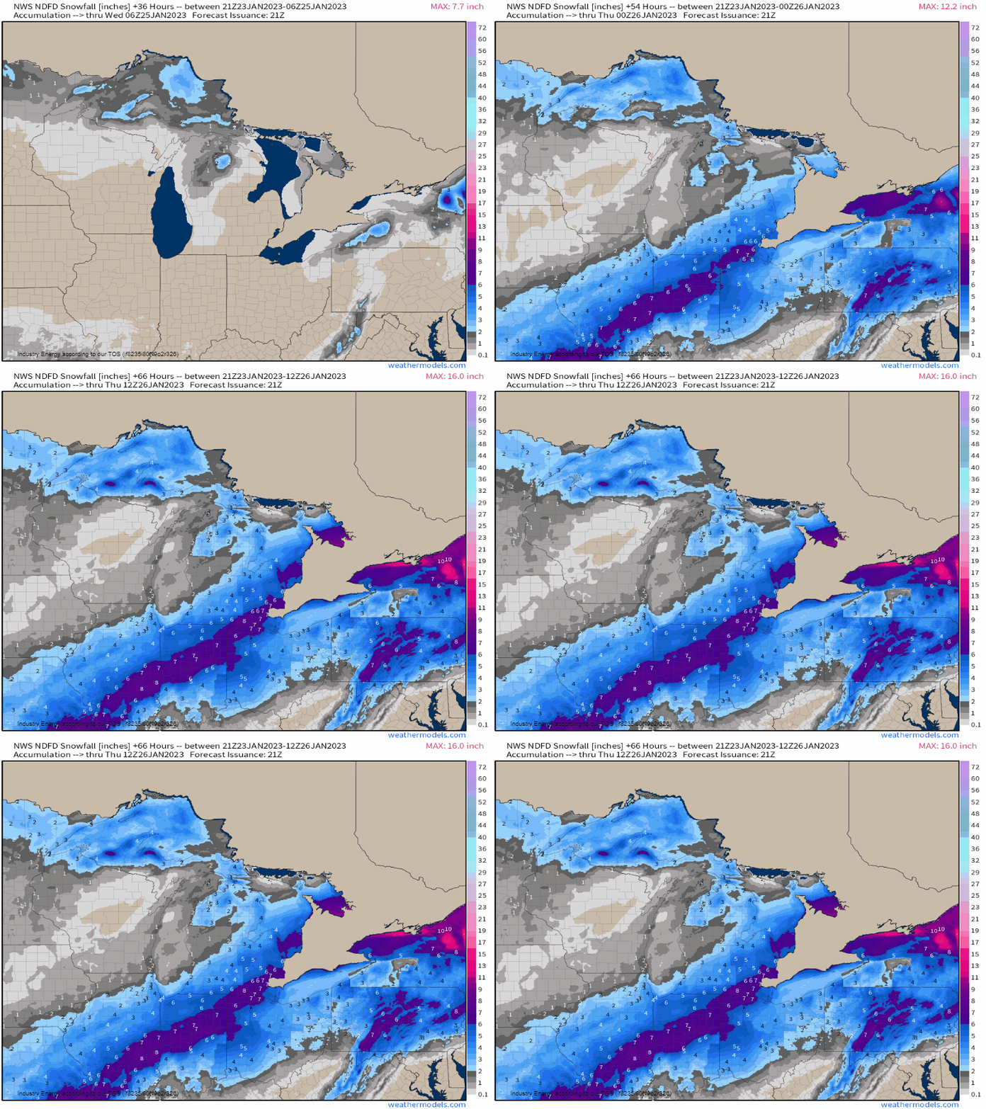
Then, overnight tonight and into tomorrow, we’ll see snow spread across the Midwest/Great Lakes regions with a swath of 3-6”/4-8” with Chicago being on the northern extent, though accumulating snow is on the way for tomorrow. As a favorable track verbatim (i.e. south along IL, IN, & into OH), this is how we can get plowable snowstorms for these areas!
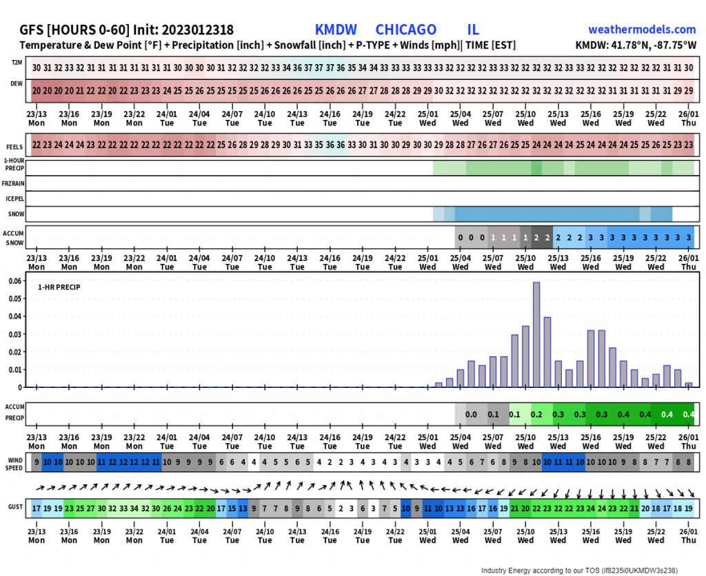
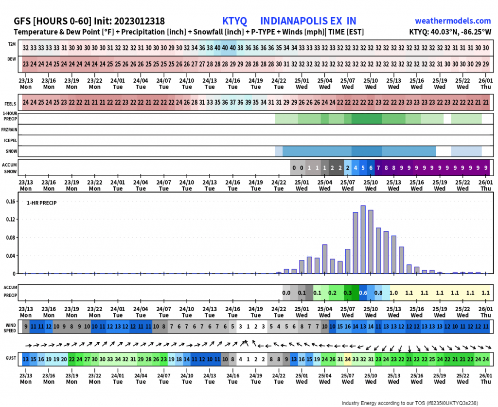
A neat way to also visualize data for a certain city, is through meteograms. What we see are data parameters that include hourly temperature, dewpoint, wind, precip-type, and QPF. If you notice Chicago, IL for example, the QPF in the form of snow suddenly surges overnight Wednesday into Thursday with the peak happening early Thursday morning. Verbatim the GFS, we see a general 1-3” forecasted.
We then also see for major cities like Indianapolis and Dayton where the further east in longitude you go, the higher the snow totals given that these areas will be closer to the more favorable atmospheric processes and dynamics that result in mesoscale banding and heavier snowfall.

Then once we progress further into Wednesday and Thursday, we’ll see this same system bring a wintry threat to those mainly north of the Mason-Dixon. This would be a classic front-end “thump” with marginal temperatures initially allowing for snow to first occur (especially as precipitation picks up in intensity and can diabatically cool the column within the vertical), before a changeover to plain rain. This verbatim occurs with a track that heads into western PA and NY before a “jump” occurs with a secondary low off the New England coast, which favors rain tracking up the entire I-95 corridor. It’ll be a close call for places like Philly and NYC as further north and east has more cold air to work with, albeit marginal still. It remains to be seen if NYC does in fact break the record for the latest recorded measurable snowfall of an 1”. As of now, Jan. 29th, 1973 currently holds that record. If it can’t be done with this event, then it’s likely going to be broken. We shall see!
