An Active Pattern Brings More Snow to the North; The South Warms Up
Any one sick of snow yet? Well, too bad. An active pattern continues this week as a few waves move along a stalled frontal boundary. But before we get to those, let’s take a look at the ridiculously cold temperatures freezing the northern tier.
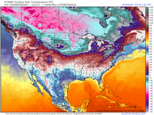
This map is the “Surface Skin Temperature” which is basically the “feels like” temperature. With areas in Minnesota and North Dakota feeling like -30 or lower, I think we all have to agree that it’s just… frigid.
Seriously though, these are dangerous levels of cold. If you live in these areas, stay home and inside if you can. If that’s not possible, limit your exposure as much as possible and bundle up properly while you’re out. That means many layers and covering up exposed skin. Once temperatures dip below zero, frostbite can occur in under 30 mins. Once those temperatures plunge below -10 degrees F, frostbite takes less than 15 minutes to set in. Protect your skin if you need to be out and about.
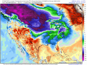
Disregarding the southeastern extent of the cold, which is still in debate amongst the models, this Arctic air looks to stick around for the northern tier for at least the next week. Seems it’s payback for being above average during the first half of the winter.
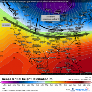
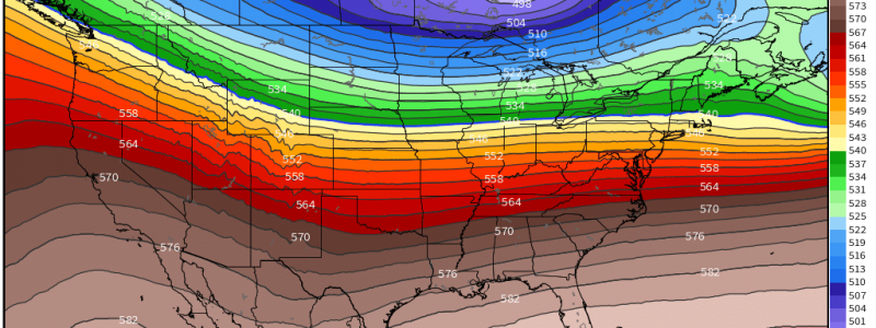
The arctic cold is able to filter into the lower 48 due to the jet stream just sort of laying across the country without much movement north or south. This fairly zonal flow will persist this week as shortwaves and at least one larger disturbance move along it one after the other. Translation: an active pattern with a few shots of snow for those in the colder temperatures.
The first of these shortwaves will move east over the day today bringing snow to the Mid-west and then to the Northeast by Tuesday morning. A quick shot of 1 to 3 inches is expected in the Mid-West while the Northeast will generally see 2 to 4 inches with the exception of the mountains of Northeast PA and SE New York which may see enhanced totals of 6 inches. In light of the heavier mountain snowfall, I feel the need to apologize to my poor aunt in the Poconos who is still digging out from last weekend’s nor’easter which gave them nearly 36 inches. Sorry Aunt Susie! Maybe you’ll be able to leave the mountain by May…
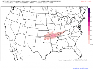
While, as mentioned, it will snow in the northern areas, we will have borderline temperatures in parts of the Southern Plains states. This will be one of two possible icing events this week as these areas straddle the line between arctic air and mild air.
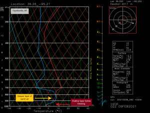
Looking at a forecasted sounding taken from near Fayetteville, AR, it is a classic freezing rain profile. We have a very shallow layer of below freezing air at the surface with a deeper layer of air above freezing on top of it. Precip will fall as rain and then likely freeze on elevated surfaces as it hits the ground. Though the forecasted ice accumulation isn’t particularly heavy, it may be enough for a few scattered power outages or tree limbs down. Either way, use caution in these locations if you are out and about later today.
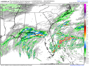
With the jet stream keeping the arctic air confined to the northern portion of the country, the south will actually be able to warm up nicely over the next few days. A southerly flow will allow most of the southeast to warm into the 60s and even 70s for the first part of this week. However, a southerly flow also means that moisture will be brought in from the Gulf making for a soggy-at-times forecast accompanying the warmth.
We aren’t talking about widespread flooding or anything, but the lower south will see the showers and thunderstorms typically associated with warm weather near the coast. No severe weather is expected for the first part of the week, though there is a chance during the second half of the week. That’s something we’ll discuss as we get closer to the event.
Well, southerners: enjoy your warm weather. Northerners: I’m really sorry about the cold. Stay warm and remember to protect your skin if you’re out and about. Y’all have a good day!
