An Active End Of Month Pattern For the Great Lakes & Northeast Regions
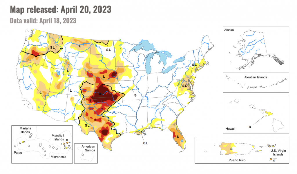
It’s always good to get a sense of what areas this time of year are in need of precipitation given some regions, where winter droughts or lack of precipitation can have implications for the upcoming summer. Thus far, while the obvious areas are shown by the bright reds and oranges across the Plains (seeing solid dosage now in fact), we see a dry anomaly across the general Northeast / Mid-Atlantic. Access to this site is here.
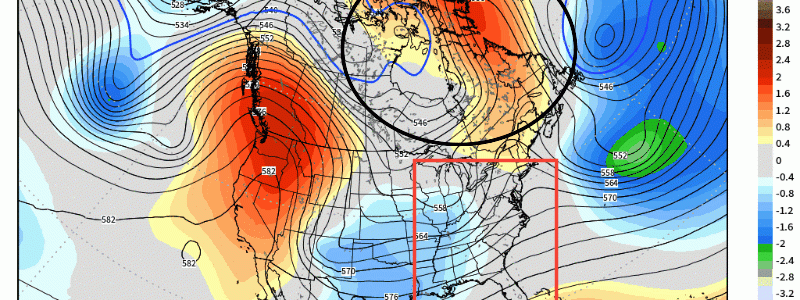
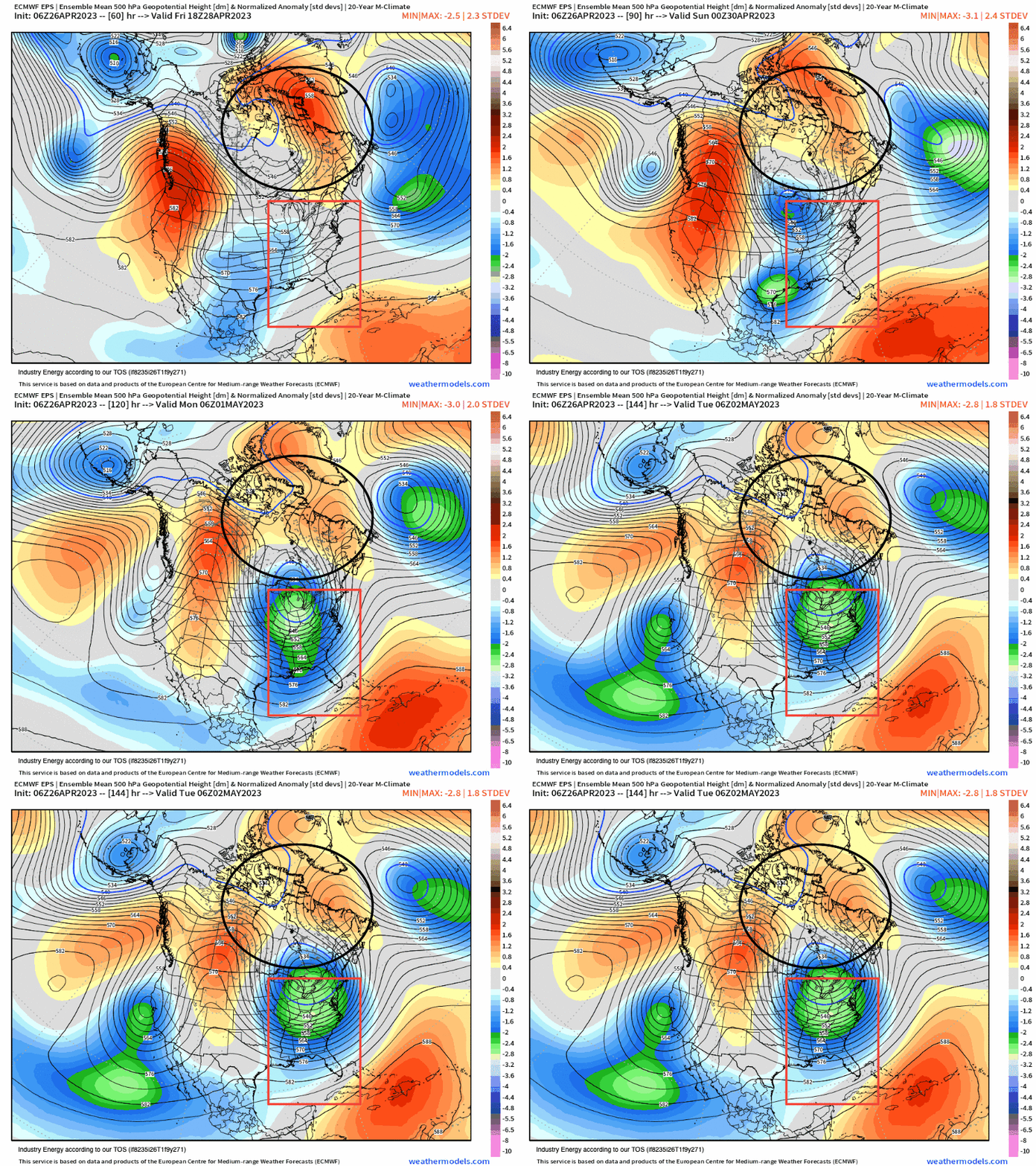
We begin aloft at 500mb (18,000 ft) where we look at the main culprits responsible for an active, amplified pattern as we close out April. To no surprise, we see the high-latitude blocking across Greenland and southeastern Canada (-NAO). Out West, we see another blocking ridge (+PNA) build into western N.A. The result downstream is a developing trough that descends into the Plains and Great Lakes with a southern stream disturbance eject out from the Plains. We then end up seeing an anomalous long wave eastern trough and phase.
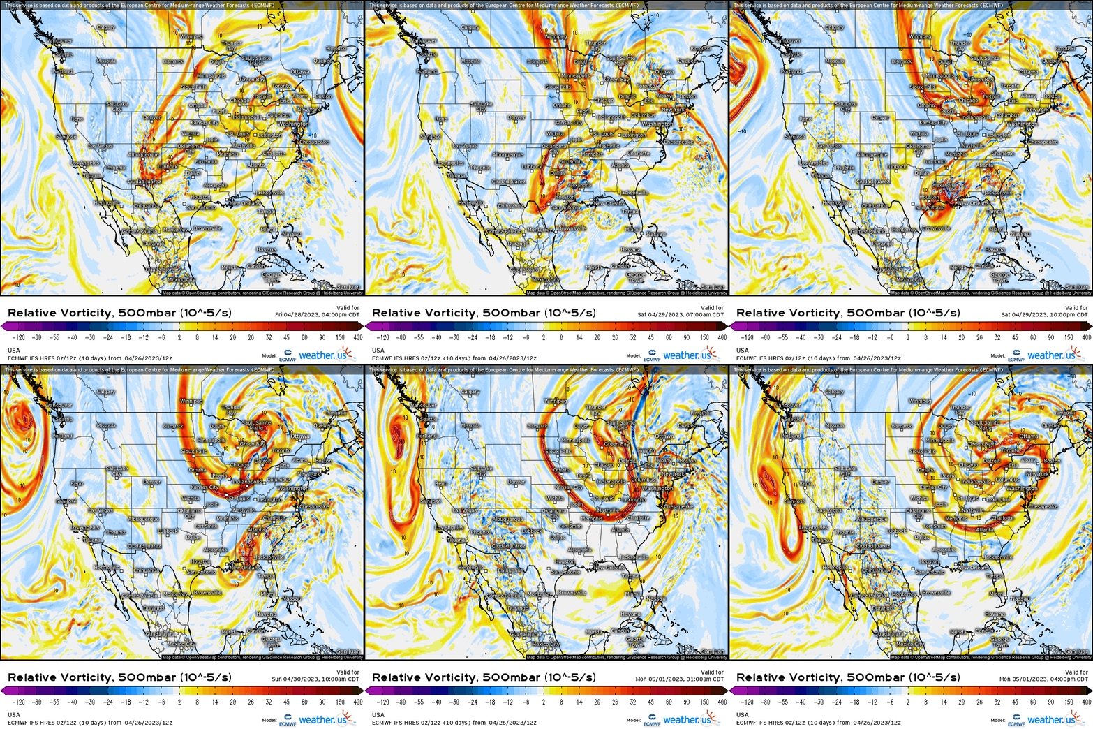
Sticking with 500mb, but showing it through vorticity, we see the elongated upper-level low across the Lakes region in conjunction with the southern disturbance out ahead. This main trough now rotates around, digs, and this now interacts with the southern disturbance that aligns properly to allow for a phase across the East.
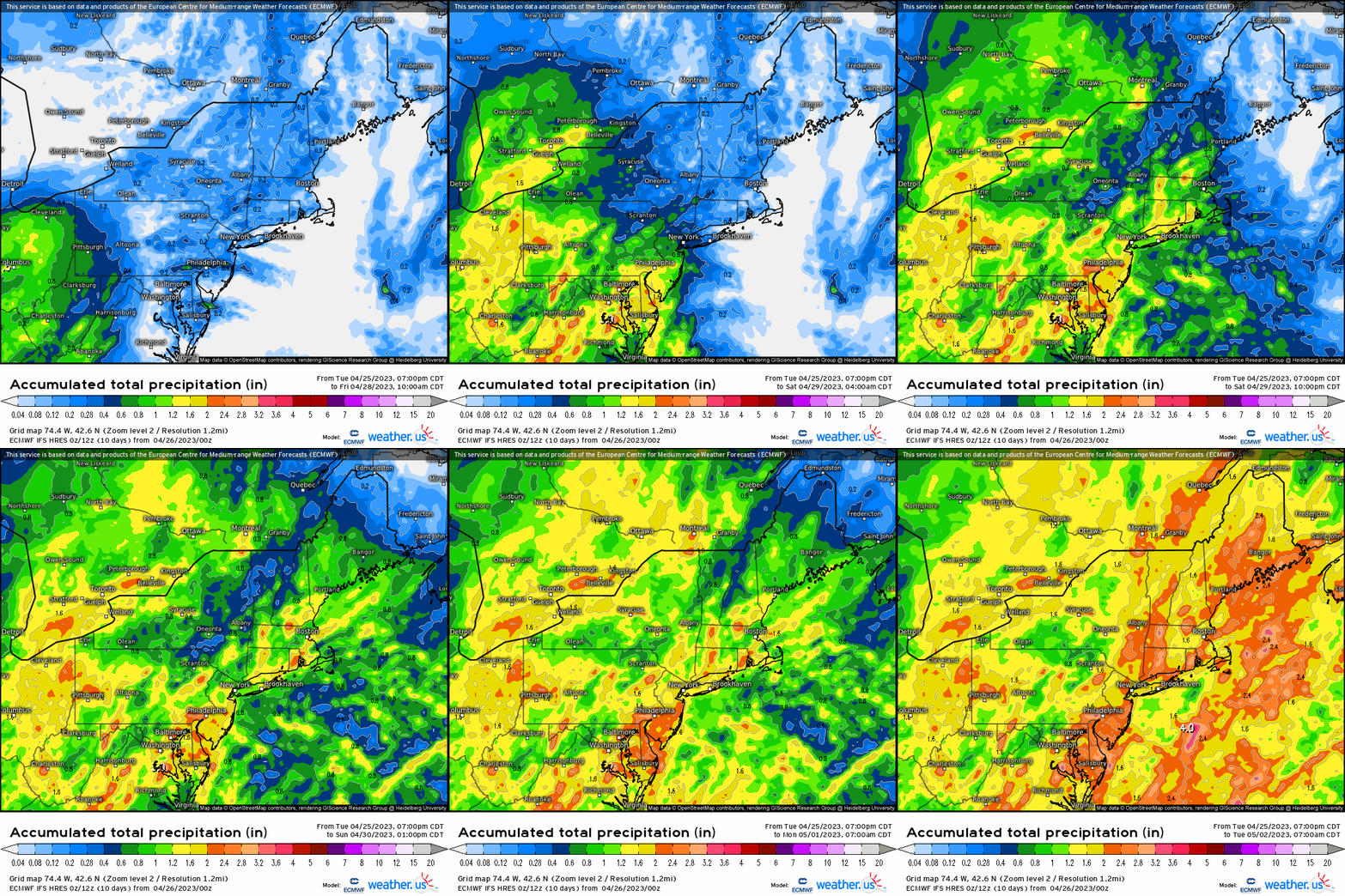
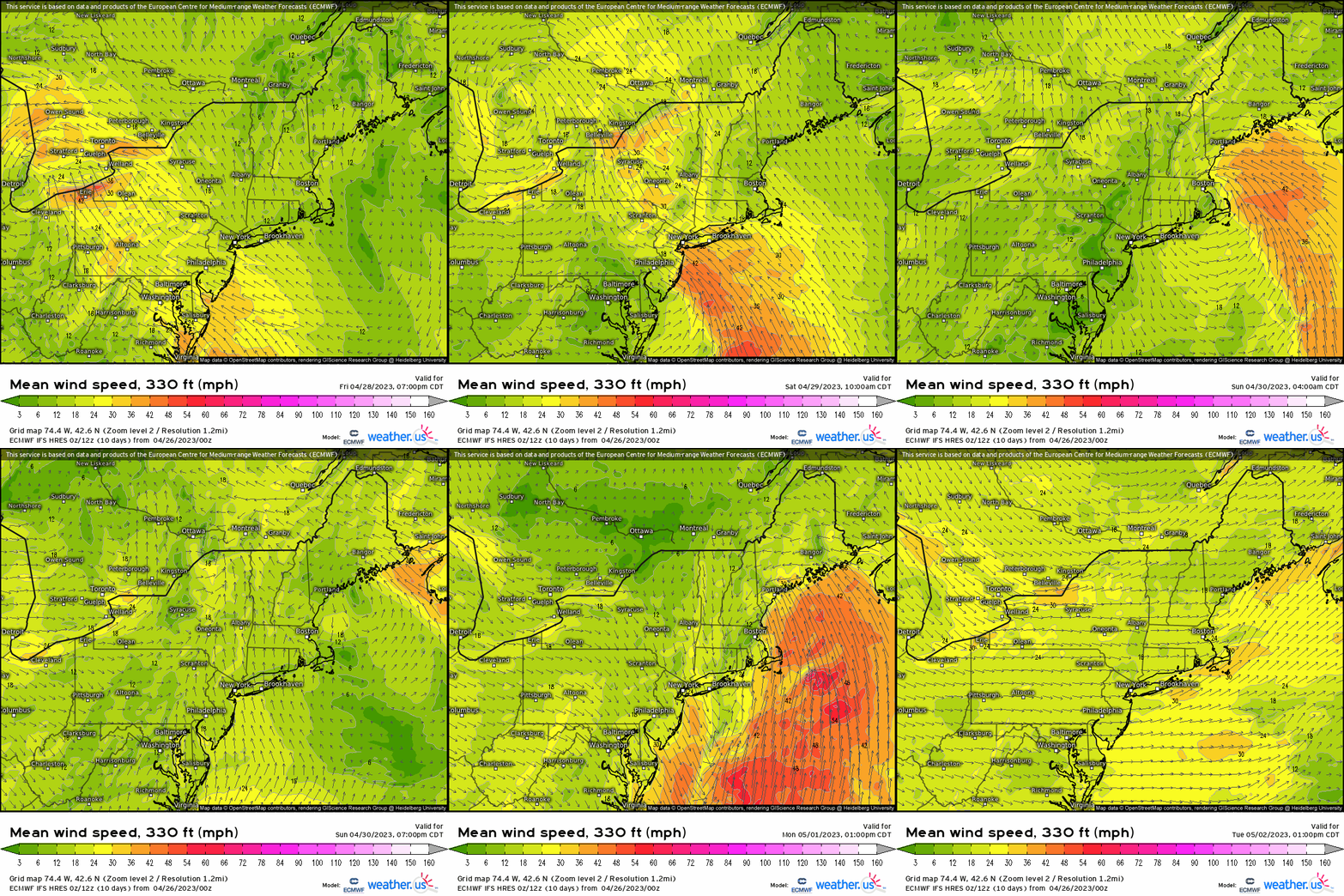
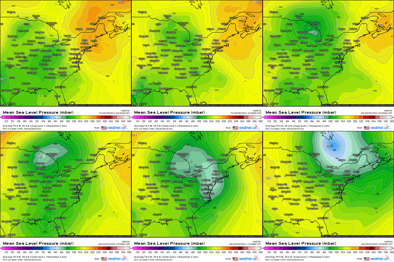
At the surface, this translates to an initial primary low that heads into the Ohio Valley and into the Great Lakes Friday into Saturday. Then, as the front swings through the East Coast, another low (with the phase as we see above) develops along that front in the Southeast by Saturday into Sunday. This new low pressure will then trek northward up the Eastern Seaboard bringing heavy rainfall and winds Sunday into Monday. Prior to the coastal Monday, several waves of rain will push through this weekend making for an unsettled, dreary weekend though bringing beneficial rainfall to these regions!
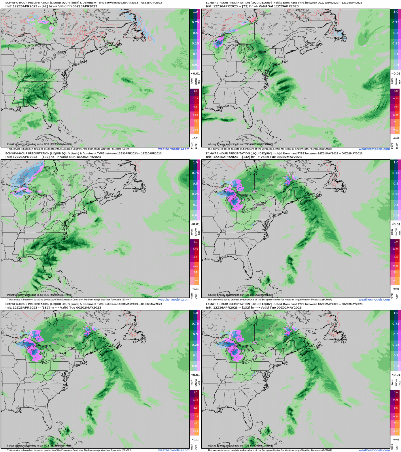
In terms of rainfall, we’re looking at a general 1-3” from the Ohio Valley to the Northeast (could be locally more), with some stronger wind gusts especially once the coastal surges up the Eastern Seaboard bringing an easterly fetch that could allow for minor flooding in prone areas along the coast and coastal flooding.
April showers certainly will be bolstering May flowers for this region with beneficial rainfall!
