Amidst Ridging Return, The Cutoffs Take Control!
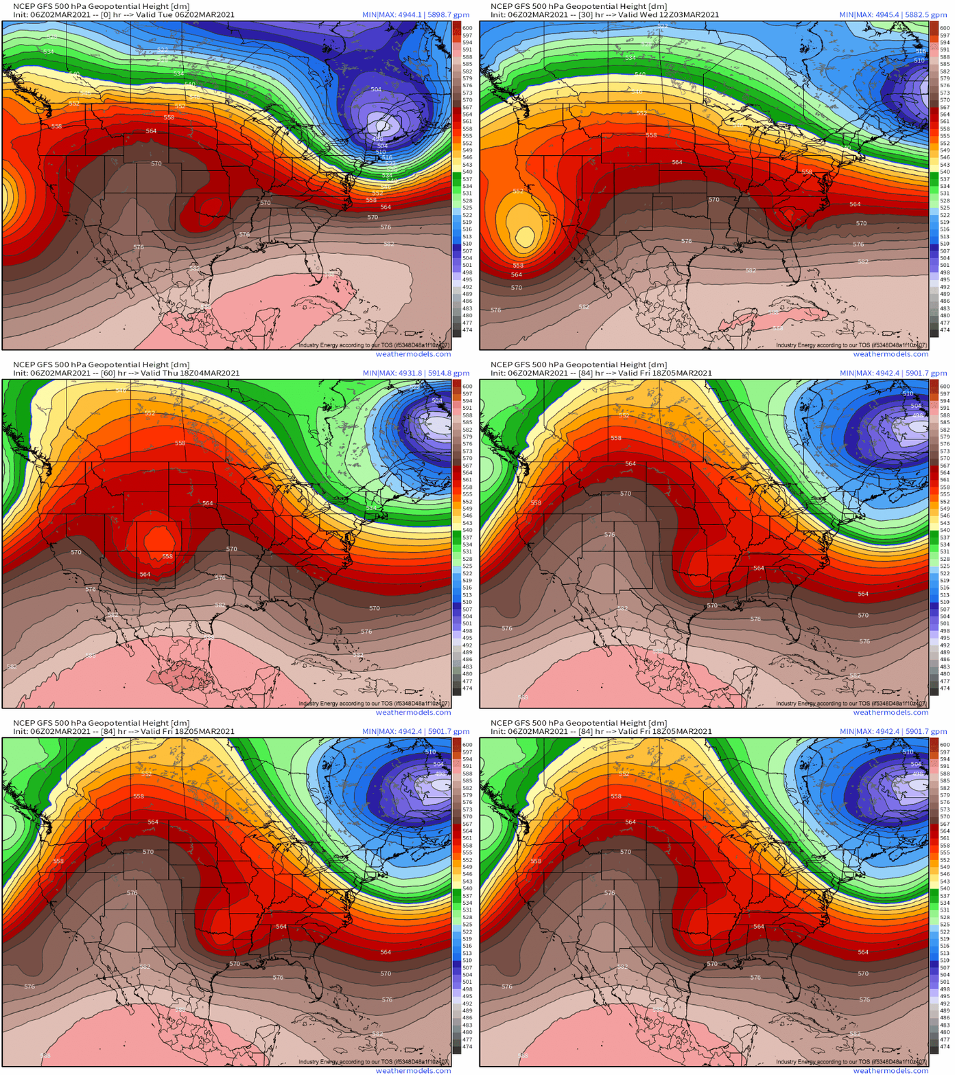
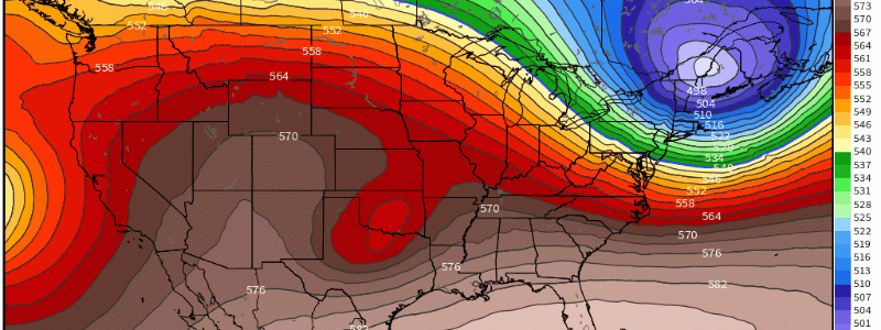
As a fairly jovial title may suggest, weather for the next few days is set to be more interesting than serious, with a string of cutoff lows amidst increasingly amplified ridging looking to bring a diverse set of low-end impacts to parts of the US.
I’m watching three of these cutoff lows evolve through the work week amidst a pattern favorable for their development, with a strong “split” jet regime amidst powerhouse ridging that prevents polar air and associated runaway cyclone development from occurring.
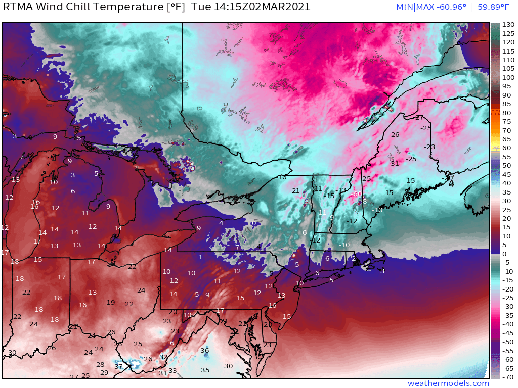
The first of these closed lows is actually a compact blob of frigid arctic air known as a tropospheric polar vortex, currently pivoting quickly through the northeast. A split of the consolidated mass of cold known as the polar vortex allowed this little visitor to hop south of the border, where it’s responsible for a fairly anomalously cold morning.
Impressive divergence immediately to the closed low’s east is allowing an impressive surface cyclone to strengthen in Southeast Canada, tightening up pressure gradients through New England and adding brisk to damaging winds into the cold air equation. Windchills well into the negatives are the predictable result, with frostbite and power outages threats to be aware of today.
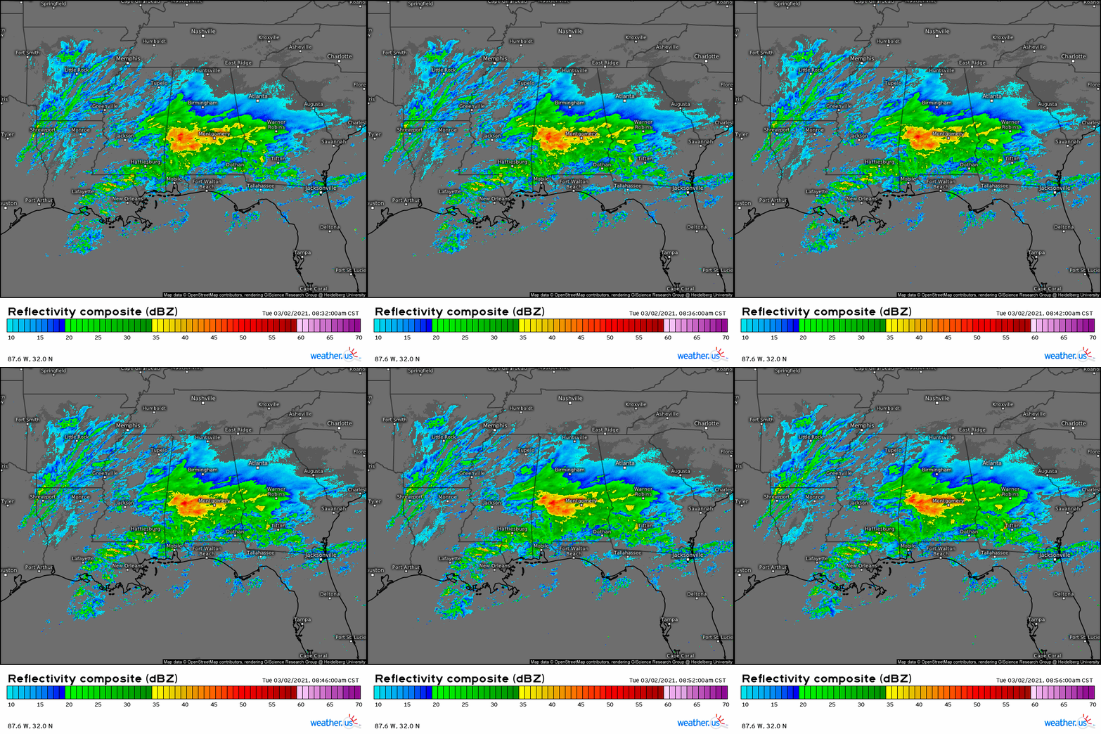
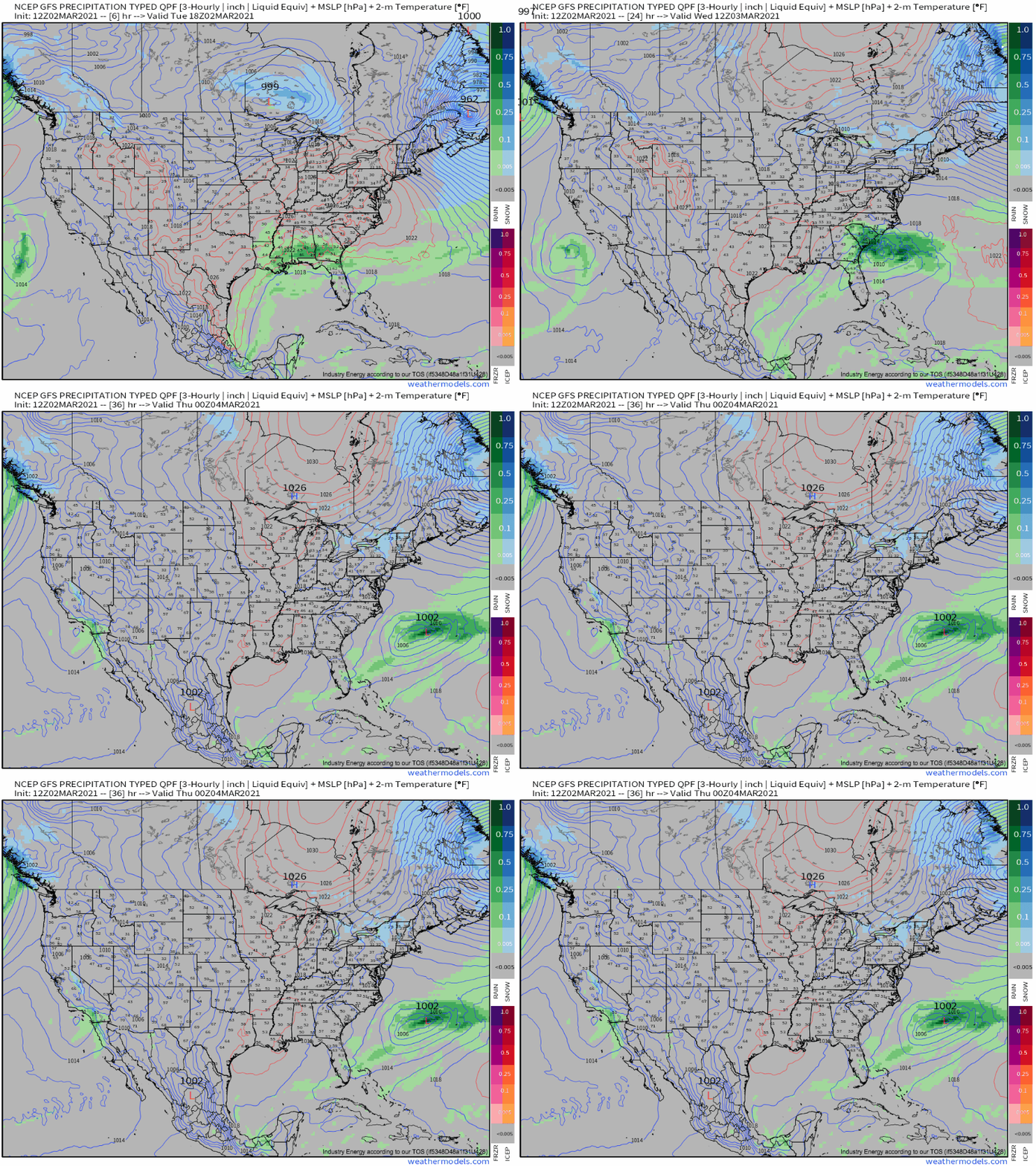
The next system of some national concern is a broad, fairly diffusely defined closed low over the south-central US this morning. As it evolves through the southeast over the next 24 hours, some degree of encouragement for ascent will allow modest pressure falls associated with a slowly consolidating surface low currently over the northern Gulf.
Currently, heavy rain well to the surface low’s north is associated with a displaced low level cyclone interacting with Gulf moisture streaming north. This will continue, but shouldn’t pose much of a flooding threat given the storm’s quick motion, rather diffuse forcing mechanism, and limited instability.
As the closed low interacts with broader troughing while tracking east, it’ll lose amplitude quickly, but not before associated divergence aloft interacts with the temperature gradients of the western Atlantic. The result will be a steady intensification of the surface low as it moves offshore tonight, with chilly stratiform rain and gusty wind impacting the Carolinas.
Just as this fairly tame weather system clears the southeast coast, a stronger closed low will pinwheel ashore from the Pacific. It’ll deliver some showery precipitation in a swath from SoCal east into the four corners region, as an attendant surface low begins to consolidate to the lee of the Rockies.
By late Thursday, an impressive midlevel jet will be ejecting into the Southern Plains, with an attendant occluding surface low beneath a pocket of anomalously cold air aloft. Marginal moisture return will work with an early March sun angle and lapse rates enhanced by frigid midlevels to allow conditional instability to squeak into the positive direction, where it could collaborate with favorable exit-region kinematics to produce some “cold core” tornadoes Thursday night. More on that potential later! For now, enjoy the calm!
