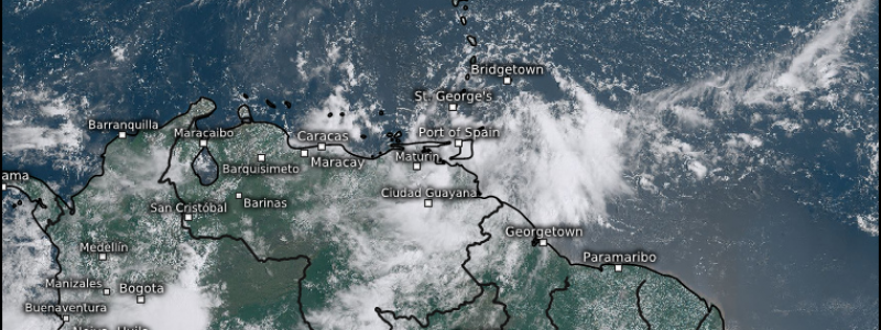
All Eyes on Invest 98L
Unless you have been living off the grid for the last day or so, you’ve likely seen much wailing and gnashing of teeth on social media over an area of interest just east of the Windward Islands currently called Invest 98L.
It’s true: 98L has the most potential thus far this season to pose an actual threat to any part of the US Coast. However, that’s all it has right now – potential. There’s a lot we still don’t know about the future of 98L and, most importantly, it hasn’t even formed yet! Until that center forms, there will be a whole bunch of jumping around in the models.
But, since everyone is talking about it anyway, let’s take a look and what we do know and what is still up in the air.
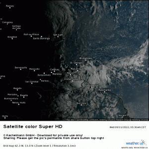
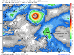
98L is consolidating nicely and firing convection in a fairly concentrated area. Though it is currently being sheared from the the NNW by the outflow from Hurricane Fiona, it’s still not the worst-looking invest we’ve seen this year.
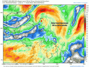
Fiona’s shear will work to keep 98L weak and somewhat disorganized for now. Being a weaker disturbance and not rooted very deeply in the atmosphere, it will “feel” the lower-level flow for the time being. This means the westerly trade winds have control and will continue steering it into the Caribbean. Once there, however, things will change.
As mentioned, moderate to heavy shear is and will continue impacting 98L in the short term. Once the disturbance is able to escape the shear and enters the Central Caribbean, it is faced with an environment that contains very little shear.
Now, we all know that shear isn’t the only variable we need to be favorable for intensification, so let’s look at some other factors.
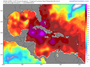
The water in the Caribbean is warm. That’s pretty much a given. These waters have remained generally untapped so far this season, which is what makes them an excellent place for development.
The map above is Tropical Cyclone Heat Potential. This measures how much heat is stored in the upper layers of the ocean – heat which TCs need in order to strengthen. As you can see, the northern half of the Caribbean is just bursting with TC fuel.
In short: as far as the waters of the Caribbean go, they offer no roadblocks to development.
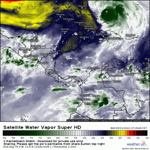
Dry air has been the bane of TC development so far this season. It doesn’t, however, seem to currently be a hindrance in the Caribbean. While there is a little bit of dry air in the Central Caribbean with much more to the north in the Gulf of Mexico, the environment, in the short term, is mostly moist ahead of 98L.
Adding together all the factors above and with the caveat that 98L will need to clear Fiona’s shear first AND that it’s forward speed doesn’t throw a wrench in things, development seems extremely likely. That would leave us with a TC in the next 3 to 5 days. This is where the forecast becomes murky.
We’ve already discussed that conditions should allow for intensification, so a quick escalation to hurricane status could be possible while it festers in the Caribbean. But where does it go from there?
That’s the million dollar question, isn’t it? And honestly, it is a question that cannot be answered right now.
The most important factor is: we do not have a well-defined center. Without that, models have nothing to lock on to and potential tracks will continue to fluctuate run to run based on where that particular model thinks the center will be.
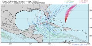
Ensembles are our friend at this point in time. We can use these to monitor the trends.
- Are the track clusters shifting around a lot? Are they widely spread with no clustering? This indicates very low confidence in a solution.
- On the other hand, are they clustering? Are the clusters remaining consistent with location from run to run? This could indicate a higher confidence solution, though it is not yet a lock.
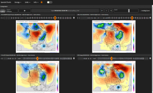
What we can do is look at the synoptic pattern, though we’ll need to keep in mind that any landfall is likely 8 to 10 days out and pattern confidence may not be extremely high.
Ignoring the position of the TC as that will change from model to model based on the pattern, we see a few features in play here.
- A ridge over the Western US.
- How far east does this ridge build? The further east it builds, the more likely a TC is to be pushed further east.
- Conversely, if it retreats west, it opens the door slightly for a more western solution.
- A trough over the Eastern US.
- How far south does this trough dig? A further south dig could bring interaction with the TC or even phasing with the TC into play. Also, it will affect the subtropic Atlantic ridge.
- Staying further north may allow the Atlantic ridge to remain further west, point to a more Central Gulf solution.
- The Subtropic Ridge
- Does the ridge retreat, strengthen, or remain in place?
- Retreating will open a door to the NE for the TC to escape through. If this occurs, timing will be crucial as it will either allow the TC to escape into the Atlantic and avoid a contiguous US landfall, or it could bring it straight into Florida.
- If the ridge strengthens or remains in place, a more central/westerly solution may be favored.
As you can see, there is still A LOT up in the air regarding the synoptic pattern, and it all makes a very big impact on the future track of our would-be TC.
Summary: The most important point is that we do not have a TC yet, and therefore no center to track. Models will continue to jump around until (if) we do. It is useless trying to figure out the final destination of a storm that hasn’t formed yet. Monitor the trends for now and, if you’re a coastal resident, make sure you have a hurricane plan and are ready to use it if need be.
In the short term, the Windward Islands, NW Venezuela, and NE Colombia are likely to receive heavy rainfall and gusty winds whether or not 98L develops in the next few days and should prepare for impacts.
We’ll be here tracking the progress and development of this potential TC right along with you, so check back often for updates!


Came here looking for a clear explanation of the forecast for 98L and this did not disappoint! Thank you.