After Sensible Lull, Hazardous Springtime Pattern Begins In Earnest
I rarely feel such little reservation saying this: Good morning!
Broad ridging amidst Pacific flow, and widespread southerly wind east of an intensifying Dakotas cyclone, have allowed very anomalously warm weather to build into much of the central and eastern US in the few hours since sunrise. Temperatures already approach 50ºF in places not typically accustomed to early march warmth, from northern Minnesota to central Michigan, Boston to the Finger Lakes.
47.5% of the US is currently above 50ºF! Truly, what a mid-morning this is!
This first taste of meaningful spring weather will surely bring joy to many, myself enthusiastically included. But there is, unfortunately, a dangerous pattern shift that often occurs amidst springtime jet structures, and one seems likely to begin all at once tomorrow. It will start with somewhat low end severe thunderstorm and heavy rain threats, steadily evolving into an increasingly significant risk for flash flooding and severe storms by weekend at the hands of a rare combination of optimal jet placement and unusual persistence.
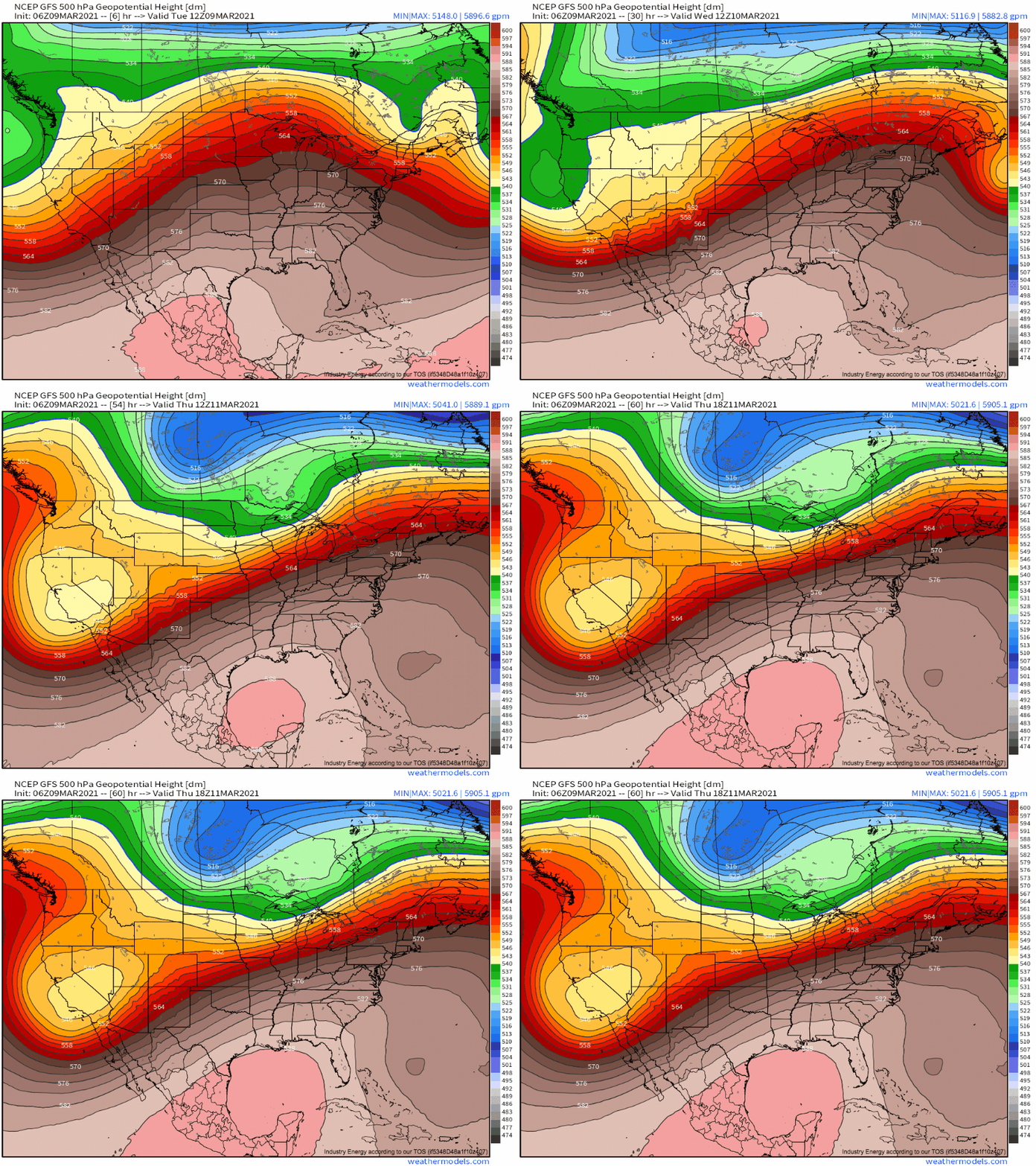
The atmospheric arrangement responsible for it all will begin to take shape today, as a longwave moves ashore the West Coast. The broad trough will be largely split into two sub-regimes: a compact, north-end shortwave and a wide, somewhat diffuse south-end closed low.
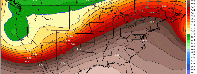
As the shortwave accelerates east near the Canadian border, the closed low will slow down dramatically on approach to the Rocky Mountains. The result will be a midlevel jet stretched to a dramatic positive tilt over the next couple of days.
This jet pattern is spring-loaded to pounce on the central US with a variety of significant weather impacts.
The first will occur tomorrow, as subtle height falls ahead of the quick moving shortwave overspread areas as far south as Kansas and Oklahoma.
A responsive low-level cyclone over Kansas will draw a partially moistened Gulf-origin airmass north, where it will be overspread by a belt of moderate westerlies associated with the expansive longwave jet. While dewpoints generally at or below 55ºF will limit convective threat to a degree by forcing high LCLs and preventing widespread convective initiation, some degree of a severe threat is possible. This is at the hands of an impressive EML, with lapse rates in the warm sector between 500mb and 700mb expected to exceed 9ºC/km in places. The result will be a thermodynamic profile incredibly favorable for elevated convection conditional on sufficient lift, but unfavorable for much surface based activity, or any activity if lift is not met. Great kinematics could result in some impressive mesocyclones capable of dropping large to significant hail given this thermodynamic profile, although damaging wind and tornado threats should be low-end due to near-surface inhibition of convective energy transfer.
While the region of interest may be a little far east in the latest HRRR, it shows the general theme of convective initiation almost entirely along lifting, which will be ahead of a surface low and along a dryline tomorrow. 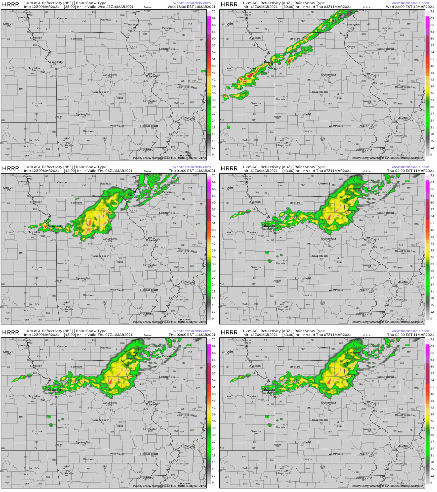
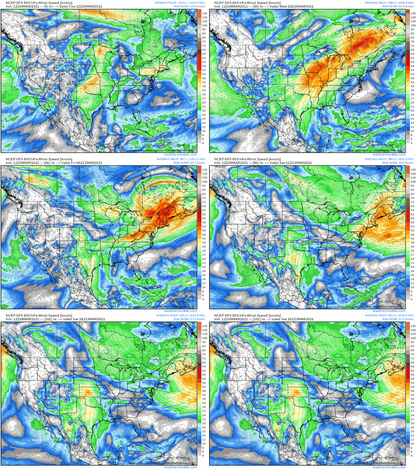
Even after the shortwave moves north of optimal moisture return with incentive for ascent tomorrow night, a severe threat will continue to build, as the unusual jet orientation maintains southerly flow by maintaining low level cyclogenesis well north of the central plains, and preventing wind shifts from clearing moisture.
This long-fused southerly flow will create a gunpowder keg of sorts, as persistent moistening creates an expansive warm sector primed for conditional instability. A significant ramp-up in convective activity will occur after a lull Thursday, then, when the closed low moves into the south-central US from Friday until Sunday. More on this later in the week.
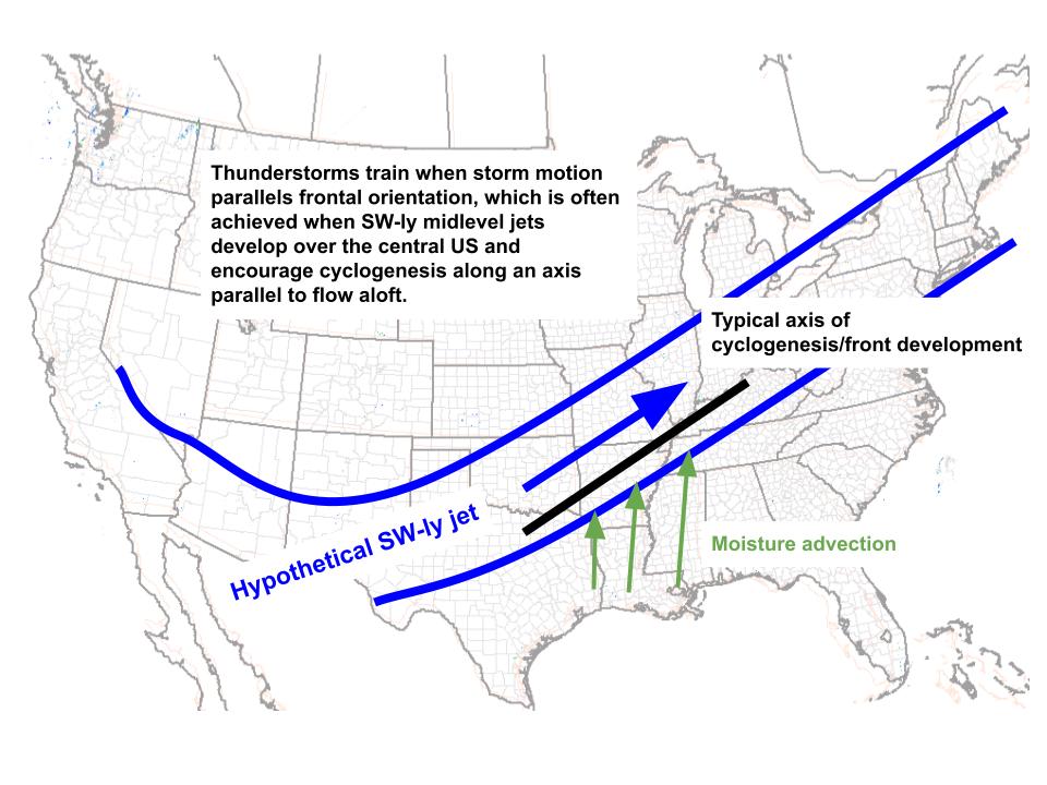
To the east of this severe thunderstorm threat, meanwhile, persistent Gulf advection amidst a frontal boundary maintained nearly parallel to flow aloft will encourage a potentially significant flash flood threat into the weekend.
Flooding requires a laundry list of parameters. But a southwesterly midlevel jet over the central US can satisfy many of them, promoting persistent mass removal that allows southerly moisture advection and generally favoring a frontal orientation that allows convective training.
Flooding is all about persistence. The favorability for training with this pattern provides it in the short term, but a few hours of thunderstorms hitting the same place won’t usually lead to major hydrological issues. For major flooding, the jet itself must remain static. With the exception of storms such as Hurricane Harvey, it’s really hard to find atmospheric forcing that stays still for several days. Troughs like to move! But really, the atmosphere doesn’t have to sit in one place- it just has to seem as if it is from the ground.
Sometimes, this medium-range relative persistence can happen when deep troughing digs south over the Rockies, buckling the jet stream. Immediately to the east, the jet acts almost like a pivoting nor’easter snow band: a dynamic system behaving as if it is static. This happened, for example, at the end of April in 2017, causing significant flooding downstream in Missouri.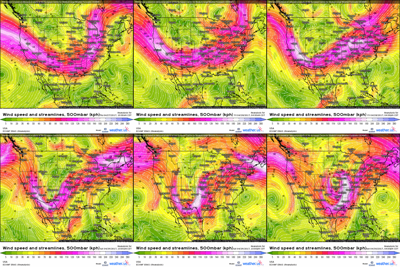
The tendency for this synoptic pattern to occur alongside typical cyclone/trough evolution allows a swath of the central US, from Arkansas and Missouri through Kentucky and Tennessee, to see extreme flash flooding every few years. Guidance suggests it will probably happen to a degree this week.
The jet pattern is unmistakable. Notice the persistence of the flow regime centered over S. Missouri, despite the typical progression of the jet at large, as high-amplitude troughing digs upstream. 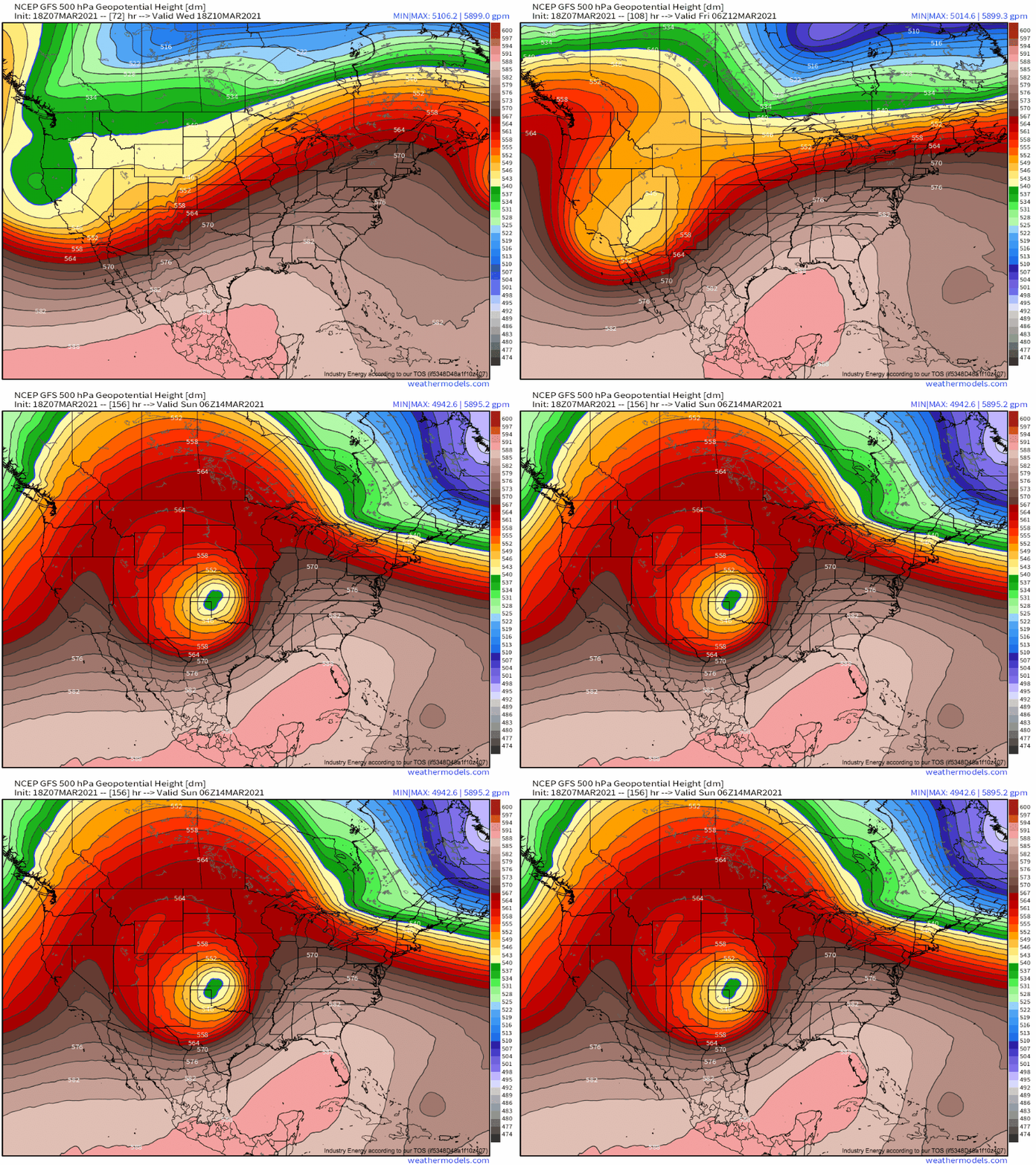
This persistent synoptic support for convective training would occur amidst open Gulf advection via a speedy low level jet, modest convective support, and a Pacific moisture infusion aloft. Expect more on this threat, which may end up being quite significant, through the rest of the week.
