After Less Than a Week, Another Storm Takes Aim at Northeast
For the second time in a week, a nor’easter threatens to bring significant snowfall to some in parts of the northeastern US. The storm is expected to bring impacts largely to a different corridor of the region, however, dropping heavy snow mostly on places that saw rain and dry slotting on Monday. Additionally, the quick hitting storm won’t come close to the maximum accumulations seen earlier in the week. However, high snowfall rates for a few hours for many will prove majorly disruptive to travel for some.
Meghan talked about the setup’s background in her blog yesterday; I’ll summarize the stage setting and then get into specifics. Check out her blog for more on how the system got to where it is, and to some of the forecasting challenges we’ve been dealing with.
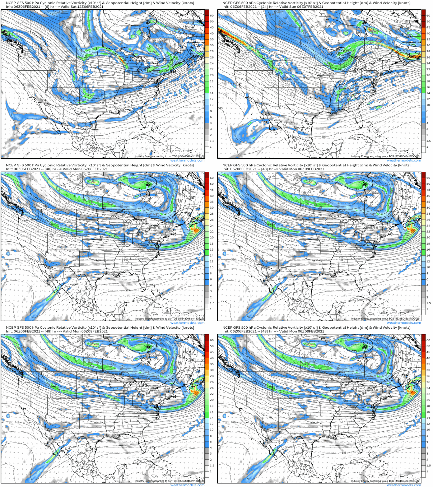
Much of the CONUS is currently under the influence of a major midlevel low over Canada, which is keeping the height field and corresponding flow quite speedy and zonal, although with a notable split. Two rather subtle but potent shortwaves within this regime will race east around the expansive, consolidating Canadian low, one on the northern stream of the split and one on the southern stream.
The two won’t phase until they’ve moved well into the northeastern Atlantic, preventing the type of airmass clash that can allow a system to rapidly deepen. But the southern stream trough alone will still have access to sufficient moisture, and provide enough dynamic support, for a sizable slug of snow. The northern stream trough, located to the northwest of the southern stream trough, will also play a supporting role, overspreading the interior northeast with a secondary degree of divergence that will likely encourage enhanced mass removal, expanding the geographical spread of light to moderate snow and increasing the intensity of the strongest band of midlevel warm air advection that will serve to create heavy snow. Two troughs don’t have to be phased to influence weather together!
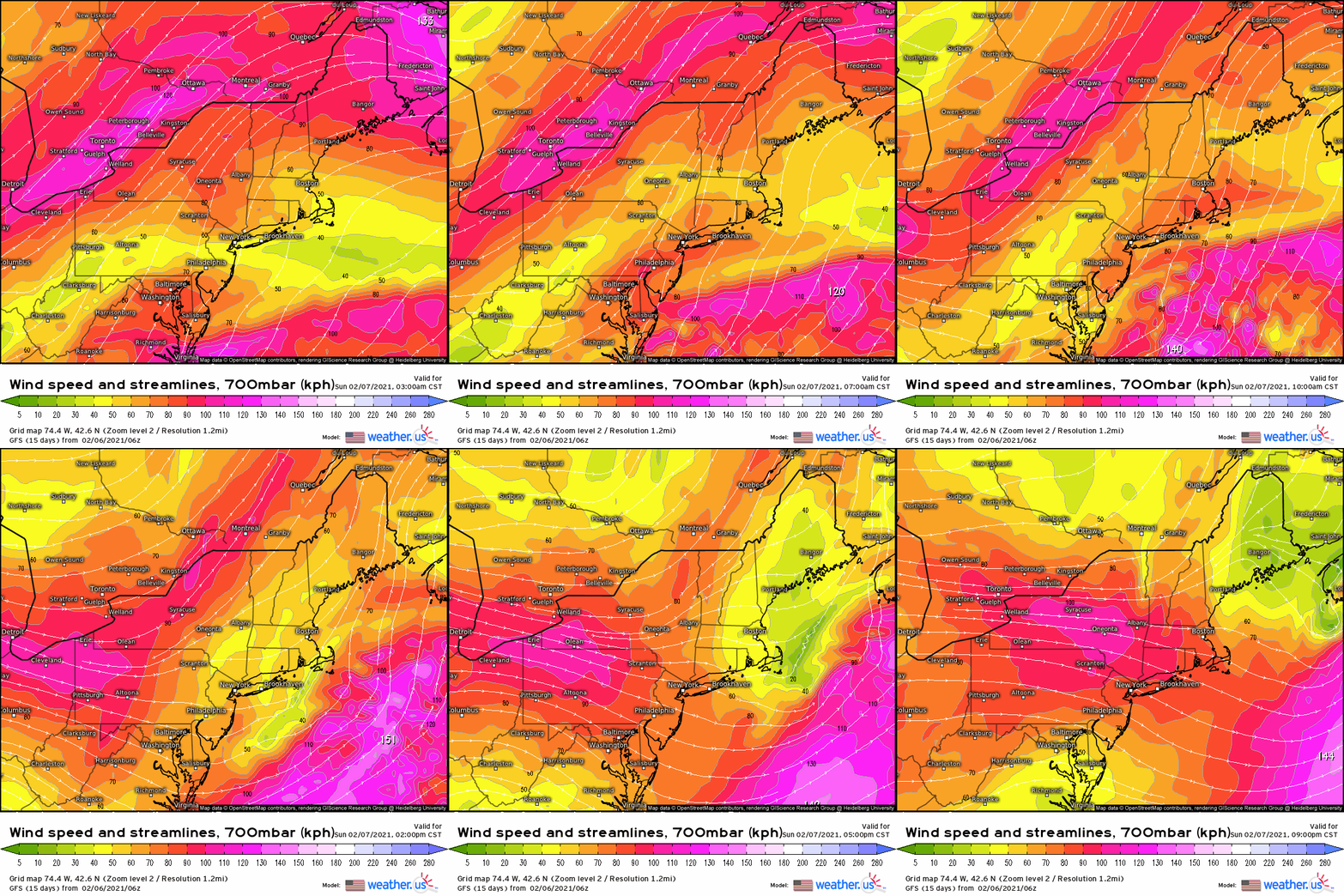
How, exactly, will the southern stream trough lead to “a sizable slug of snow”? The answers lie a few thousand feet above the surface, where mass removal at the hands of the trough will cause the height field to drop, a depression that air from the south will race to fill. This will create a powerful 700mb low level jet, with a sharp northern gradient that corresponds with a rough line drawn stretching east of the perturbation at that level. That was a lot of words that may be hard to grasp; it can help to think about it like a middle-atmosphere take on a surface warm front, where winds from the north hit a boundary all of a sudden and make a hard left turn. The only difference is that, instead of a pronounced directional shift, there’s a pronounced speed shift, as winds dramatically slow along a boundary.
This dramatic slowing will force air to pile up suddenly at the boundary, as parcels move towards it faster than they can move away. The result will be convergence, forcing air to rise and, if moisture is sufficient, to condense.
This boundary will be quite intense, and will progress quickly north-northeast across parts of the northeastern US from late tonight into late tomorrow, bringing focused and powerful lift.
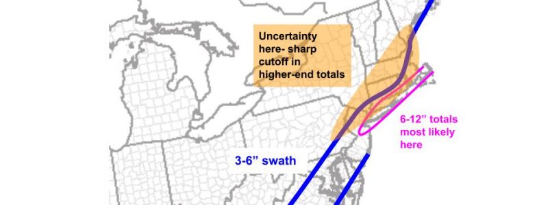
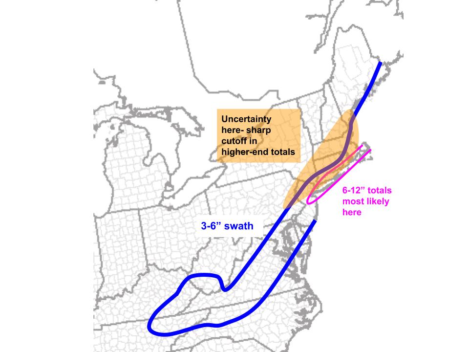
Early tomorrow, as this boundary crosses the southern and central mid-Atlantic, high rates of wet, heavy snow will be likely for many. While it’ll wrap up rather quickly, a solid 4-6″ will fall for many. See the graphic below for the swath I expect this snow to take. It’ll stick to trees like glue and be a pain to shovel.
The high easterly component to trough motion with the approach of the northern stream trough will push a lot of the most intense midlevel speed convergence offshore mid-morning, where it will impact Long Island and coastal Massachusetts with a swath of heavy snow for a few hours. The shape of the boundary will parallel the motion of the cyclone, which suggests Long Island and parts of Rhode Island and SE MA could see maximum totals approaching 12″ with this storm, as the band trains over one area for several hours.
However, this parallel motion also dramatically increases uncertainty. This is because the training boundary won’t allow moderate snow more than a few dozen miles north. The cutoff should be quite significant, if you will, between higher end totals and very little snow. Because the swath of heaviest snow and the cutoff, in turn, will rely so heavily on where the band actually tracks, normal ~50 mile wobbles in shortwave position can well shift the heaviest axis of snow inland into CT or offshore of Long Island.


