A Wounded Fred Limps Onward, Brings US Impacts
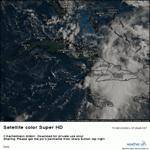
Tropical Depression Fred is in rough shape this morning.
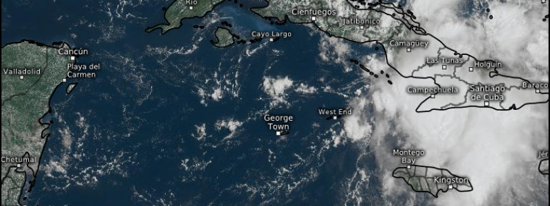
It seems that Fred had a little too much fun passing through the Caribbean and is now simply a naked swirl that left much of it’s clothes (thunderstorms) behind.
Land interaction, shear, and dry air has made Fred not much more than an open wave as Hurricane Hunters reported that they had great difficulty identifying a solid closed low in their morning missions. Fred will continue to slide along the northern coast of Cuba today, making any further intensification/reorganization, at least through the rest of the day, rather difficult.
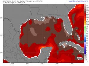
Eventually, however, Fred will emerge into the Gulf where warm water awaits it.
Warm water, as we know, is the fuel that drives tropical cyclones. While these waters are indeed expected to help Fred intensify, the current state of the storm and a continued battle against westerly shear from a nearby upper level trough will likely seriously impede any significant intensification. In fact, the latest NHC forecast now keeps Fred as a rather weak TS through landfall.
One thing to be wary of, though.
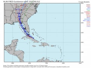
The general consensus between models is that the center of Fred remains offshore as it slides roughly parallel to the Florida peninsula. Should the westerly shear abate at all, as the models hint that it may briefly, Fred may be able to take advantage of more favorable conditions and strengthen some as it moves toward landfall.
That said, even some quick strengthening during a favorable window probably wouldn’t give it too much of a boost. It’s current pressure – 1013 mb – is rather high and, as I mentioned above, it has weakened to what is likely an open wave. We will need a closed circulation before Fred can attempt to strengthen.
Regardless of Fred’s eventual strength, the results will be about the same. Specifically: heavy rain leading to freshwater flooding, some gusty conditions, and a low-end tornado threat in the right-front quadrant as Fred passes. Fred is expected to be heavily eastern-weighted due to shear, so most, if not all, of the heavy rain will be located to the east of the center.
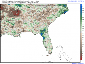
The Florida Peninsula into the Big Bend area has received quite a bit of rainfall recently.
Some areas have received roughly 300% of normal over the last 14 days. Saturated ground plus more heavy rain (2 to 5 inches is the general forecast) plus gusty winds means that not only is flooding a concern, but power outages will be as well as trees fall easier when the ground is saturated.
So, in summary: as long as Fred is still hanging on, the west coast of Florida into the big bend should prepare for potential flooding, gusty winds, and perhaps a few tornadoes Saturday through Monday as the storm treks parallel to the coast. Monitor your local weather for more detailed forecasts for your areas and prepare accordingly.
After landfall: moisture from Fred is expected to move into the southeast and pose potential flooding issues there, as Jacob mentioned in his blog yesterday. This, of course, depends on how Fred evolves over the weekend so stay tuned for updates!
