A Wintry Week Ahead: Northern Plains To the Northeast
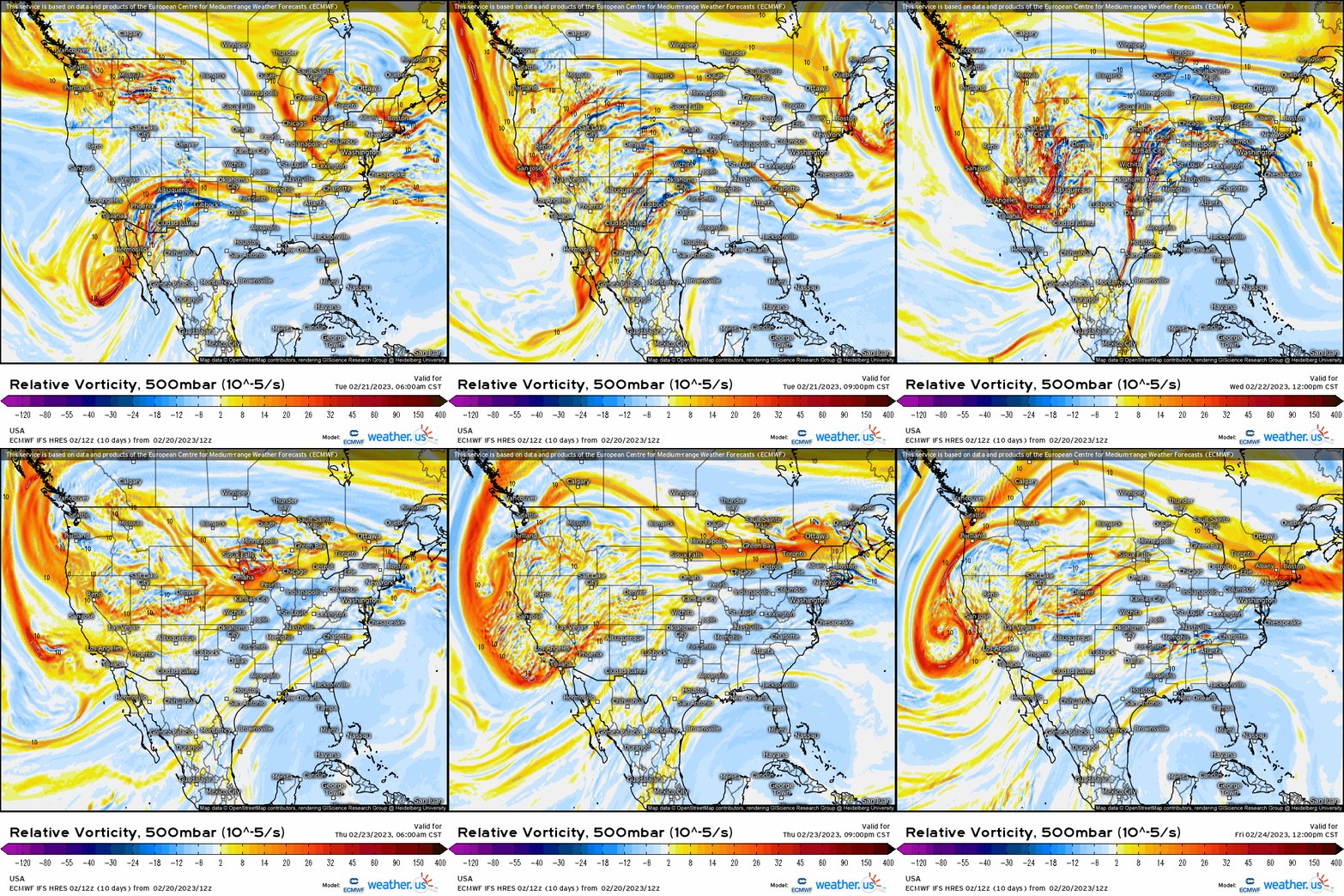
Let’s start off by analyzing the generic mid-level pattern at 500mb this week through the end of the week. We see quite an active stretch as several shortwave troughs swing by out first in the Northeast, followed by a much more notable longwave trough digging into California before surging into the Midwest and Plains. This translates to several systems at the surface with wintry implications!
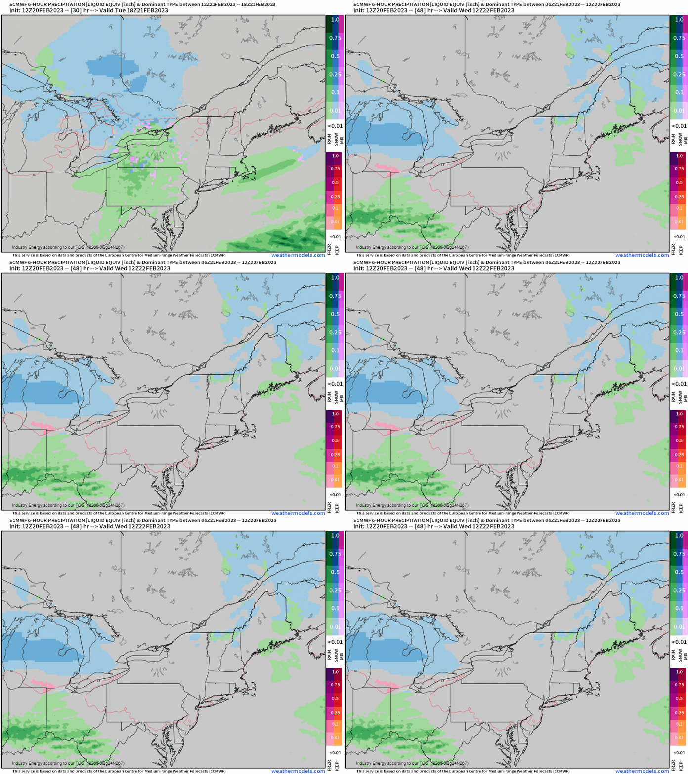
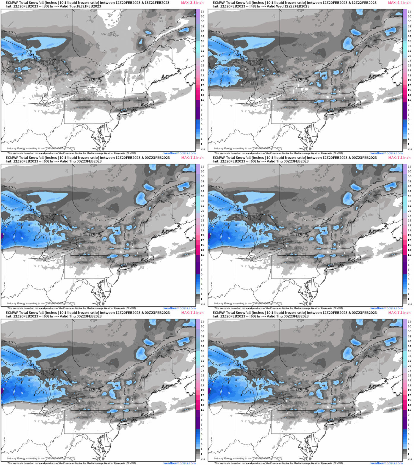
First, a shortwave trough will zip across the Northeast as a weak frontal system delivers some light snow to the interior Northeast including upstate NY, VT, NH, and into ME later tonight and into tomorrow morning with cold enough temperatures. This will look to put down around an inch or so in these aforementioned places.
Then the attention shifts to midweek this week as a very robust winter event will unfold beginning out across the Great Basin before shifting into the upper Midwest & Plains. The setup entails a large cyclone developing out across the Front Range (lee cyclogenesis). From there, we’ll see a good amount of warm air advection, moisture advection, and differential cyclonic vorticity advection out ahead of the longwave trough: all major “ingredients” we look for in terms of where it’ll precipitate in the end!
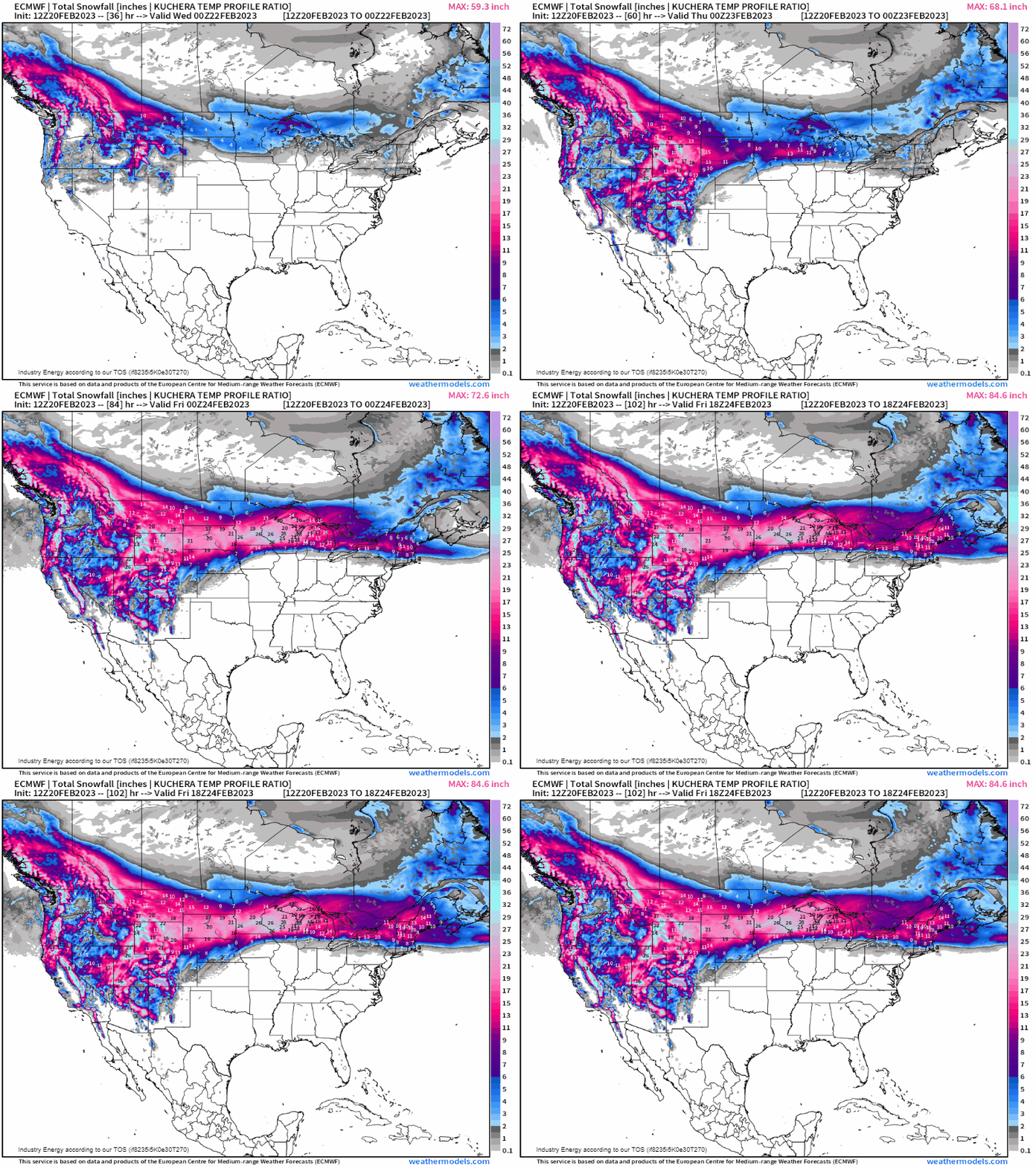
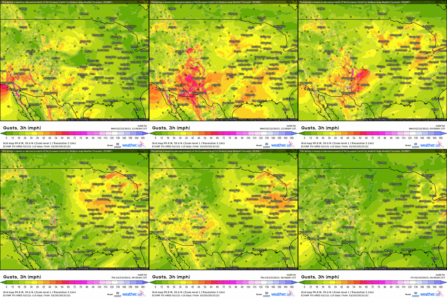
- Heavy snowfall with blizzard conditions will impact WY, NE, SD, into northern IA, MN, and WI as several wind gusts exceed 50mph with whiteout conditions likely. What’s more, we’re going to be talking about over a foot in many spots, especially locations along and north of the warm front that’ll be draped across the northern Plains and into the Great Lakes. Over 20” of snow could even be expected for places like southern MN and eastern SD!
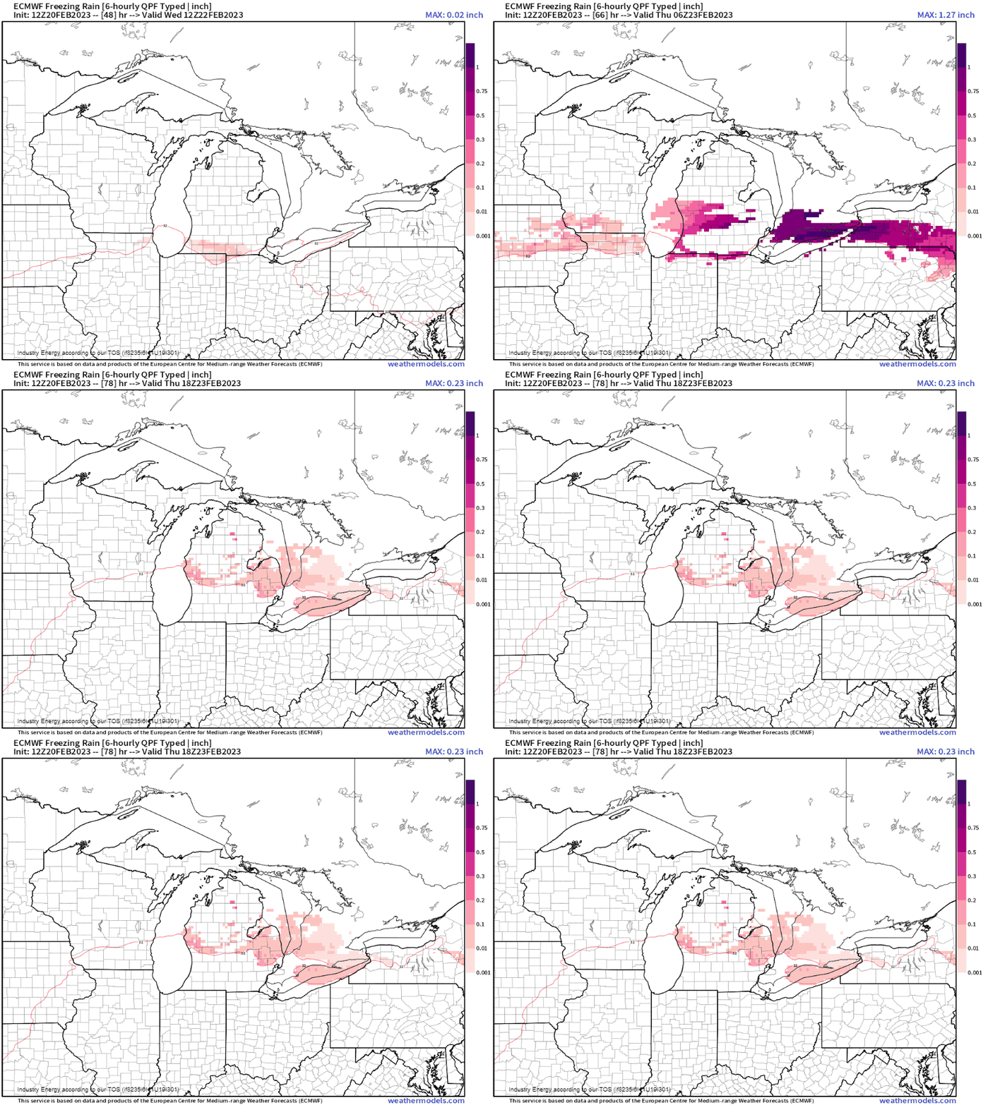
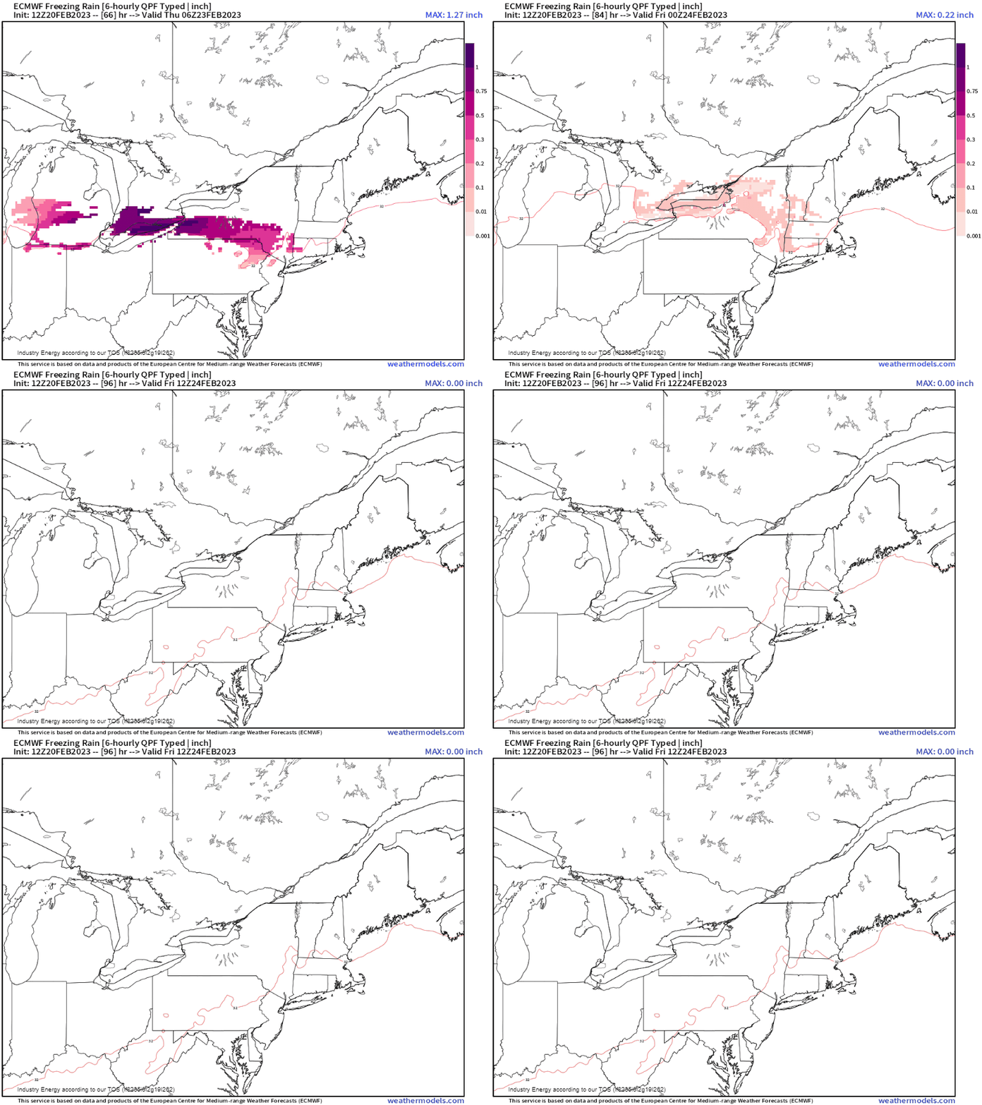
- The more dangerous component to this prolonged winter event will be the icing! The threat of freezing rain of up to .50” (locally higher possible) will occur along the “battle zone” of where the warm and cold air meet, with strong warm air advection in the mid-levels with surface temperatures hovering 32 degrees making for the ideal recipe for freezing rain accretion with a persistent northerly wind. This “jackpot” for freezing rain looks to be anywhere from eastern IA, along the WI/IL border and into southern MI before shifting into the interior Northeast including western NY, northern PA, and into the Hudson Valley.
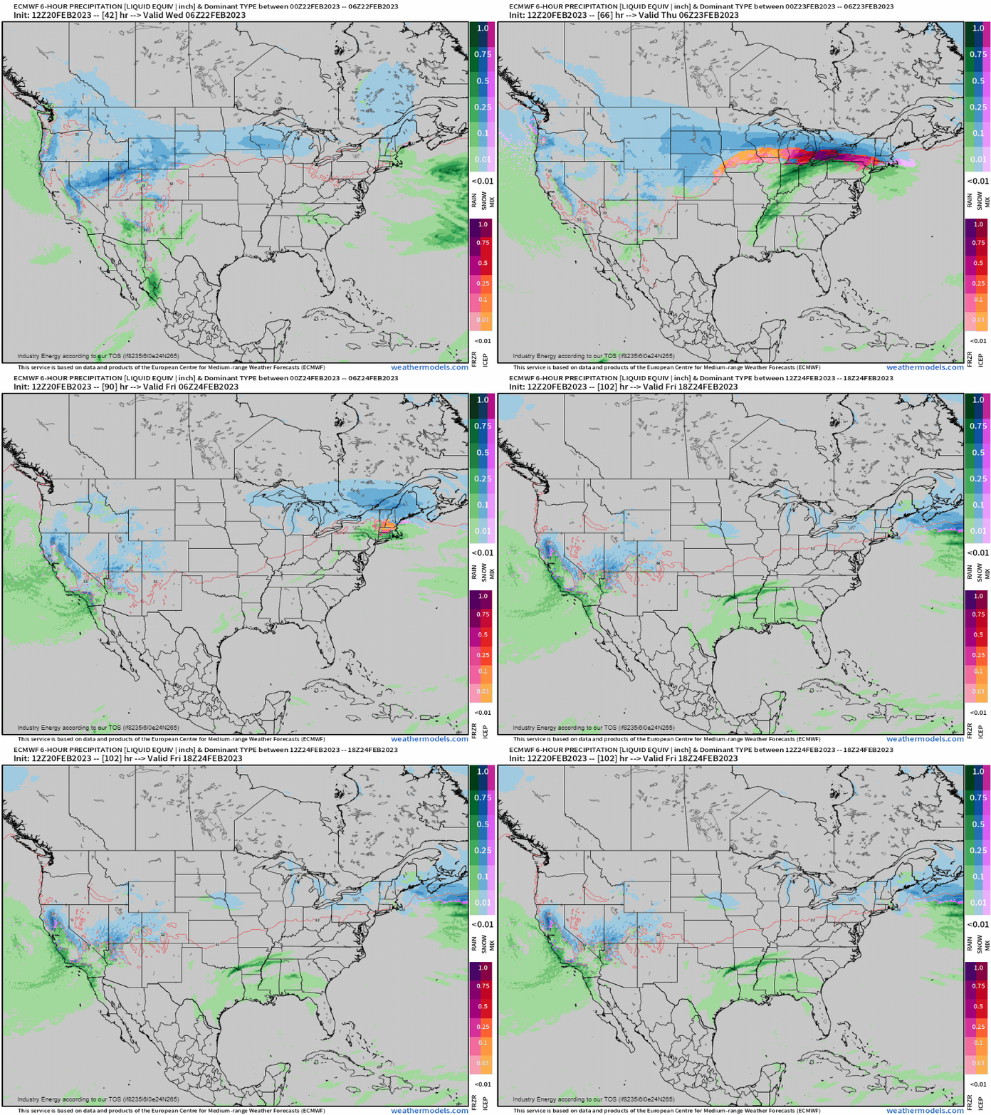
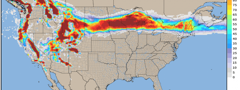
Here is the large swath of heavy snow that extends from the Intermountain West, into the northern Plains, Great Lakes, and the Northeast.
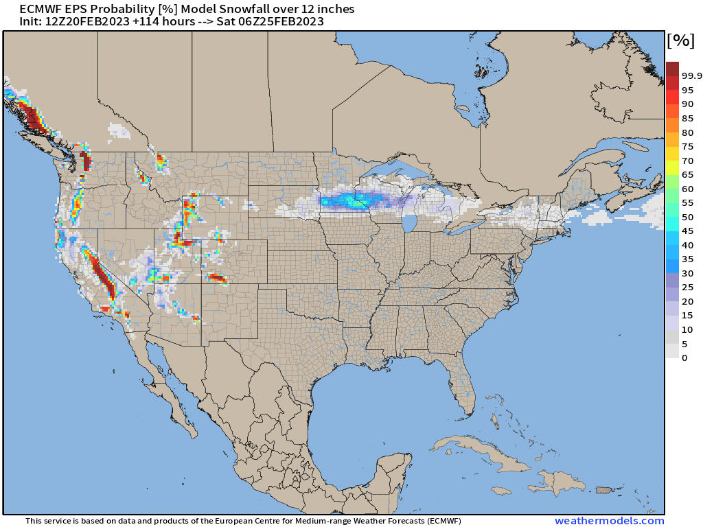
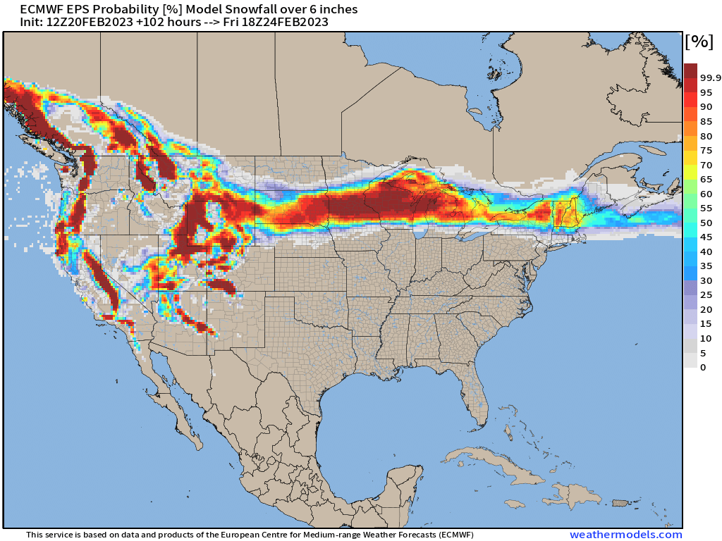
Here are the EPS probabilities of seeing over a foot of snow, with the most obvious being central/southern MN and into WI with over 30% probability. The other is 6”+ (below), with a much more notable widespread swath of > 50% extending from SD to ME.
In 6-hour intervals, we see several tenths of ice prognosticated across the Upper Midwest, Great Lakes, and into the Northeast with anywhere from a coating of ice, up to .50 – .75” of an inch or so making for concerning hazards regarding infrastructure and power outages!
Here we see 10 meter wind gusts kick up as the cyclone moves into the upper Midwest and Great Lakes, so expect plenty of wind-blown snow along with whiteout, blizzard conditions north of the cyclone’s track.
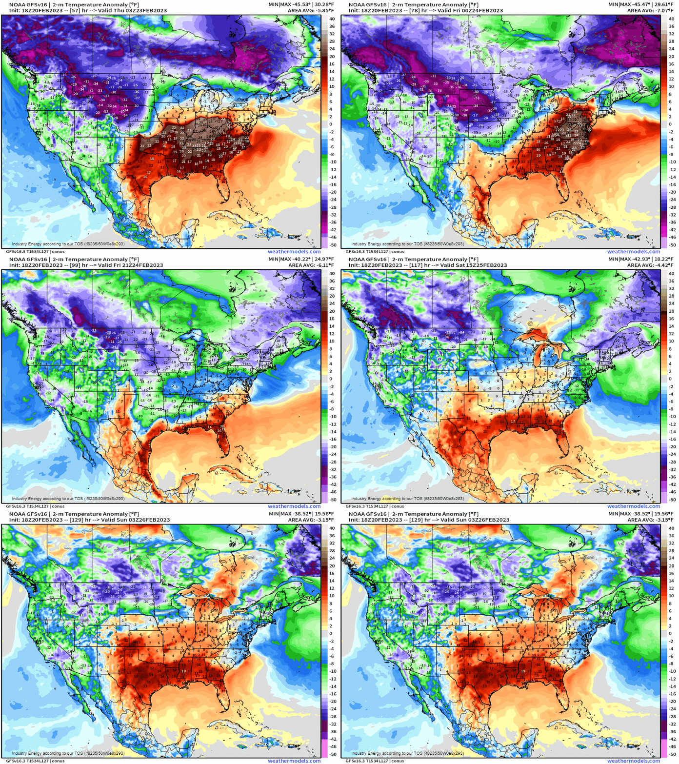
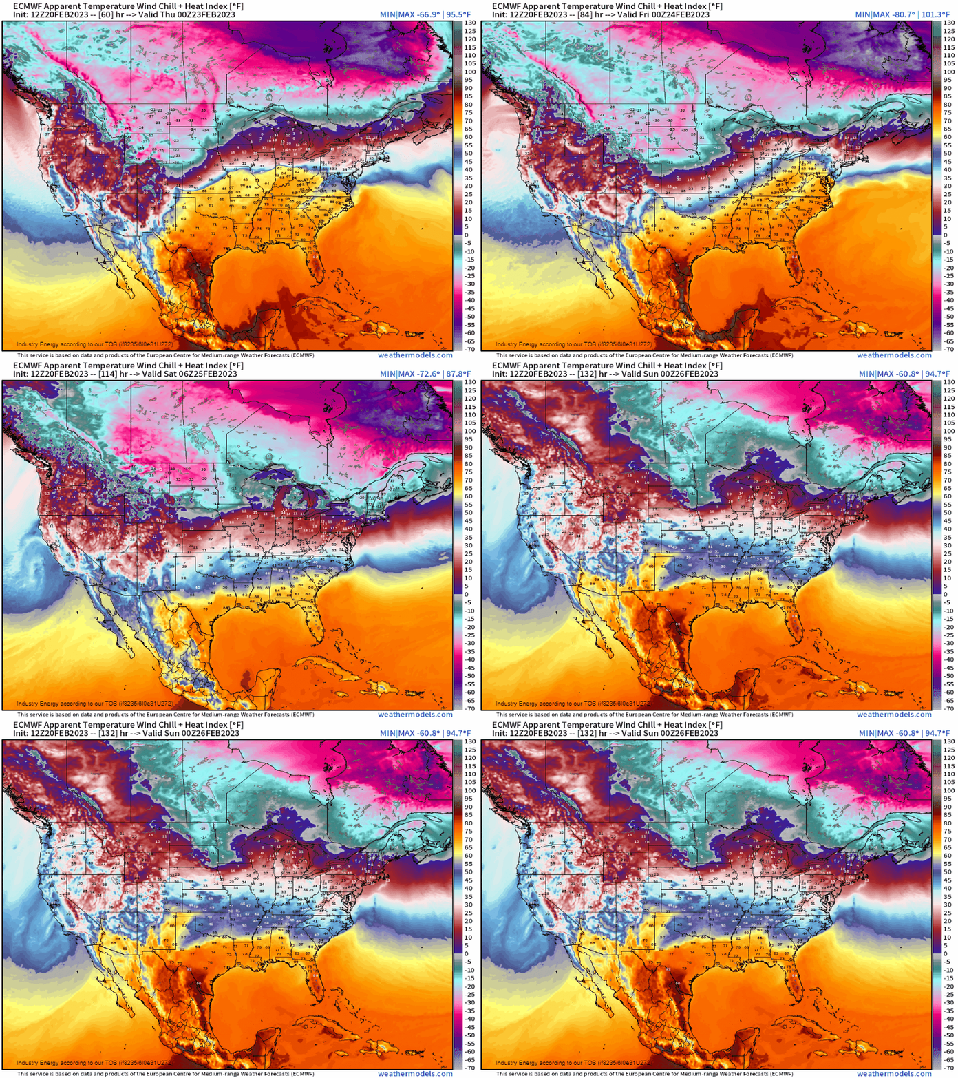
Then, what makes this setup more dangerous across the northern tier (i.e. Plains, Midwest), is the very cold temperatures that follows with an arctic high that pushes in behind delivering potentially record nighttime lows and wind chills below zero (especially with snow cover). This high pressure system then shifts into the Northeast by later this week, though moderating as it does so and temporary in the meantime.
To recap:
- A weak frontal system crosses the Northeast later today into tomorrow bringing light snowfall primarily north of lower Hudson Valley, CT, and Massachusetts turnpike.
- Much more formidable winter event strikes the Plains and upper Midwest beginning late tonight into tomorrow as well, prolonging into early Friday. Heavy snowfall, strong wind gusts, and freezing rain along and north of the warm front with over a 6”+ impacting a large majority from the Plains to the Northeast. Over 12-18+” expected mainly for eastern SD, southern/central MN, and into WI being more in the “bullseye” of this prolong event. Widespread power outages expected for locations that’ll endure heavy snow, so please be prepared with non-perishable items, clothes, backup generators, and a backup plan in general!
- The Northeast – upstate NY, lower Hudson, northern locations of southern New England, and most of the the interior Northeast, sees this event start precipitating with freezing rain, sleet, and snow tomorrow night into Thursday clearing by Friday morning. Cold below average temperatures follow behind into the weekend, though moderation takes place by Sunday.
- Dangerous wind chills over 30* below zero follow behind the Midwest cyclone that allocates into the Northeast by Friday, primarily targeting the northern Plains with brutally cold air. We see the same arctic air, however, modify as it translates eastward into the Northeast though does provide cold wind chills below zero mainly across the interior Northeast and down to near zero into Southern New England.
Stay safe and be prepared!


