A Wintry Mess
As we slide into February this week, an active sub-tropical jet will keep things messy over the southern half of the country.
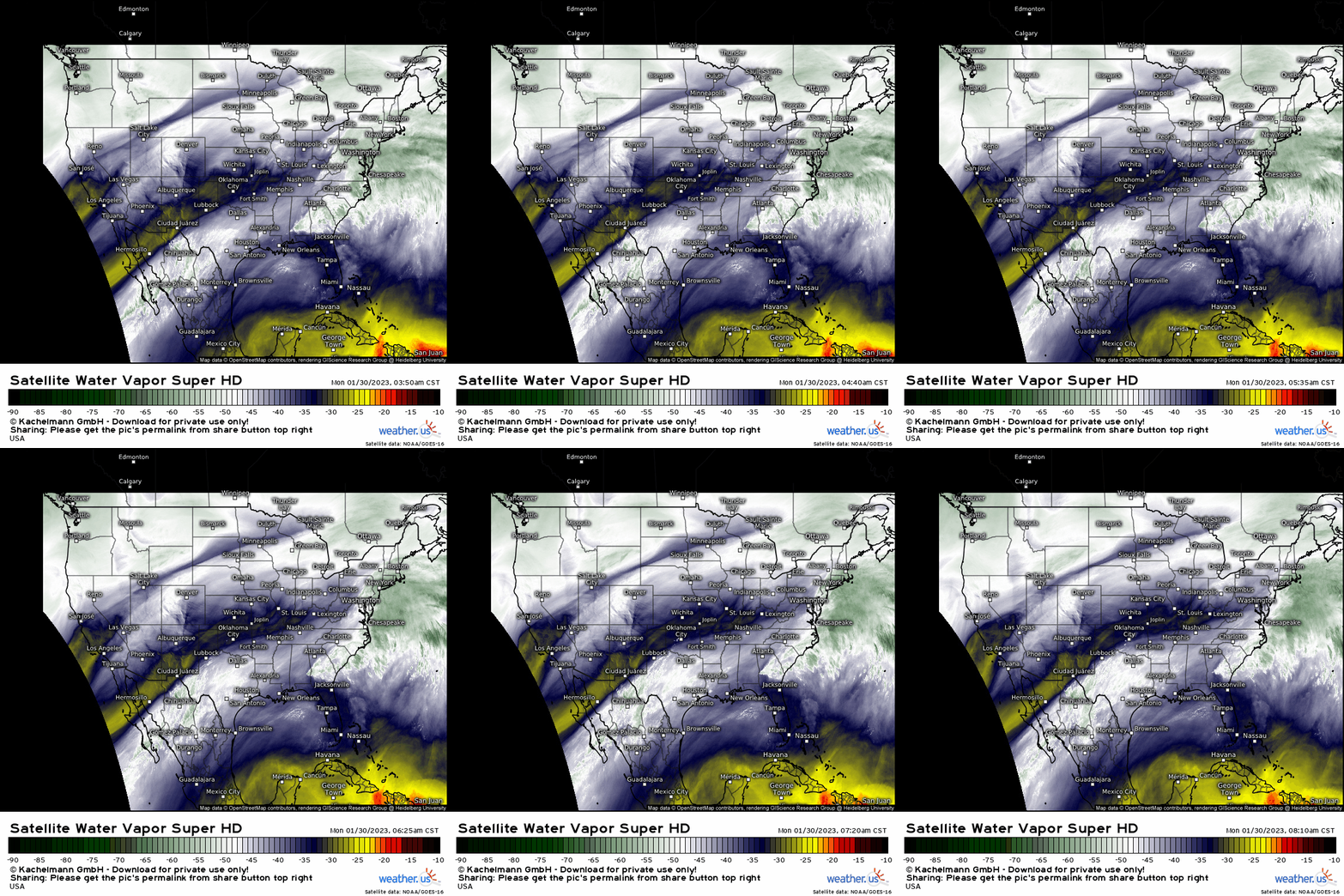
A constant stream of moisture, “warm” air, and a few disturbances moving through will clash with frigid air firmly entrenched in the central portion of the US.
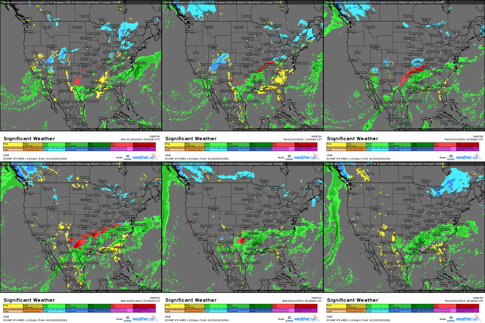
The result of these ingredients? A rather prolonged risk of icy weather for the Southern Plains to nearly the Ohio Valley region. Let’s take a look at the set up.
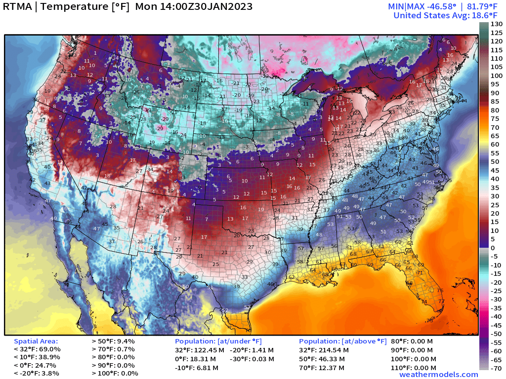
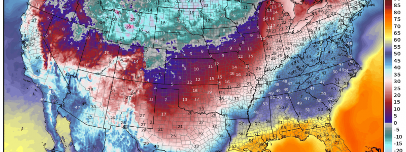
As mentioned, we currently have Arctic air locked into place over the middle of the country. Though the coldest air is located in the Northern Plains/Rockies, it is plenty chilly in the Central Plains states as well.
We can spot the subtropical jet (STJ) by the boundary between the chilly temps and comparatively warmer temps.
Meanwhile, the STJ will remain draped across the southern portion of the country for a few days more.
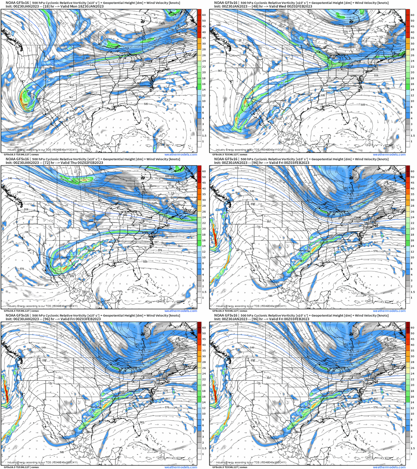
As it sits there, a series of impulses will travel along it, inciting rounds of precipitation.
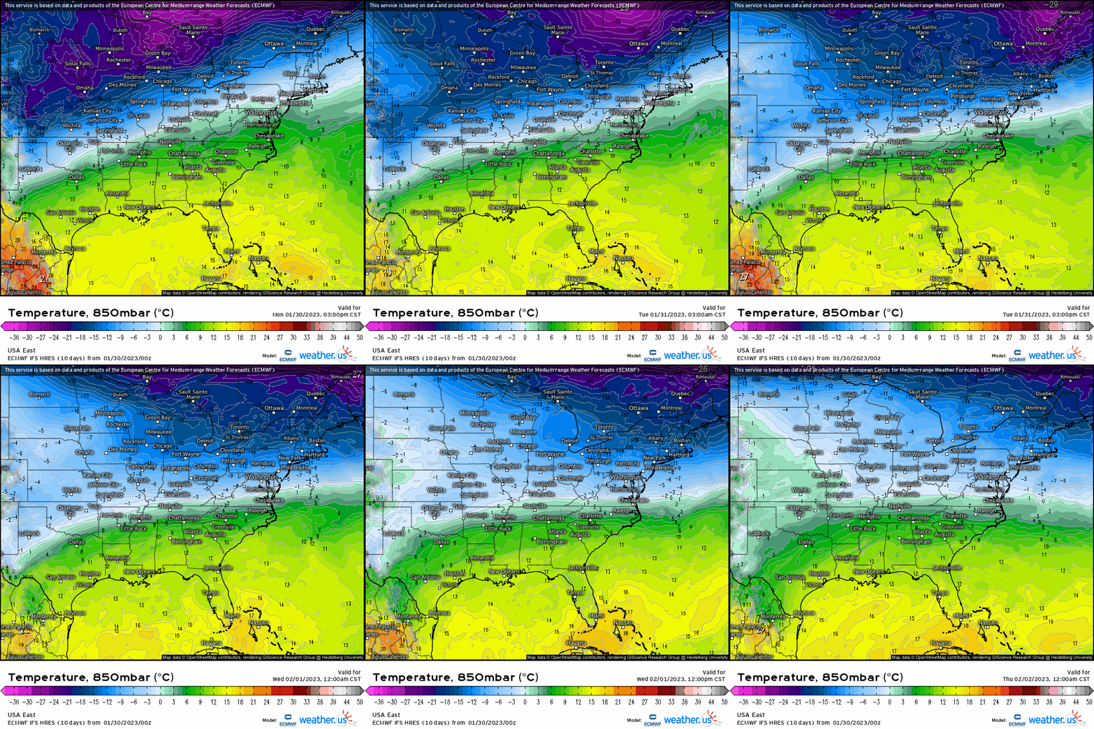
Temperatures at the surface along and above the STJ’s position are plenty cold enough for snow. However, just few thousand feet aloft, a steady southerly flow will allow comparatively warm air to overrun the cold air at the surface. As we know from a previous blog explaining precipitation types, this introduces the possibility of both sleet and freezing rain.
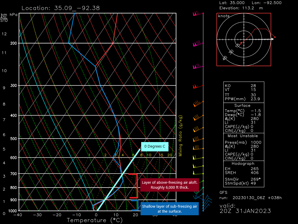
If we pull a sounding from the GFS valid Tuesday afternoon for Central Arkansas, we’ll see a classic freezing rain set-up.
- Upper levels are sufficiently cold and saturated. Precip starts as snow aloft.
- A deep layer of above-freezing air is present in the mid/lower levels. Snow will achieve total melt in this layer, turning back to rain.
- A shallow layer of sub-freezing air at the surface. Rain will freeze on contact – elevated, colder surfaces first, then roadways.
While any amount of freezing rain can be impactful, what makes this event such a big deal is the expected duration. The cold air and STJ will remain stalled in place for a few days as impulses travel along. So, while the cold air isn’t going anywhere, neither is the overrunning warm air that allows for mixed precipitation.
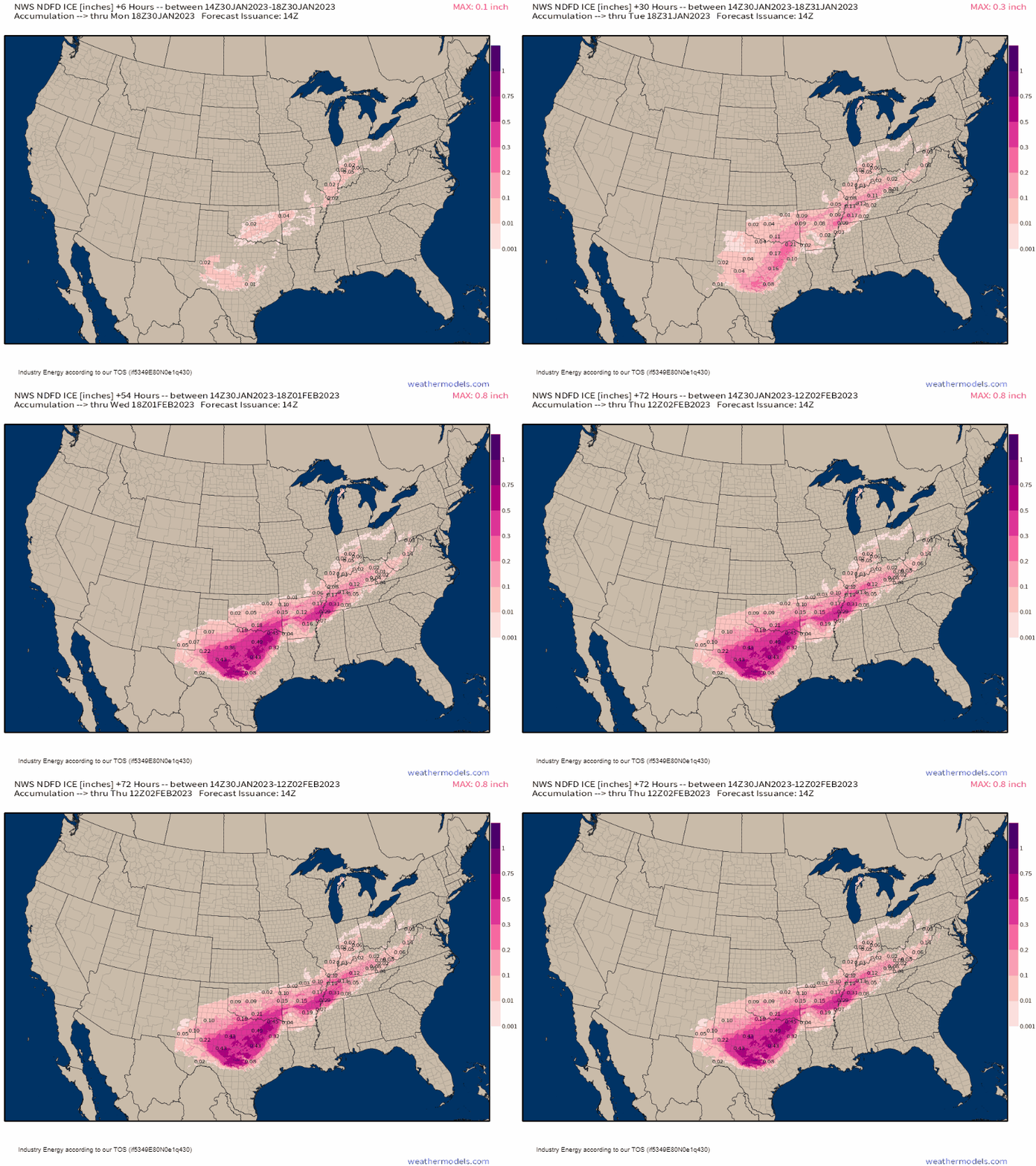
While it’s nearly impossible to pinpoint exactly how much ice accretion to expect, the fact that nearly half an inch of ice is a possibility for some is alarming.
Half an inch of ice lends to significant disruptions and damage. Travel would become nearly impossible while power outages would be plenty as trees fall on the lines under the weight of the ice. While not everyone will experience this extreme, even 0.10″ can cause widespread issues.
If you’re located in the broad zone from roughly Central Texas to Central Kentucky, you’re likely already under some sort of winter weather watch/warning. Pay attention to the forecast as it evolves and the event unfolds. Remember that this will be several events strung together over the next few days, not just a single one-and-done event.
Prepare for difficult to impossible travel along with power outages. Don’t travel if you don’t have to. Prepare to stay warm if the power does go out – remember, though the air is “warmer” aloft, it’s still rather cold at the surface. You will need extra blankets and/or an alternative source of heat if the power goes.
We’ll keep you updated as the event unfolds over the next couple of days.


