A Wintry Headache For Forecasters
The seasonal flip-flop continues this upcoming weekend as our winter-that-isn’t-quite-a-winter rolls onward.
After a work week full of very spring-like temperatures in the Southeast, we’ll edge our way back toward winter once again as the chance for wintry precip materializes.
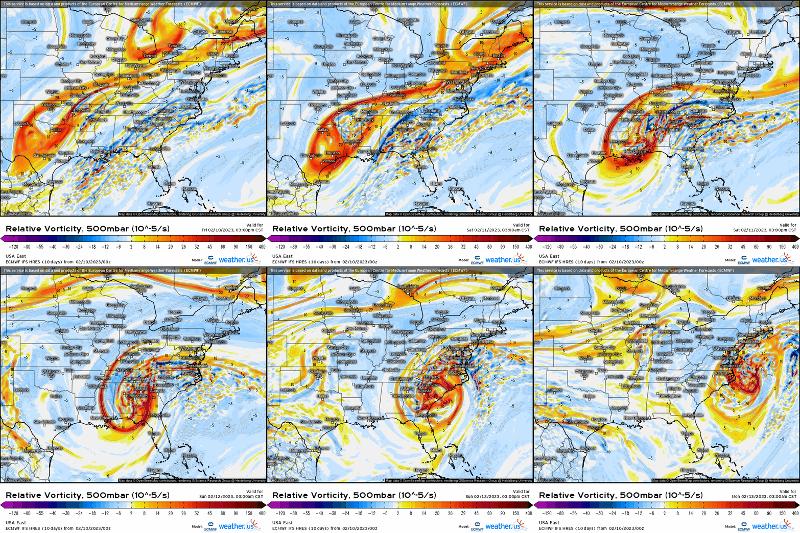
A potent upper-level low will work its way across the southeastern portion of the country this weekend.
At times, these upper-level lows can be full of wintry surprises for the Southeast. In the past, they have resulted in a few big snowfalls for portions of the country that don’t typically receive much snow throughout the winter.
However, they are also notoriously hard to forecast. Meteorologists all over this region are struggling to pin-point impacts for this event as changes materialize from run to run. Small track wiggles can add up to big fluctuations in a forecast. Additionally, the availability of cold air plays a huge factor in which region sees the potential for snowfall.
Track
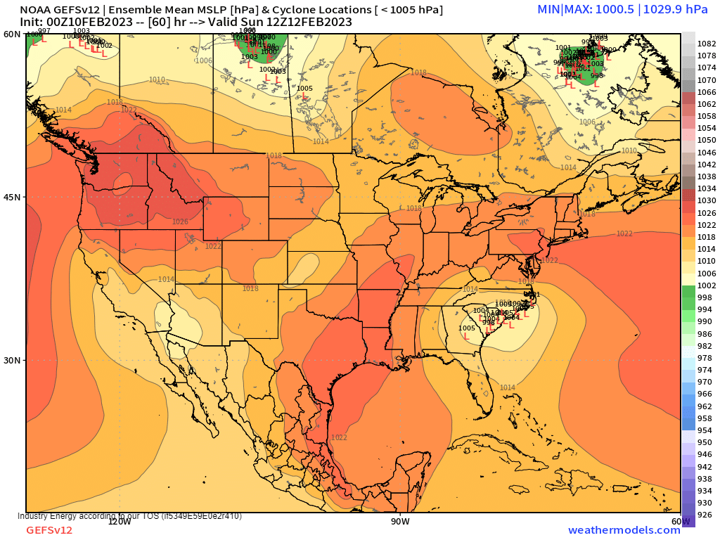
In a set-up like this, typically areas north and west of the center of low pressure would be in play for wintry weather. More specifically, the areas that are close enough to benefit from overrunning moisture while also being far enough away to avoid any warm air advection aloft via the low-level jet.
Per the 00z GEFS low locations (and the similar EPS), this would put Northern Georgia, Northwestern South Carolina, the foothills and mountains of North Carolina, and perhaps parts of Eastern Tennessee in the crosshairs.
Or it would if we were only worried about where the center of the low is located. However, we need to consider availability of sufficiently cold air as well.
Cold Air
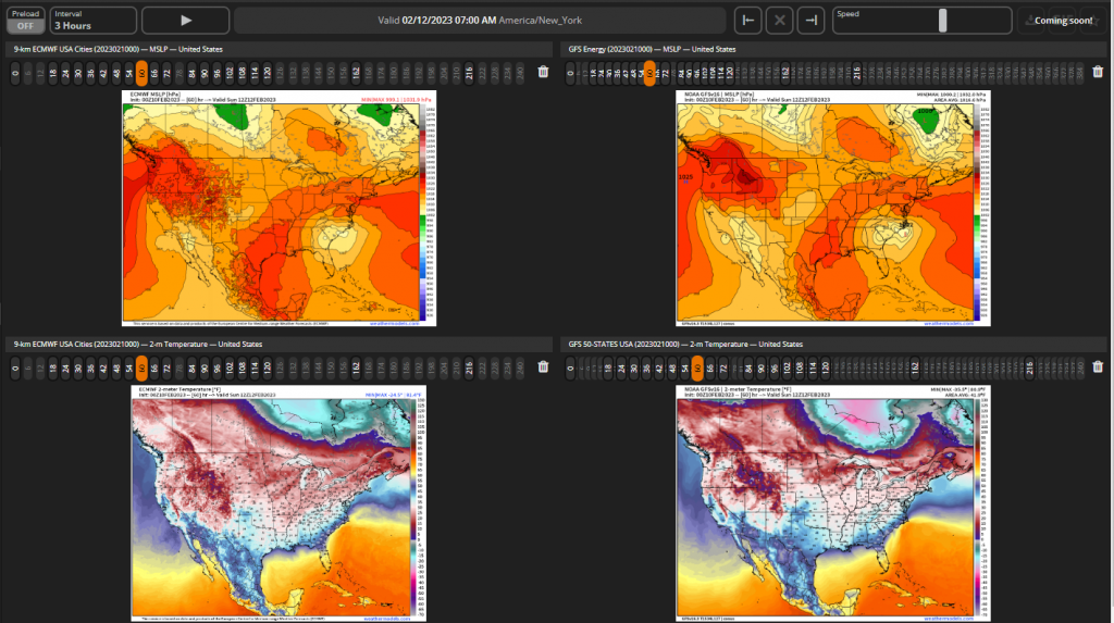
If we take a look at a MSLP map, not only do we not have a strong (or even semi-strong) Arctic high anywhere in sight, but the high that is nearby is unfavorably oriented. Additionally, the source air under that high is really not that cold.
So, when we consider the unfavorable positioning of the high along with sort-of cold air that will modify as it travels, we end up with temperatures that are marginal at best.
What do I mean by marginal? Well, temps in the aforementioned regions will likely be hovering in the mid-30s, at least in the lower elevations. Not exactly conducive to a snow event. The higher elevations, however, are naturally cooler and should be (mostly) below freezing.
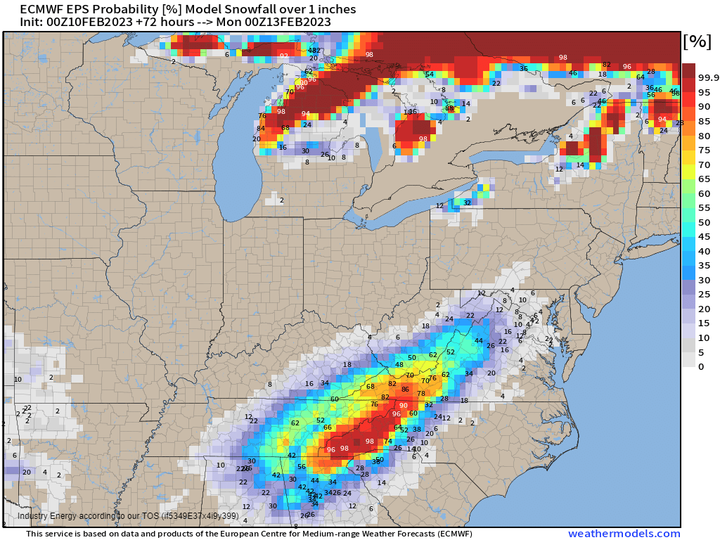
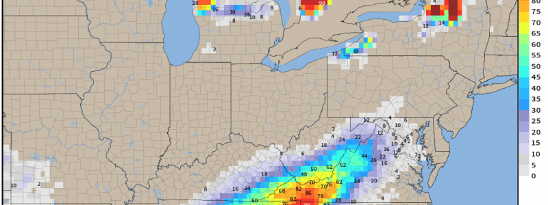
Using what we’ve discussed above and probabilities, the Appalachians of North Carolina and higher peaks of the Smokies are likely the only “slam dunk” in terms of snowfall. Probabilities decrease steadily with a decrease in elevation on either side of the Appalachians. It’s also worth noting that the Cumberland Plateau in Tennessee will carry a higher probability of accumulating snow than the surrounding valleys due to its higher elevation.
So, while some in the lower elevations of this region may see snow falling as temperatures wiggle back and forth, the only guaranteed accumulation will be in the higher elevations.
Another important note: if temperatures are just a few degrees colder than modeled for the lower elevations of this region, it could completely change the forecast.
The current forecast is really right on the line between a mix/snow event and a cold rain event for many. Expect the forecast to waffle back and forth as we hone in on exact track and temperatures over the next day or so. Upper-level lows such as this are often full of surprises.


