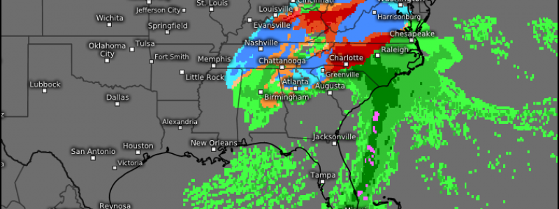
A Wide Variety of Impacts Likely With This Weekend’s Storm
We last looked at this weekend’s system in a blog from Thursday. Honestly, I feel pretty good about the over-all forecast I presented in that blog. Today we’re going to look at the forecast by region and mention some of the more mesoscale components and, yes, totals.
Mississippi and Tennessee River Valleys
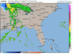
This region will be the first affected as the surface low perpetuates eastward. Already we are seeing some showers south of the low and snow on the back side in places like Missouri and Arkansas.
Rain showers this afternoon will become a more widespread rainfall by this evening as the low really taps in to the Gulf moisture.
As rain changes to snow on the back side of the low, it’s entirely possible that Western TN and Northern MS could receive a few hours of heavy snow amounting to a “surprise” jackpot zone.
Everywhere south of a line from Birmingham to Atlanta to Augusta to Charleston should expect mainly rain, though a few novelty flakes or wintry mix is possible as the cold air rushes south when the system begins its exit.
As for the Tennessee Valley, there’s really no good way to describe this forecast except for “an absolute mess.” Surface temperatures will hold just above freezing initially. With air aloft also above freezing, this translates to a chilly rain for most at the onset. As cold air filters in from the northwest, rain becomes sleet or freezing rain for some before turning to snow late Sunday.
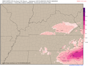
Elevation here will be both your friend and foe. Initially, higher, colder elevations below 5000 ft will see a faster change to mixed precip and could experience light ice accumulations.
This will be especially true for south/southeastern Kentucky where surface temperatures will remain below freezing for longer on Sunday morning before climbing later in the day.
Another spot to watch for ice accumulation is the foothills of Northern Alabama. Their elevation will keep them near freezing for longer on Sunday than the surrounding low-lands.
But eventually that cold air rushes in for everyone north of the line I mentioned earlier, which will trigger the change-over to snow.
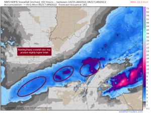
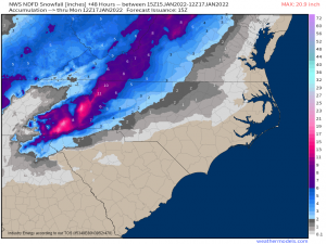
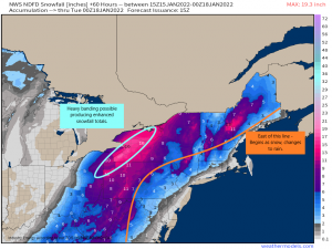
I find the NWS NDFD is usually a decent predictor of snowfall totals, with a caveat or two. The areas I’ve circled in the graphic above have the potential to see some banding occur on the back side of the system. Heavier snowfall rates could be possible and totals slightly exceeding what is modeled are possible locally. Subtle topography changes and the persistence of the banding will come into play here.
The East Tennessee Valley, Northern AL, and NW GA will be the last to see the changeover to snow due to lower elevation, warming due to downsloping below the Smokies, and stubborn, warmer temps. Not much of an accumulation is expected here. Keep in mind, though, that temps will plummet below freezing behind the system and anything wet will freeze, leading to hazardous road conditions in a few areas.
Southeast
This region will by far experience the most dangerous part of the storm.
In my blog on Thursday, I mentioned the Cold Air Damming (CAD) event that would facilitate the risk for extended periods of ice and/or sleet. That forecast hasn’t changed.
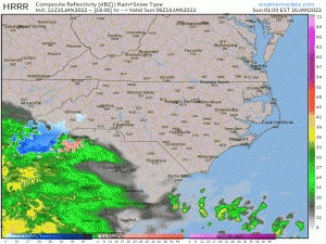
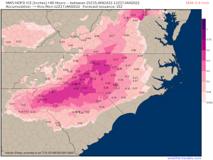
The threat for ice begins as early as Midnight on Sunday in the Carolinas. It quickly overspreads the region and, for the next 24 hours, at least part this region is experiencing ice. That’s not to say that ice will pile up for everyone for the full 24 hours. However, the CAD will be slow to mix out. As long as surface temperatures are below freezing and the air aloft isn’t, if precip is falling, it’s going to be either sleet or freezing rain.
Unfortunately, a “jackpot” of potential accumulation exists over heavily populated cities such as Greenville, SC, and Charlotte and Greensboro, NC. Totals upwards of 0.25″ are expected here and would be enough to cause major issues.
This region will also receive snowfall, especially throughout the Appalachians.
The higher elevations will obviously be the big winners here with some potentially receiving over a foot. A foot and a half could be possible on the highest peaks – Mt Mitchell and Grandfather Mtn. The Smokies also stand to see decent accumulations though not quite as much as the Blue Ridge.
Lower elevations should expect their totals to be cut into some by a changeover to mixed precip Sunday afternoon as warm air moves in aloft around the center of the low.
I would, under no circumstances, plan to travel in this region any time on Sunday. Treacherous won’t even begin to describe the roads away from the coast. Make plans to stay home through Monday morning if at all possible.
Mid-Atlantic/Northeast
After much uncertainty, it seems the center of the low will indeed take an inland path as it speeds up the coast.
Precip here may start as snow with a few inches accumulation, especially further inland. However, as the low approaches, some will change over to rain, or a mix. Precip that is entirely snowfall will be confined to far western New York, far western Pennsylvania, and Eastern Ohio.
As discussed in Thursday’s blog, the low level jet is forecast to be extremely strong and, in addition to advecting warm air aloft far inland, will cause all kinds of non winter weather issues for the coast.
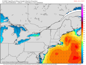
Rough seas with wave heights over ten feet are likely. This onshore push of water will also lead to coastal flooding, especially if/where it syncs up with high tide. If your area is vulnerable to coastal flooding, be aware of this possibility.
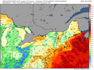
High winds will also be an issue – not only for the coast, but for inland locales as well. This could lead to power outages as trees are blown down.
Heavy rain is also a possibility with widespread totals of 1 to 1.5 inches, especially along the coast.
As for snow…
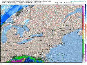
Roughly everything east of the orange line in the graphic will begin as snow, but then change to rain. Accumulations will likely come before the rain, and then melt away. There could be some additional light accumulations on the back side as it departs.
West of that line (and in the higher elevations), precip remains snow. We likely will see some heavy banding in Western New York and Western PA that will lead to the “jackpot” zone. Depending on persistence and rate of snowfall, locally higher totals than what is depicted are possible.
A few things to keep in mind:
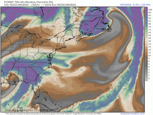
Systems like this always, always have a dry slot – an area where dry air aloft works in and precip does not fall.
They can be hard to predict exactly, but it’s almost a given that one will appear. Where ever this tracks, it has the potential to cut down on totals whether they be rain, snow, or ice. Don’t look an accumulation map and automatically assume you’ll get the high end. Ranges are given for a reason and a dry slot is one of them. You can easily end up with the lower total – or even less than that.
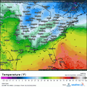
Very cold air will be spilling south behind this system.
Anything that has fallen as liquid or melted during the event will freeze as temperatures plunge below freezing. Bridge icing, roadway icing, slippery sidewalks – they’ll all remain possible even after the storm has departed.
Finish your preparations for this system today if at all possible. Rearrange travel plans, stock up on supplies, have a plan to stay warm in the event of a power outage (if applicable for your area).
Stay safe, y’all!
