A Wet End To The Week: TN River Valley / MS River Region
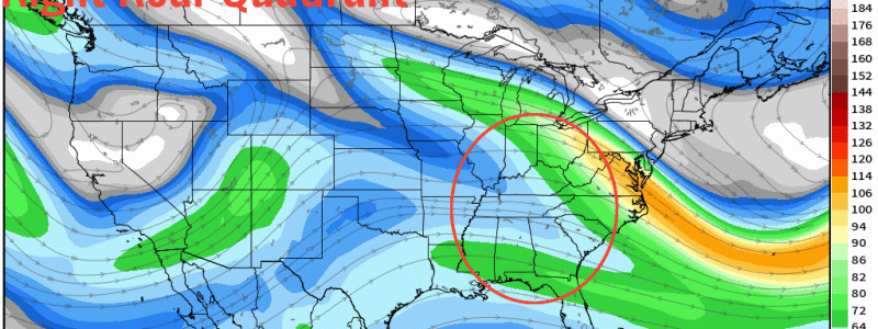
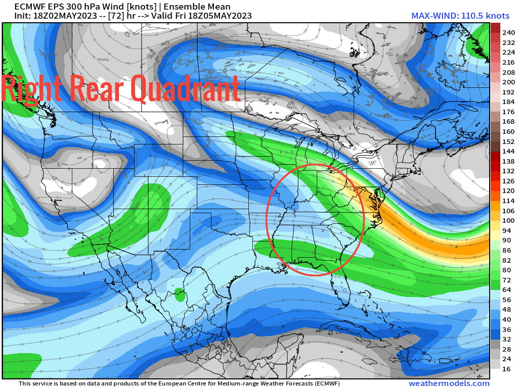
We first identify aloft what the jet streak looks like to see if we’ll have any assistance from the upper jet streak. Verbatim, we certainly look to do as the region outlined – TN River, parts of the Ohio Valley, and MS River Valley – look to be within the zone of unsettled weather comprising heavy rainfall. With the right rear quadrant superimposed, this now leads to enhancing the surface processes leading to mass evacuation.
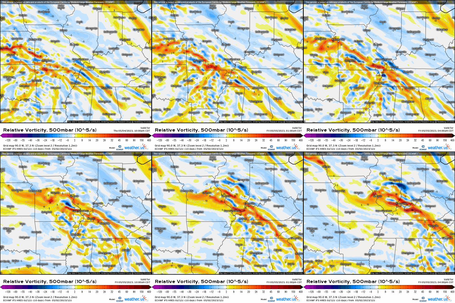
At 500mb, lets check to see if we have enough forcing, or any at all for that matter. We certainly appear to do so as this synoptic forcing comes in the form of differential vorticity advection, with a shortwave helping to now focus areas of heavy rain and/or thunderstorms.
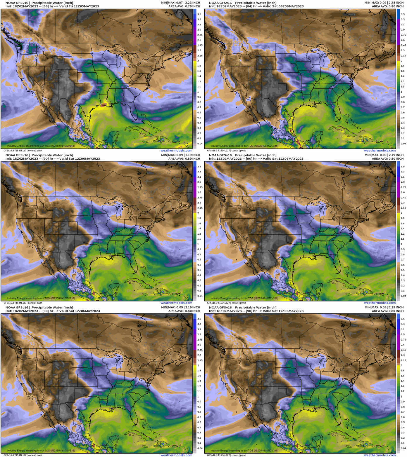
Checking to see our environment in terms of moisture, and we not the advection coming from the wide open gulf so we have now plenty of energy in the form of latent heat stored in the moisture. We also see that the environment is quite saturated with PWAT’s over 1” across the majority of the South and Southeast.
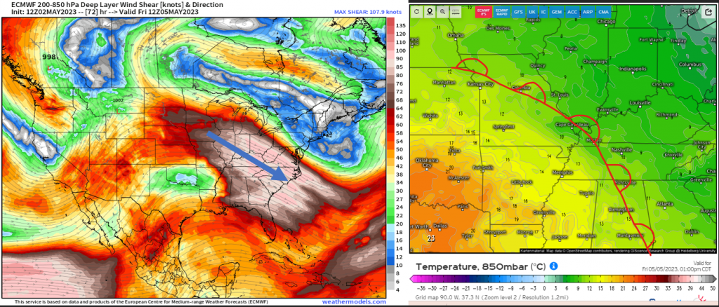
Now, what’ll really allow for heavy rainfall to become exacerbated is the fact that this shortwave and upper support from the jet streak works in tandem with the surface warm front. We have ingredients all there to support precipitation across these regions. What I do want to now point out is how we can get training of convection. When our shear (deep layer shear on right) is parallel to the frontal feature of interest, this incites “back-building” as clusters of storms can continuously propagate and form due to the slow-moving nature and added lift from the ambient environment as the net movement essentially “cancels” out given the shear vector is oriented in the same direction as the front (which is again inducing synoptic-scale lift).
So when taking all of these favorable atmospheric ingredients together (lift + moisture + instability), we’ll get heavy rainfall Friday into Saturday across these areas where a general 1 – 3” / 2-4” is possible, and locally if not more isolated that there are some areas seeing slightly higher.
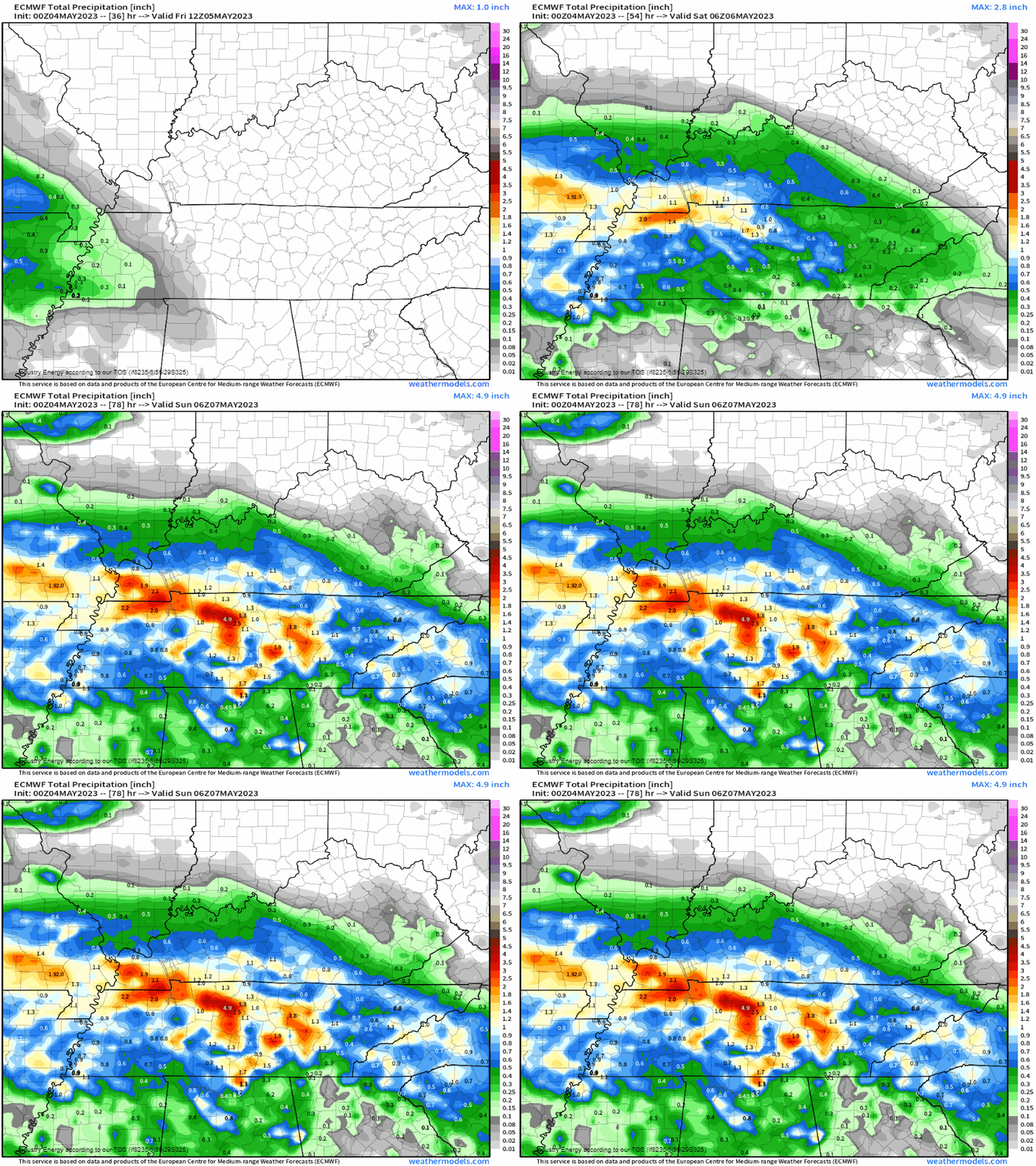
If in any reside in prone-flooding urbanized areas and/or susceptible to poor-drainage roadway flooding, be cautious with this weather situation coming up tomorrow.


