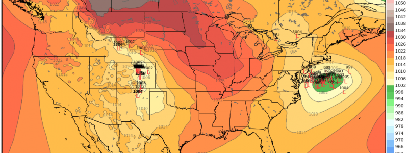
A Tricky Forecast Looms as a Possible Nor’easter Looks to Impact the Eastern US
Well, it’s Friday, which means we’re going to have to start talking about the potential nor’easter on the table for this weekend. Before we start, let it be known that right now, the forecast is extremely low confidence. Models have been all over the board on this system so I’m going to do my best to interpret what we’re seeing.
What we know:
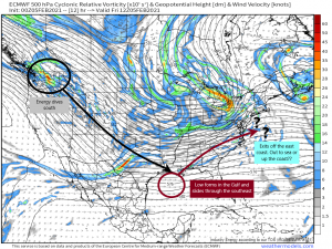
- An area of energy over the Pacific Northwest will dive south today. As it stands now, it is fairly moisture-starved so, with the exception of the Rocky Mountains, no big impacts are expected along the path of it’s journey south.
- Once it approaches the Gulf, it begins to gather moisture there and a low forms.
- This low will then slide northeastward over the southern/mid-Atlantic region. With access to moisture and marginal temps along the way, we will see impacts here, but we’ll get to that in a bit. The low will then emerge off the east coast in the Mid-Atlantic.
- From here, there are two possible scenarios. Either it goes out to sea, or it crawls up the northeast coast.
According to ensemble guidance, the out-to-sea option is the least likely. So then, we’re left with the up-the-coast scenario. The question is: how close to the coast does the low track?
In order for this low to really hug the coast and deliver widespread impacts inland, it would need to phase with another area of vorticity over southeastern Canada. None of the models are onboard with this solution so the low remains off the coast.
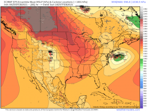
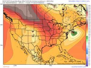
The EPS is still fairly split between relatively close and not close at all, though there is a heavier clustering on the “closer” side. The GEFS, however, leans toward the closer to the coast solution. And indeed, the trend on the low’s position has been to the northwest over the last few model runs.
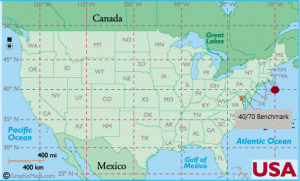
When it comes to nor’easters, meteorologists often talk about the 40/70 benchmark.
This is where 40 degrees N latitude intersects with 70 degrees W longitude. This is kind of the sweet spot for the I-95 corridor. When a low tracks over this benchmark, it gives the coastal northeast the highest chance of a decent, all-snow event. Further west of this point means the precip shield may not extend far enough for impacts while further east introduces mixing issues due to warm air advection and/or the cold air not being able to filter far enough south to provide thermal support for snow.
Taking the average of the ensembles, it seems likely that the low will track close to, or maybe somewhat west of 40/70 meaning that this will indeed be a coastal storm, with lesser/no impacts further inland.
Okay, so now that we have a probable track nailed down (as much as we can), let’s take a look at impacts.
The South
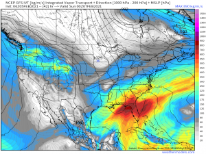
This system will pull plentiful moisture from the Gulf on it’s way to the northeast. Warming temperatures due to a southerly flow means the precip will initially fall in the form of rain. On the back side of the low, however, cold air in place over the center of the country will be filtering in. It appears that temperatures will be able to drop just enough to support snow across the south.
The usual places, namely the elevations of the Appalachians, will have the highest chance of accumulating snow thanks to colder temperatures and, of course, orographic lifting. It honestly wouldn’t be a normal blog if I didn’t use that phrase at least once. But, outside of the mountains, potential exists to see at least a small amount of accumulating snow as far west as Knoxville and the Cumberland Plateau, as far south as the foothills of northern Georgia, and as far south/east as perhaps Charlotte, though the latter may see snow falling but not accumulating due to warm ground temperatures.
So, as outlined above, the mid-Atlantic and parts of the south stand to see some accumulating snow from this system. As mentioned, temperatures will be marginal and heavily dependent on cold air filtering back in quickly behind the low. Should that air not move fast enough, snow could be off the table for a lot of the warmer valley locations (Knoxville, the Carolina Piedmont, Georgia Foothills).
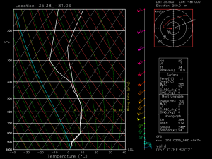
Another issue I see, specifically for the Carolina Piedmont and parts of south/eastern Virginia would be warm air aloft.
This sounding is for Charlotte, NC around 11 pm on Saturday. Though the surface temperature supports snow, the air aloft is still quite a bit above freezing (warm nose). This would likely lead to sleet or even just plain cold rain. So, the chance for accumulating snow seems somewhat slim, but perhaps falling snow isn’t quite off the table.
The Northeast
This is a difficult area to talk about impacts in since the track isn’t quite clear yet. I’ll use the middle-ground track I identified earlier and leave it up to Jacob and his blog tomorrow to nail down the specifics.
Assuming the off-shore, close to 40/70 benchmark track is followed, this will be an all snow event. Cold air is already in place and isn’t going anywhere, though I must mention possible “battlegrounds” of Cape Cod and Long Island. Thermal support here will be iffy, especially if the low approaches inside of 40/70.
With the low offshore and assuming an average-sized precip shield, biggest impacts will be seen closer to the coast. The inland areas that got wrecked in last weekend’s storm get a reprieve this time and will generally see only light totals, if anything.
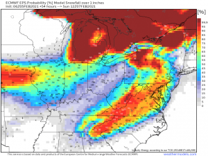
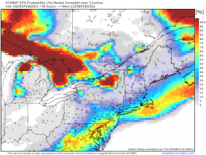
These chances of 3 inches of accumulating snow are based on the EPS guidance in which most of the ensembles keep the low further off the coast than the GEFS ensembles do, so impacts are slightly less. But it still serves to illustrate my point that a system somewhere near the 40/70 benchmark will deliver heavier impacts to the I-95 corridor and much less inland. Don’t get hung up on hard and fast boundaries or totals yet as little wiggles NW or SE could drastically change impacts. I know this sounds a lot like “I don’t know” but in all honesty, we don’t know just yet. Until we can hone in on a probable track, specifics are up in the air. The best we can do here is give a probable track and the associated impacts and make adjustments as we get new information.
In summary: As it stands now, expect mostly coastal impacts from the northeast portion of this storm. Plowable (3 inches +) snow is absolutely a possibility but solid totals along with the total area they cover are still a bit up in the air.
I hope that was somewhat informative and helped y’all understand the complexity of this forecast! Look for Jacob’s blog tomorrow with more specific details as, hopefully, models come into better agreement. Have a wonderful weekend!


You’re going to be a great forecaster! Keep it up!