A Summer Cooldown on Tap for the Northeast & Great Lakes Regions
After a consecutive stretch of surface temperatures greater than 90*F – even breaking daily maximum records for numerous cities for many places across the Northeast and Mid-Atlantic states over the past week, a notable reprieve is coming later this week and into this weekend.
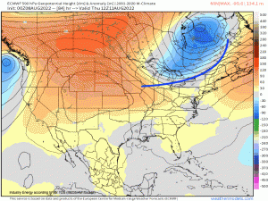
Below is an animated loop of the ECMWF z500mb Geopotential height anomaly; the anomaly aspect presents a nice visualization of simply showing you how the relative (how it “matches” up with the daily average 500mb Geopotential height climate period between 2001-2020) vertical air temperature from the surface to 500mb, varies in the horizontal.
A series of shortwaves will slowly erode the northern periphery of the Bermuda ridge that has anchored off the Southeast coast (typical for this time of year). The leading edge of the trough, demarcated by a rather robust cold front (also will be the cause for heavy rainfall along and into the Ohio Valley that’ll result in more flooding issues for ravaged areas like Eastern KY), will usher in a very comfortable airmass for the weekend across the Northeast & Great Lakes.
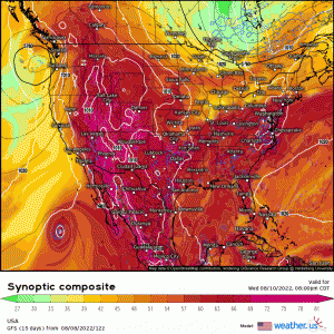
Utilizing the GFS synoptic composite parameter, which is a very useful tool in understanding mid-level and low-level pressure patterns, distribution of heat/moisture, and upper-level wind flow patterns as well, illustrates nicely how a large long-wave trough will settle into the Northeastern states. Denoted by the green shading, this indicates lowering humidity and moisture levels and implies a refreshing Canadian high pressure airmass for the upcoming weekend. This is what you typically see with troughs once they pass through an area.
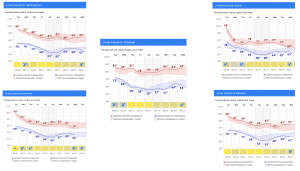
We can just see the difference between the pattern change by displaying a graphical representation of a variable in the form of a meteogram, or in this case surface temperatures. Cherry-picking certain cities across the general Northeast all show the same underlying consensus of a downward trend in daily maximum temperatures where the high’s will actually be several degrees below normal for this time of year. Even nighttime lows for numerous cities and towns will approach the 50’s, making for an absolute gorgeous and comfortable summer-time airmass.
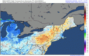
Here is another nice looped visualization of the surface temperature anomalies for the end of the week generated by the NWS. Notice the prevalence of blue shading for a large portion of the Great Lakes, Mid-Atlantic, and Northeast! Quite the change from what many have experienced since the beginning of August.
This type of synoptic progression – with relatively low Geopotential heights embodied by the long-wave trough toward the latter half of the week and into this weekend, serves as a friendly reminder that Fall is approaching rather quickly! For those that live within this region, hang in there a bit longer because a welcomed change is right on your “doorstep”!


