A Stormy Day In The Deep South
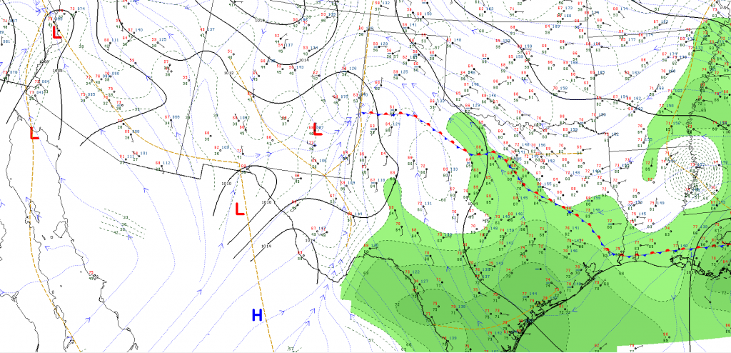
Today along a quasi stationary boundary across the panhandle of TX that extends into central portions of the state, we’ll see a focus for severe thunderstorms – clusters and discrete supercells in particular given the favorable environment today. From current analysis via College of Dupage , we can see nicely where our front is.
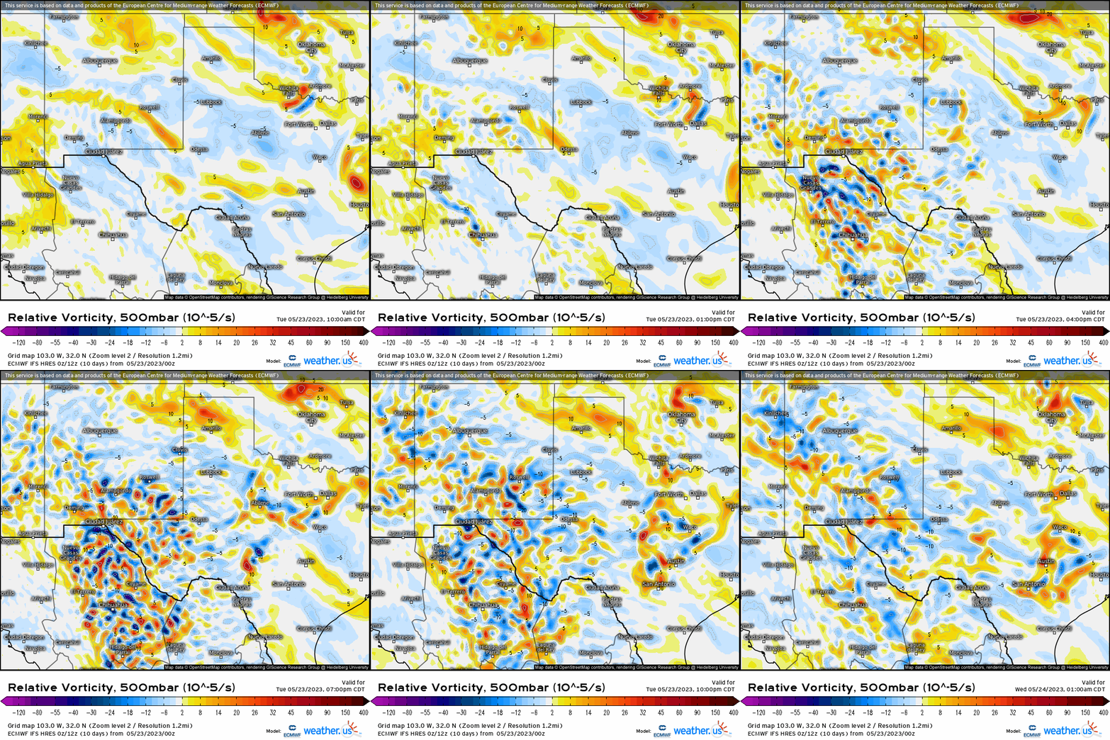
When we have synoptic forcing from both the surface (front) and aloft (500mb) with small perturbations (orange / yellows here are positive vorticity ) in the flow, we get an environment that allows for vertical motion to be enhanced. In most cases, usually too much forcing (i.e. very strong shortwave with a divergent quadrant jet streak juxtaposed over the area) results in messy convection with dominant downdrafts. Here, it’s more subtle so we can expect discrete supercells and upscale growth this afternoon and evening.
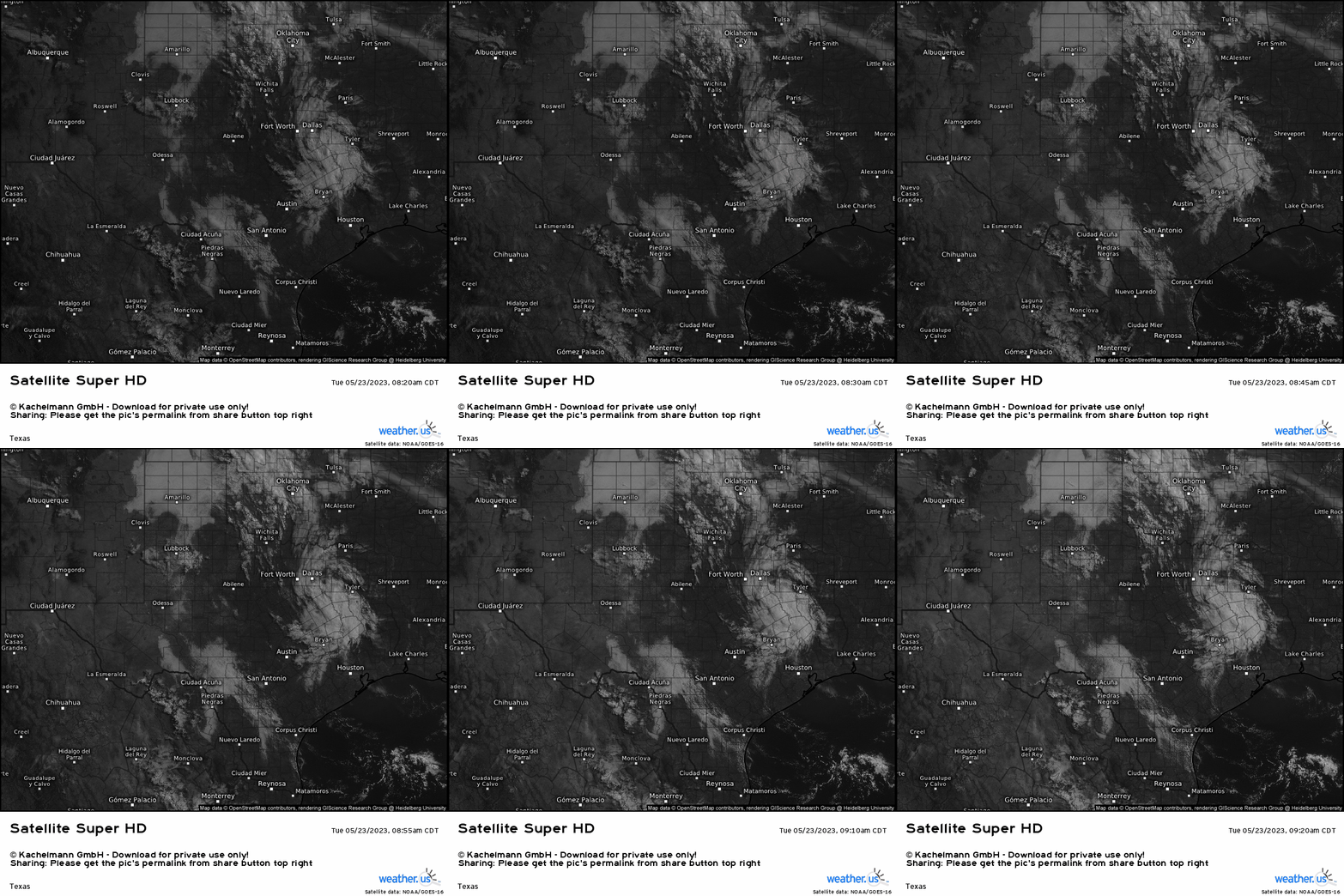
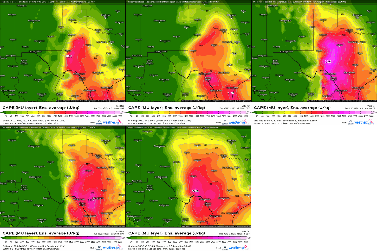
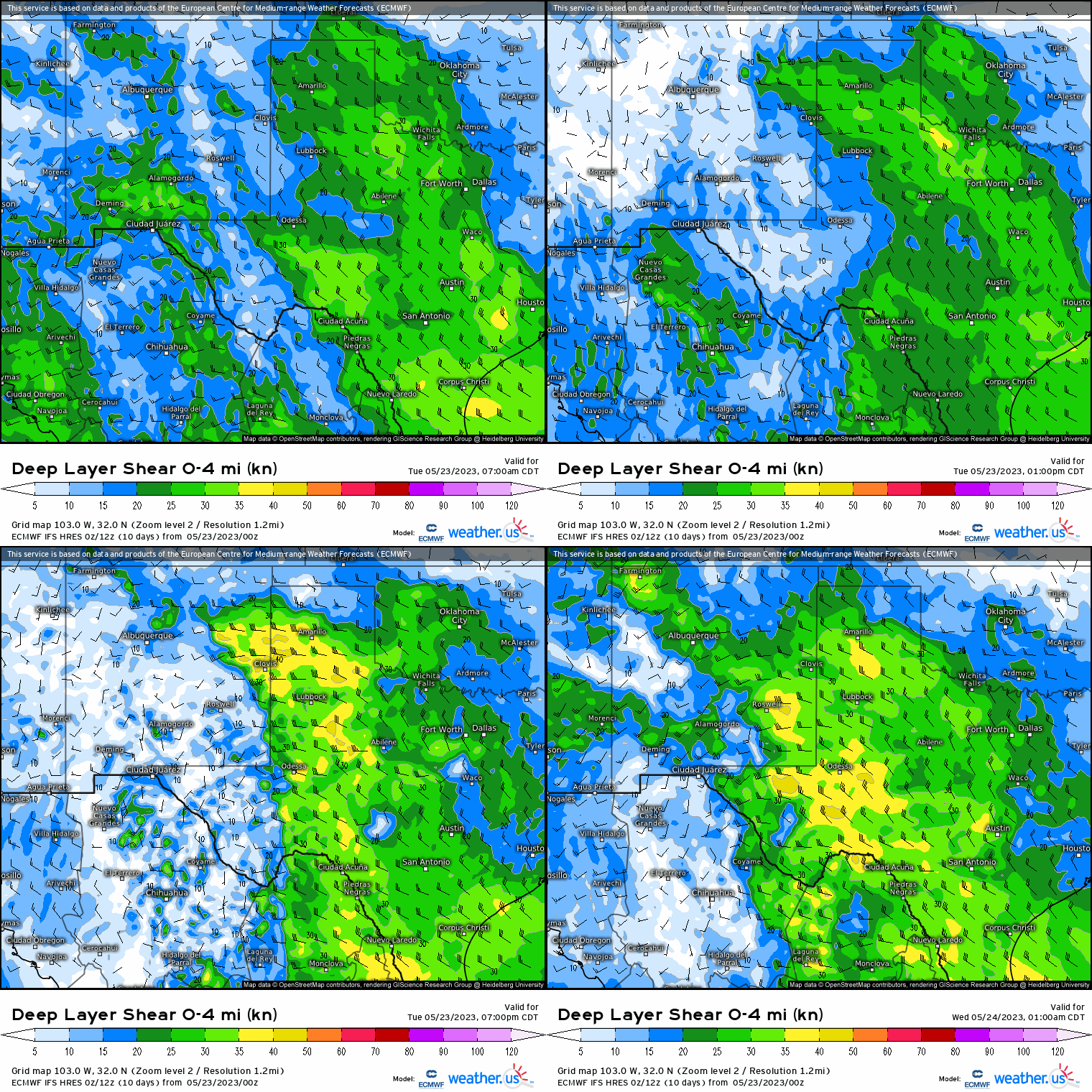
As we look now at the severe weather parameters given we’ve analyzed the “bigger picture” knowing we have sufficient forcing, lets see now with daytime heating and vertical wind shear. With clearing using visible satellite across TX, instability will build through the course of the day until the afternoon. Not coincidentally, notice how below the MUCAPE suddenly intensifies by this afternoon. So we have storms that’ll tap into that, and their updrafts billow. Lastly, vertical shear will be sufficient (20 – 30 knots) to separate the updrafts from the downdrafts, allowing supercells to develop nearest the front and clusters to grow upscale. Once storms develop, the 0-4km vector by looking at the wind shear parameter shows a southeastward trajectory.
Putting it all together, we see by 2-3 PM CST, storms fire across eastern NM and propagate into the panhandle. Initial discrete cells form while multicellular clusters then dominate later this afternoon and prevail into the evening. The main hazards today will be damaging gusts over 50 mph, and large golf ball or greater sized hail – especially with the discrete supercells. There is also a risk for an isolated tornado with some of these clusters or supercells, especially nearest the front.

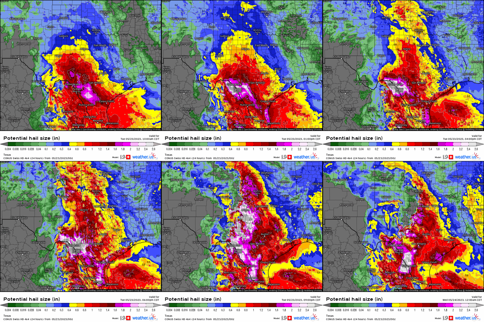
Given our unique potential hail size parameter via CONUS SWISS model, we can visually see how during the afternoon into the evening, the pinks and purples suddenly become apparent northward toward Abilene, Lubbock, and Forth worth on north/northwest demarcating hail sizes that will be over 2”!
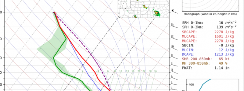
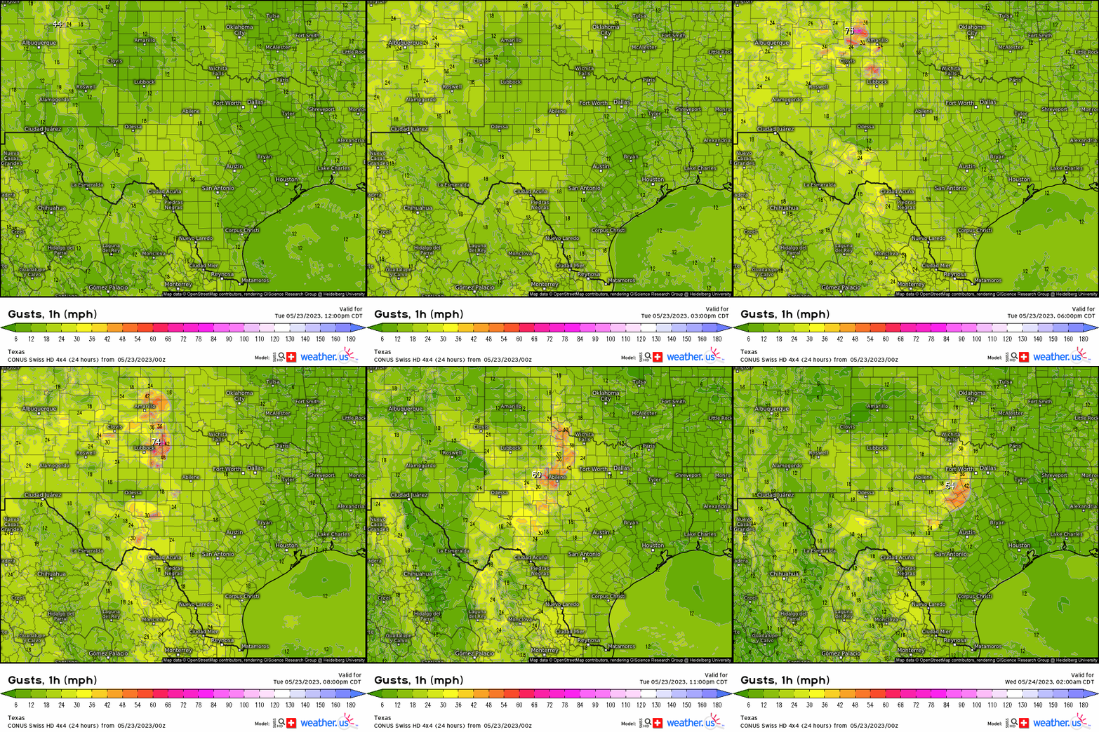
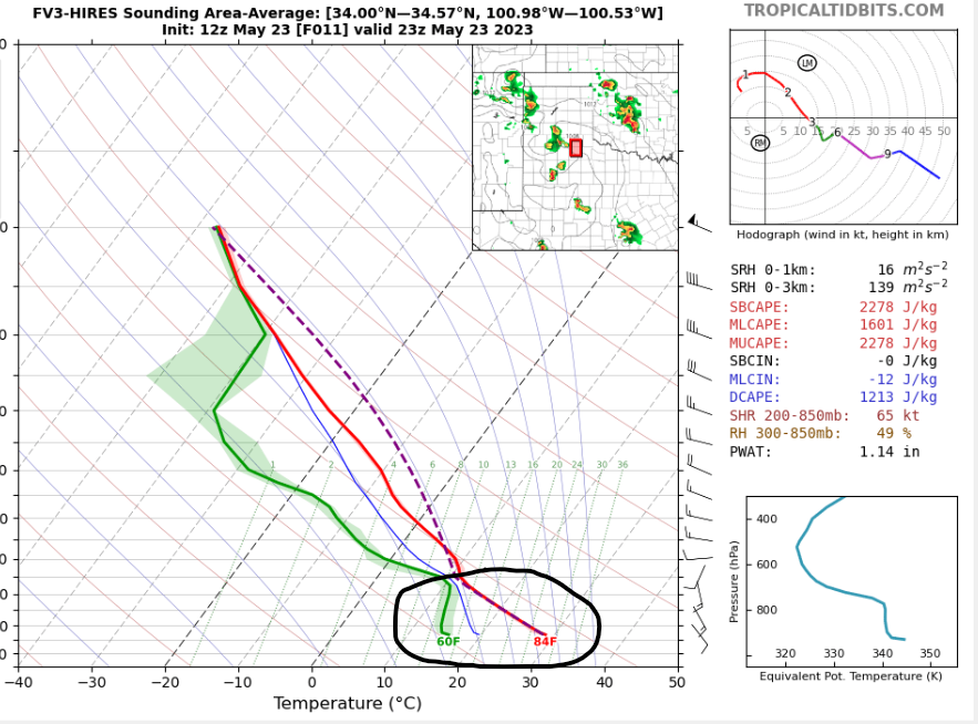
Lastly, notice once we see our clusters develop, gusts over 55 – 60 mph manifest as a result of evaporated rain-cooled air given the classic “inverted V” in soundings via tropical tidbits . When this is evident, this implies that the sub-cloud layer has a relatively large dewpoint depression, or dry air level, that when rain falls through this it evaporates. Evaporation is a cooling process (i.e. heat is taken out of the atmosphere to cool parcels), and denser air under gravity is directed toward the surface. So whenever you see this, that’s how you know strong gusts, if not severe, are a threat.
As always when it comes to severe weather potential, always have an emergency kit, backup plan, and ways to receive warnings so you can put yourself in the hands of safety!


