A Soggy Weekend Ahead for the Southern Plains
After a couple of busy weather days over the past week or so, we’ll just have a short and simple blog this evening.
There isn’t too much of note going on tonight aside from a slow moving cold front draped across the interior East firing up storms and showers along it as it meanders ever eastward. A couple of storms with damaging winds and/or hail are possible this evening along this front, but the overall threat is low.
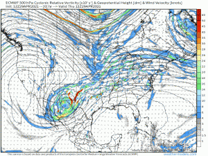
Behind the elongated cold front, there is a bowling ball-like upper low over northern Mexico/southern New Mexico that is going to take its time clearing out. If you’ll check out the gif below, you’ll see that it just sort of shimmies east inch by inch until late Sunday when the next incoming system finally flushes it out.
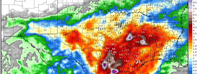
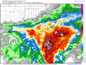
Stagnant systems near a moisture source often bring repeatedly soggy conditions, and this is no exception. The low will keep pulling deep moisture northward as it creeps across the Southern Plains this weekend. Repeated thunderstorms and downpours training over the same area, namely south/eastern Texas and Lousiana, will make for some impressive totals, possibly approaching double digits locally, by the end of the weekend.
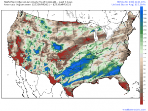
This region has received more than it’s fair share of rain over the past 7 days…
…and with the ground likely still saturated or at least close to it, flash flooding is a real possibility.
It sounds like a silly catch-phrase but “Turn around, don’t drown” has merit to it. Never drive through a flooded roadway. It may look shallow to you but in reality it only takes 6 inches to cause loss of control and 12 inches to float your car. Beyond that, you never know if the road has washed out underneath the flooding. You may not actually have a road to drive on any longer. Please use caution.


