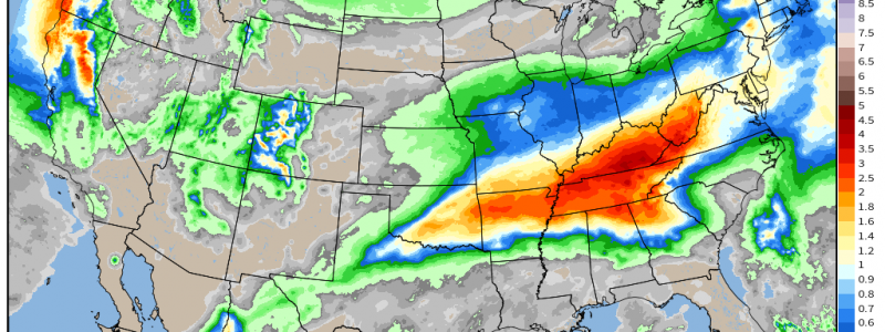
A Soggy Week Ahead
As you may have heard, or even read online, a large portion of the lower 48 is in some form of drought.
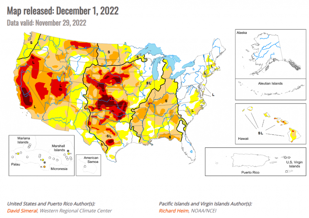
In fact, according to the US Drought Monitor, 79.75% of the US is abnormally dry or in an official drought category.
For the Lower Mississippi, Tennessee, and Ohio Valleys, ridging was dominant during late summer and early fall. This lead to warmer-than-average temperatures and very little rain – and drought built in rather quickly.
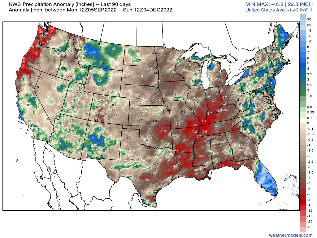
Ninety-day rainfall deficits along these regions exceed 5 inches for the most part.
But some relief comes in the form of an upper-air pattern that will produce multiple days of on and off rainfall for some of this region this week.
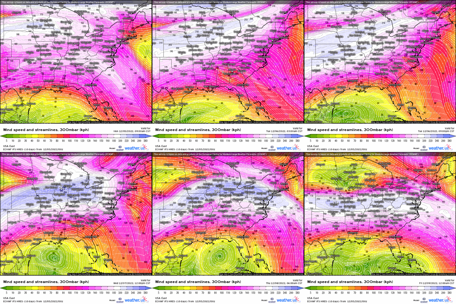
The jet stream will remain draped across the middle of the country for a portion of this week. Additionally, a warm front will stall in the region in question. This provides a focus for potentially heavy rainfall as persistent southwesterly flow repeatedly advects moisture from the Gulf northward.
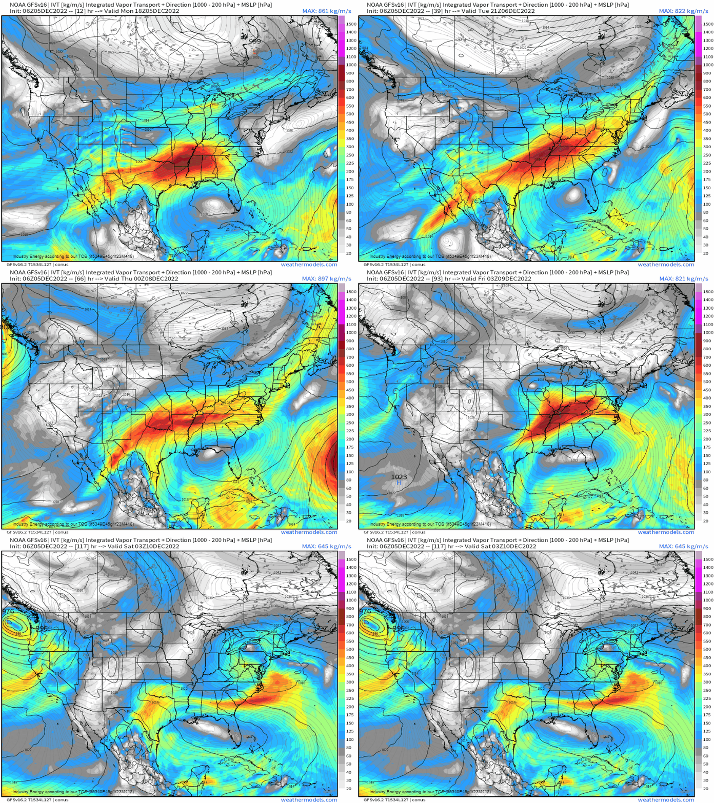
The focus of the heaviest rain will change from day to day as the warm front shifts.
Today, it will remain over the lower Tennessee Valley – generally in southern Tennessee, Northern Alabama, and Northern Georgia.
Tomorrow, the warm front will lift into Kentucky. Consequently, heavier rain will be found along the Kentucky/Tennessee border.
On Wednesday, the focus will shift westward.
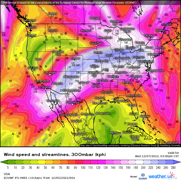
A shortwave will move into the Plains region. Additionally, a strong jet streak will be present over the Plains/Midwest. The region located under the favorable right entrance of the aforementioned jet streak (roughly eastern Oklahoma through western Tennessee) will be at most risk for heavy rainfall. This will be especially true if the weak instability allows thunderstorms to form and access the deep moisture in place.
On Thursday, the axis of heavier rain will shift eastward as the formerly sluggish flow gets moving again thanks to the shortwave mentioned above. Flooding potential seems on the lower side at the moment, however, due to the forecasted faster movement of the system.
Since we’re forecasting days of rainfall over the same general area, we’ll have to also mention flooding potential.
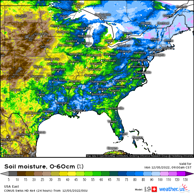
Soil moisture across the area in question is generally around average, give or take a few percent either way. Therefore, where ever heavier rainfall, be it convective or just prolonged, is allowed to persist is where flooding issues will arise. I discussed above where the heaviest rainfall will likely set up from day to day. These will be the areas we’re watching for potential issues.
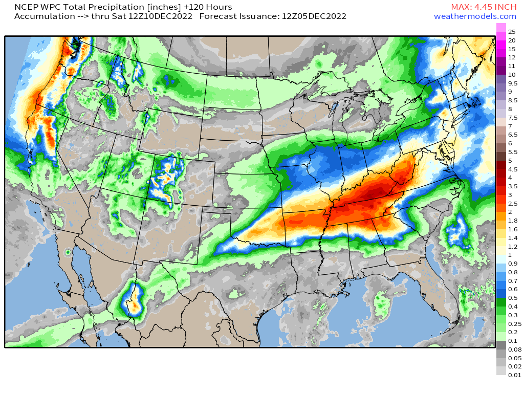
Over the next 5 days, widespread totals of 3+ inches are possible. This is great news in terms of putting a dent in the drought, provided it doesn’t come all at once for any one region.
What you need to know:
- Periods of rainfall, some heavy at times, will prevail in the Lower Mississippi and Tennessee Valley regions through the work week.
- Heavier, prolonged rainfall could lead to localized flooding issues.
- Use caution in your travels throughout the week. If you encounter roadway flooding, use an alternate route.


