A Soggy, Severe Tuesday for the Sunshine State
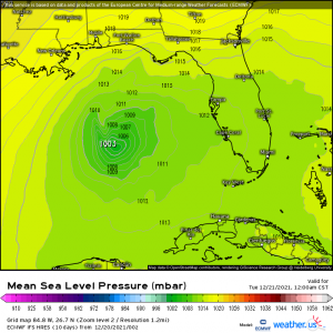
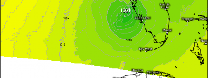
At the end of last week, an interesting feature showed up in the Gulf on the medium range models.
This little low grabbed a bit of attention. Some even speculated if it would become a tropical feature.
Though there are still pockets of warm water left in the Gulf, most of the northern half has cooled to the point where it couldn’t really support tropical activity. No tropical mischief here for the time being. No, this is simply a Gulf low. These can be fairly common in the winter and present as cold-core systems – tilted with height and bearing frontal boundaries.
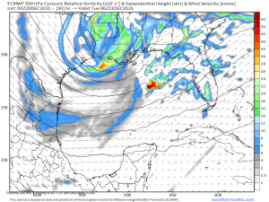
In this case, we have a shortwave trough skimming across the Gulf.
A surface low is expected to form ahead of a frontal boundary. A bit of a no-brainer but, this low has plenty of access to Gulf moisture, seeing as how it’s forming over the Gulf. It will carry with it the threat of heavy rain for the lower Southeast.
The placement of the center of the low is a point of contention between models at the moment. Both the GFS and the ECMWF bring the low ashore in the Big Bend area. Conversely, both the HRRR and the NAM bring it ashore somewhere between Tampa and Naples while the ICON splits the difference and brings it ashore on top of Tampa.
Does it really matter where it comes ashore? It does for two reasons:
- Heaviest Rainfall. The heaviest precip will be found closer the the center of the low. If it comes ashore in the Big Bend area, the northern peninsula will see heavier totals. If it comes ashore between Tampa and Naples, the mid/southern peninsula will see greater rainfall.
- Severe Threat. We’ll discuss this more below but due to the expected limitations, the greatest chance for severe weather will exist closer to the center of the low.
I was going to share a Total Precip map but with the uncertainty in the placement of the low, there really isn’t much point. What’s important is that over an inch of rain is likely along whatever path the low decides to take. Provided Flash Flood Guidance values aren’t exceeded (they’re not expected to be at this time), this is good news for parts of Florida.
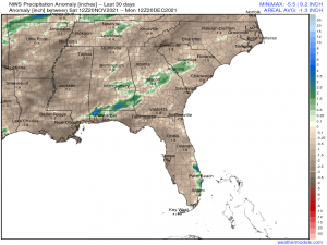
The last 30 days have been rather dry for the Florida Peninsula:
This rainfall is likely welcome and will go toward easing the deficit.
What isn’t welcome, however, is the lower-end risk of severe weather that accompanies this low.
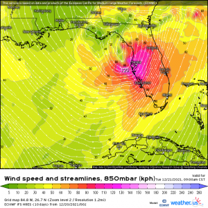
A strong low level jet accompanying the system will provide ample shear for the formation of a few waterspouts or a weak tornado or two. Extensive cloud cover, heavy rain and the morning arrival time of the low point to instability that is expected to remain rather limited. Given these conditions, the threat is not expected to increase and is forecast to remain confined to areas closer the center of the low.
As mentioned above, where the center of the low decides to track matters regarding the severe threat. Since there is still a bit of disagreement, if you reside in the Florida peninsula, assume you have a low risk of severe weather tomorrow beginning during the morning hours. Monitor the evolution of the forecast as the forecast should become more solid by this evening.
Even though it’s a low-end risk, have those weather radios on and ready to go and a plan to shelter should you need it. Be safe!
